1920s Maps of Kern County, California
Explore 16 historic maps of Kern County from the 1920s. These maps offer a rare glimpse into what life looked like during the 1920s — showing old roads, neighborhoods, homes, and landmarks that have changed or disappeared over time.
Whether you're researching your family's past, planning a metal detecting trip, or studying how Kern County's landscape evolved across the 1920s, these high-resolution maps are a powerful tool for exploring the history of this region.
- Focus on a specific era: All maps on this page are from the 1920s, giving you a focused view of this time period.
- See what’s changed: Compare century-old streets, trails, and buildings to today's modern landscape using overlays and satellite layers.
- Research with precision: Use these maps for genealogy, historical research, land use analysis, or educational projects.
- View, download, or print: Maps are fully viewable online in high resolution, and can be downloaded or printed for your own records.
Start exploring Kern County's history through authentic maps from the 1920s. This is your window into the past.
Kern County, CA maps
(16)- 1920 Map of Delonagha
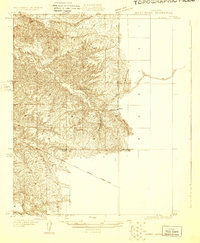
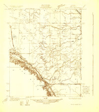
 1920 Delonagha1920 Print · USGSThe Sierra Nevada foothills of Kern County come into focus in 1920, showing a landscape defined by the Sequoia National Forest. Researchers can trace the early layout of Glenville, identify remote outposts like Brown Mill, and locate family-named features such as Caughran Springs.
 - 1926 Map of Quincy School
 1926 Quincy School1926 Print · USGSThe foothills of the southern San Joaquin Valley come into focus in the mid-1920s as early infrastructure began to define the rural landscape. Trace the location of the Quincy School and follow the route of the Delano-Woody Road across the White River.2 unique versions available
 - 1926 Map of Glennville
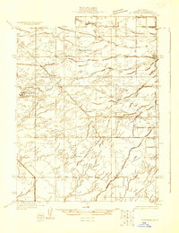
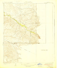
 1926 Glennville1926 Print · USGSKern County's high country is captured here during the 1920s, showing a network of remote ranger stations and early mountain settlements. Genealogists and historians can trace old homestead sites near Havilah, early forestry outposts like Davis RS, and the waters of Delonagha Springs.
 - 1927 Map of McFarland
 1927 McFarland1927 Print · USGSCentral Valley agriculture and transportation converge in the late twenties near the Kern County line. Genealogists and historians can trace the early townsite of McFarland and the settlement of Jasmine along the Southern Pacific rail lines.
 - 1927 Map of Semitropic
 1927 Semitropic1927 Print · USGSRanching and early oil exploration defined this Kern County landscape in the late 1920s. Researchers can locate Indian Burial Mounds and family-named landmarks like Banducci Ranch and the Doheny Gun Club.
 - 1929 Map of Bena
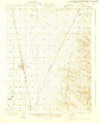
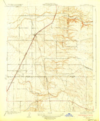
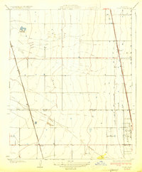
 1929 Bena1929 Print · USGSKern County's rugged transit corridors come alive in this late-1920s survey of the mountain approaches. Trace the historic route of the Southern Pacific railroad and the Tehachapi Highway as they wind past Walker and Cottonwood Creek.3 unique versions available
 - 1929 Map of Delano
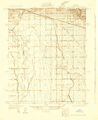
 1929 Delano1929 Print · USGSThe San Joaquin Valley's agricultural heartland is captured here in the late twenties, showing the growth of the Central Valley rail corridor. Genealogists and local historians can trace early town plats in Delano, rural school locations like Columbine Sch, and the original route of the Orange Belt Highway.2 unique versions available
 - 1929 Map of Richgrove
 1929 Richgrove1929 Print · USGSThe Southern San Joaquin Valley citrus and grape belt comes into focus during the late twenties at the border of Tulare and Kern counties. Genealogists and historians can trace rail-side settlements like Richgrove and Vestal or locate the rural Thermal Sch and Quinn Ranch.3 unique versions available
 - 1929 Map of Stevens
 1929 Stevens1929 Print · USGSThe Kern River valley in the late 1920s was a hub of early irrigation and oil development. Researchers can trace the legacy of local education and industry through sites like Munzer Sch, the Elmer Oil Company, and the Rio Bravo Oil Pumping Station.
 - 1929 Map of Fairfax School
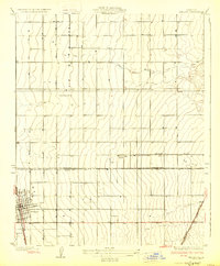
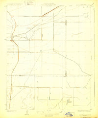
 1929 Fairfax School1929 Print · USGSSoutheastern Bakersfield and the surrounding Kern County ranch lands are captured here in the late twenties, during a period of significant agricultural growth. Genealogists and local historians can trace rural school districts like Fairfax Sch and Mountain View Sch alongside the essential Kern Island Canal system.
 - 1929 Map of Hacienda Ranch
 1929 Hacienda Ranch1929 Print · USGSThe southern San Joaquin Valley landscape was defined by large-scale ranching and early irrigation canals during the late 1920s. Genealogists and historians can trace the footprints of Bent Ranch, Fowler Ranch, and the Westlake Gun Club near the shared borders of Kings, Kern, and Tulare counties.2 unique versions available
 - 1929 Map of Quincy School
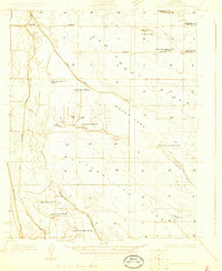
 1929 Quincy School1929 Print · USGSThe borderlands of Tulare and Kern counties are captured here in the late twenties during a period of infrastructure expansion. Genealogists and researchers can locate the Quincy Sch or trace the routes of White River and the Southern California Edison Company Transmission Line.3 unique versions available
 - 1929 Map of Coles Levee
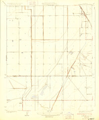
 1929 Coles Levee1929 Print · USGSKern County in the late twenties shows a landscape defined by water engineering and early transport. You can trace the Southern Pacific RR and find sites like the Mesquite Hunting Club and the Western Water Co Pumping Plant.
 - 1929 Map of Mouth of Kern
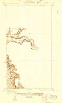
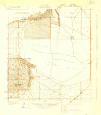 1929 Mouth of Kern1929 Print · USGSThe oil and gas boom in the San Joaquin Valley is fully underway in the late 1920s, showing a landscape of pumping stations and energy reserves. Genealogists and industrial historians can trace the operations of the Standard Gas Company, locate the Old Gun Club, or follow the Southern Pacific (Taft-Bakersfield Branch) near Pelican Island.
 - 1929 Map of Stone
 1929 Stone1929 Print · USGSThe southern San Joaquin Valley during the late 1920s shows a landscape of expanding rail and agricultural lines. Genealogists and local historians can trace the early layout of Stone, Delano, and Kernell along the Southern Pacific tracks.3 unique versions available
 - 1929 Map of Allensworth
 1929 Allensworth1929 Print · USGSThe historic town of Allensworth is captured here in the late 1920s, showing the early infrastructure of the San Joaquin Valley. Genealogists and historians can trace the Atchison Topeka and Santa Fe rail line and the course of the Homeland Canal.3 unique versions available
End of results
Showing maps 1-16 of 16
Top cities of Kern County
- Bakersfield historical maps
- Delano historical maps
- Ridgecrest historical maps
- Wasco historical maps
- Shafter historical maps
- Arvin historical maps
See more
Frequently asked questions
- What are the different types of historical maps available for Kern County?
- What is the oldest map of Kern County?
- Where can I purchase historical maps of Kern County for my home or office?
- Where can I download high-res historical maps of Kern County?
- Are there historical topographic maps available for Kern County?
- Is there historical aerial imagery available for Kern County?
- Where are historical maps of Kern County sourced from?