1960s Maps of Kern County, California
Explore 41 historic maps of Kern County from the 1960s. These maps offer a rare glimpse into what life looked like during the 1960s — showing old roads, neighborhoods, homes, and landmarks that have changed or disappeared over time.
Whether you're researching your family's past, planning a metal detecting trip, or studying how Kern County's landscape evolved across the 1960s, these high-resolution maps are a powerful tool for exploring the history of this region.
- Focus on a specific era: All maps on this page are from the 1960s, giving you a focused view of this time period.
- See what’s changed: Compare century-old streets, trails, and buildings to today's modern landscape using overlays and satellite layers.
- Research with precision: Use these maps for genealogy, historical research, land use analysis, or educational projects.
- View, download, or print: Maps are fully viewable online in high resolution, and can be downloaded or printed for your own records.
Start exploring Kern County's history through authentic maps from the 1960s. This is your window into the past.
Kern County, CA maps
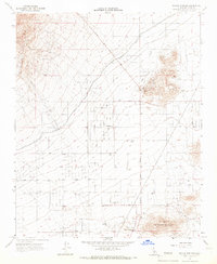
(41)- 1960 Map of Trona
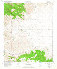
 1960 Trona1960 Print · USGSThe Mojave Desert at mid-century reveals a landscape of massive military installations and industrial mineral works. Researchers can trace the heritage of mining and ranching at Ashford Mill, Randsburg, and Paxton Ranch while following the Old Spanish Trail.2 unique versions available
 - 1960 Map of Bakersfield
 1960 Bakersfield1960 Print · USGSThe Southern San Joaquin Valley at mid-century reveals a complex landscape of petroleum development and massive irrigation projects. Researchers can trace the rail lines of the Southern Pacific, explore oil-era landmarks like Oil City, and locate early settlements including Allensworth and Pixley.2 unique versions available
 - 1961 Map of Orchard Peak, 1962 Print
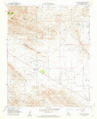
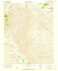
 1961 Orchard Peak1962 Print · USGSThe high Temblor Range and Polonio Pass in the early sixties reveal a landscape of remote ranching and emerging energy infrastructure. Researchers can locate the settlement of Annette, trace the Antelope Grade, and find isolated water sources like Twisselmann Lake.2 unique versions available
 - 1961 Map of Sawtooth Ridge, 1962 Print
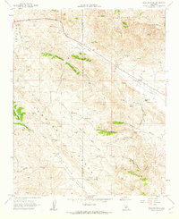
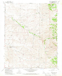
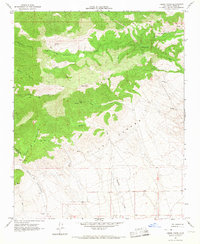
 1961 Sawtooth Ridge1962 Print · USGSNorthwestern Kern County during the early 1960s reveals a landscape transitioning from the open basins of Antelope Valley to the uplifted Temblor Range. Researchers can trace the industrial footprint of the Devils Den Oil Field and the remote outpost of Keeks Corner.3 unique versions available
 - 1961 Map of Packwood Creek, 1962 Print
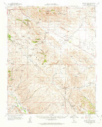
 1961 Packwood Creek1962 Print · USGSThe high desert border between Kern and San Luis Obispo counties is captured here in the early sixties, showing a landscape of remote cattle ranges and infrastructure. Genealogists and historians can trace the Butterwater Pumping Station and the settlement at Poso Ortega among the ridges of the Temblor Range.2 unique versions available
 - 1961 Map of Orchard Peak, 1962 Print
 1961 Orchard Peak1962 Print · USGSThe Temblor Range and the Kern-San Luis Obispo border area come into focus in the early sixties as the regional oil and water infrastructure expands. Researchers can trace the era's industrial footprint through Oil Wells at Devils Den and the Antelope Pumping Sta.
 - 1961 Map of Holland Canyon, 1962 Print
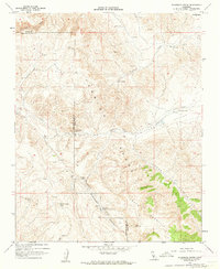
 1961 Holland Canyon1962 Print · USGSThe ranching country of the San Luis Obispo and Kern County border is captured here in the early sixties as it was surveyed for water resources. Researchers can locate remote sites like the San Juan Ranch, the Choice Valley Sch, and uniquely named water sources such as Bellyache Spr.4 unique versions available
 - 1962 Map of Bakersfield, 1969 Print
 1962 Bakersfield1969 Print · USGSThe Southern San Joaquin Valley is shown in the 1960s as a bustling intersection of petroleum production, irrigation agriculture, and mountain recreation. Researchers can trace the rail lines of the Southern Pacific through the valley or locate early desert developments like California City and Tehachapi.4 unique versions available
 - 1965 Map of Woody, 1966 Print
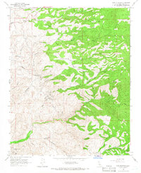
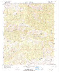
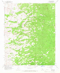 1965 Woody1966 Print · USGSKern County ranching country and foothill peaks are captured here in the mid-sixties before modern development. Genealogists and local historians can locate the Blue Mountain Cem, the historic Blake Sch, and legacy properties like Woody Ranch.2 unique versions available
 - 1965 Map of Knob Hill, 1966 Print
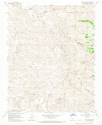
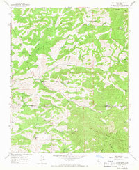
 1965 Knob Hill1966 Print · USGSKern County’s oil industry and rugged canyonlands are captured here in the mid-1960s, showing a landscape shaped by petroleum extraction and drainage systems. Researchers can trace the footprint of the Mt Poso Oil Field, the Poso Canal, and the isolated Halfway House.4 unique versions available
 - 1965 Map of Sand Canyon, 1966 Print
 1965 Sand Canyon1966 Print · USGSKern County ranching and petroleum production meet in the mid-1960s across this intricate network of canyons and gulches. Genealogists and historians can locate family-named sites like Villard Ranch, Carbon Ranch, and the expansive Mount Poso Oil Field.3 unique versions available
 - 1965 Map of Pine Mountain, 1966 Print
 1965 Pine Mountain1966 Print · USGSThe foothills of Kern County come into sharp focus in the mid-1960s, showing a landscape shaped by ranching and resource extraction. Researchers can locate the Long Tom Mine, the Round Mountain Oil Field, and the community at Granite Station.2 unique versions available
 - 1965 Map of Tylerhorse Canyon, 1966 Print
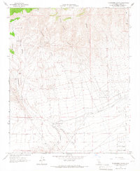 1965 Tylerhorse Canyon1966 Print · USGSKern County's high desert landscape comes into focus in the mid-sixties as the southern foothills meet the valley floor. Researchers can trace the path of the Los Angeles Aqueduct and locate early landmarks like West Antelope Station and the White Oak Landing Field.2 unique versions available
 - 1965 Map of White River, 1966 Print
 1965 White River1966 Print · USGSThe Tulare and Kern county line near the White River settlement comes alive in this mid-sixties survey of foothill ranching and mining. Trace family-held lands like Guthrie Ranch and find old diggings such as the Last Chance Mine or Gold Mine.2 unique versions available
 - 1965 Map of Neenach School, 1966 Print
 1965 Neenach School1966 Print · USGSAntelope Valley's high desert landscape and ranching history are frozen in time just after the mid-century. Researchers can trace the water-driven economy of the era through the Los Angeles Aqueduct, the rural Neenach School, and the Gorrindo Ranch.3 unique versions available
 - 1965 Map of Quincy School, 1966 Print
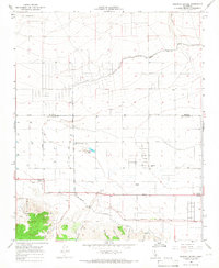
 1965 Quincy School1966 Print · USGSThe Tulare and Kern county line area in the mid-1960s is defined by remote ranching outposts and historical travel routes. Genealogists and historians can trace the Old Stockton Los Angeles Stage Road and locate sites like Flynn Ranch and the Quincy Sch (Site).2 unique versions available
 - 1965 Map of Little Buttes, 1967 Print
 1965 Little Buttes1967 Print · USGSThe Antelope Valley desert comes into focus during the mid-sixties, showing a landscape defined by isolated homesteads and volcanic outcrops. Trace the early layout of Antelope Acres and find local landmarks like Rogers School or the Little Buttes.2 unique versions available
 - 1965 Map of Fairmont Butte, 1967 Print
 1965 Fairmont Butte1967 Print · USGSThe high desert of northern Los Angeles County appears in the mid-sixties as a landscape of grid-aligned roads and isolated homesteads. Genealogists and researchers can trace water infrastructure and property lines near Fairmont Butte, the Landing Strip, and Broad Canyon.2 unique versions available
 - 1965 Map of Willow Springs, 1967 Print
 1965 Willow Springs1967 Print · USGSThe Antelope Valley foothills in the mid-sixties reveal a landscape shaped by gold mining and the essential water of the California desert. Genealogists and historians can trace family-named sites like Wagon Wheel Ranch and mining operations such as Cactus Queen Mine.2 unique versions available
 - 1965 Map of La Liebre Ranch, 1967 Print
 1965 La Liebre Ranch1967 Print · USGSNorthern Los Angeles County is captured in the mid-1960s as it transitioned between historic ranching and modern water infrastructure. Researchers can trace the Old Ridge Route or locate landmarks like La Liebre Ranch and Zana.2 unique versions available
 - 1965 Map of Liebre Twins, 1967 Print
 1965 Liebre Twins1967 Print · USGSKern County’s high desert and mountain interface is captured here in the mid-1960s, showing a landscape defined by seasonal water and remote trails. Researchers can trace early infrastructure like the Quarry or follow the JEEP TRAILS that connect Twin Lakes to the Liebre Twins.2 unique versions available
 - 1966 Map of Los Angeles
 1966 Los Angeles1966 Print · USGSSouthern California underwent a mid-century transformation as suburban grids reached the base of the San Gabriel Mountains. Researchers can trace the path of the Los Angeles Aqueduct or locate defense landmarks like Edwards Air Force Base.
 - 1966 Map of San Bernardino
 1966 San Bernardino1966 Print · USGSThe San Bernardino Valley and Mojave Desert met during a period of massive military and suburban growth in the mid-sixties. Genealogists and historians can trace the development of Edwards Air Force Base, old desert mines like the Bagdad Chase Mine, and mountain communities near Big Bear Lake.
 - 1966 Map of Bakersfield
 1966 Bakersfield1966 Print · USGSThe southern San Joaquin Valley in the mid-sixties reveals a massive industrial and agricultural landscape shaped by water and oil. Genealogists and historians can trace the growth of Bakersfield and Oildale, or locate remote airfields like Minter Field and Mojave-Kern County No. 7 Airport.
 - 1966 Map of Winters Ridge, 1967 Print
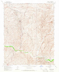
 1966 Winters Ridge1967 Print · USGSKern County ranch lands and high ridges are captured in the mid-1960s, showing the complex terrain of the historic Mexican land grants. You can trace the path of the Tejon Trail and locate dozens of remote water sources like Cow Chip Spring and Urcado Springs across Winters Ridge.2 unique versions available
Showing maps 1-25 of 41
Top cities of Kern County
- Bakersfield historical maps
- Delano historical maps
- Ridgecrest historical maps
- Wasco historical maps
- Shafter historical maps
- Arvin historical maps
See more
Frequently asked questions
- What are the different types of historical maps available for Kern County?
- What is the oldest map of Kern County?
- Where can I purchase historical maps of Kern County for my home or office?
- Where can I download high-res historical maps of Kern County?
- Are there historical topographic maps available for Kern County?
- Is there historical aerial imagery available for Kern County?
- Where are historical maps of Kern County sourced from?