1950s Maps of Kern County, California
Explore 118 historic maps of Kern County from the 1950s. These maps offer a rare glimpse into what life looked like during the 1950s — showing old roads, neighborhoods, homes, and landmarks that have changed or disappeared over time.
Whether you're researching your family's past, planning a metal detecting trip, or studying how Kern County's landscape evolved across the 1950s, these high-resolution maps are a powerful tool for exploring the history of this region.
- Focus on a specific era: All maps on this page are from the 1950s, giving you a focused view of this time period.
- See what’s changed: Compare century-old streets, trails, and buildings to today's modern landscape using overlays and satellite layers.
- Research with precision: Use these maps for genealogy, historical research, land use analysis, or educational projects.
- View, download, or print: Maps are fully viewable online in high resolution, and can be downloaded or printed for your own records.
Start exploring Kern County's history through authentic maps from the 1950s. This is your window into the past.
Kern County, CA maps
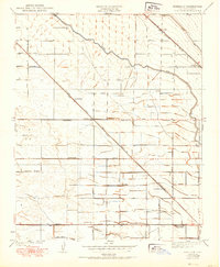
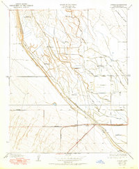
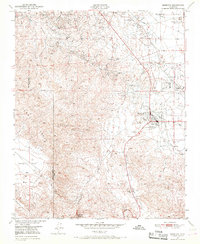
(118)- 1950 Map of Reynolds Ranch
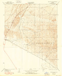
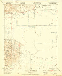
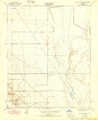 1950 Reynolds Ranch1950 Print · USGSKern County ranching and water management are captured here during the mid-century, reflecting the landscape as it was surveyed in the 1930s. Genealogists and researchers can trace family-named sites such as Gilbert Ranch and Reynolds Ranch or follow the Goose Lake Canal.
 - 1950 Map of Pentland
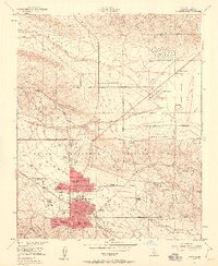
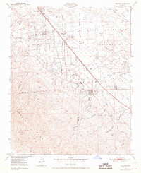
 1950 Pentland1950 Print · USGSKern County's petroleum landscape is captured here at mid-century, showing the dense industrial grid of the southern San Joaquin Valley. Researchers can locate specialized worker sites like General Petroleum Corp Essex Camp and major facilities such as the Lakeview Refining Co near Pentland.
 - 1950 Map of Avenal Gap
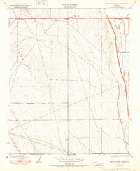
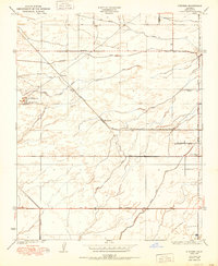
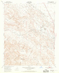
 1950 Avenal Gap1950 Print · USGSThe Kings and Kern County line crosses the southern San Joaquin Valley here at mid-century. Researchers can trace early road routes and locate the Devils Den settlement and Devils Den Sch near the Antelope Plain.
 - 1950 Map of Gosford
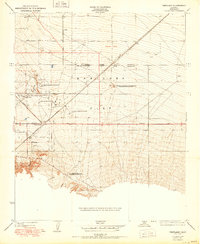
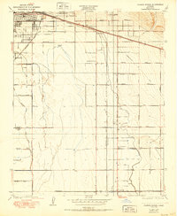
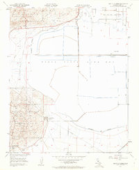
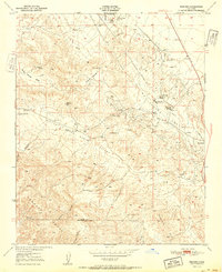
 1950 Gosford1950 Print · USGSSouthwest Bakersfield and the surrounding Kern County ranch lands are caught in a moment of post-war expansion. Local researchers can trace the historic irrigation network of the Stine Canal and find old rural schools like Union Ave Sch and Fairview Sch.
 - 1950 Map of Hamlin School
 1950 Hamlin School1950 Print · USGSKern County was a hub for sporting life at mid-century, defined by a dense network of water-managed hunting grounds. Researchers can trace the layout of legacy properties like the Hollywood Gun Club and Lurline Gun Club, or locate the site of the Hamlin School.
 - 1950 Map of Rosedale
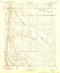
 1950 Rosedale1950 Print · USGSThe Rosedale area of Kern County is shown during a period of significant agricultural expansion and rail development. Researchers can trace early irrigation networks like the Calloway Canal and locate vanished local landmarks such as Una Siding and Palm Sch.
 - 1950 Map of West of Goose Lake
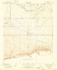
 1950 West of Goose Lake1950 Print · USGSThe northern Kern County oil and agricultural fields are captured here at mid-century, centered on the growing community of Lost Hills. Researchers can trace early roads and infrastructure like the Lost Hills Sch and the path of the West Side Canal.
 - 1950 Map of Fairfax School
 1950 Fairfax School1950 Print · USGSThe outskirts of Bakersfield and the surrounding Kern County farmland are captured here at the start of the 1950s. Genealogists and local historians can trace irrigation networks like the Weed Patch Canal and locate rural landmarks such as Fairfax School and the rail hub at Magunden.
 - 1950 Map of Goose Lake
 1950 Goose Lake1950 Print · USGSKern County ranchlands and dry lake basins are captured here at mid-century as the region's irrigation network was firmly established. Genealogists and local historians can locate early family holdings like Banducci Ranch and several Indian Burial Mounds.
 - 1950 Map of Lokern
 1950 Lokern1950 Print · USGSThe San Joaquin Valley landscape around Lokern appears here at mid-century, defined by indigenous history and a sprawling irrigation network. Genealogists and historians can trace the Southern Pacific rail lines and numerous Indian Burial Mounds along the Buena Vista Slough.
 - 1950 Map of Oil Center
 1950 Oil Center1950 Print · USGSBakersfield and the Kern County oil fields are caught here at a height of industrial activity in the mid-twentieth century. Researchers can trace the layout of early energy settlements like Oil Center and Oil City or locate local landmarks including Aztec Sch and the County Hospital.
 - 1950 Map of Famoso
 1950 Famoso1950 Print · USGSMid-century Kern County comes alive in this survey of the agricultural corridor north of Bakersfield. Researchers can trace the rail-and-road economy through stops like Famoso and Kimberlina or follow the vital irrigation paths of the Lerdo Canal.
 - 1950 Map of Stevens
 1950 Stevens1950 Print · USGSMid-century Kern County is defined here by its complex irrigation networks and oil infrastructure just as the valley's agricultural character was fully maturing. Researchers can trace the Southern Pacific rail line through Stevens or locate landmarks like the Rio Bravo Oil Pumping Sta and Munzer Sch.
 - 1950 Map of West Elk Hills
 1950 West Elk Hills1950 Print · USGSKern County's oil-rich landscapes are captured in the mid-century, showing the critical energy infrastructure around the Elk Hills. Genealogists and researchers can trace early transportation routes like the Southern Pacific railroad and the settlement at Asphalto.
 - 1950 Map of Coal Oil Canyon
 1950 Coal Oil Canyon1950 Print · USGSKern County's southern valley floor and foothills are captured here during the mid-century expansion of the petroleum and agricultural industries. Researchers can trace the development of infrastructure like the Kern Island Ditch and find local landmarks such as Pleito Ranch and the Panama Migratory Sch.
 - 1950 Map of Edison
 1950 Edison1950 Print · USGSKern County's agricultural and industrial landscape comes into focus during the mid-century expansion of its rail and road networks. Genealogists and historians can trace old property boundaries and transit hubs near Edison, Di Giorgio, and the El Tejon foothills.
 - 1950 Map of Taft, 1960 Print
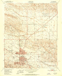
 1950 Taft1960 Print · USGSThe Kern County oil patch is at its mid-century peak here, defined by the federal petroleum reserves and company housing. Researchers can trace the layout of specific company camps like Standard Oil Camp 11-C and the Southern Calif Gas Camp.5 unique versions available
 - 1950 Map of Mouth of Kern, 1962 Print
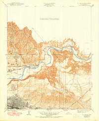
 1950 Mouth of Kern1962 Print · USGSThe industrial heart of the San Joaquin Valley is on display here at mid-century, where oil production meets large-scale water reclamation. Researchers can trace the massive Buena Vista Lake Bed and energy sites like the South Coles Levee Oil Field and Naval Petroleum Reserve No 1.4 unique versions available
 - 1950 Map of Maricopa, 1965 Print
 1950 Maricopa1965 Print · USGSMaricopa and the southern San Joaquin Valley are captured here during the 1950s oil boom. Researchers can trace the industrial footprint of Oil Wells and the Norwalk Oil Refinery alongside small settlements like Spellacy and Hazelton.2 unique versions available
 - 1950 Map of Fellows, 1968 Print
 1950 Fellows1968 Print · USGSMid-century petroleum production in the San Joaquin Valley is centered here around Fellows and the sprawling Naval Petroleum Reserve No 2. Genealogists and industrial historians can locate the Midway Oil Camp, Associated Oil Camp, and the Midway School.4 unique versions available
 - 1950 Map of Reward, 1969 Print
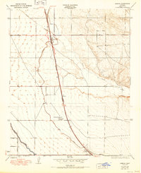
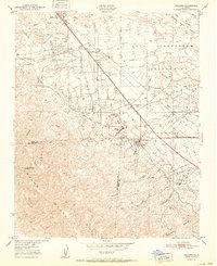
 1950 Reward1969 Print · USGSKern County industrial and ranching life is captured at mid-century as the oil fields of the west side were in full operation. Genealogists and historians can trace the footprint of Reward, the Olig School, and the extensive Southern Pacific rail and oil infrastructure.4 unique versions available
 - 1951 Map of Reward
 1951 Reward1951 Print · USGSKern County's oil boom era is on full display in this mid-century survey of the valley foothills. Researchers can trace the industrial footprint of Standard Oil Co and Union Oil near the vanished Olig School and the settlement of Reward.
 - 1951 Map of Mouth of Kern
 1951 Mouth of Kern1951 Print · USGSThe industrial energy corridor of Kern County is captured here in the early fifties, showcasing the massive scale of petroleum extraction. Researchers can trace the mid-century footprint of the South Coles Levee Oil Field, the Buena Vista Lake Bed, and the Richfield Oil Pumping Station.
 - 1951 Map of Taft
 1951 Taft1951 Print · USGSCentral California's oil fields are shown in peak production during the early fifties, centering on the city of Taft. Researchers can trace company-founded settlements like Honolulu Oil Main Camp, the Standard Oil Tank Farm, and Dustin Acres.
 - 1951 Map of Fellows
 1951 Fellows1951 Print · USGSThe oil-rich landscape of Kern County is captured here in the early fifties during the peak of federal energy extraction. Genealogists and historians can trace the specific layouts of Fellows, Midway Oil Camp, and the historic Midway School.
Showing maps 1-25 of 118
Top cities of Kern County
- Bakersfield historical maps
- Delano historical maps
- Ridgecrest historical maps
- Wasco historical maps
- Shafter historical maps
- Arvin historical maps
See more
Frequently asked questions
- What are the different types of historical maps available for Kern County?
- What is the oldest map of Kern County?
- Where can I purchase historical maps of Kern County for my home or office?
- Where can I download high-res historical maps of Kern County?
- Are there historical topographic maps available for Kern County?
- Is there historical aerial imagery available for Kern County?
- Where are historical maps of Kern County sourced from?