1980s Maps of Kern County, California
Explore 15 historic maps of Kern County from the 1980s. These maps offer a rare glimpse into what life looked like during the 1980s — showing old roads, neighborhoods, homes, and landmarks that have changed or disappeared over time.
Whether you're researching your family's past, planning a metal detecting trip, or studying how Kern County's landscape evolved across the 1980s, these high-resolution maps are a powerful tool for exploring the history of this region.
- Focus on a specific era: All maps on this page are from the 1980s, giving you a focused view of this time period.
- See what’s changed: Compare century-old streets, trails, and buildings to today's modern landscape using overlays and satellite layers.
- Research with precision: Use these maps for genealogy, historical research, land use analysis, or educational projects.
- View, download, or print: Maps are fully viewable online in high resolution, and can be downloaded or printed for your own records.
Start exploring Kern County's history through authentic maps from the 1980s. This is your window into the past.
Kern County, CA maps
(15)- 1981 Map of San Luis Obispo
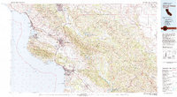 1981 San Luis Obispo1981 Print · USGSThe Central Coast comes alive in the early eighties as the Southern Pacific railroad connects growing coastal towns and rugged inland ranges. Researchers can trace land grants like Santa Manuela, locate Cem sites, and explore the footprint of California Polytechnic State University.3 unique versions available
 - 1981 Map of Cuyama
 1981 Cuyama1981 Print · USGSThe high Cuyama Valley and the vast reaches of the Los Padres National Forest are captured here in the early eighties. Researchers can trace the San Andreas Rift Zone past New Cuyama or locate remote outposts like the Gibraltar Mine and Thorn Lookout.2 unique versions available
 - 1981 Map of Taft, 1982 Print
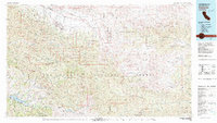
 1981 Taft1982 Print · USGSKern County's oil country and the high desert of the San Luis Obispo border come into focus during the early eighties. Researchers can trace the industrial landscape of Naval Petroleum Reserve No 1 alongside settlements like Taft, McKittrick, and the San Andreas Rift Zone.2 unique versions available
 - 1981 Map of Lancaster, 1984 Print
 1981 Lancaster1984 Print · USGSThe high desert and mountain passes of northern Los Angeles County come alive in this early eighties survey. Researchers can trace the San Andreas Rift Zone past remote outposts like Gorman or locate the historic Golden Queen Mine near the Mojave edge.2 unique versions available
 - 1982 Map of Victorville
 1982 Victorville1982 Print · USGSThe High Desert during the early eighties reveals a landscape of massive aerospace installations and growing desert communities. Researchers can trace the sprawling boundaries of Edwards Air Force Base alongside the vital California Aqueduct and the rail hub at Barstow.2 unique versions available
 - 1982 Map of Ninemile Canyon, 1983 Print
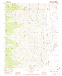 1982 Ninemile Canyon1983 Print · USGSNinemile Canyon and the surrounding high desert terrain are captured in the early 1980s as a critical junction for regional water infrastructure. Researchers can trace the path of the Los Angeles Second Aqueduct through Sand Canyon and locate remote mining prospects near Sawtooth Peak.
 - 1982 Map of Pearsonville, 1983 Print
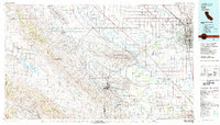
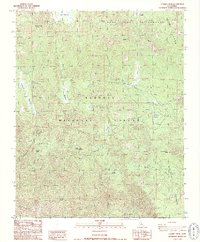
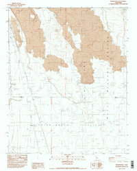 1982 Pearsonville1983 Print · USGSPearsonville and the surrounding high desert are shown in the late seventies as the military and racing industries shaped the landscape. Genealogists and researchers can trace the restricted boundaries of the China Lake Naval Weapons Center and locate local landmarks like the Auto Race Track and the settlement of Linnie.2 unique versions available
 - 1983 Map of White Hills
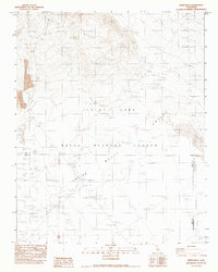 1983 White Hills1983 Print · USGSIn the high desert during the early 1980s, this area served as a critical hub for military testing at the Naval Weapons Center. Researchers can trace the layout of specialized defense infrastructure including the Launch Pad, Missile Line, and various Target Areas.
 - 1986 Map of Lamont Peak
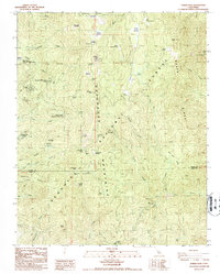
 1986 Lamont Peak1986 Print · USGSThe high Sierra Nevada backcountry near the Tulare and Inyo county lines was a landscape of remote peaks and wilderness trails in the mid-eighties. Hikers and historians can trace the original path of the Pacific Crest National Scenic Trail as it passes Chimney Peak and the Heliport.2 unique versions available
 - 1986 Map of Posey, 1987 Print
 1986 Posey1987 Print · USGSThe Southern Sierra Nevada high country near the Tulare-Kern county line comes into focus in the mid-1980s. Researchers can locate family outposts like Burton Ranch, explore the area around the Tungstore Mine, or trace the seasonal tracts at Sugarloaf Village.2 unique versions available
 - 1986 Map of Kernville, 1987 Print
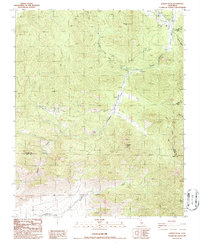
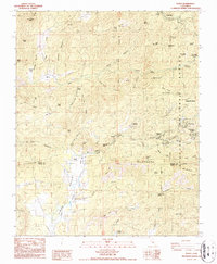
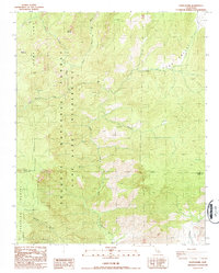
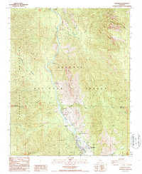 1986 Kernville1987 Print · USGSThe Kern River canyon comes into sharp focus during the mid-eighties as a hub for both hydroelectric power and mountain recreation. Researchers can trace the development of Kernville and Riverkern or locate industrial sites like the Powerhouse.2 unique versions available
 - 1986 Map of Tobias Peak, 1987 Print
 1986 Tobias Peak1987 Print · USGSThe Greenhorn Mountains and Sequoia National Forest are captured here in the mid-1980s, showcasing a landscape of high-country summer tracts and historical mining. Researchers can locate remote sites like the Sugarloaf Saw Mill, the Betty Lou Mine, and the Spear Creek Summer Home Tract.2 unique versions available
 - 1986 Map of Cannell Peak, 1987 Print
 1986 Cannell Peak1987 Print · USGSHigh Sierra backcountry in the mid-eighties was a landscape of remote granite domes and isolated forest outposts. Researchers can trace historic grazing lands and forest service activity at Cannell Meadow Forest Service Sta, Potato Patch, and the high meadows of Bartolas Country.2 unique versions available
 - 1987 Map of White Dome
 1987 White Dome1987 Print · USGSThe Sierra Nevada high country at the Tulare and Kern county line is captured here in the late eighties. Researchers can trace the rugged drainage of the South Fork Kern River and find landmarks like White Dome, Black Mountain, and Long Valley.2 unique versions available
 - 1989 Map of Paso Robles
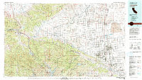
 1989 Paso Robles1989 Print · USGSCoastal mountains and the Salinas River valley meet in the late eighties as this region balances military installations and agriculture. Genealogists and historians can trace the Southern Pacific line through Paso Robles and Templeton or locate the Klau Mine and San Miguel.
End of results
Showing maps 1-15 of 15
Top cities of Kern County
- Bakersfield historical maps
- Delano historical maps
- Ridgecrest historical maps
- Wasco historical maps
- Shafter historical maps
- Arvin historical maps
See more
Frequently asked questions
- What are the different types of historical maps available for Kern County?
- What is the oldest map of Kern County?
- Where can I purchase historical maps of Kern County for my home or office?
- Where can I download high-res historical maps of Kern County?
- Are there historical topographic maps available for Kern County?
- Is there historical aerial imagery available for Kern County?
- Where are historical maps of Kern County sourced from?