1990s Maps of Kern County, California
Explore 48 historic maps of Kern County from the 1990s. These maps offer a rare glimpse into what life looked like during the 1990s — showing old roads, neighborhoods, homes, and landmarks that have changed or disappeared over time.
Whether you're researching your family's past, planning a metal detecting trip, or studying how Kern County's landscape evolved across the 1990s, these high-resolution maps are a powerful tool for exploring the history of this region.
- Focus on a specific era: All maps on this page are from the 1990s, giving you a focused view of this time period.
- See what’s changed: Compare century-old streets, trails, and buildings to today's modern landscape using overlays and satellite layers.
- Research with precision: Use these maps for genealogy, historical research, land use analysis, or educational projects.
- View, download, or print: Maps are fully viewable online in high resolution, and can be downloaded or printed for your own records.
Start exploring Kern County's history through authentic maps from the 1990s. This is your window into the past.
Kern County, CA maps
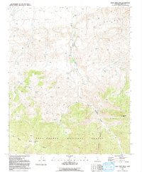
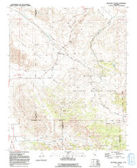
(48)- 1991 Map of Sawmill Mountain
 1991 Sawmill Mountain1991 Print · USGSThe high country of the Ventura and Kern county line is captured here in the early nineties, centered on the Pine Mountain Club community. Researchers can trace the massive San Andreas Rift Zone across the mountains or locate remote outposts like Sheep Camp and the Condor Observation Site.2 unique versions available
 - 1991 Map of Santiago Creek
 1991 Santiago Creek1991 Print · USGSThe high desert canyons and the San Andreas Fault define this Kern and Ventura County borderland in the early nineties. Geologists and local historians can trace the San Andreas Rift Zone as it cuts between the Bitter Creek National Wildlife Refuge and Santiago Corrals.
 - 1991 Map of Eagle Rest Peak
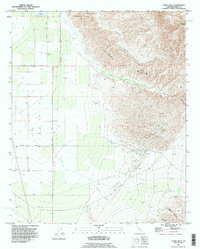
 1991 Eagle Rest Peak1991 Print · USGSThe San Emidio mountains come into focus in the early nineties, showing a landscape defined by ranching and resource extraction. Trace the legacy of the San Emidio Ranch or locate the Oil Wells and the Marian Campground near Eagle Rest Peak.
 - 1991 Map of Apache Canyon
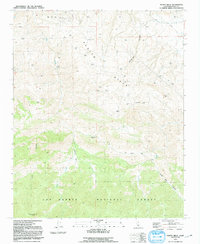
 1991 Apache Canyon1991 Print · USGSVentura and Kern counties meet in this high-elevation wilderness in the early nineties. Researchers can trace the trails and seasonal camps around Nettle Spring Campground and find remote water sources like Blue Rock Spring and Mystery Spring.2 unique versions available
 - 1991 Map of Pleito Hills
 1991 Pleito Hills1991 Print · USGSThe northern slopes of the San Emigdio Mountains come into focus in the early nineties, showing a landscape defined by ranching and oil extraction. Researchers can trace historical footprints at the Harris Ranch (Site) or locate the high reaches of Antimony Peak and Joe Clark Flat.
 - 1991 Map of Cuddy Valley
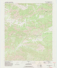
 1991 Cuddy Valley1991 Print · USGSVentura and Kern counties meet along the geological fracture of the San Andreas Rift Zone during the late twentieth century. Researchers can trace the layout of mountain communities like Pinon Pines Estates or locate historical points like the Stauffer (Site) and Adobe.2 unique versions available
 - 1991 Map of Ballinger Canyon
 1991 Ballinger Canyon1991 Print · USGSThe high-desert terrain of Kern and San Luis Obispo counties is captured here in the early nineties, dominated by the San Andreas Rift Zone. Researchers can trace old land grants like the Cuyama Grant and find quiet locales like Adobe and Stubblefield.
 - 1991 Map of Pastoria Creek, 1992 Print
 1991 Pastoria Creek1992 Print · USGSThe northern slopes of the Tehachapi Mountains come into sharp focus in the late eighties, showing the intersection of heavy industry and historic ranching. You can trace the massive California Aqueduct system, the Tejon Oil Field, and remote outposts of the Tejon Ranch.
 - 1991 Map of Lebec, 1992 Print
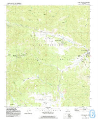
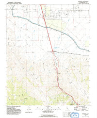
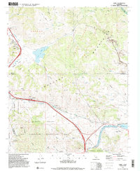 1991 Lebec1992 Print · USGSThe mountain passes of the Tejon area are captured here in the early nineties as a critical junction of infrastructure and recreation. Researchers can trace the San Andreas Rift Zone past Lebec and locate local landmarks like Castac Lake and the California Aqueduct.2 unique versions available
 - 1991 Map of Frazier Mtn, 1992 Print
 1991 Frazier Mtn1992 Print · USGSThe high mountain passes and tectonic rifts of Kern County are captured here in the early nineties. Researchers can trace the San Andreas Rift Zone, the grounds of Old Fort Tejon, and remote sites like Frazier Mine.2 unique versions available
 - 1991 Map of Grapevine, 1992 Print
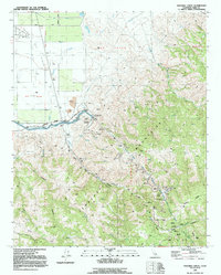
 1991 Grapevine1992 Print · USGSGrapevine Canyon and the southern edge of the Central Valley are captured in the early 1990s as a vital transportation and utility corridor. Researchers can trace the path of the California Aqueduct and locate historic sites like Rose Station and Fort Tejon State Historic Park.
 - 1992 Map of Edwards
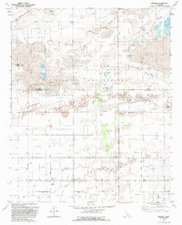
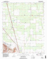
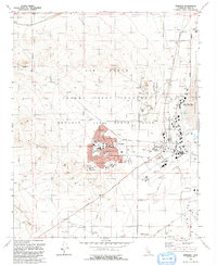 1992 Edwards1992 Print · USGSThe high desert of Kern County serves as the backdrop for military aviation history in the early nineties. Researchers can trace the layout of Edwards and its schools, from Desert HS to Bailey Sch, alongside the NASA Ames-Dryden Flight Research Facility.
 - 1992 Map of Rogers Lake South
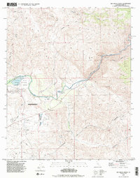
 1992 Rogers Lake South1992 Print · USGSThe high desert at the Kern and Los Angeles county line in the early nineties reveals a landscape dedicated to aerospace testing. Researchers can trace military infrastructure from Mercury Boulevard to the Tracking Station and Rogers Lake shoreline.2 unique versions available
 - 1992 Map of Rogers Lake North
 1992 Rogers Lake North1992 Print · USGSIn the California desert during the early 1990s, this area served as a critical hub for American aerospace and flight research. Military historians and researchers can trace the infrastructure of Edwards Air Force Base, from the NASA Jet Propulsion Laboratory to the Old Railroad Grade.
 - 1992 Map of Redman
 1992 Redman1992 Print · USGSThe high desert of northern Los Angeles County is captured here in the early nineties as the military and civilian worlds converge. Trace the intersection of desert life and defense at Redman, the Air Force Flight Test Center, and the dry beds of Rogers Lake.
 - 1992 Map of Tehachapi South, 1995 Print
 1992 Tehachapi South1995 Print · USGSThe southern fringes of the high desert and mountain passes are captured here during the 1990s. Researchers can trace old mining sites like the Uncle Sam Mine, find remote water sources such as Indian John Spring, and locate the historic Oak Creek Pass.
 - 1992 Map of Tehachapi North, 1995 Print
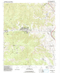
 1992 Tehachapi North1995 Print · USGSThe Tehachapi Pass region is shown here in the early nineties, where the high-altitude rail line and local industry meet. Genealogists and rail historians can trace the Southern Pacific RR through Cable and Summit, or locate local landmarks like the Cem and Old Town.
 - 1992 Map of Rio Bravo Ranch, 1995 Print
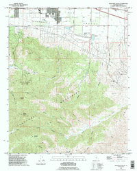
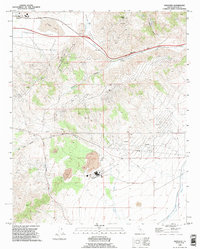
 1992 Rio Bravo Ranch1995 Print · USGSNortheast of Bakersfield in the early nineties, this area showcases the intersection of the Kern River economy and foothill ranching. Researchers can trace the development of Lake Ming, the industrial footprint of the local Oil Field, and landmarks like the Father Garces Monument.2 unique versions available
 - 1992 Map of Tejon Hills, 1995 Print
 1992 Tejon Hills1995 Print · USGSKern County ranch lands and petroleum works meet the base of the Sierra Nevada foothills in the 1990s. Researchers can trace land grant lines and water sources like Bino Springs, alongside infrastructure of the El Tejon Field and Tejon Creek.
 - 1992 Map of Tehachapi NE, 1995 Print
 1992 Tehachapi NE1995 Print · USGSKern County’s high desert peaks and canyons are captured here in the early nineties, revealing a landscape of mining and industrial utility. You can trace the Inclined Railway, locate the Horse Canyon Agate Beds, or find the small Cem tucked near Sand Canyon.
 - 1992 Map of Lamont, 1995 Print
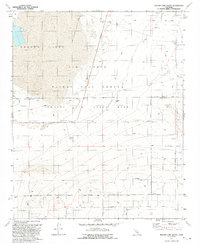
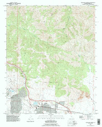
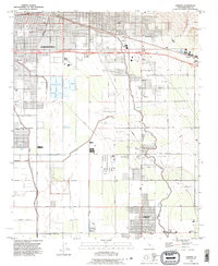 1992 Lamont1995 Print · USGSThe outskirts of Bakersfield and the surrounding San Joaquin Valley are captured here in the early nineties, showing a landscape defined by petroleum and irrigation. Researchers can trace the industrial footprints of Fuller Acres, the Union Cemetery, and the Kern Island Canal.
 - 1992 Map of Bear Mountain, 1995 Print
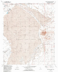
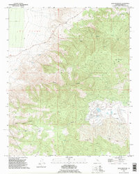 1992 Bear Mountain1995 Print · USGSThe Tehachapi Mountains come into sharp focus in the early nineties, showing a landscape of cattle ranching and modern utility corridors. Trace the transition from El Tejon up to Bear Mountain and search for landmarks like Horsethief Flat and Bear Valley.
 - 1992 Map of Mettler, 1995 Print
 1992 Mettler1995 Print · USGSThe southern San Joaquin Valley comes into focus during the early 1990s, where intensive agriculture meets the petroleum industry. Researchers can trace the path of the Governor Brown California Aqueduct and locate local landmarks like the Oil Field and Mettler.
 - 1992 Map of Monolith, 1995 Print
 1992 Monolith1995 Print · USGSTehachapi Valley is shown during a period of industrial activity in the early nineties, centered on the high mountain passes. Researchers can trace the Los Angeles Aqueduct and locate various Mine sites near Monolith and Cameron.
 - 1992 Map of Keene, 1995 Print
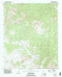
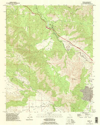 1992 Keene1995 Print · USGSIn the mountains of Kern County during the 1990s, the railroad remains the heart of the landscape. Trace the path of the Southern Pacific through The Loop and find historical rail stops at Walong, Keene, and Woodford.
Showing maps 1-25 of 48
Top cities of Kern County
- Bakersfield historical maps
- Delano historical maps
- Ridgecrest historical maps
- Wasco historical maps
- Shafter historical maps
- Arvin historical maps
See more
Frequently asked questions
- What are the different types of historical maps available for Kern County?
- What is the oldest map of Kern County?
- Where can I purchase historical maps of Kern County for my home or office?
- Where can I download high-res historical maps of Kern County?
- Are there historical topographic maps available for Kern County?
- Is there historical aerial imagery available for Kern County?
- Where are historical maps of Kern County sourced from?