1910s Maps of Illinois
Explore 65 historic maps of Illinois from the 1910s. These maps offer a rare glimpse into what life looked like during the 1910s — showing old roads, neighborhoods, homes, and landmarks that have changed or disappeared over time.
Whether you're researching your family's past, planning a metal detecting trip, or studying how Illinois's landscape evolved across the 1910s, these high-resolution maps are a powerful tool for exploring the history of this region.
- Focus on a specific era: All maps on this page are from the 1910s, giving you a focused view of this time period.
- See what’s changed: Compare century-old streets, trails, and buildings to today's modern landscape using overlays and satellite layers.
- Research with precision: Use these maps for genealogy, historical research, land use analysis, or educational projects.
- View, download, or print: Maps are fully viewable online in high resolution, and can be downloaded or printed for your own records.
Start exploring Illinois's history through authentic maps from the 1910s. This is your window into the past.
Illinois maps
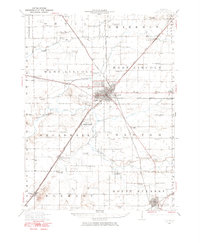
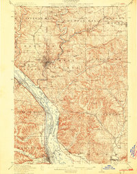
(65)- 1910 Map of Herrin
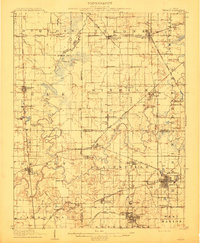 1910 Herrin1910 Print · USGSSouthern Illinois thrived at the height of its rail-and-coal era, with this 1910 survey capturing a landscape of growing towns and industrial spurs. Genealogists and historians can trace family roots through localized sites like Dewmaine, Old Duquoin, and the Oak Grove School.2 unique versions available
 - 1910 Map of Carlyle
 1910 Carlyle1910 Print · USGSClinton County and the Kaskaskia River valley are captured here at a peak of rural development in the Edwardian era. Genealogists can trace a dense network of family-named landmarks including Hull School, McKendree Chapel, and the river crossing at Colmers Ferry.2 unique versions available
 - 1910 Map of Hardinville
 1910 Hardinville1910 Print · USGSSoutheastern Illinois at the start of the century reveals a landscape defined by the Embarrass River and early oil exploration. Genealogists can trace family roots through numerous local landmarks like Oil Center, Lucky Ford Ferry, and the Mann School.2 unique versions available
 - 1910 Map of Murphysboro
 1910 Murphysboro1910 Print · USGSSouthern Illinois at the turn of the century shows a landscape of busy rail junctions and tight-knit rural school districts. Genealogists can trace family footprints at Sutter Church, Sodom School, and the early township centers of Oraville and Vergennes.2 unique versions available
 - 1910 Map of Okawville
 1910 Okawville1910 Print · USGSEastern St. Clair and Washington counties appear here in the early 1900s, where the winding river bottomlands met the expanding railroad. Local historians can trace the development of Okawville along the Louisville & Nashville RR or find rural landmarks like Stone Church and Woodland School.2 unique versions available
 - 1910 Map of Rock Island, 1949 Print
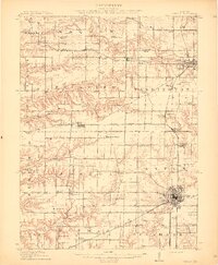
 1910 Rock Island1949 Print · USGSEastern Iowa and the Illinois borderlands come alive in this late nineteenth-century survey of the river valleys and rail hubs. Genealogists and historians can trace old homesteads near Lost Nation, the early streets of Dewitt, and the sprawling U.S. Arsenal.
 - 1910 Map of Waterloo, 1956 Print
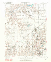
 1910 Waterloo1956 Print · USGSMonroe and St. Clair counties are shown in detail during the early twentieth century, highlighting a landscape of rail-dependent prairie towns. Family historians can trace rural schools and churches like Oakdale School or Zion Church, and locate early stops on the Mobile and Ohio RR.
 - 1911 Map of La Salle
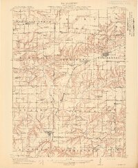
 1911 La Salle1911 Print · USGSThe Illinois River valley thrived as a hub of rail and river commerce in the early twentieth century. Researchers can trace the development of industrial centers like La Salle and Oglesby, or locate vanished post offices and rural landmarks like Standard Taft PO and St Bedes College.
 - 1911 Map of Hennepin
 1911 Hennepin1911 Print · USGSThe Illinois River valley and the railroad hub of Princeton are captured here at the height of the steam era. Genealogists and historians can trace family locations near the Highland School, Berean Church, and early village sites like Tiskilwa and Hallowayville.2 unique versions available
 - 1911 Map of Elizabeth
 1911 Elizabeth1911 Print · USGSNorthwestern Illinois at the start of the century was a landscape of ridge-top schools and valley-floor mines. Genealogists can trace early homesteads near Salem Church or locate historic mining operations like the Illinois Mines and Skene Mine.2 unique versions available
 - 1911 Map of Galena, 1953 Print
 1911 Galena1953 Print · USGSBefore the decline of the local lead industry, this area was a hub of mining and river commerce. Genealogists can trace family names through dozens of rural schools and mines like Blackjack Mine, or locate long-lost river crossings like Gears Ferry.3 unique versions available
 - 1911 Map of Sumner, 1954 Print
 1911 Sumner1954 Print · USGSSoutheast Illinois at the dawn of the twentieth century was a landscape of bustling rail towns and ubiquitous country schools. Genealogists can locate family-named landmarks and long-lost rural centers like Berryville, the Oil Tanks of Bridgeport, and Frogeye School.
 - 1911 Map of Lincoln, 1967 Print
 1911 Lincoln1967 Print · USGSLogan County at the dawn of the automotive age shows a landscape defined by rail lines and one-room schoolhouses. Genealogists can trace family footprints at Rose Hill Cemetery or locate ancestral farm sites near Hartsburg, Broadwell, and Mount Pulaski.
 - 1912 Map of New Athens
 1912 New Athens1912 Print · USGSThe St. Clair County prairies in the early nineteen-hundreds were a bustling corridor of river commerce and rail expansion. Genealogists and historians can locate vanished landmarks like Lementon, dozens of country schools, and the Kaskaskia River oxbows.2 unique versions available
 - 1912 Map of Canton
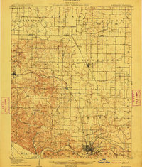
 1912 Canton1912 Print · USGSFulton County's coal-and-rail corridor is in full operation at the beginning of the twentieth century, with Canton serving as the regional center. Genealogists and local historians can trace family roots through dozens of rural landmarks like Lone Elm School, the Seller Mine, and the County Farm.4 unique versions available
 - 1912 Map of Milan
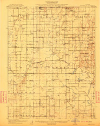
 1912 Milan1912 Print · USGSThe river confluence and burgeoning rail networks of Rock Island County are captured here just before the First World War. Researchers can trace the legacy of early industry and education through sites like the Coal Valley Mine, Blackhawk Watchtower, and Excelsior School.7 unique versions available
 - 1912 Map of Kimmswick
 1912 Kimmswick1912 Print · USGSThe Illinois bottomlands along the Mississippi River are shown here in the early twentieth century, just as the railroad was solidifying the region's economy. Genealogists and local researchers can trace the locations of Harrisonville, the Blue Church, and historic schools like Miles Prairie School.2 unique versions available
 - 1912 Map of Macomb, 1966 Print
 1912 Macomb1966 Print · USGSMcDonough County during the early twentieth century shows a landscape of scattered farmsteads and one-room schoolhouses. Genealogists can trace family landmarks like Runkle School and Pennington Point or follow the path of the Waubonsie Trail.
 - 1912 Map of Baldwin, 1967 Print
 1912 Baldwin1967 Print · USGSRandolph and St. Clair counties come alive in this early twentieth-century survey of the Kaskaskia River valley. Genealogists can trace family footprints across dozens of local school sites, including Charter Oak School, Stringtown School, and the rural community of Schuline.
 - 1912 Map of Gillespie, 1971 Print
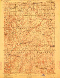
 1912 Gillespie1971 Print · USGSMacoupin County at the height of its mining and rail era reveals a landscape of industrial towns and dense rural school districts. Genealogists and historians can trace numerous named institutions like Spanish Needle School, the Wayne Cem, and coal operations like Mine No 7.
 - 1913 Map of Colchester
 1913 Colchester1913 Print · USGSWestern Illinois at the start of the twentieth century was a landscape of dense rural school districts and prairie rail towns. Trace the early footprints of Colchester and Tennessee, or locate forgotten sites like Vishnu Sprs and the Clay Mine.3 unique versions available
 - 1913 Map of La Salle
 1913 La Salle1913 Print · USGSThe industrial heart of the Illinois River valley thrives in the early twentieth century, showing the intersection of heavy rail and river trade. Genealogists can trace family homes near St Bedes College or find old post offices like Standard Taft PO and rural stops at Hicks Corners.4 unique versions available
 - 1913 Map of Waterloo
 1913 Waterloo1913 Print · USGSMonroe and St. Clair counties are shown just after the first decade of the twentieth century as the region’s rural economy matured. Genealogists can trace family footprints through dozens of rural landmarks like Diamond Joe Mine, Palmer Cem, and the Mobile and Ohio RR.3 unique versions available
 - 1913 Map of Galena
 1913 Galena1913 Print · USGSThe mining and river districts of Jo Daviess County are captured here just before the First World War. Genealogists and researchers can locate family-named landmarks like Horseshoe Mound, local schools such as Miners School, and industrial sites like the Hoskin Mine.3 unique versions available
 - 1913 Map of Sumner
 1913 Sumner1913 Print · USGSThe rural landscape of Lawrence and Richland counties is captured here just before the First World War, centered on the BALTIMORE AND OHIO SOUTHWESTERN rail line. Genealogists can locate numerous rural schools like Frogeye School and Buckhorn School or trace the early Oil Tanks near Bridgeport.2 unique versions available
Showing maps 1-25 of 65
Top cities of Illinois
- Chicago historical maps
- Aurora historical maps
- Joliet historical maps
- Naperville historical maps
- Rockford historical maps
- Springfield historical maps
See more
Top counties of Illinois
- Cook County historical maps
- Lake County historical maps
- McHenry County historical maps
- Winnebago County historical maps
- Madison County historical maps
- Saint Clair County historical maps
See more
Frequently asked questions
- What are the different types of historical maps available for Illinois?
- What is the oldest map of Illinois?
- Where can I purchase historical maps of Illinois for my home or office?
- Where can I download high-res historical maps of Illinois?
- Are there historical topographic maps available for Illinois?
- Is there historical aerial imagery available for Illinois?
- Where are historical maps of Illinois sourced from?