1960s Maps of Illinois
Explore 311 historic maps of Illinois from the 1960s. These maps offer a rare glimpse into what life looked like during the 1960s — showing old roads, neighborhoods, homes, and landmarks that have changed or disappeared over time.
Whether you're researching your family's past, planning a metal detecting trip, or studying how Illinois's landscape evolved across the 1960s, these high-resolution maps are a powerful tool for exploring the history of this region.
- Focus on a specific era: All maps on this page are from the 1960s, giving you a focused view of this time period.
- See what’s changed: Compare century-old streets, trails, and buildings to today's modern landscape using overlays and satellite layers.
- Research with precision: Use these maps for genealogy, historical research, land use analysis, or educational projects.
- View, download, or print: Maps are fully viewable online in high resolution, and can be downloaded or printed for your own records.
Start exploring Illinois's history through authentic maps from the 1960s. This is your window into the past.
Illinois maps
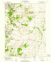
(311)- 1960 Map of Rolla
 1960 Rolla1960 Print · USGSThe Ozark Highlands in the mid-twentieth century reveal a landscape of deep timber and heavy industry. Researchers can trace the rail-and-mine economy through the St Louis-San Francisco RR and the Iron Mountain Mine, alongside the growth of Fort Leonard Wood.
 - 1960 Map of Marquette Heights, 1961 Print
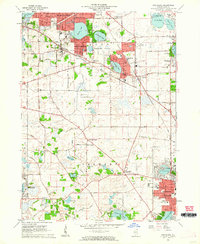
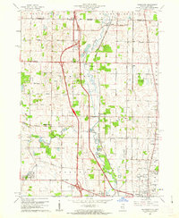
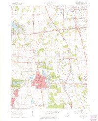
 1960 Marquette Heights1961 Print · USGSTazewell County undergoes a shift toward suburban expansion at the start of the sixties, even as the rural character of its townships remains largely intact. Researchers can trace family history through sites like the Brush Hill Sch, Glendale Memorial Cemetery, and the County Home.3 unique versions available
 - 1960 Map of Pekin, 1961 Print
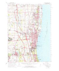
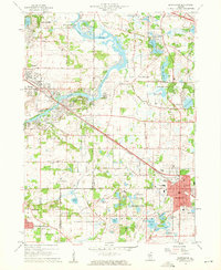
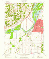 1960 Pekin1961 Print · USGSThe riverfront industry and rail networks of the Illinois valley are on full display in this mid-century survey of the Pekin area. Researchers can trace family history through sites like Lakeside Cemetery or locate vanished landmarks like the Drive-in Theater and Orchard Mines.3 unique versions available
 - 1960 Map of Fox Lake, 1962 Print
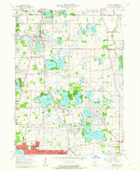
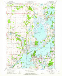 1960 Fox Lake1962 Print · USGSThe Chain O’Lakes region in the early sixties was a bustling landscape of resort life and growing residential pockets. Trace the layout of settlements like Lotus Woods, locate local landmarks like Wilmot Hills Raceway, and find family-named cemeteries such as Orvis Cem.3 unique versions available
 - 1960 Map of Lake Zurich, 1962 Print
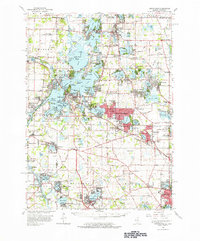
 1960 Lake Zurich1962 Print · USGSSoutheastern Lake County transitioned from rural farming to suburban communities during the early sixties. Genealogists and local researchers can locate family plots at Fairfield Cem or Cady Cem and trace old rail lines through Lake Zurich.4 unique versions available
 - 1960 Map of Waukegan, 1962 Print
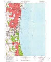 1960 Waukegan1962 Print · USGSThe Lake Michigan shoreline in the early sixties shows a dense industrial and military landscape stretching from Waukegan to Lake Forest. Researchers can trace the massive Great Lakes Naval Training Center and old family plots at St Marys Cem or Northshore Cemetery.4 unique versions available
 - 1960 Map of Grayslake, 1962 Print
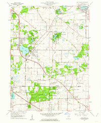
 1960 Grayslake1962 Print · USGSLake County was entering a period of suburban transformation in the early sixties as former resort areas became permanent residential hubs. Researchers can trace the development of Round Lake Beach, old schools like Swan Sch, and cemeteries such as Avon Centre Cem.4 unique versions available
 - 1960 Map of Zion, 1962 Print
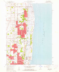 1960 Zion1962 Print · USGSThe Lake Michigan coast at the turn of the 1960s shows the suburban and industrial expansion of Lake County. Local historians can trace the development of ZION and Winthrop Harbor, from the Jack Benny Jr High Sch to the grounds of Camp Logan and ILLINOIS BEACH STATE PARK.3 unique versions available
 - 1960 Map of Waukegan, 1962 Print
 1960 Waukegan1962 Print · USGSCoastal Lake County thrives in the early sixties as industrial centers and military installations expand along the lakefront. Researchers can locate family landmarks like St Patricks Cem, trace the rail corridors of Rondout, or explore the grounds of St Marys of the Lake Seminary.
 - 1960 Map of Wadsworth, 1962 Print
 1960 Wadsworth1962 Print · USGSNortheastern Illinois and the Wisconsin borderlands are captured here during the early years of the tollway era. Genealogists and historians can trace family plots at Mount Rest Cem or locate community centers like Newport Sch and York House Ch.3 unique versions available
 - 1960 Map of Lake Calumet, 1962 Print
 1960 Lake Calumet1962 Print · USGSThe industrial south side of Chicago and the Indiana borderlands meet in this early 1960s survey. Genealogists and historians can trace neighborhood evolution through parish schools like Our Lady of Hungary Sch, early housing at Altgeld Gardens, and the heavy rail lines of the Pennsylvania RR.
 - 1960 Map of Barrington, 1962 Print
 1960 Barrington1962 Print · USGSThe Fox River valley and the emerging suburban corridors of Cook and Lake Counties are captured here at the dawn of the 1960s. Researchers can locate family landmarks such as Evergreen Cem, St Ann Sch, and the rail lines of the Chicago and North Western.4 unique versions available
 - 1960 Map of Calumet City, 1962 Print
 1960 Calumet City1962 Print · USGSGreater Chicago's southeastern industrial corridor meets the Indiana state line in this early 1960s survey of burgeoning suburbs and rail hubs. Researchers can trace family roots at Holy Cross Cemetery, locate the old Chicago Hammond Airport, or study the rail network of the Grand Trunk and Monon lines.
 - 1960 Map of Wauconda, 1962 Print
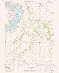
 1960 Wauconda1962 Print · USGSThe Fox River and its surrounding glacial lakes are shown during a period of mid-century residential growth. Researchers can trace the development of Island Lake and Wauconda, or locate local landmarks like the Drive-in Theater and St Marys Chapel.5 unique versions available
 - 1960 Map of Antioch, 1962 Print
 1960 Antioch1962 Print · USGSLake County's glacial terrain was rapidly evolving in the early sixties as new suburbs like Lindenhurst rose among the ancient waters. Researchers can trace family roots at St Benedicts Abbey, Hickory Union Cem, and the early runways of Antioch Airport.3 unique versions available
 - 1960 Map of Libertyville, 1962 Print
 1960 Libertyville1962 Print · USGSLake County at the dawn of the sixties shows a landscape of expanding suburbs and historic institutions. Genealogists and local historians can trace landmarks like St Marys of the Lake Seminary, Ascension Cemetery, and the Rondout rail junction.5 unique versions available
 - 1960 Map of Grayslake, 1965 Print
 1960 Grayslake1965 Print · USGSLake County's glacial landscape is captured here in the early sixties, showing the rise of commuter suburbs among the region's famous waterways. Researchers can locate dozens of country landmarks like Wray-Imeson Cem, Allendale Farm Sch, and Antioch Airport.
 - 1961 Map of Dubuque
 1961 Dubuque1961 Print · USGSThe Tri-State region's river-and-rail landscape is captured here during the early sixties, showing the convergence of Iowa, Illinois, and Wisconsin. Trace mid-century rail lines like the Chicago Great Western Ry and explore sites like the Savanna Ordnance Depot and Backbone State Park.
 - 1961 Map of Aurora
 1961 Aurora1961 Print · USGSNorthern Illinois at the height of the post-war era reveals a landscape of massive industrial works and thriving river towns. Genealogists and historians can trace the paths of the Lincoln Highway or locate long-standing landmarks like the Green River Ordnance Plant and Starved Rock State Park.
 - 1961 Map of Burlington
 1961 Burlington1961 Print · USGSThe tri-state borderlands along the Mississippi River are captured here during the late fifties and early sixties, showing the vital river-and-rail economy of Iowa, Illinois, and Missouri. Genealogists and historians can trace the development of major hubs like Galesburg and Macomb alongside landmark sites such as the Iowa Ordnance Plant and the historic river town of Nauvoo.
 - 1961 Map of Peoria
 1961 Peoria1961 Print · USGSCentral Illinois thrived at the intersection of river trade and rail power during the late fifties. Genealogists and local historians can trace the rail networks of the Illinois Central and Wabash, alongside landmarks like Chanute AFB and Weldon Springs State Park.
 - 1961 Map of Davenport
 1961 Davenport1961 Print · USGSThe Quad Cities and the eastern Iowa riverlands are captured here in the early sixties, showing the region's transition into a modern industrial and transit hub. Genealogists and historians can trace the paths of major railroads and find river landmarks like Rock Island Arsenal, Huron Island, and the Coralville Reservoir.
 - 1961 Map of New City
 1961 New City1961 Print · USGSSangamon County at the start of the 1960s reveals a landscape balancing suburban growth near Southlawn with the rural traditions of Cotton Hill. Researchers can locate historic family sites like Brunk Cem, the village of New City, and the Baltimore and Ohio rail line.3 unique versions available
 - 1961 Map of Decatur
 1961 Decatur1961 Print · USGSCentral Illinois in the late fifties was a bustling corridor of rail lines and prairie commerce centered on the state capital. Genealogists and historians can trace the intricate connections between Springfield, Decatur, and dozens of smaller settlements like Nokomis and Arcola.2 unique versions available
 - 1961 Map of Paducah
 1961 Paducah1961 Print · USGSThe Lower Ohio Valley at mid-century is a landscape defined by its great rivers and newly formed reservoirs. Researchers can trace the riverfronts of Paducah and Metropolis, or locate smaller settlements like Old Shawneetown and Cave in Rock along the banks.2 unique versions available
Showing maps 1-25 of 311
Top cities of Illinois
- Chicago historical maps
- Aurora historical maps
- Joliet historical maps
- Naperville historical maps
- Rockford historical maps
- Springfield historical maps
See more
Top counties of Illinois
- Cook County historical maps
- Lake County historical maps
- McHenry County historical maps
- Winnebago County historical maps
- Madison County historical maps
- Saint Clair County historical maps
See more
Frequently asked questions
- What are the different types of historical maps available for Illinois?
- What is the oldest map of Illinois?
- Where can I purchase historical maps of Illinois for my home or office?
- Where can I download high-res historical maps of Illinois?
- Are there historical topographic maps available for Illinois?
- Is there historical aerial imagery available for Illinois?
- Where are historical maps of Illinois sourced from?