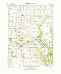
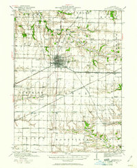
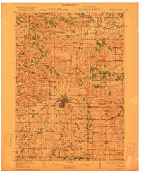
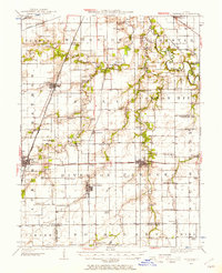
1920s Maps of Illinois
Explore 263 historic maps of Illinois from the 1920s. These maps offer a rare glimpse into what life looked like during the 1920s — showing old roads, neighborhoods, homes, and landmarks that have changed or disappeared over time.
Whether you're researching your family's past, planning a metal detecting trip, or studying how Illinois's landscape evolved across the 1920s, these high-resolution maps are a powerful tool for exploring the history of this region.
- Focus on a specific era: All maps on this page are from the 1920s, giving you a focused view of this time period.
- See what’s changed: Compare century-old streets, trails, and buildings to today's modern landscape using overlays and satellite layers.
- Research with precision: Use these maps for genealogy, historical research, land use analysis, or educational projects.
- View, download, or print: Maps are fully viewable online in high resolution, and can be downloaded or printed for your own records.
Start exploring Illinois's history through authentic maps from the 1920s. This is your window into the past.
Illinois maps
- 1920 Map of Goloonda
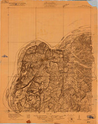 1920 Goloonda1920 Print · USGSThe Ohio River bottomlands of Livingston County are captured here just after the Great War, when river ferries and rural schoolhouses still anchored local life. Genealogists and researchers can trace family lands near Berry Ferry, Mt Pisgah Church, or the many district schools like Trimble School.
 - 1920 Map of Grays Lake
 1920 Grays Lake1920 Print · USGSLake County and the Illinois-Wisconsin borderlands are shown here in the early twenties, when the region was a bustling network of lakeside retreats and rural school districts. Genealogists and historians can trace dozens of family-named landmarks and institutions, including the English Prairie School, St Marys Chapel, and Union Cemetery.3 unique versions available
 - 1920 Map of Jonesboro
 1920 Jonesboro1920 Print · USGSSouthern Illinois during the late post-war era reveals a complex landscape of Mississippi riverfront bottoms and high ridges. Genealogists can trace family roots through numerous local landmarks, from the Casper Church to rural schools like Big Barn School and McClure School.
 - 1920 Map of Dongola, 1953 Print
 1920 Dongola1953 Print · USGSSouthern Illinois at the close of the 1910s reveals a landscape of river-bottom farms and busy rail junctions. Genealogists can trace family roots through dozens of local landmarks like Beech Grove School, Joppa Junction, and the State Hospital.3 unique versions available
 - 1920 Map of Monroe, 1960 Print
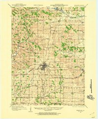 1920 Monroe1960 Print · USGSGreen County at the start of the twenties was a landscape of thriving rail towns and dozens of country schoolhouses. Genealogists can trace family footprints near named sites like Hardscrabble School, the County Farm, or along the Sugar River valley.
 - 1921 Map of Fords Ferry
 1921 Fords Ferry1921 Print · USGSCrittenden County in the early twenties shows a landscape of river-dependent commerce and small rural hamlets connected by the Illinois Central. Genealogists can trace family footprints through dozens of local landmarks like Shelby Store, Hurricane Church, and the Seminary School.
 - 1921 Map of Golconda
 1921 Golconda1921 Print · USGSThe Ohio River valley at the start of the 1920s reveals a bustling corridor of small river towns and rural school districts spanning Illinois and Kentucky. Genealogists and historians can trace family roots through dozens of local landmarks like Berrys Ferry, Cammens Store, and the Bethel Church.3 unique versions available
 - 1921 Map of Vermont
 1921 Vermont1921 Print · USGSWestern Illinois prairie and river breaks are documented here just after the Great War, showing a landscape defined by small family farms. Researchers can trace rural school districts and pioneer churches like Mud Acre School, Mt Pleasant Church, and the settlement at Bernadotte.2 unique versions available
 - 1921 Map of Buda, 1959 Print
 1921 Buda1959 Print · USGSBureau County’s rail-and-water corridors are in full bloom in the 1920s, showing the intersection of heavy industry and small-town life. Trace family roots through dozens of local landmarks like the County Farm, Old Manlius Church, and the Illinois and Mississippi Canal.
 - 1921 Map of Monmouth, 1961 Print
 1921 Monmouth1961 Print · USGSWarren County at the opening of the 1920s reveals a bustling agricultural landscape centered on the rail hub of Monmouth. Genealogists and historians can trace dozens of country schools and vanished locales like Coonville, Farmers Academy, and the County Farm.3 unique versions available
 - 1922 Map of Monroe
 1922 Monroe1922 Print · USGSGreen County at the start of the twenties reveals a landscape of thriving rural school districts and busy rail lines. Genealogists can locate family-named landmarks like Hardscrabble School, the County Farm, and the early village of Juda.
 - 1922 Map of Carbondale
 1922 Carbondale1922 Print · USGSSouthern Illinois in the early 1920s is captured here at the height of its rail-driven rural development. Genealogists can trace family connections through dozens of named rural sites like Stone School, Cottage Home Church, and the Illinois Central corridor.3 unique versions available
 - 1922 Map of Cape Girardeau, 1954 Print
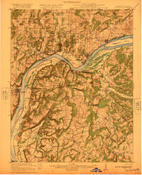
 1922 Cape Girardeau1954 Print · USGSThe Missouri-Illinois riverfront was a bustling corridor of rail and river commerce in the early 1920s. Genealogists can trace family names through dozens of rural landmarks like Rock Hill Church, Needmore School, and the river landing at Neelys Landing.3 unique versions available
 - 1922 Map of Divernon, 1957 Print
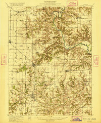
 1922 Divernon1957 Print · USGSThe Sangamon County prairie in the early twenties was a landscape of bustling rail towns and one-room schoolhouses. Genealogists can trace family roots through dozens of local landmarks like Cotton Hill Academy, Stout Church, and the Illinois Traction System.
 - 1922 Map of Momence, 1958 Print
 1922 Momence1958 Print · USGSThe Kankakee River valley in the early twenties is a landscape of river islands and busy rail junctions. Genealogists and historians can locate dozens of country schools like Frogtown School and Searls School or trace the Illinois-Indiana border at Illinoi.
 - 1922 Map of Kankakee, 1959 Print
 1922 Kankakee1959 Print · USGSThe Kankakee valley thrived in the early 1920s as a major crossroads of electric interurbans and transcontinental railroads. Researchers can trace the footprints of numerous rural schoolhouses, the East Illinois Hospital grounds, and historic routes like the Egyptian Trail.2 unique versions available
 - 1922 Map of Oregon, 1967 Print
 1922 Oregon1967 Print · USGSNorthern Illinois at the start of the twenties reveals a landscape of thriving rail towns and numerous one-room schoolhouses. Genealogists can trace family footprints at Wessels School, Ebenezer Church, and early village sites like Adeline and Egan.
 - 1923 Map of Carlinville
 1923 Carlinville1923 Print · USGSMacoupin County in the early twenties reveals a landscape connected by the Illinois Traction System and scores of one-room schoolhouses. Genealogists can locate family landmarks like Bethel Cem, Liberty Church, and dozens of named rural schools from Franklin School to Cherry Grove School.
 - 1923 Map of Grays Lake
 1923 Grays Lake1923 Print · USGSThe glacial lake country of northern Illinois is captured here in the early twenties, just as the resort and rail economy flourished. Genealogists can trace family roots at St Marys Chapel, English Prairie School, and numerous villages like Wauconda and Spring Grove.4 unique versions available
 - 1923 Map of Barrington
 1923 Barrington1923 Print · USGSNorthwest of Chicago in the early twenties, these townships were a network of farm-to-market roads and lakefront resorts. Trace the early boundaries of the Cook County Forest Preserve and find long-gone rural landmarks like Speeck Resort or Quentins Corners.4 unique versions available
 - 1923 Map of Monmouth
 1923 Monmouth1923 Print · USGSWarren County in the early twenties was a thriving prairie landscape defined by its dense network of rural schools and rail junctions. Researchers can trace dozens of early educational sites like Hickory College and Scotchtown School or locate the historic COUNTY FARM near the hub of Monmouth.2 unique versions available
 - 1923 Map of Buda
 1923 Buda1923 Print · USGSBureau County’s agricultural heartland is captured here in the 1920s, defined by its intensive network of railroads and the Illinois and Mississippi Canal. Genealogists and historians can locate scores of one-room schoolhouses like Hickory Grove School and family-named landmarks such as Cedar Bluff.2 unique versions available
 - 1923 Map of Joliet
 1923 Joliet1923 Print · USGSJoliet and the Des Plaines River valley are shown here in the 1920s, a hub of heavy industry and vital shipping canals. Genealogists and local historians can trace family roots through numerous country schools like Spaulding School, the Du Page Church, and the expansive State Penitentiary Farm.5 unique versions available
 - 1923 Map of Dongola
 1923 Dongola1923 Print · USGSSouthern Illinois in the early twenties reveals a landscape of marshy river bottoms and upland family farms. Researchers can trace ancestral locations through dozens of named rural sites like St Johns Church, Egypt School, and Hoppa Junction.2 unique versions available
 - 1923 Map of Alexis
 1923 Alexis1923 Print · USGSNorthwestern Illinois at the height of the steam-rail era shows a countryside dotted with local schools and coal-hauling branch lines. Genealogists and historians can trace family ties to Ohio Grove Church, Mann Cemetery, or vanished stops like Shale City.2 unique versions available
Showing maps 1-25
Top cities of Illinois
- Chicago historical maps
- Aurora historical maps
- Joliet historical maps
- Naperville historical maps
- Rockford historical maps
- Springfield historical maps
See more
Top counties of Illinois
- Cook County historical maps
- Lake County historical maps
- McHenry County historical maps
- Winnebago County historical maps
- Madison County historical maps
- Saint Clair County historical maps
See more
Frequently asked questions
- What are the different types of historical maps available for Illinois?
- What is the oldest map of Illinois?
- Where can I purchase historical maps of Illinois for my home or office?
- Where can I download high-res historical maps of Illinois?
- Are there historical topographic maps available for Illinois?
- Is there historical aerial imagery available for Illinois?
- Where are historical maps of Illinois sourced from?