1920s Maps of Indiana
Explore 15 historic maps of Indiana from the 1920s. These maps offer a rare glimpse into what life looked like during the 1920s — showing old roads, neighborhoods, homes, and landmarks that have changed or disappeared over time.
Whether you're researching your family's past, planning a metal detecting trip, or studying how Indiana's landscape evolved across the 1920s, these high-resolution maps are a powerful tool for exploring the history of this region.
- Focus on a specific era: All maps on this page are from the 1920s, giving you a focused view of this time period.
- See what’s changed: Compare century-old streets, trails, and buildings to today's modern landscape using overlays and satellite layers.
- Research with precision: Use these maps for genealogy, historical research, land use analysis, or educational projects.
- View, download, or print: Maps are fully viewable online in high resolution, and can be downloaded or printed for your own records.
Start exploring Indiana's history through authentic maps from the 1920s. This is your window into the past.
Indiana maps
- 1922 Map of Momence, 1958 Print
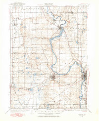
 1922 Momence1958 Print · USGSThe Kankakee River valley in the early twenties is a landscape of river islands and busy rail junctions. Genealogists and historians can locate dozens of country schools like Frogtown School and Searls School or trace the Illinois-Indiana border at Illinoi.
 - 1924 Map of Momence
 1924 Momence1924 Print · USGSEastern Illinois and the Indiana borderlands are captured here during the 1920s, showing a landscape defined by the Kankakee River and a web of rail lines. Researchers can trace dozens of legacy district schools like Frogtown School and locate family landmarks in Momence, St Anne, and Grant Park.2 unique versions available
 - 1927 Map of Niles
 1927 Niles1927 Print · USGSBerrien County and the Michigan-Indiana borderlands are captured here during the late 1920s, showing a landscape of river-powered towns and rural school districts. Genealogists can trace family roots through dozens of local landmarks like Ruggles Cem, Salem Ch, and Emmanuel Missionary College.
 - 1928 Map of Lawrenceburg, 1962 Print
 1928 Lawrenceburg1962 Print · USGSThe tri-state river valley at the end of the Roaring Twenties shows a landscape shaped by the Ohio River and bustling rail junctions. Researchers can trace historic ferries like the Lawrenceburg Ferry and find family-named landmarks like Commissary Corner or the Bullittsburg Ch.
 - 1929 Map of Calumet Lake
 1929 Calumet Lake1929 Print · USGSThe industrial heart of the South Side and the Indiana borderlands comes alive in this survey of the Calumet region. Genealogists and historians can trace the streets of Pullman, the extensive rail yards of the Belt Ry of Chicago, and early features like the Pullman Training School.3 unique versions available
 - 1929 Map of Calumet City
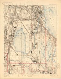
 1929 Calumet City1929 Print · USGSThe Calumet region during the late twenties shows a landscape transitioning from rural townships to industrial hubs. Genealogists and historians can trace the early rail networks, numerous family-named cemeteries like Oak Hill Cem, and local landmarks such as the Brickyard and Sunnybrook School.3 unique versions available
 - 1929 Map of Jackson Park
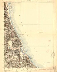 1929 Jackson Park1929 Print · USGSThe South Side of Chicago during the late 1920s reveals a sophisticated network of grand parks and lakefront landmarks. Genealogists and urban historians can trace the grid from Oakwoods Cemetery to iconic sites like Soldiers Field and the Field Museum.3 unique versions available
 - 1929 Map of Dyer, 1946 Print
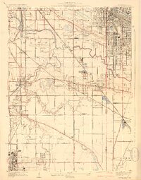
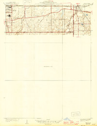 1929 Dyer1946 Print · USGSThe industrial suburbs and agricultural lands of the Illinois-Indiana border are captured here in the late 1920s. Researchers can trace the path of the Lincoln Highway and locate long-standing landmarks like the Cats Corner School or Strassburg School.
End of results
Showing maps 1-8
Top cities of Indiana
- Indianapolis historical maps
- Fort Wayne historical maps
- Evansville historical maps
- South Bend historical maps
- Carmel historical maps
- Fishers historical maps
See more
Top counties of Indiana
- Lake County historical maps
- Allen County historical maps
- Hamilton County historical maps
- Saint Joseph County historical maps
- Elkhart County historical maps
- Tippecanoe County historical maps
See more
Frequently asked questions
- What are the different types of historical maps available for Indiana?
- What is the oldest map of Indiana?
- Where can I purchase historical maps of Indiana for my home or office?
- Where can I download high-res historical maps of Indiana?
- Are there historical topographic maps available for Indiana?
- Is there historical aerial imagery available for Indiana?
- Where are historical maps of Indiana sourced from?