1980s Maps of Indiana
Explore 69 historic maps of Indiana from the 1980s. These maps offer a rare glimpse into what life looked like during the 1980s — showing old roads, neighborhoods, homes, and landmarks that have changed or disappeared over time.
Whether you're researching your family's past, planning a metal detecting trip, or studying how Indiana's landscape evolved across the 1980s, these high-resolution maps are a powerful tool for exploring the history of this region.
- Focus on a specific era: All maps on this page are from the 1980s, giving you a focused view of this time period.
- See what’s changed: Compare century-old streets, trails, and buildings to today's modern landscape using overlays and satellite layers.
- Research with precision: Use these maps for genealogy, historical research, land use analysis, or educational projects.
- View, download, or print: Maps are fully viewable online in high resolution, and can be downloaded or printed for your own records.
Start exploring Indiana's history through authentic maps from the 1980s. This is your window into the past.
Indiana maps
(69)- 1980 Map of Chicago
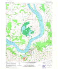
 1980 Chicago1980 Print · USGSThe Chicago metropolitan area and the industrial shores of Northwest Indiana are captured here at the start of the 1980s. Genealogists and local historians can trace the vast urban landscape through landmarks like Loyola University, St Casimir Cemetery, and the busy docks of Calumet Harbor.
 - 1980 Map of Taswell
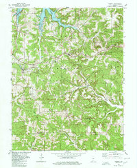 1980 Taswell1980 Print · USGSCrawford County in the early eighties shows a landscape of deep national forest and quiet rail stops. Genealogists and historians can trace the rural fabric of Taswell and Eckerty alongside landmarks like Highfill Chapel and the Township Sch.
 - 1980 Map of Greenbrier
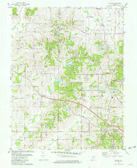
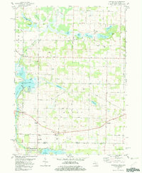
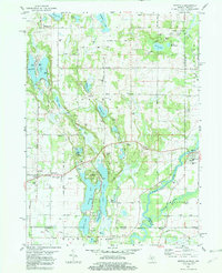
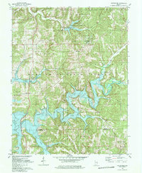 1980 Greenbrier1980 Print · USGSSouthern Indiana was undergoing a dramatic transformation in the late seventies as the newly created Patoka Lake filled the deep wooded valleys. Genealogists and local historians can trace old road networks and find quiet landmarks like South Liberty Ch, McDougal Ch, and the settlement of Greenbrier.3 unique versions available
 - 1980 Map of Cuzco, 1981 Print
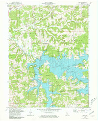 1980 Cuzco1981 Print · USGSOrange County's transition to a reservoir-centered landscape is clear in the early eighties as the new lake fills the valleys. Genealogists can trace the highlands around Cuzco and Crystal, finding landmarks like Cane Creek Ch and isolated rural Cem sites.2 unique versions available
 - 1980 Map of Birdseye, 1981 Print
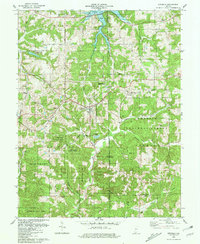 1980 Birdseye1981 Print · USGSBirdseye and the surrounding forest lands of southern Indiana are shown here just as the regional reservoir system reached into the valleys. Genealogists can trace family landmarks and rural burials at Waddle Cem, Spencer Cem, and Blunk Cem tucked among the hills.
 - 1981 Map of Kasson
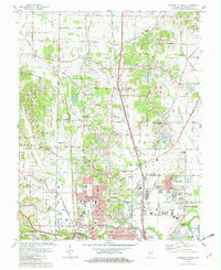
 1981 Kasson1981 Print · USGSVanderburgh and Posey Counties appear here in the early eighties as a landscape of rural parish life and active oil production. Genealogists can trace family landmarks like Parkers Settlement, Engleheim Cem, and the old No 6 School.3 unique versions available
 - 1981 Map of Wilson
 1981 Wilson1981 Print · USGSThe Ohio River borderlands of Henderson County appear here in the early eighties, balancing vast wetlands with rising industrial footprints. Genealogists can locate family-named sites like Clay Cem and Stroud Cem, while historians can trace the development of Geneva and the Henderson Community College.2 unique versions available
 - 1981 Map of Kosmosdale
 1981 Kosmosdale1981 Print · USGSThe Ohio River corridor south of Louisville in the early eighties shows a landscape of suburban expansion meeting heavy river-industry. Researchers can trace family roots at De Pauw Cem, locate the former site of Watson Lane Sch, or explore the rail networks of the Illinois Central Gulf.3 unique versions available
 - 1981 Map of West Franklin
 1981 West Franklin1981 Print · USGSThe rural stretches of Posey and Vanderburgh counties meet the Ohio River here in the early eighties. Genealogists and local historians can trace family-named roads and landmarks like St Pauls Ch, Burdette Park, and the riverfront at West Franklin.2 unique versions available
 - 1981 Map of Uniontown
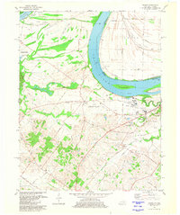
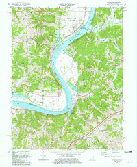
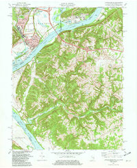
 1981 Uniontown1981 Print · USGSThe riverfront town of Uniontown and its surrounding floodplains are captured here in the early eighties as a landscape of managed wetlands and river industry. Researchers can trace the river's path through Mississippi Bend or locate local landmarks like St Agnes Cem and the Uniontown Locks and Dam.
 - 1981 Map of Wadesville
 1981 Wadesville1981 Print · USGSPosey County in the early eighties shows a rural landscape transitioning between its agrarian roots and the rise of the energy sector. Researchers can trace family history through Laurel Hill Cem, the South Terrace Sch, and the Louisville and Nashville rail line.
 - 1981 Map of Mount Vernon
 1981 Mount Vernon1981 Print · USGSMount Vernon and the winding Ohio River shoreline appear here in the early eighties, capturing a landscape of active river industry and rural family life. Genealogists can trace sites like Belle Fontaine Cem, Zoar Ch, and the defunct Dead Mans Crossing along the rail lines.
 - 1981 Map of Solitude
 1981 Solitude1981 Print · USGSThe lower Wabash River valley comes to life in this early 1980s survey, showing the intricate bend of the river and the historic site of New Harmony. Trace rural family history through local landmarks like Bethesda Ch, Savah, and the Alexander Cem near the Illinois border.2 unique versions available
 - 1981 Map of Wabash Island
 1981 Wabash Island1981 Print · USGSThe tri-state borderlands of Illinois, Indiana, and Kentucky are defined by the winding Wabash River and Ohio River in the early eighties. Genealogists and local historians can trace family sites at Oak Grove and Rowe Cem or locate the old Private Ferry crossing.
 - 1981 Map of Hooven, 1982 Print
 1981 Hooven1982 Print · USGSThe Ohio-Indiana-Kentucky borderlands are captured here in the early eighties as industrial gravel operations and rail lines shaped the river valleys. Researchers can trace the Conrail lines through Valley Junction or locate old burial sites like Sugar Ridge Cem and Maple Grove Cem.2 unique versions available
 - 1981 Map of Edwardsburg, 1982 Print
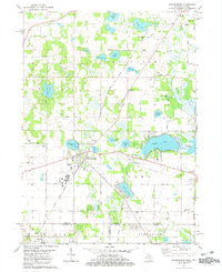 1981 Edwardsburg1982 Print · USGSCrossing the Michigan and Indiana border in the early 1980s, this area centers on the lake-dotted townships of Cass and St. Joseph counties. Researchers can find generational landmarks like the Jefferson Red Brick School, the Grand Trunk Western rail line, and Gods Half Acre Cemetery.
 - 1981 Map of Aurora, 1982 Print
 1981 Aurora1982 Print · USGSThe Indiana-Kentucky borderlands come alive in this early 1980s survey of the riverfront corridor between Aurora and Lawrenceburg. Researchers can trace the path of the Baltimore and Ohio Railroad and locate rural landmarks like Mt Tabor Ch and Kirschs Corner.2 unique versions available
 - 1981 Map of Adamsville, 1982 Print
 1981 Adamsville1982 Print · USGSSouthern Michigan and northern Indiana border life is captured here in the early eighties, showing a landscape of quiet country crossroads and glacial lakes. Genealogists can locate family landmarks like Five Points Cem, Bethel Ch, and the rural community of Kessington.
 - 1981 Map of Patriot, 1982 Print
 1981 Patriot1982 Print · USGSThe Ohio River valley in the early eighties serves as a backdrop for the riverside community of Patriot and the fertile farmsteads of the bottomlands. Researchers can trace ancestral roots through dozens of local sites like McNutt Cem, Concord Ch, and the outlying settlement at Searcy Crossroads.2 unique versions available
 - 1981 Map of Niles East, 1982 Print
 1981 Niles East1982 Print · USGSThe Michigan-Indiana state line and the eastern expansion of NILES are captured here in the early eighties. Researchers can trace family roots at Smith Chapel or Truitt Cem and locate vanished landmarks like the Drive-in Theater and Tyler Memorial Airport.
 - 1981 Map of Evansville South, 1982 Print
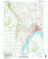
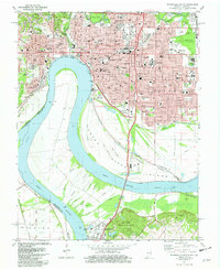 1981 Evansville South1982 Print · USGSEvansville stands as a major river-and-rail hub along the Ohio River at the start of the eighties. Researchers can trace institutional history at Evansville University and Evansville State Hospital, or locate family sites at Oak Hill Cemetery.2 unique versions available
 - 1981 Map of Mottville, 1982 Print
 1981 Mottville1982 Print · USGSThe Michigan and Indiana borderlands are captured here in the early eighties, showcasing a lake-heavy landscape where the St Joseph River flows through Mottville. Researchers can trace local history through sites like Baldwin Prairie Sch, Plum Grove Cem, and Union.
 - 1981 Map of Lawrenceburg, 1982 Print
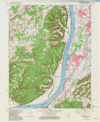
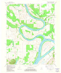
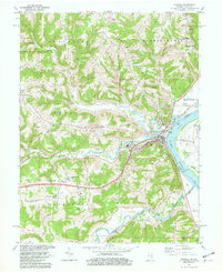
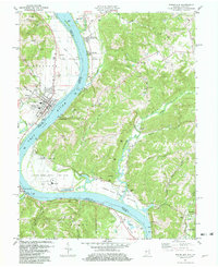
 1981 Lawrenceburg1982 Print · USGSThe tri-state junction of Indiana, Kentucky, and Ohio is captured here in the early eighties as the river economy matured. Researchers can trace family history through numerous burial sites like Greendale Cem and Petersburg Cem or locate the old Courthouse in Lawrenceburg.3 unique versions available
 - 1981 Map of Evansville North, 1982 Print
 1981 Evansville North1982 Print · USGSNorth of the Ohio River in the early eighties, this survey captures the residential and industrial growth of the Evansville area. Researchers can trace family history through sites like Locust Hill Cemetery, Richter Cem, and the rural enclave of Darmstadt.3 unique versions available
 - 1981 Map of Rising Sun, 1982 Print
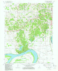
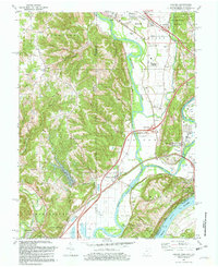
 1981 Rising Sun1982 Print · USGSThe Ohio River valley between Indiana and Kentucky comes to life in this early 1980s record of rural river life and industry. Genealogists can trace deep local roots at Rabbit Hash and Rising Sun, or locate family sites like Stephens Cem and Rice Cem.3 unique versions available
Showing maps 1-25 of 69
Top cities of Indiana
- Indianapolis historical maps
- Fort Wayne historical maps
- Evansville historical maps
- South Bend historical maps
- Carmel historical maps
- Fishers historical maps
See more
Top counties of Indiana
- Lake County historical maps
- Allen County historical maps
- Hamilton County historical maps
- Saint Joseph County historical maps
- Elkhart County historical maps
- Tippecanoe County historical maps
See more
Frequently asked questions
- What are the different types of historical maps available for Indiana?
- What is the oldest map of Indiana?
- Where can I purchase historical maps of Indiana for my home or office?
- Where can I download high-res historical maps of Indiana?
- Are there historical topographic maps available for Indiana?
- Is there historical aerial imagery available for Indiana?
- Where are historical maps of Indiana sourced from?