1930s Maps of Indiana
Explore 59 historic maps of Indiana from the 1930s. These maps offer a rare glimpse into what life looked like during the 1930s — showing old roads, neighborhoods, homes, and landmarks that have changed or disappeared over time.
Whether you're researching your family's past, planning a metal detecting trip, or studying how Indiana's landscape evolved across the 1930s, these high-resolution maps are a powerful tool for exploring the history of this region.
- Focus on a specific era: All maps on this page are from the 1930s, giving you a focused view of this time period.
- See what’s changed: Compare century-old streets, trails, and buildings to today's modern landscape using overlays and satellite layers.
- Research with precision: Use these maps for genealogy, historical research, land use analysis, or educational projects.
- View, download, or print: Maps are fully viewable online in high resolution, and can be downloaded or printed for your own records.
Start exploring Indiana's history through authentic maps from the 1930s. This is your window into the past.
Indiana maps
- 1930 Map of Three Oaks
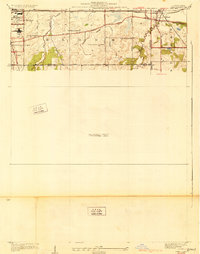
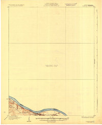
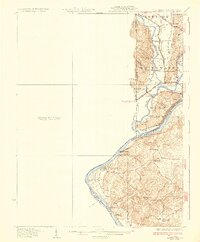
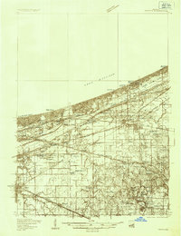
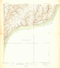
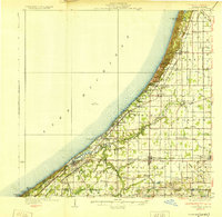 1930 Three Oaks1930 Print · USGSSouthwest Michigan's lakeshore and interior townships are captured in detail during the late twenties. Genealogists and historians can trace family roots through numerous rural schoolhouses like California Sch or visit the settled blocks of Three Oaks and New Buffalo.3 unique versions available
 - 1930 Map of Dyer
 1930 Dyer1930 Print · USGSThe Illinois-Indiana borderlands appear in the late twenties during a period of industrial and automotive growth. Genealogists and local historians can trace early schoolhouse locations like Cats Corner School and the path of the famous Lincoln Highway near Dyer.
 - 1930 Map of Niles
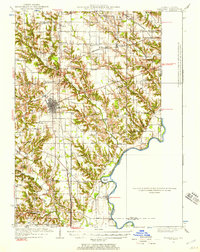
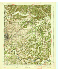
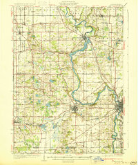 1930 Niles1930 Print · USGSBerrien County's rural heartland is captured here at the onset of the 1930s, showing the agricultural and riverine landscape before modern development. Genealogists can trace family roots through numerous country schools like Bedinger Sch and landmark sites such as Salem Ch or Pennellwood.4 unique versions available
 - 1931 Map of Corydon
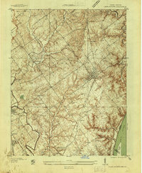
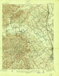
 1931 Corydon1931 Print · USGSThe Kentucky-Indiana borderlands along the Ohio River are captured here during the late Prohibition era. Local researchers can trace the riverbank settlement of Brandenburg or locate landmarks like the Oak Grove Sch and Hamilton Hill.4 unique versions available
 - 1932 Map of Lawrenceburg
 1932 Lawrenceburg1932 Print · USGSThe tri-state confluence of Indiana, Ohio, and Kentucky comes alive in this early 1930s survey of the river valleys. Genealogists can trace family roots through rural landmarks like Eighteenmile House, Bullittsville Ch, and the Woolper Sch.3 unique versions available
 - 1932 Map of La Grange
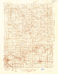
 1932 La Grange1932 Print · USGSThe Bluegrass region in the early thirties reveals a landscape defined by the Louisville and Nashville Railroad and the Ohio River. Genealogists can locate family landmarks like Henrysville Cemetery and several rural schoolhouses including Sweeney Sch.
 - 1932 Map of Marshall, 1957 Print
 1932 Marshall1957 Print · USGSThe Illinois-Indiana borderlands of the early 1930s come alive through this survey of the Marshall rail corridor and Wabash River valley. Trace family roots and vanished landmarks like Bohn Ferry, Ziegler Cem, and the Airway Beacon.
 - 1933 Map of Hoopeston
 1933 Hoopeston1933 Print · USGSVermilion County and the Illinois-Indiana borderlands are captured here in the early 1930s as a thriving rail and agricultural corridor. Genealogists can locate dozens of rural schools like White Sch and family-linked landmarks such as Ross Cem or Manns Chapel.
 - 1934 Map of Cannelton
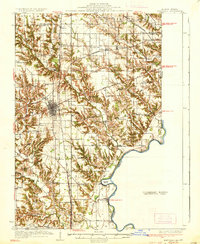
 1934 Cannelton1934 Print · USGSThe Ohio River corridor between Indiana and Kentucky comes to life in this mid-1930s survey of the riverfront and its rugged hinterlands. Genealogists can trace family footprints through a dense network of country schools and churches, from St Johns Ch and New Bethel Ch to rural outposts like Mattingly PO.2 unique versions available
 - 1934 Map of Porter
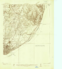
 1934 Porter1934 Print · USGSThe Indiana shoreline of the mid-1930s is mapped here in detail, from the sands of Indiana Dunes State Park to the rail hubs of Chesterton. Trace local family history through sites like the Seven Dolors Shrine, Liberty Center Sch, and the Mc Cool Emergency Landing Field.
 - 1934 Map of Bedford
 1934 Bedford1934 Print · USGSLawrence County's limestone district and the winding White River valley are detailed here during the mid-1930s. Genealogists and researchers can trace local families through many rural landmarks, including Sherril Cem, Leesville, and the Peerless Quarry.2 unique versions available
 - 1935 Map of Oolitic
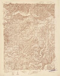
 1935 Oolitic1935 Print · USGSLawrence and Greene Counties are captured in the mid-1930s during a period of heavy limestone production and rural transition. Local historians can trace family roots through numerous country landmarks like Popcorn Church, Williams Bridge, and the Dark Hollow stone works.6 unique versions available
 - 1935 Map of Watseka
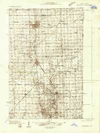
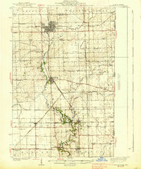
 1935 Watseka1935 Print · USGSIroquois County in the mid-1930s is a landscape of thriving rail-side villages and rural school districts connected by a dense rail network. Researchers can trace family history through dozens of landmarks like Independence Sch, Mt Taber Ch, and St Joseph Cem.
 - 1936 Map of Vine Grove
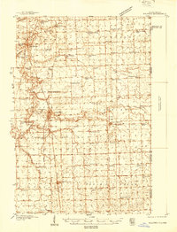
 1936 Vine Grove1936 Print · USGSHardin and Bullitt counties are shown here during a period of massive military expansion before the mid-century. Researchers can trace the development of Fort Knox alongside established communities like Vine Grove and old rural landmarks like Stovall Chapel or the Glenbeddis Sch.
 - 1937 Map of Jeffersonville
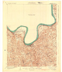
 1937 Jeffersonville1937 Print · USGSJeffersonville and the northern banks of the Ohio River appear here in the late 1930s, documenting a landscape shaped by early industry and river trade. Researchers can trace the path of the Indiana Railroad (Electric Line) and locate landmarks like Asbury Chapel and Walnut Ridge Cemetery.
 - 1937 Map of Bedford
 1937 Bedford1937 Print · USGSLawrence County limestone country is seen here in the late 1930s, defined by its massive quarries and river-valley railroads. Genealogists can trace family landmarks and rural life at the County Farm, Leesville, and the United Brethren Ch.2 unique versions available
 - 1937 Map of Charlestown
 1937 Charlestown1937 Print · USGSClark County during the late thirties shows a landscape of rail-connected towns and rural institutions. Genealogists and historians can trace Crab College, the Clark Co Asylum, and family sites like Bottorff Cem and Tunnel Mill.
 - 1937 Map of Marshall
 1937 Marshall1937 Print · USGSClark and Edgar Counties are captured here in the 1930s, showing a landscape of river-bend settlements and dense rural school districts. Genealogists can trace family names through Forsythe Cem, identify remote crossings like Bohn Ferry, or locate lost schoolhouses like Rabbit Ridge Sch.2 unique versions available
 - 1938 Map of Coal City
 1938 Coal City1938 Print · USGSSouthern Indiana at the end of the 1930s shows a landscape of small coal-mining towns and rural crossroads between the forks of the Eel River. Researchers can trace the path of the Wabash and Erie Canal and locate family roots at Coal City, Sink Cem, or Scaffold Prairie Ch.
 - 1938 Map of Owen
 1938 Owen1938 Print · USGSThe Indiana riverfront near Charlestown in the late thirties is defined by active river landings and the sprawling Clark Military Grant. Genealogists can trace family footprints through community sites like Salem Ch, Rose Island, and the Golden Valley Sch.
 - 1938 Map of Milford
 1938 Milford1938 Print · USGSIroquois County at the end of the Depression era is a landscape of thriving rail towns and numerous one-room schoolhouses. Researchers can locate nearly thirty distinct rural schools like White College Sch and Fidelity Sch, along with family burial grounds such as Belmont Cem.
 - 1938 Map of Hoopeston
 1938 Hoopeston1938 Print · USGSEastern Illinois at the height of the rail era shows a landscape defined by busy junctions and tightly knit rural communities. Genealogists and historians can trace family roots through dozens of local landmarks like Squankum Sch, Rose Cem, and Pleasant View Ch.3 unique versions available
 - 1938 Map of Switz City
 1938 Switz City1938 Print · USGSIn the late 1930s, Switz City functioned as a vital Indiana rail hub where two major lines crossed amidst a landscape shaped by drainage canals. Researchers can locate numerous family burial sites like Bohley Cem or trace early industry at a Coal Mine.
 - 1938 Map of Speed
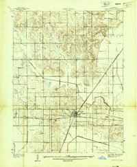
 1938 Speed1938 Print · USGSSouthern Indiana was a busy junction of steam and electric rail at the close of the 1930s. Researchers can trace the dual paths of the Pennsylvania Railroad and Indiana Railroad (Electric) through Sellersburg, Speed, and Memphis.
 - 1938 Map of New Harmony, 1958 Print
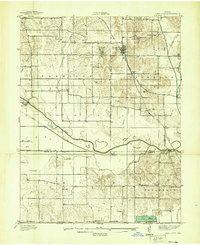
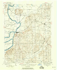 1938 New Harmony1958 Print · USGSIndiana's southwestern tip along the Wabash River is captured here during the late thirties. Genealogists and local historians can trace family land near the Mumford Hills or locate historic rail stops in Poseyville, Stewartsville, and Griffin.
Showing maps 1-25
Top cities of Indiana
- Indianapolis historical maps
- Fort Wayne historical maps
- Evansville historical maps
- South Bend historical maps
- Carmel historical maps
- Fishers historical maps
See more
Top counties of Indiana
- Lake County historical maps
- Allen County historical maps
- Hamilton County historical maps
- Saint Joseph County historical maps
- Elkhart County historical maps
- Tippecanoe County historical maps
See more
Frequently asked questions
- What are the different types of historical maps available for Indiana?
- What is the oldest map of Indiana?
- Where can I purchase historical maps of Indiana for my home or office?
- Where can I download high-res historical maps of Indiana?
- Are there historical topographic maps available for Indiana?
- Is there historical aerial imagery available for Indiana?
- Where are historical maps of Indiana sourced from?