1970s Maps of Indiana
Explore 107 historic maps of Indiana from the 1970s. These maps offer a rare glimpse into what life looked like during the 1970s — showing old roads, neighborhoods, homes, and landmarks that have changed or disappeared over time.
Whether you're researching your family's past, planning a metal detecting trip, or studying how Indiana's landscape evolved across the 1970s, these high-resolution maps are a powerful tool for exploring the history of this region.
- Focus on a specific era: All maps on this page are from the 1970s, giving you a focused view of this time period.
- See what’s changed: Compare century-old streets, trails, and buildings to today's modern landscape using overlays and satellite layers.
- Research with precision: Use these maps for genealogy, historical research, land use analysis, or educational projects.
- View, download, or print: Maps are fully viewable online in high resolution, and can be downloaded or printed for your own records.
Start exploring Indiana's history through authentic maps from the 1970s. This is your window into the past.
Indiana maps
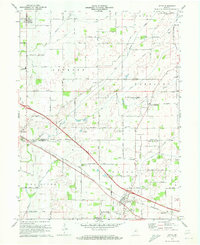
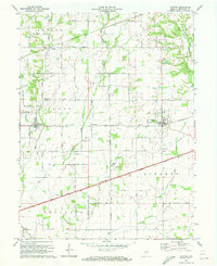
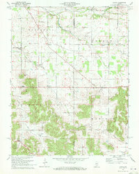
(107)- 1970 Map of Mauckport, 1972 Print
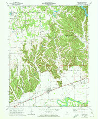
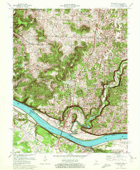 1970 Mauckport1972 Print · USGSThe Ohio River valley at the start of the 1970s reveals a landscape of riverfront towns and steep timbered ridges. Genealogists and historians can locate riverside landmarks like Mauckport and Morvins Landing or inland sites like Mt Zion Ch.2 unique versions available
 - 1970 Map of Alton, 1972 Print
 1970 Alton1972 Print · USGSThe Ohio River meanders between Indiana and Kentucky in the 1970s, shaping the life of riverfront towns and upland forests. Genealogists and historians can trace riverside settlements like Alton and Concordia, or find family landmarks such as St Theresa Academy and Owens Cem.
 - 1970 Map of Beechwood, 1972 Print
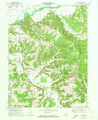
 1970 Beechwood1972 Print · USGSSouthern Indiana's river bends and deep forests are captured here just as modern highway expansions were being planned in the early seventies. Local historians can trace family roots through numerous remote sites like Old Union Ch, Riddle Cem, and the Buzzard Roost Lookout Tower.2 unique versions available
 - 1970 Map of Eminence, 1972 Print
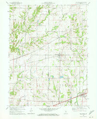
 1970 Eminence1972 Print · USGSThe crossroads of Putnam and Morgan counties are captured here in the early seventies, showing a landscape of small farming towns and rural school districts. Genealogists can locate family sites at Walnut Chapel, the Whitaker-Patrick Cem, and the historic Covered Bridge.2 unique versions available
 - 1970 Map of Paoli, 1972 Print
 1970 Paoli1972 Print · USGSIndiana's hilly southern interior is captured here in the early seventies, centered on the historic crossroads of Paoli. Local researchers can trace old property lines against the Old Indian Treaty Boundary or locate rural landmarks like Braxtons Siding, Stouts Chapel, and Syria.3 unique versions available
 - 1970 Map of New Amsterdam, 1972 Print
 1970 New Amsterdam1972 Print · USGSThe Ohio River borderlands of Indiana and Kentucky remained a world of steep ridges and riverside hamlets in the early seventies. Researchers can trace family sites and rural landmarks like Greer Cem, the community of Battletown, and the river crossing at New Amsterdam.2 unique versions available
 - 1970 Map of Cloverdale, 1972 Print
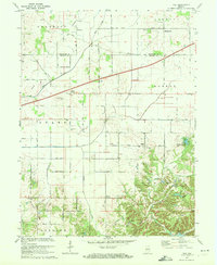
 1970 Cloverdale1972 Print · USGSSouthern Putnam County is captured here in the early seventies, showcasing a transition from rural rail-side life to the interstate era. Genealogists and historians can trace family locations at Old Bethel Cem, locate the Township Sch in Cloverdale, or find the Old RR Grade near Putnamville.3 unique versions available
 - 1970 Map of Leavenworth, 1972 Print
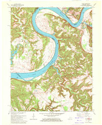
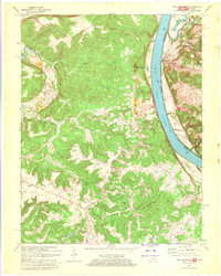
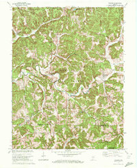
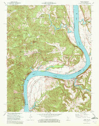
 1970 Leavenworth1972 Print · USGSThe Ohio River valley near the Crawford and Harrison county line is captured here in the early seventies, centered on the historic river town of Leavenworth. Genealogists and hikers can trace old family burial sites like Mt Hope Ch Cem or explore landmarks such as Wyandotte Cave and the landing at Schooner Point Landing.3 unique versions available
 - 1970 Map of Lizton, 1972 Print
 1970 Lizton1972 Print · USGSThe rural border of Boone and Hendricks counties comes to life in the early seventies, centered on the railroad town of Lizton. Genealogists and local historians can trace family ties at the Poplar Grove Cemetery or locate the Pinnell School and Old Union Church.
 - 1970 Map of Campbellsburg, 1972 Print
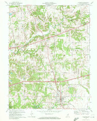
 1970 Campbellsburg1972 Print · USGSSouthern Indiana rail and river life converge here during the early seventies, centered on the MONON line. Researchers can trace the layout of small settlements like Saltillo and Campbellsburg or locate rural landmarks like Fishing Creek Chapel and Freedom Cem.2 unique versions available
 - 1970 Map of Cloverport, 1972 Print
 1970 Cloverport1972 Print · USGSThe banks of the Ohio River in the early 1970s reveal a mix of river-town industry and rural ridge-top life. Genealogists and historians can trace old homesteads and landmarks near Cloverport, Patesville, and the Harris Memorial Cemetery.2 unique versions available
 - 1970 Map of Coatesville, 1972 Print
 1970 Coatesville1972 Print · USGSIndiana farmland and rail corridors define the landscape between Coatesville and Stilesville during the early 1970s. Trace the paths of the National Road and the Penn Central tracks past local landmarks like Bethel Ch and Sunset Lake.3 unique versions available
 - 1970 Map of Clayton, 1972 Print
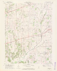
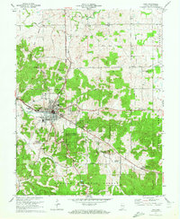
 1970 Clayton1972 Print · USGSSouthern Hendricks County at the start of the 1970s shows a landscape transitioning around its historic transit corridors. Genealogists can trace family names through sites like Old Spring Cem or locate the Drive-in Theater and Cascade Sch along the NATIONAL ROAD.
 - 1970 Map of Modesto, 1972 Print
 1970 Modesto1972 Print · USGSThe hills of central Indiana remained a mix of dense timber and rural homesteads during the early seventies. Genealogists and local researchers can trace family landmarks like Sodom Cem, Liberty Ch, and the small settlement of Modesto.3 unique versions available
 - 1970 Map of Hall, 1972 Print
 1970 Hall1972 Print · USGSMorgan and Hendricks counties are captured here in the early 1970s, showing a landscape of small crossroads settlements and family farms. Local historians can trace established rural landmarks like Mt Pleasant Cem, the community of Hall, and Mt Moriah Ch.2 unique versions available
 - 1970 Map of Valeene, 1972 Print
 1970 Valeene1972 Print · USGSSouthern Indiana's rugged backcountry is shown in the early seventies, featuring the foundational surveying point for the entire state. Researchers can trace the Old Indian Treaty Boundary and locate family sites like Purkhiser Cem or the rural settlement of Valeene.
 - 1970 Map of Livonia, 1972 Print
 1970 Livonia1972 Print · USGSIndiana's limestone country in the early seventies reveals a landscape of sinking streams and rural crossroads. Genealogists can trace family roots through landmarks like Lost River Ch, Posey Chapel, and the small settlement of Bromer.
 - 1970 Map of Rome, 1972 Print
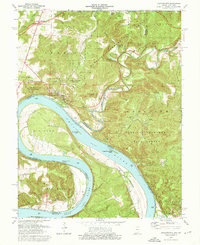
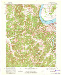
 1970 Rome1972 Print · USGSThe banks of the Ohio River define this 1970s landscape where Perry County, Indiana meets Breckinridge County, Kentucky. Genealogists can trace family heritage through numerous hillside sites like St Peters Ch and Maier Cem, or locate the riverfront rail stops at Stephensport and Addison.
 - 1970 Map of Plainfield, 1972 Print
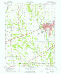 1970 Plainfield1972 Print · USGSPlainfield and the surrounding townships were rapidly evolving in the early seventies as the National Road and rail lines spurred new development. Genealogists and historians can trace family locations near Salem Ch, Spring Hill Cem, or the institutional grounds of the Indiana Boys School.3 unique versions available
 - 1970 Map of Dunreith, 1972 Print
 1970 Dunreith1972 Print · USGSHenry and Rush counties are captured here in the early 1970s, showcasing a landscape defined by historic transit and rural industry. Trace the intersections of the National Road with several rail lines and find local landmarks like Beard Sch and Stone Quarry Mills.3 unique versions available
 - 1970 Map of Paragon, 1972 Print
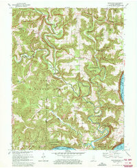
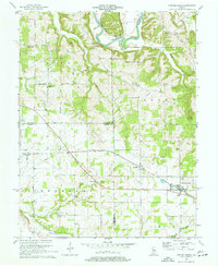
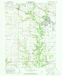
 1970 Paragon1972 Print · USGSMorgan County's river-bottoms and high ridges are shown here in the 1970s, just as the local rural character remained defined by the White River. Researchers can trace old family lines through Friendship Park Cem, Lingle Cem, and small settlements like Plano and Paragon.5 unique versions available
 - 1970 Map of Mattingly, 1972 Print
 1970 Mattingly1972 Print · USGSBreckinridge County sits along the Ohio River during the early seventies, centered on the historic rail town of Cloverport. Local historians can trace family ties at rural landmarks like Mattingly, New Bethel Ch, and the Chapin Cem.2 unique versions available
 - 1970 Map of Cannelton, 1972 Print
 1970 Cannelton1972 Print · USGSThe Ohio River valley at the Indiana-Kentucky border shows its industrial and spiritual heart in the early seventies. Genealogists can locate family sites like Keiser Mill, St Michaels Cem, and Township Sch tucked among the hollows.2 unique versions available
 - 1970 Map of Danville, 1972 Print
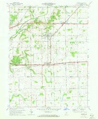
 1970 Danville1972 Print · USGSThe Hendricks County seat at Danville and the surrounding township lands are captured here in the early 1970s. Genealogists and local historians can trace the paths of the Penn Central and Baltimore and Ohio railroads or locate rural landmarks like Mt Pleasant Cem and Montclair.
 - 1970 Map of Brownsburg, 1972 Print
 1970 Brownsburg1972 Print · USGSHendricks County is seen here at a pivotal moment of suburban growth during the early seventies. Genealogists and local historians can trace family roots through numerous burial sites like St Malachy West Cem and Abner Creek Cem or locate long-standing landmarks like Bartlett Chapel.3 unique versions available
Showing maps 1-25 of 107
Top cities of Indiana
- Indianapolis historical maps
- Fort Wayne historical maps
- Evansville historical maps
- South Bend historical maps
- Carmel historical maps
- Fishers historical maps
See more
Top counties of Indiana
- Lake County historical maps
- Allen County historical maps
- Hamilton County historical maps
- Saint Joseph County historical maps
- Elkhart County historical maps
- Tippecanoe County historical maps
See more
Frequently asked questions
- What are the different types of historical maps available for Indiana?
- What is the oldest map of Indiana?
- Where can I purchase historical maps of Indiana for my home or office?
- Where can I download high-res historical maps of Indiana?
- Are there historical topographic maps available for Indiana?
- Is there historical aerial imagery available for Indiana?
- Where are historical maps of Indiana sourced from?