1940s Maps of Indiana
Explore 268 historic maps of Indiana from the 1940s. These maps offer a rare glimpse into what life looked like during the 1940s — showing old roads, neighborhoods, homes, and landmarks that have changed or disappeared over time.
Whether you're researching your family's past, planning a metal detecting trip, or studying how Indiana's landscape evolved across the 1940s, these high-resolution maps are a powerful tool for exploring the history of this region.
- Focus on a specific era: All maps on this page are from the 1940s, giving you a focused view of this time period.
- See what’s changed: Compare century-old streets, trails, and buildings to today's modern landscape using overlays and satellite layers.
- Research with precision: Use these maps for genealogy, historical research, land use analysis, or educational projects.
- View, download, or print: Maps are fully viewable online in high resolution, and can be downloaded or printed for your own records.
Start exploring Indiana's history through authentic maps from the 1940s. This is your window into the past.
Indiana maps
- 1940 Map of Metz
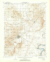
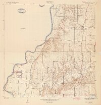
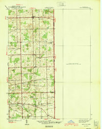 1940 Metz1940 Print · USGSThe Indiana-Ohio borderlands come into focus in the years before the war, showing a landscape of drainage ditches and family-named bridge crossings. Genealogists can trace rural life through landmarks like Metz Cem, Bethel Ch, and the small settlement of Alvarado.2 unique versions available
 - 1940 Map of Lewis
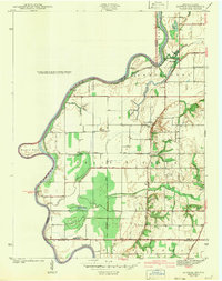
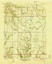 1940 Lewis1940 Print · USGSVigo and Sullivan counties are shown here just before the Second World War as coal mining and rail transport shaped the local economy. Researchers can trace family history through sites like Smith Cem or locate industrial landmarks like the Blackhawk Mine and Brown Jug Corner.
 - 1940 Map of Linton
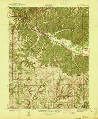
 1940 Linton1940 Print · USGSLinton and its surrounding coalfields are captured in the late thirties, showcasing a landscape shaped by heavy industry and rail. Genealogists and historians can locate vanished country landmarks like Morris Chapel, Victoria, and Sassafras Sch among the early Strip Mine sites.2 unique versions available
 - 1940 Map of Jasonville
 1940 Jasonville1940 Print · USGSJasonville and the surrounding coalfields are captured in the late 1930s, showing a landscape defined by industry and rural community. Genealogists can locate family landmarks like Sanderson Cem, Little Flock Ch, and Listen Sch.2 unique versions available
 - 1940 Map of Orland
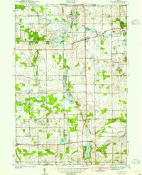 1940 Orland1940 Print · USGSSteuben and LaGrange Counties appear at the end of the 1930s as a landscape of glacial lakes and quiet farming settlements. Genealogists can trace early homesteads near Orland, Greenlawn Cem, and the old prairie tracks of Vistula Road.2 unique versions available
 - 1940 Map of Clear Lake
 1940 Clear Lake1940 Print · USGSThe tri-state border region of Indiana, Michigan, and Ohio is captured here just before the 1940s, centered on the activity surrounding Clear Lake. Researchers can trace early school sites and family landmarks like Powers Sch, Stallman Bridge, and the Teeters Cem.2 unique versions available
 - 1940 Map of Pimento
 1940 Pimento1940 Print · USGSVigo and Sullivan Counties are shown in the late 1930s, capturing the rural character of the Indiana prairie before modern development. Genealogists can trace family roots through numerous local landmarks, including Kester Cem, Farmers Chapel, and the settlement of Prairie Creek.2 unique versions available
 - 1940 Map of Porter
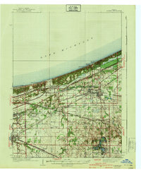 1940 Porter1940 Print · USGSPorter County's industrial and shoreline heritage is captured here in the years before World War II. Researchers can locate early lakefront settlements like Baillytown or trace the routes of the Wabash and Pere Marquette railroads past Tratebas Mill.3 unique versions available
 - 1940 Map of Carmi, 1965 Print
 1940 Carmi1965 Print · USGSThe river-and-rail hub of Carmi and the surrounding White County prairies are documented here just before the mid-century. Researchers can trace rural family roots through dozens of named sites like Miller Cem, Stokes Chapel, and Williams Sch.
 - 1941 Map of Borden
 1941 Borden1941 Print · USGSIn the hills of Clark and Floyd counties just before the war, small crossroads like Navilleton and Starlight were the heart of rural life. Genealogists can trace early homesteads through family landmarks like Fisher Cem and Goss Sch near the Muddy Fork railroad line.
 - 1941 Map of Orland
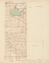
 1941 Orland1941 Print · USGSSteuben and LaGrange Counties are shown here just before the war, characterized by a landscape of glacial lakes and prairie. Trace family roots and local landmarks like Orland Fish Hatchery, Greenlawn Cem, and Greenfield Mills.2 unique versions available
 - 1941 Map of Ekron
 1941 Ekron1941 Print · USGSNorthern Kentucky and the Ohio River shoreline are captured here in the early 1940s, showing the rural communities of Meade and Hardin Counties. Genealogists can trace family locations near Ekron, Shumate School, and the historic Sherman Landing.
 - 1941 Map of Angola West
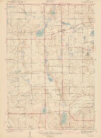
 1941 Angola West1941 Print · USGSSteuben County is a dense network of glacial lakes and early parklands at the start of the 1940s. Genealogists and local historians can trace family-named landmarks and rural outposts like the County Farm, Nevada Mills, and Lake Gage Cem.2 unique versions available
 - 1941 Map of Seelyville
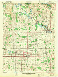
 1941 Seelyville1941 Print · USGSVigo County at the start of the 1940s shows the industrial expansion of Terre Haute toward Seelyville. Trace family roots at Highland Lawn Cemetery or locate old industrial sites like the Binkley Mine and the Central Canal (Abandoned).2 unique versions available
 - 1941 Map of Terre Haute
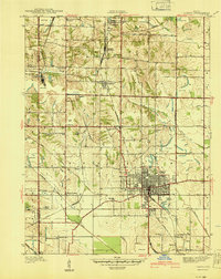
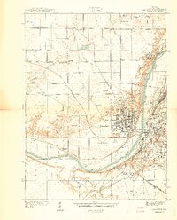
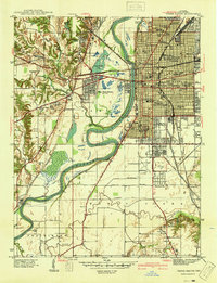 1941 Terre Haute1941 Print · USGSTerre Haute and the Wabash River valley are shown in high detail just before the mid-century industrial boom. Genealogists and local historians can trace family roots through dozens of named sites like Toad Hop, Woodlawn Cemetery, and Gerstmeyer High School.
 - 1941 Map of Lafayette
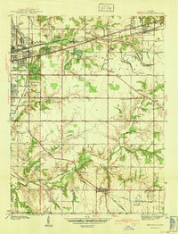
 1941 Lafayette1941 Print · USGSLafayette and West Lafayette sit at a crossroads of river and rail during the early days of the Second World War. Researchers can trace the development of Purdue University, the grounds of the St Joseph Orphanage, and family plots in Sand Ridge Cem or Grandview Cem.
 - 1942 Map of Ashley
 1942 Ashley1942 Print · USGSNortheastern Indiana's lake country is captured in the early 1940s, showing the vital rail junction where the WABASH and Central York New lines intersect. Genealogists can trace family roots at Hollister Cem, St Johns Ch, and the settlements of Ashley and Steubenville.2 unique versions available
 - 1942 Map of Franklin
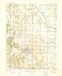
 1942 Franklin1942 Print · USGSCentral Indiana during the early years of the war shows a landscape of established rail towns and growing military installations. Genealogists can trace family names across small settlements like Nineveh, Bean Blossom, and Helmsburg, or locate the Indiana University Observatory.
 - 1942 Map of Fairbanks
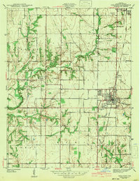
 1942 Fairbanks1942 Print · USGSSullivan County, Indiana, is captured here in the early 1940s as a landscape of river-bend farms and historic family plots. Genealogists and local historians can trace the Harrison Trail or locate ancestral sites like Pogue Cem, Johnson Cem, and the York Ferry river crossing.2 unique versions available
 - 1942 Map of Shelburn
 1942 Shelburn1942 Print · USGSWestern Indiana coal and rail life are captured here in the early 1940s, as mining towns thrived along the corridor. Trace local family roots at Ebenezer Cem or explore the rail hubs of Shelburn and Curryville near the Linda Lou Mine.2 unique versions available
 - 1942 Map of Hutton
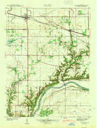
 1942 Hutton1942 Print · USGSThe Indiana-Illinois borderlands along the Wabash River are captured here in the early 1940s, showing a landscape of bayous and ferries. Researchers can trace historic river crossings at Darwin Ferry and locate family burial sites at Shattuck Cem and Lykens Cem.2 unique versions available
 - 1942 Map of Angola West
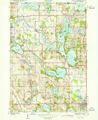
 1942 Angola West1942 Print · USGSSteuben County was a bustling hub of lakefront living and rural industry in the early 1940s. Genealogists and researchers can trace family landmarks like the Jamestown Cemetery, find the location of the County Farm, or explore the original layout of the Potawatomi Inn.
 - 1942 Map of Columbus
 1942 Columbus1942 Print · USGSBartholomew and Shelby counties are shown during the early years of the war, as military installations and rail lines reshaped the rural Indiana landscape. Genealogists can trace family-named sites and established communities like St Louis Crossing, Hope, and the sprawling Camp Atterbury.
 - 1942 Map of Otterbein
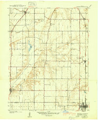
 1942 Otterbein1942 Print · USGSIndiana's prairie meets the Wabash River valley at the start of the 1940s, showing a landscape defined by rail lines and early canal history. Genealogists and historians can trace family roots through rural landmarks like Asbury Cem, the Armstrong Chapel, and the community of Green Hill.
 - 1942 Map of Stroh
 1942 Stroh1942 Print · USGSNortheast Indiana’s lake country is captured here in the early 1940s, showing a landscape of small farming hamlets and lakeside landings. Researchers can trace family roots at Reed Cem or locate old community hubs like Salem Center and Helmer.2 unique versions available
Showing maps 1-25
Top cities of Indiana
- Indianapolis historical maps
- Fort Wayne historical maps
- Evansville historical maps
- South Bend historical maps
- Carmel historical maps
- Fishers historical maps
See more
Top counties of Indiana
- Lake County historical maps
- Allen County historical maps
- Hamilton County historical maps
- Saint Joseph County historical maps
- Elkhart County historical maps
- Tippecanoe County historical maps
See more
Frequently asked questions
- What are the different types of historical maps available for Indiana?
- What is the oldest map of Indiana?
- Where can I purchase historical maps of Indiana for my home or office?
- Where can I download high-res historical maps of Indiana?
- Are there historical topographic maps available for Indiana?
- Is there historical aerial imagery available for Indiana?
- Where are historical maps of Indiana sourced from?