1960s Maps of Indiana
Explore 479 historic maps of Indiana from the 1960s. These maps offer a rare glimpse into what life looked like during the 1960s — showing old roads, neighborhoods, homes, and landmarks that have changed or disappeared over time.
Whether you're researching your family's past, planning a metal detecting trip, or studying how Indiana's landscape evolved across the 1960s, these high-resolution maps are a powerful tool for exploring the history of this region.
- Focus on a specific era: All maps on this page are from the 1960s, giving you a focused view of this time period.
- See what’s changed: Compare century-old streets, trails, and buildings to today's modern landscape using overlays and satellite layers.
- Research with precision: Use these maps for genealogy, historical research, land use analysis, or educational projects.
- View, download, or print: Maps are fully viewable online in high resolution, and can be downloaded or printed for your own records.
Start exploring Indiana's history through authentic maps from the 1960s. This is your window into the past.
Indiana maps
(479)- 1960 Map of Brazil East
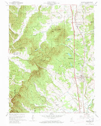
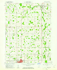
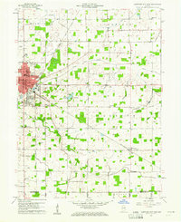
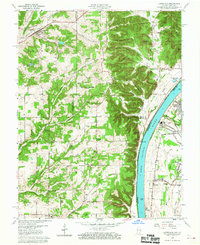
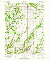
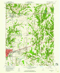 1960 Brazil East1960 Print · USGSClay County at the dawn of the 1960s shows a landscape of busy coal pits and industrial towns. Genealogists and historians can trace family locations near Knightsville, search for burials at Calcutta Cem, or follow the path of the Pennsylvania Railroad.3 unique versions available
 - 1960 Map of Gilman
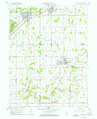
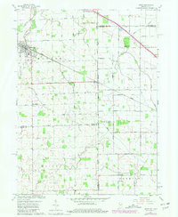
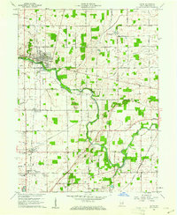
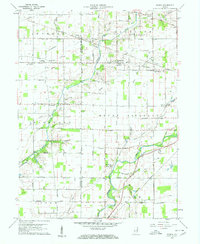 1960 Gilman1960 Print · USGSThe Indiana countryside near Daleville and Gilman is shown here in the early 1960s, a landscape defined by its river bends and intersecting rail lines. Researchers can trace family sites at Vermillion Meetinghouse, identify old burials at Jones Cem, or locate former rail stops at Reed Station and Moonville.5 unique versions available
 - 1960 Map of Shoals
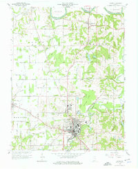
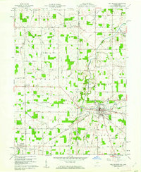
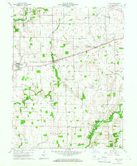
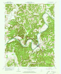 1960 Shoals1960 Print · USGSIn the early 1960s, the East Fork White River dominated this Martin County landscape, winding past the rail hub of Shoals. Genealogists and historians can locate rural landmarks such as Hindostan, the Ship Mine, and country congregations like Poplar Grove Ch.3 unique versions available
 - 1960 Map of Winchester
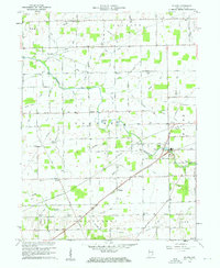
 1960 Winchester1960 Print · USGSCentral Kentucky's diverse landscape is shown here at mid-century, from the bluegrass plains to the rugged Pottsville Escarpment. Genealogists and historians can trace the rail-and-river network connecting towns like Bardstown and Stanford alongside landmarks like Lake Cumberland.
 - 1960 Map of Noblesville, 1961 Print
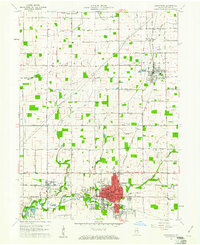
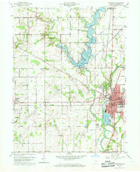 1960 Noblesville1961 Print · USGSNoblesville and the White River valley are captured in the early sixties as new landmarks like Morse Reservoir began to reshape the landscape. Local historians can trace old community centers such as Deming or locate family plots at Riverside Cem and Crownland Cem.2 unique versions available
 - 1960 Map of Henryville, 1961 Print
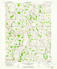
 1960 Henryville1961 Print · USGSSouthern Indiana's knobs and forest lands are captured here just as modern conservation efforts and rail transit shaped the local landscape. Genealogists can locate family landmarks like New Chapel Ch, Mt Zion Cem, and the historic Pigeon Roost Memorial.4 unique versions available
 - 1960 Map of New Castle West, 1961 Print
 1960 New Castle West1961 Print · USGSHenry County is captured here at a mid-century peak of rail and road connectivity, centered on the growing city of New Castle. Genealogists and local historians can trace family plots at South Mound Cemetery or locate old landmarks like Sugar Grove Sch and the Drive-In Theater.3 unique versions available
 - 1960 Map of Union City, 1961 Print
 1960 Union City1961 Print · USGSThe Indiana-Ohio border communities are captured here in the early sixties, centered on the bustling rail junction of Union City. Researchers can trace old family sites at Spring Hill Cem, Poplar Grove Ch, and the rural crossroads of New Lisbon.4 unique versions available
 - 1960 Map of Elwood, 1961 Print
 1960 Elwood1961 Print · USGSElwood and the Madison County borderlands are shown here in the early sixties as a thriving rail and agricultural hub. Local researchers can trace family plots at St Josephs Cemetery or locate vanished landmarks like the Drive-In Theater and Townships School.2 unique versions available
 - 1960 Map of Pennville, 1961 Print
 1960 Pennville1961 Print · USGSIndiana's eastern farmland is documented here in the early sixties, showing the vital rail and river networks of Jay and Blackford counties. Researchers can locate family landmarks like Maple Lawn Cem, the crossroads of Ridertown, and the Pennsylvania Railroad corridor.2 unique versions available
 - 1960 Map of Jasper, 1961 Print
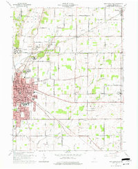
 1960 Jasper1961 Print · USGSDubois County centered on Jasper shows a landscape of river-bend settlements and expanding rail infrastructure in the early sixties. Genealogists can locate family landmarks like Shiloh Ch and numerous rural plots including Alexander Cem and Wilhoit Cem.4 unique versions available
 - 1960 Map of New Castle East, 1961 Print
 1960 New Castle East1961 Print · USGSHenry County in the early sixties reveals a landscape shaped by the institutional presence of the Indiana Village for Epileptics and the industrial hub of New Castle. Researchers can locate vanished rural landmarks like Ashland Sch, the Batson Ch, and the rail lines of the Central Indiana Road.3 unique versions available
 - 1960 Map of Point Isabel, 1961 Print
 1960 Point Isabel1961 Print · USGSAgricultural life in central Indiana comes into focus during the early sixties, showing a landscape of small crossroads and family-named ditches. Genealogists can locate Antioch Ch, Knox Chapel, and the settlement of Point Isabel.4 unique versions available
 - 1960 Map of Hartford City East, 1961 Print
 1960 Hartford City East1961 Print · USGSBlackford County life in the early sixties is anchored by the eastern expansion of Hartford City and the surrounding townships. Researchers can trace family sites from Personett Cemetery to Millgrove, and find mid-century landmarks like the Drive-in Theater.3 unique versions available
 - 1960 Map of Middletown, 1961 Print
 1960 Middletown1961 Print · USGSThe rural landscapes of Madison, Delaware, and Henry counties are captured here at the dawn of the sixties. Genealogists can trace family names at Bronnenberg Cem or Painter Cem, and locate rural landmarks like the Allen-Bethel Ch and Valley Grove Sch.4 unique versions available
 - 1960 Map of Fort Knox, 1961 Print
 1960 Fort Knox1961 Print · USGSFort Knox and the surrounding river valleys are captured here during the height of the Cold War era. Researchers can trace the layout of the U S Bullion Depository and Godman Army Airfield or locate family plots like Boone Cem and McIntire Cem.3 unique versions available
 - 1960 Map of Fort Recovery, 1961 Print
 1960 Fort Recovery1961 Print · USGSThe Indiana-Ohio borderlands come into focus during the early sixties, centered on the historic village of Fort Recovery. Genealogists and historians can trace the Old Indian Treaty Road and locate numerous family burial grounds like Old Pioneer Cem and Limber Cem.2 unique versions available
 - 1960 Map of Lanesville, 1961 Print
 1960 Lanesville1961 Print · USGSHarrison County, Indiana, and the Jefferson County shoreline are documented here in the early sixties. Genealogists can trace family names at Lottick Corner or locate ancestral sites like St Johns Church and the Tabler Cemetery near the river bluffs.2 unique versions available
 - 1960 Map of Dixon, 1961 Print
 1960 Dixon1961 Print · USGSThe Indiana-Ohio borderlands come into focus in the early sixties, showing a landscape shaped by rural townships and the CONRAIL railroad. Local historians can trace family roots at Odd Fellows Cem and Alpha Cem or locate old community centers like Mentzer Ch.5 unique versions available
 - 1960 Map of Manilla, 1961 Print
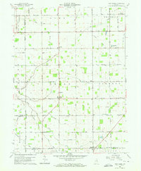
 1960 Manilla1961 Print · USGSRush County's agricultural heartland is documented here in the early sixties, showing a landscape shaped by the Pennsylvania railroad and the Flat Rock River. Researchers can locate the Covered Bridge near Gowdy, as well as numerous family sites like Homer Cem and Bebout Cem.3 unique versions available
 - 1960 Map of Blaine, 1961 Print
 1960 Blaine1961 Print · USGSJay County's rural townships are shown here during a period of steady mid-century growth along the river and rail lines. Genealogists and researchers can trace family-named sites like Whiteman Cem, visit country landmarks like Sugar Grove Ch, or locate the old Drive-in Theater.3 unique versions available
 - 1960 Map of Liberty, 1961 Print
 1960 Liberty1961 Print · USGSThe eastern Indiana countryside around the town of Liberty is shown here in the early sixties, just as the local landscape was being shaped by the new Whitewater State Park. Researchers can locate numerous family landmarks and burial sites, including Potter Cem, Woods Chapel, and the Baltimore and Ohio rail line.
 - 1960 Map of Eaton, 1961 Print
 1960 Eaton1961 Print · USGSDelaware County at the start of the 1960s shows a landscape of established rail lines and emerging mid-century landmarks. Genealogists can trace family names through the Union Cemetery or Godlove Cem, while identifying sites like the Township Sch and Delaware Chapel.3 unique versions available
 - 1960 Map of Alexandria, 1961 Print
 1960 Alexandria1961 Print · USGSMadison County, Indiana, is captured here at the dawn of the sixties, showcasing the thriving railroad and farming hub of Alexandria. Researchers can trace the legacy of family farms and rural life through landmarks like Forrestville Cem, Cunningham Sch, and the town of Orestes.3 unique versions available
 - 1960 Map of Mount Pleasant, 1961 Print
 1960 Mount Pleasant1961 Print · USGSIndiana's rural heartland is captured in the early sixties as a network of crossroads settlements and small farmsteads. Local historians can trace the foundations of Mount Pleasant, Luray, and Rogersville alongside historic sites like Buck Creek Ch and Lebanon Cem.4 unique versions available
Showing maps 1-25 of 479
Top cities of Indiana
- Indianapolis historical maps
- Fort Wayne historical maps
- Evansville historical maps
- South Bend historical maps
- Carmel historical maps
- Fishers historical maps
See more
Top counties of Indiana
- Lake County historical maps
- Allen County historical maps
- Hamilton County historical maps
- Saint Joseph County historical maps
- Elkhart County historical maps
- Tippecanoe County historical maps
See more
Frequently asked questions
- What are the different types of historical maps available for Indiana?
- What is the oldest map of Indiana?
- Where can I purchase historical maps of Indiana for my home or office?
- Where can I download high-res historical maps of Indiana?
- Are there historical topographic maps available for Indiana?
- Is there historical aerial imagery available for Indiana?
- Where are historical maps of Indiana sourced from?