Old Maps of Indiana
Explore 1,559 old maps of Indiana, spanning from 1889 to today. These high-resolution historic maps reveal how streets, neighborhoods, landmarks, and natural features evolved over time — perfect for genealogy, metal detecting, research, and local history exploration.
What you can do with these maps:
- See how Indiana changed over time: Compare historical maps to modern-day views to trace roads, homesites, rail lines & more.
- View detailed metadata: Each map includes creators, publishers, year, scale, and archive source.
- Overlay maps with satellite & LiDAR: Visualize the past alongside modern tools to explore terrain & human change.
- Trusted historical sources: Maps sourced from the USGS, Library of Congress, and other archives.
- Access maps your way: View online, download high-res files, or order prints for personal or research use.
Start exploring old maps of Indiana to uncover forgotten places, hidden landmarks, and the deep history beneath your feet.
Indiana maps
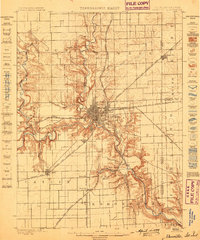
(1,559)- 1889 Map of Chicago
 1889 Chicago1889 Print · USGSCovers Indiana, including Chicago, Cicero, and other nearby areas
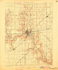
 - 1891 Map of Chicago
 1891 Chicago1891 Print · USGSCovers Indiana, including Chicago, Cicero, and other nearby areas
 - 1892 Map of Calumet
 1892 Calumet1892 Print · USGSCovers Indiana, including Chicago, Hammond, and other nearby areas
 - 1893 Map of Calumet
 1893 Calumet1893 Print · USGSCovers Indiana, including Chicago, Hammond, and other nearby areas
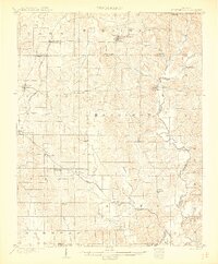
 - 1899 Map of Danville
 1899 Danville1899 Print · USGSCovers Indiana, including Danville, Westville, and other nearby areas
 - 1900 Map of Chicago
 1900 Chicago1900 Print · USGSCovers Indiana, including Chicago, Cicero, and other nearby areas
 - 1900 Map of Toleston
 1900 Toleston1900 Print · USGSCovers Indiana, including Hammond, Gary, and other nearby areas6 unique versions available
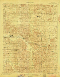
 - 1900 Map of Danville
 1900 Danville1900 Print · USGSCovers Indiana, including Danville, Westville, and other nearby areas7 unique versions available
 - 1900 Map of Calumet
 1900 Calumet1900 Print · USGSCovers Indiana, including Chicago, Hammond, and other nearby areas
 - 1900 Map of St Meinrad, 1961 Print
 1900 St Meinrad1961 Print · USGSCovers Indiana, including Ferdinand, Dale, and other nearby areas
 - 1900 Map of De Gonia Springs, 1963 Print
 1900 De Gonia Springs1963 Print · USGSCovers Indiana, including Boonville, Dale, and other nearby areas
 - 1901 Map of Calumet
 1901 Calumet1901 Print · USGSCovers Indiana, including Chicago, Hammond, and other nearby areas5 unique versions available
 - 1901 Map of Owensboro
 1901 Owensboro1901 Print · USGSCovers Indiana, including Owensboro, Rockport, and other nearby areas5 unique versions available
 - 1901 Map of Chicago
 1901 Chicago1901 Print · USGSCovers Indiana, including Chicago, Cicero, and other nearby areas5 unique versions available
 - 1901 Map of Princeton, 1954 Print
 1901 Princeton1954 Print · USGSCovers Indiana, including Princeton, Mount Carmel, and other nearby areas
 - 1901 Map of Haubstadt, 1955 Print
 1901 Haubstadt1955 Print · USGSCovers Indiana, including Evansville, Armstrong, and other nearby areas
 - 1902 Map of Ditney
 1902 Ditney1902 Print · USGSCovers Indiana, including Evansville, Boonville, and other nearby areas3 unique versions available
 - 1902 Map of Degonia Springs
 1902 Degonia Springs1902 Print · USGSCovers Indiana, including Boonville, Dale, and other nearby areas2 unique versions available
 - 1902 Map of Boonville
 1902 Boonville1902 Print · USGSCovers Indiana, including Evansville, Boonville, and other nearby areas4 unique versions available
 - 1903 Map of St. Meinrad
 1903 St. Meinrad1903 Print · USGSCovers Indiana, including Ferdinand, Dale, and other nearby areas2 unique versions available
 - 1903 Map of Velpen
 1903 Velpen1903 Print · USGSCovers Indiana, including Winslow, Holland, and other nearby areas2 unique versions available
 - 1903 Map of Haubstadt
 1903 Haubstadt1903 Print · USGSCovers Indiana, including Evansville, Armstrong, and other nearby areas3 unique versions available
 - 1903 Map of New Harmony
 1903 New Harmony1903 Print · USGSCovers Indiana, including Grayville, Poseyville, and other nearby areas3 unique versions available
 - 1903 Map of Petersburg
 1903 Petersburg1903 Print · USGSCovers Indiana, including Oakland City, Petersburg, and other nearby areas2 unique versions available
 - 1903 Map of Tell City
 1903 Tell City1903 Print · USGSCovers Indiana, including Tell City, Lewisport, and other nearby areas7 unique versions available
Showing maps 1-25 of 1,559
Top cities of Indiana
- Indianapolis historical maps
- Fort Wayne historical maps
- Evansville historical maps
- South Bend historical maps
- Carmel historical maps
- Fishers historical maps
See more
Top counties of Indiana
- Lake County historical maps
- Allen County historical maps
- Hamilton County historical maps
- Saint Joseph County historical maps
- Elkhart County historical maps
- Tippecanoe County historical maps
See more
Frequently asked questions
- What are the different types of historical maps available for Indiana?
- What is the oldest map of Indiana?
- Where can I purchase historical maps of Indiana for my home or office?
- Where can I download high-res historical maps of Indiana?
- Are there historical topographic maps available for Indiana?
- Is there historical aerial imagery available for Indiana?
- Where are historical maps of Indiana sourced from?