1900s (20th Century) Maps of Hamilton County, Kansas
Explore 49 historic maps of Hamilton County from the 1900s (20th Century). These maps offer a rare glimpse into what life looked like during the 1900s — showing old roads, neighborhoods, homes, and landmarks that have changed or disappeared over time.
Whether you're researching your family's past, planning a metal detecting trip, or studying how Hamilton County's landscape evolved across the 1900s, these high-resolution maps are a powerful tool for exploring the history of this region.
- Focus on a specific era: All maps on this page are from the 1900s, giving you a focused view of this time period.
- See what’s changed: Compare century-old streets, trails, and buildings to today's modern landscape using overlays and satellite layers.
- Research with precision: Use these maps for genealogy, historical research, land use analysis, or educational projects.
- View, download, or print: Maps are fully viewable online in high resolution, and can be downloaded or printed for your own records.
Start exploring Hamilton County's history through authentic maps from the 1900s. This is your window into the past.
Hamilton County, KS maps
(49)- 1900 Map of Syracuse
 1900 Syracuse1900 Print · USGSWestern Kansas at the turn of the century shows a frontier landscape shaped by the Arkansas River and the arriving railroad. Genealogists and researchers can locate early settlements like Hatton, Edwin, and Gognac along with the path of the Atchison Topeka and Santa Fe.5 unique versions available
 - 1920 Map of Syracuse
 1920 Syracuse1920 Print · USGSWestern Kansas at the close of the frontier era centers on the vital Arkansas River valley and the reach of the railroad. Genealogists and local historians can trace early prairie settlements like Gognac, Hatton, and Kendall along the Atchison Topeka and Santa Fe line.
 - 1953 Map of Holly East, 1954 Print
 1953 Holly East1954 Print · USGSThe Arkansas River valley at the Colorado-Kansas border was a vital transit corridor in the early fifties. Historians can trace the Old Santa Fe Trail past the Site of Old Trail City and the rail-side towns of Holly and Coolidge.4 unique versions available
 - 1954 Map of Lamar, 1964 Print
 1954 Lamar1964 Print · USGSSoutheastern Colorado and the Kansas borderlands appear here in the mid-fifties, dominated by the vital Arkansas River irrigation network. Researchers can trace the development of river towns like Lamar and La Junta alongside the Amity Cemetery and several major reservoirs.3 unique versions available
 - 1955 Map of Holly NE, 1956 Print
 1955 Holly NE1956 Print · USGSThe Colorado-Kansas state line is captured here in the mid-1950s, showing a high-plains landscape shaped by vital irrigation. Genealogists and researchers can trace the path of the Amity Canal, locate a School (Aband), and explore the terrain of Coolidge Ridge.3 unique versions available
 - 1955 Map of La Junta, 1966 Print
 1955 La Junta1966 Print · USGSSoutheastern Colorado during the mid-fifties is captured here as a sprawling network of ranching outposts and rail sidings. Researchers can locate vanished landmarks like the Sunderland School, trace the isolated Lycan Post Office, or find the Bomb target (abandoned) on the western plains.3 unique versions available
 - 1955 Map of Dodge City, 1968 Print
 1955 Dodge City1968 Print · USGSSouthwest Kansas in the mid-fifties reveals an expansive landscape of cattle towns, early gas fields, and prairie outposts. Researchers can trace rural school districts like Moundview and Good Luck or locate the Kansas State Game Farm near Lakin.3 unique versions available
 - 1955 Map of Scott City, 1969 Print
 1955 Scott City1969 Print · USGSWestern Kansas in the mid-fifties is captured here as a landscape of rural schoolhouses and significant rail corridors. Family historians can trace the locations of Skyline and Beaver Creek Schools or follow the Union Pacific line through Oakley and Sharon Springs.4 unique versions available
 - 1958 Map of La Junta
 1958 La Junta1958 Print · USGSSoutheast Colorado and the Kansas borderlands appear in the late fifties as a landscape of isolated ranching outposts and vital rail junctions. Researchers can trace the lineage of vanished post offices and rural school sites like the Lycan Post Office and Sunderland School.2 unique versions available
 - 1958 Map of Lamar
 1958 Lamar1958 Print · USGSThe High Plains of Eastern Colorado and Western Kansas in the late fifties reveal a landscape tied to the Arkansas River and the rails. Trace the heritage of the river valley through Fort Lyon, the Atchison Topeka and Santa Fe RR, and rural landmarks like Kendrick Church.2 unique versions available
 - 1958 Map of Dodge City
 1958 Dodge City1958 Print · USGSSouthwest Kansas in the late fifties shows a landscape of river-valley agriculture and burgeoning energy infrastructure. Genealogists can trace rural life through numerous landmarks like Fairview Cemetery, the Goodwell School, and Concord Church.
 - 1958 Map of Scott City
 1958 Scott City1958 Print · USGSWestern Kansas at the peak of the post-war era reveals a landscape of high-plains agriculture and vital rail junctions. Genealogists and historians can trace old country school sites like Prairie Bell School, the landmark Chalk Pyramids, and small stops along the Union Pacific and Missouri Pacific.
 - 1959 Map of Dodge City
 1959 Dodge City1959 Print · USGSSouthwest Kansas in the mid-fifties is captured at its agricultural height, centered on the vital rail and river hubs of Dodge City and Garden City. Genealogists and local historians can trace rural school districts like Shockey School and Hickok School or locate the Fairview Cemetery.
 - 1959 Map of Big Bow NE, 1960 Print
 1959 Big Bow NE1960 Print · USGSSouthwest Kansas at the close of the 1950s shows a landscape transformed by the regional gas boom. Researchers can trace the drainage of Bear Creek through Big Bow and Sherman townships or locate numerous scattered Gas Well sites.
 - 1959 Map of Big Bow NW, 1960 Print
 1959 Big Bow NW1960 Print · USGSWestern Kansas at the close of the fifties reveals a landscape transitioning from traditional ranching to an active gas-producing region. Genealogists and historians can locate the Mitchell Cem and trace the meandering courses of Bear Creek and Little Bear Creek through the Big Bow area.2 unique versions available
 - 1966 Map of Syracuse West SW, 1967 Print
 1966 Syracuse West SW1967 Print · USGSHamilton County, Kansas, is captured in the mid-1960s when high-plains agriculture and resource extraction shaped the local landscape. Researchers can locate the Bear Creek Cem, trace the course of North Bear Creek, and find the isolated School No C-2.
 - 1966 Map of Syracuse East SW, 1967 Print
 1966 Syracuse East SW1967 Print · USGSHamilton County agricultural lands and early energy development are captured here during the mid-sixties. Genealogists and local historians can locate rural landmarks such as Ebenflure Ch, the nearby Cem, and industrial Gas Well sites.
 - 1966 Map of Tribune 3 SW, 1967 Print
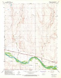 1966 Tribune 3 SW1967 Print · USGSWestern Kansas at the height of the mid-sixties reveals a landscape defined by the Arkansas River and its irrigation history. Researchers can trace the path of the Atchison Topeka and Santa Fe railroad and find the old Coolidge Cem and Medway settlement.2 unique versions available
 - 1966 Map of Syracuse East, 1967 Print
 1966 Syracuse East1967 Print · USGSHamilton County in the mid-sixties reveals a river valley defined by heavy rail and irrigation. Genealogists and historians can trace the grid of Syracuse, locate the rail siding at Mayline, and study the expansive Shifting Sand dunes south of the Arkansas River.
 - 1966 Map of Durkee Creek NE, 1967 Print
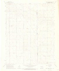 1966 Durkee Creek NE1967 Print · USGSThe high plains of the Prowers and Hamilton county line appear in the mid-1960s, showing the quiet landscape along the Colorado-Kansas border. Researchers can trace land use patterns through the Canal system, the flow of Bear Creek, and numerous rural wells.
 - 1966 Map of Syracuse West SE, 1967 Print
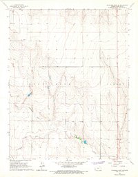 1966 Syracuse West SE1967 Print · USGSHamilton County was a landscape of wide-open High Plains and winding creek beds in the mid-1960s. Genealogists and local historians can trace the paths of Bear Creek and Little Bear Creek or locate early industrial sites like the Oil Well and local Sandpit.
 - 1966 Map of Syracuse West, 1967 Print
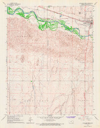 1966 Syracuse West1967 Print · USGSWestern Kansas irrigation and commerce are well-defined in the 1960s as the river corridor meets the high plains. Researchers can trace the path of the Atchison Topeka and Santa Fe railroad alongside the Alamo Ditch and the historic Syracuse Cemetery.
 - 1966 Map of Tribune 4 NW, 1967 Print
 1966 Tribune 4 NW1967 Print · USGSHamilton County townships show their mid-century character during this era of rural infrastructure growth and energy exploration. Genealogists and historians can trace the paths of Mattox Draw or locate regional landmarks like the Dykeman Airport and early Gas Wells.2 unique versions available
 - 1966 Map of Syracuse West NW, 1967 Print
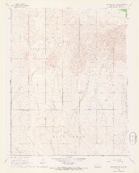 1966 Syracuse West NW1967 Print · USGSHamilton County in the mid-1960s reveals a prairie landscape of active dunes and rural infrastructure. Genealogists and historians can locate the Sunnyvale Cem or trace industrial markers like the local Oil Well and Pipeline through Coolidge.
 - 1966 Map of Tribune 3 SE, 1967 Print
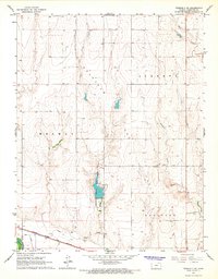 1966 Tribune 3 SE1967 Print · USGSHamilton County in the mid-1960s exhibits a landscape of river-bottom irrigation and high plains grazing. Trace the historical path of the Atchison Topeka and Santa Fe railroad as it skirts the Arkansas River near Alamo Ditch.2 unique versions available
Showing maps 1-25 of 49
Top cities of Hamilton County
Frequently asked questions
- What are the different types of historical maps available for Hamilton County?
- What is the oldest map of Hamilton County?
- Where can I purchase historical maps of Hamilton County for my home or office?
- Where can I download high-res historical maps of Hamilton County?
- Are there historical topographic maps available for Hamilton County?
- Is there historical aerial imagery available for Hamilton County?
- Where are historical maps of Hamilton County sourced from?