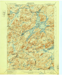
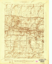
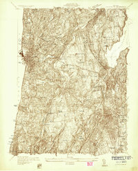
1930s Maps of New York
Explore 90 historic maps of New York from the 1930s. These maps offer a rare glimpse into what life looked like during the 1930s — showing old roads, neighborhoods, homes, and landmarks that have changed or disappeared over time.
Whether you're researching your family's past, planning a metal detecting trip, or studying how New York's landscape evolved across the 1930s, these high-resolution maps are a powerful tool for exploring the history of this region.
- Focus on a specific era: All maps on this page are from the 1930s, giving you a focused view of this time period.
- See what’s changed: Compare century-old streets, trails, and buildings to today's modern landscape using overlays and satellite layers.
- Research with precision: Use these maps for genealogy, historical research, land use analysis, or educational projects.
- View, download, or print: Maps are fully viewable online in high resolution, and can be downloaded or printed for your own records.
Start exploring New York's history through authentic maps from the 1930s. This is your window into the past.
New York maps
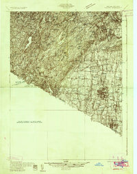
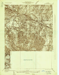
(90)- 1930 Map of Schunemunk
 1930 Schunemunk1930 Print · USGSOrange County's rail and river landscapes come into sharp focus during the late Prohibition era. Researchers can trace historic district schoolhouses like Elmwood No. 6 School and the critical junction points of the ERIE RR near Vails Gate Junction.3 unique versions available
 - 1930 Map of Starrucca
 1930 Starrucca1930 Print · USGSUpper Wayne County was a major transportation and recreation hub in the 1930s, defined by the Delaware River rail corridors and numerous upland lakes. Genealogists can trace family roots through localized sites like the South Preston Grange Hall and schools like Fairmont Sch.3 unique versions available
 - 1930 Map of Schenectady
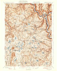
 1930 Schenectady1930 Print · USGSThe Mohawk Valley and southern Saratoga County are caught in a moment of transition in the late twenties, balancing industrial river life with rural farmsteads. Genealogists and historians can trace the Erie Canal (Abandoned) path and locate old family landmarks like Harmony Corners or Vischer Ferry.5 unique versions available
 - 1931 Map of Ramapo
 1931 Ramapo1931 Print · USGSRockland County in the late twenties and early thirties shows a unique mix of expanding suburban rail towns and state park wilderness. Genealogists and historians can trace Letchworth Village, the old Hogan Kamp Mine, and early schools like Bardonia Sch.3 unique versions available
 - 1931 Map of Lyon Mountain
 1931 Lyon Mountain1931 Print · USGSThe northern Adirondack mining and timber lands are shown here in the early 1900s, centered on the heights of Lyon Mountain. Researchers can trace the Chateaugay R.R. as it serves industrial sites like Junction Kilns and the settlement at Standish.
 - 1931 Map of Mendon Ponds
 1931 Mendon Ponds1931 Print · USGSMonroe County was undergoing a significant transition in the early 1930s as Rochester's industrial reach met rural township life. Genealogists can trace family footprints across dozens of district schools like Henrietta No 2 Sch or locate the Iola Sanitarium.
 - 1931 Map of Cranberry Lake
 1931 Cranberry Lake1931 Print · USGSThe Adirondack wilderness around Cranberry Lake is captured here in the early thirties, showcasing a landscape of logging, mining, and remote rail travel. Genealogists and historians can trace the industrial footprints of Benson Mines, the State Ranger School, and the New York Central line.
 - 1931 Map of Rochester West
 1931 Rochester West1931 Print · USGSMonroe County is seen here during the early thirties as the western suburbs of Rochester began to take shape alongside major transit corridors. Researchers can trace the path of the Erie Barge Canal and locate historic sites like St Bernards Seminary and Coldwater Sta.
 - 1931 Map of Rochester East
 1931 Rochester East1931 Print · USGSMonroe County was undergoing a period of rapid residential expansion in the early thirties as the city reached toward the lake. Researchers can find old neighborhood landmarks like the Genesee Lighthouse, Claverhouse PO, and the Riverside Cemetery.
 - 1931 Map of Amsterdam
 1931 Amsterdam1931 Print · USGSThe Mohawk Valley thrives at the height of its rail and canal era in the late twenties and early thirties. Genealogists can trace family names through dozens of rural schools and churches, from St Marys Ch to the quiet hamlets of Mariaville and Scotch Bush.3 unique versions available
 - 1932 Map of Webster
 1932 Webster1932 Print · USGSMonroe County settlements and rural school districts are captured here in the early 1930s. Genealogists can locate specific farm-to-market routes and historic landmarks like Thousand Acre Swamp, West Webster, and the New York Central RR.
 - 1932 Map of Corry
 1932 Corry1932 Print · USGSThe industrial crossroads at the junction of the Pennsylvania and Erie Railroads come to life in the early 1930s. Trace old family roots and rural schoolhouses like Picidilli Sch and Daytown Sch near Spartansburg and Corry.3 unique versions available
 - 1932 Map of Union City
 1932 Union City1932 Print · USGSNorthwestern Pennsylvania at the dawn of the 1930s reveals a landscape of thriving rail junctions and rural crossroads. Genealogists can trace family landmarks and forgotten hamlets such as Riceville, Mill Village, and the many one-room schools like Bonnell Sch.3 unique versions available
 - 1932 Map of Hamlin
 1932 Hamlin1932 Print · USGSLake Ontario’s shoreline meets the orchards and rail-linked villages of northern Monroe County in the early 1930s. Trace old family plots at Lakeside Cem or follow the New York Central through Hamlin Station and Morton.
 - 1932 Map of Spencerport
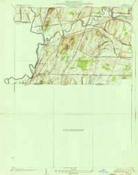
 1932 Spencerport1932 Print · USGSMonroe County was a thriving network of canal-side hamlets and agricultural enterprise in the early 1930s. Genealogists and historians can trace family locations through numbered school districts and landmarks like Chesbro Seminary, the Harris Seed Farm, and Ogden Center.
 - 1932 Map of White Plains
 1932 White Plains1932 Print · USGSWestchester County's evolving landscape is captured here in the early thirties, showing the dense growth of the county seat alongside massive institutional estates. Genealogists and historians can locate families in White Plains or trace the early grounds of Marymount College and Sleepy Hollow Cemetery.
 - 1932 Map of Fairport
 1932 Fairport1932 Print · USGSMonroe County's canal and rail corridor is captured here in the early 1930s, showing the vital intersection of the Barge Canal and major rail lines. Genealogists can locate family-named roads and numerous rural schools like School No 5 near Egypt.
 - 1932 Map of Susquehanna, 1959 Print
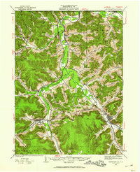
 1932 Susquehanna1959 Print · USGSSusquehanna County at the start of the 1930s is a landscape of thriving rail junctions and upland farming crossroads. Researchers can trace the path of the Erie RR through Lanesboro or locate rural landmarks like Sweet Chapel and the Lamb Cem.
 - 1932 Map of Genesee, 1961 Print
 1932 Genesee1961 Print · USGSNorthern Pennsylvania’s high plateau is captured here in the early thirties, showing the transition from timber-hauling rail lines to mountain highways. Genealogists can locate family names at Andrews Settlement, the Sweden Hill Cem, or the Ice Mine.
 - 1933 Map of Starrucca
 1933 Starrucca1933 Print · USGSUpper Wayne County was a landscape of rail-connected dairy farms and summer camps in the years between the wars. Genealogists can locate family-named rural schools and depots from Stephens Switch and Stockport Sta to Hines Corners.3 unique versions available
 - 1933 Map of Kinderhook
 1933 Kinderhook1933 Print · USGSColumbia County in the early thirties is a landscape of thriving mill towns and rail junctions. Genealogists and historians can locate family-named schoolhouses like Woltermire Sch or trace the grounds of the Martin Van Buren Homestead.3 unique versions available
 - 1933 Map of Smethport, 1960 Print
 1933 Smethport1960 Print · USGSNorthern Pennsylvania’s river valleys were centers of industry and transit in the early 1930s as rail lines followed the winding water gaps. Genealogists can trace family roots through numerous valley schoolhouses like Bush Hill Sch and rural settlements including Duke Center and Turtlepoint.
 - 1934 Map of Rush
 1934 Rush1934 Print · USGSThe Genesee River valley in the 1930s serves as a busy crossroads for major rail lines and rural hamlets. Researchers can trace family homesteads along Martin Road, locate the grounds of School No 6, or map the rail junctions at Golah and West Rush.2 unique versions available
 - 1934 Map of Castle Creek
 1934 Castle Creek1934 Print · USGSBroome County was transitioning into a regional transit hub during the mid-1930s as major railroads and highways began to reshape the river valleys. Genealogists can locate numerous rural schoolhouses and ethnic landmarks like the Polish Cem and Harry L Johnson Sch.
 - 1934 Map of Fairport
 1934 Fairport1934 Print · USGSMonroe County was undergoing significant planning and growth in the early thirties as the canal and rail lines shaped the Rochester suburbs. Trace the locations of historic rural schoolhouses, the Bushnell Basin Guard Gate, and the South Perinton Ch.
Showing maps 1-25 of 90
Top cities of New York
- New York historical maps
- Hempstead historical maps
- Brookhaven historical maps
- Islip historical maps
- Oyster Bay historical maps
- Buffalo historical maps
See more
Top counties of New York
- Kings County historical maps
- Queens County historical maps
- New York County historical maps
- Suffolk County historical maps
- Bronx County historical maps
- Nassau County historical maps
See more
Frequently asked questions
- What are the different types of historical maps available for New York?
- What is the oldest map of New York?
- Where can I purchase historical maps of New York for my home or office?
- Where can I download high-res historical maps of New York?
- Are there historical topographic maps available for New York?
- Is there historical aerial imagery available for New York?
- Where are historical maps of New York sourced from?