1900-1909 Maps of New York
Explore 229 historic maps of New York from 1900-1909. These maps offer a rare glimpse into what life looked like during the 1900s — showing old roads, neighborhoods, homes, and landmarks that have changed or disappeared over time.
Whether you're researching your family's past, planning a metal detecting trip, or studying how New York's landscape evolved across the 1900s, these high-resolution maps are a powerful tool for exploring the history of this region.
- Focus on a specific era: All maps on this page are from the 1900s, giving you a focused view of this time period.
- See what’s changed: Compare century-old streets, trails, and buildings to today's modern landscape using overlays and satellite layers.
- Research with precision: Use these maps for genealogy, historical research, land use analysis, or educational projects.
- View, download, or print: Maps are fully viewable online in high resolution, and can be downloaded or printed for your own records.
Start exploring New York's history through authentic maps from the 1900s. This is your window into the past.
New York maps
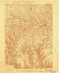
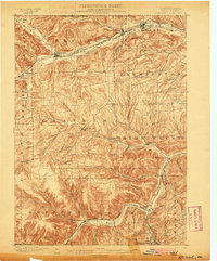
(229)- 1900 Map of Baldwinsville
 1900 Baldwinsville1900 Print · USGSOnondaga and Oswego counties are seen here at the close of the nineteenth century, when the Erie Canal still drove local commerce. Genealogists can trace family roots through canal towns like Jordan and river hubs like Baldwinsville and Phoenix.9 unique versions available
 - 1900 Map of Passaic
 1900 Passaic1900 Print · USGSNorthern New Jersey and the New York Harbor are captured here at the close of the nineteenth century, showing a landscape defined by rail, river, and coastal defense. Researchers can trace the original path of the Morris Canal, locate Seton Hall College, and explore the batteries at Fort Wadsworth.
 - 1900 Map of Little Falls
 1900 Little Falls1900 Print · USGSThe Mohawk River valley serves as a bustling industrial artery at the turn of the century, dominated by canal and rail traffic. Genealogists can trace the early footprints of Little Falls, find the County House, or locate vanished stops like Ingham Mills Sta.
 - 1900 Map of Gaines
 1900 Gaines1900 Print · USGSThe Cowanesque River valley at the turn of the century shows a landscape defined by new rail lines and remote timbering settlements. Genealogists can trace family holdings near Sunderlinville, Harrison Valley, and the rural crossroads of Mixtown and Lansing.5 unique versions available
 - 1900 Map of Paterson
 1900 Paterson1900 Print · USGSNortheastern New Jersey at the turn of the century shows a landscape defined by the Morris Canal and a dense network of early railroads. Researchers can trace ancestral roots through vanished rail stops and sites like Laurel Grove Cemetery, Wortendyke, and Sicomac.
 - 1900 Map of Dunkirk
 1900 Dunkirk1900 Print · USGSThe Lake Erie shoreline and Chautauqua hills are shown here in the late nineteenth century during a peak era of railroad expansion. Genealogists can trace early post offices like Van Buren (Cushing P.O.) and established towns such as Fredonia and Brocton.6 unique versions available
 - 1900 Map of Utica
 1900 Utica1900 Print · USGSThe Mohawk Valley was at its industrial peak at the turn of the century, anchored by the rail and canal nexus of Utica. Genealogists can trace family names through rural crossroads like Martin Corners and Brayton Corners, or follow the industrial sprawl of the Erie Canal into Ilion.9 unique versions available
 - 1900 Map of Macedon
 1900 Macedon1900 Print · USGSMonroe and Wayne counties thrive at the intersection of water and rail transport at the end of the nineteenth century. Genealogists and historians can trace the original paths of the Erie Canal and locate long-standing settlements like Despatch, Fairport, and Webster.8 unique versions available
 - 1900 Map of Canajoharie
 1900 Canajoharie1900 Print · USGSThe Mohawk Valley at the turn of the century shows a dense network of canal, rail, and river transportation. Genealogists can trace family footprints in historic Canajoharie, the upland farms near Stone Arabia, and the resort area of Sharon Springs.
 - 1900 Map of Staten Island
 1900 Staten Island1900 Print · USGSThe New York and New Jersey harbor comes alive in the late Victorian era, showing Staten Island when small villages and defensive forts still defined the coastline. Trace family roots and vanished landmarks through Fort Wadsworth, the Morris Canal, and historic settlements like Rossville or Tottenville.10 unique versions available
 - 1900 Map of Taconic
 1900 Taconic1900 Print · USGSThe tri-state border region of the Taconic Mountains thrived at the turn of the century as a hub of rail travel and valley industry. Genealogists and historians can trace the early footprints of Hoosick Falls, Bennington, and the winding path of the Rutland R.R.4 unique versions available
 - 1900 Map of Tully
 1900 Tully1900 Print · USGSIn the hills south of Syracuse during the late 1890s, this area supported a network of dairy farms and rail-dependent hamlets. Genealogists can locate long-lost rural communities like Maple Grove (Case P.O.), the Onondaga Indian Reservation, and the resort grounds at Assembly Park.9 unique versions available
 - 1900 Map of Remsen
 1900 Remsen1900 Print · USGSOneida and Herkimer Counties at the turn of the century show a landscape shaped by the rail-and-canal economy. Genealogists can trace family roots through settlements like Remsen, Hinckley, and Trenton Falls or locate industrial sites such as Bardwell Mill.9 unique versions available
 - 1900 Map of Canada Lake
 1900 Canada Lake1900 Print · USGSHamilton County was a remote wilderness of lakes and high peaks at the turn of the century. Genealogists and historians can locate early outposts like Kenwells and Northrup Lodge or trace the original shorelines of West Canada Lake.
 - 1900 Map of Wilson
 1900 Wilson1900 Print · USGSNiagara County's shoreline at the turn of the century shows a landscape of established orchards and quiet lakefront ports. Genealogists can trace the early layout of Wilson and North Wilson or locate the Rome Watertown and Ogdensburg Station along the rail line.5 unique versions available
 - 1900 Map of Oswego
 1900 Oswego1900 Print · USGSThe Lake Ontario shoreline in Oswego and Cayuga Counties at the turn of the century is a hub of maritime and rail commerce. Genealogists and historians can trace the paths of four major railroads serving lakefront communities like North Fairhaven and the historic grounds of Fort Ontario.8 unique versions available
 - 1900 Map of Tonawanda
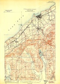
 1900 Tonawanda1900 Print · USGSNiagara County and northern Erie County are shown at the turn of the century as the Erie Canal and heavy rail lines drove the growth of the North Tonawanda lumber and shipping hub. Genealogists can trace family footprints in outlying hamlets like Bergholtz, Ransomville, and Martinsville.
 - 1900 Map of Cherry Creek
 1900 Cherry Creek1900 Print · USGSWestern New York near the turn of the century shows a landscape of developing rail hubs and managed wetlands. Genealogists can trace family roots through settlements like Forestville, South Dayton, and Leon, or locate vanished stations like Smiths Mills Sta. and the rural crossroads at Charlotte Center.6 unique versions available
 - 1900 Map of Bolton
 1900 Bolton1900 Print · USGSThe Adirondack lakeshore comes alive in this late nineteenth-century survey, showcasing the steamboat-era connections of Lake George. Genealogists and local historians can trace family locations near Bolton Landing, Hague, and the remote heights of Tongue Mountain.13 unique versions available
 - 1900 Map of Tioga
 1900 Tioga1900 Print · USGSTioga County at the turn of the century shows a landscape defined by the busy river corridors and the arrival of major rail networks. Researchers can trace the early footprints of Lawrenceville, Mansfield, and Tioga, or locate rural landmarks like Jackson Summit and Canoe Camp.
 - 1900 Map of Schoharie
 1900 Schoharie1900 Print · USGSSchoharie County at the turn of the century shows a landscape defined by the winding Schoharie Creek and vital rail connections. Genealogists can trace family roots through specific locations like Howe Cave, Mineral Springs, and the various stops along the Middleburg and Schoharie RR.8 unique versions available
 - 1900 Map of Dryden
 1900 Dryden1900 Print · USGSThe Finger Lakes region comes to life in the late nineteenth century as the rail networks of the Lehigh Valley RR and the CAYUGA DIVISION expand through the valleys. Genealogists can trace family roots through the hill settlements of Caroline Center, South Danby, and the early grounds of Cornell University.9 unique versions available
 - 1900 Map of Elkland
 1900 Elkland1900 Print · USGSTioga County at the turn of the century is defined by its deep river valleys and the expanding rail networks of the Cowanesque River. Genealogists and local historians can trace the early footprints of Knoxville, Academy Corners, and the rail junction at Stokesdale Junc.5 unique versions available
 - 1900 Map of Housatonic
 1900 Housatonic1900 Print · USGSThe Berkshires and the Housatonic Valley are captured here at a moment of industrial and social transition during the late Victorian era. Genealogists and historians can trace the early rail networks of the Boston and Albany R.R. through old settlements like Shaker Village and Lenox Furnace.5 unique versions available
 - 1900 Map of Wilmurt
 1900 Wilmurt1900 Print · USGSThe Adirondack foothills of Herkimer and Hamilton counties appear here at the turn of the century, showing a landscape of isolated hamlets and timber-rich woods. Genealogists can trace family roots in Wilmurt, Nobleboro, and Morehouseville or locate landmarks like Twin Lakes Reservoir and Hinckley Lake.
Showing maps 1-25 of 229
Top cities of New York
- New York historical maps
- Hempstead historical maps
- Brookhaven historical maps
- Islip historical maps
- Oyster Bay historical maps
- Buffalo historical maps
See more
Top counties of New York
- Kings County historical maps
- Queens County historical maps
- New York County historical maps
- Suffolk County historical maps
- Bronx County historical maps
- Nassau County historical maps
See more
Frequently asked questions
- What are the different types of historical maps available for New York?
- What is the oldest map of New York?
- Where can I purchase historical maps of New York for my home or office?
- Where can I download high-res historical maps of New York?
- Are there historical topographic maps available for New York?
- Is there historical aerial imagery available for New York?
- Where are historical maps of New York sourced from?