1960s Maps of New York
Explore 437 historic maps of New York from the 1960s. These maps offer a rare glimpse into what life looked like during the 1960s — showing old roads, neighborhoods, homes, and landmarks that have changed or disappeared over time.
Whether you're researching your family's past, planning a metal detecting trip, or studying how New York's landscape evolved across the 1960s, these high-resolution maps are a powerful tool for exploring the history of this region.
- Focus on a specific era: All maps on this page are from the 1960s, giving you a focused view of this time period.
- See what’s changed: Compare century-old streets, trails, and buildings to today's modern landscape using overlays and satellite layers.
- Research with precision: Use these maps for genealogy, historical research, land use analysis, or educational projects.
- View, download, or print: Maps are fully viewable online in high resolution, and can be downloaded or printed for your own records.
Start exploring New York's history through authentic maps from the 1960s. This is your window into the past.
New York maps
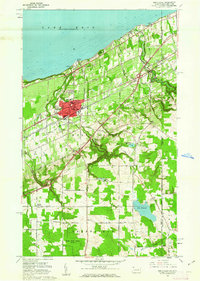
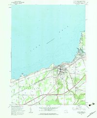
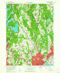
(437)- 1960 Map of Buffalo
 1960 Buffalo1960 Print · USGSWestern New York and the Niagara Peninsula thrive during the mid-twentieth century industrial peak. Genealogists and historians can trace family-named points and early settlements from Dunkirk Light to the Allegany Indian Reservation.
 - 1960 Map of Rochester
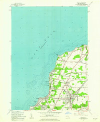
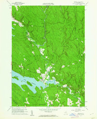
 1960 Rochester1960 Print · USGSThe Lake Ontario shoreline in the late fifties was a bustling corridor of rail and water commerce. Genealogists and historians can trace the path of the New York Central through canal towns like Newark or explore the coastal landmarks around Sackets Harbor.2 unique versions available
 - 1960 Map of Williamsport
 1960 Williamsport1960 Print · USGSNorth-central Pennsylvania in the mid-twentieth century was a vital corridor of rail and river industry stretching from the New York line to the coal regions. Genealogists can trace the rail networks of the Pennsylvania RR and Lehigh Valley RR connecting towns like Williamsport, Towanda, and Lock Haven.
 - 1960 Map of Newark
 1960 Newark1960 Print · USGSThe industrial heart of the Mid-Atlantic is shown at mid-century, stretching from the dense urban centers of Newark and Philadelphia to the Blue Mountain ridges. Researchers can trace historic rail lines, coastal defenses at Fort Hancock, and the riverfront growth of Trenton and Easton.3 unique versions available
 - 1960 Map of Poughquag, 1961 Print
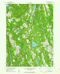
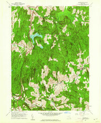
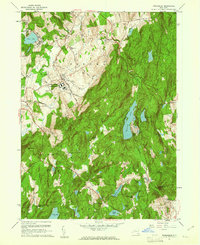 1960 Poughquag1961 Print · USGSDutchess and Putnam counties are captured in the early 1960s, showing a landscape defined by institutional landmarks and summer retreats. Genealogists and hikers can trace the Appalachian Trail past Whaley Lake or locate family plots at Beekman Cem.4 unique versions available
 - 1960 Map of Lexington, 1961 Print
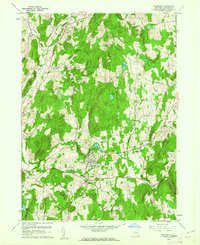
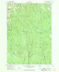
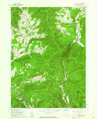
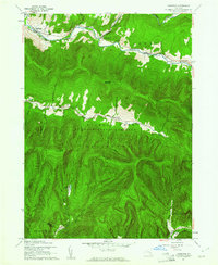 1960 Lexington1961 Print · USGSThe Greene and Ulster County borderlands are surveyed here during the early sixties, showing the high peaks and river hamlets of the Catskills. Genealogists can locate family names at Maplewood Cem or Parker Cem, and trace the route of the Ulster and Delaware Railroad near Lanesville.3 unique versions available
 - 1960 Map of Shandaken, 1961 Print
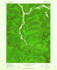 1960 Shandaken1961 Print · USGSThe northern Catskills appear in great detail during the early sixties, showing the rail-and-river corridor through Big Indian and Shandaken. Trace the high-altitude Winnisook Club near Slide Mtn or follow the New York Central line as it snakes along Esopus Creek.4 unique versions available
 - 1960 Map of Berlin, 1961 Print
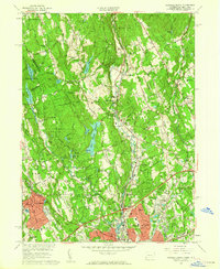
 1960 Berlin1961 Print · USGSRensselaer County at the start of the sixties reveals a valley life shaped by the Taconic Range and the winding Little Hoosic River. Genealogists can trace family heritage through numerous hillside burial grounds like Brimmer Cem and Weaver Cem, or locate landmarks like the Carmelite Novitiate.2 unique versions available
 - 1960 Map of Pound Ridge, 1961 Print
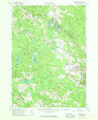
 1960 Pound Ridge1961 Print · USGSThe borderlands of New York and Connecticut are captured here during the post-war growth of the early sixties. Researchers can find numerous small family cemeteries like Williams Cem and Waterbury Cem or trace the early paths of the Merritt Pkwy and Mianus River Gorge.4 unique versions available
 - 1960 Map of Oswego, 1961 Print
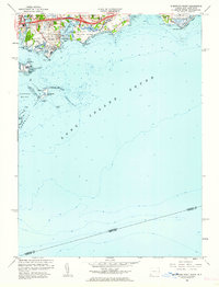
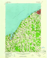 1960 Oswego1961 Print · USGSLake Ontario's southern shore and the busy port of Oswego are shown here during the early sixties. Researchers can trace the waterfront legacy of Fort Ontario, the New York Central tracks, and rural landmarks like St Joseph Chapel or School No 9.2 unique versions available
 - 1960 Map of Millbrook, 1962 Print
 1960 Millbrook1962 Print · USGSDutchess County's pastoral character is beautifully documented in the early sixties as the village of Millbrook serves as a regional center for education and society. Researchers can trace historic cemeteries like Nine Partners Cem, local institutions like Bennett College, and the winding paths of Wappinger Creek.4 unique versions available
 - 1960 Map of North East, 1962 Print
 1960 North East1962 Print · USGSThe Lake Erie shoreline in the early 1960s highlights the vital rail and road corridors connecting Pennsylvania to New York. Researchers can trace the layout of North East, identify the campus of St Marys College, and locate rural family hubs like Delhill Corners.4 unique versions available
 - 1960 Map of Ancram, 1962 Print
 1960 Ancram1962 Print · USGSColumbia and Dutchess County rural life is detailed here as it stood in the early sixties, centered on the historic settlements and waterways of the Hudson Highlands. Genealogists and historians can trace family locations near Ancram Union Cem or locate old industrial sites like Spaulding Furnace and New Forge.4 unique versions available
 - 1960 Map of Worth Center, 1962 Print
 1960 Worth Center1962 Print · USGSThe Tug Hill region in the early sixties is shown as a densely forested landscape of state-managed lands and branching river systems. Researchers can trace the rural layout of Worth Center, the remote Littlejohn settlement, and the network of waters feeding the Mad River.4 unique versions available
 - 1960 Map of Williamstown, 1962 Print
 1960 Williamstown1962 Print · USGSOswego County in the early sixties is defined by its extensive reforestation areas and network of quiet glacial ponds. Researchers can trace the legacy of rural life through sites like Checkered House, Sch No 4, and the old Railroad Grade.3 unique versions available
 - 1960 Map of Norwalk North, 1962 Print
 1960 Norwalk North1962 Print · USGSFairfield County's suburban landscape is captured here in the early sixties as it expanded across the ridges and river valleys. Genealogists and local researchers can trace family names and landmarks like Lakeview Cemetery, Cannondale, and the Silvermine community.5 unique versions available
 - 1960 Map of Silver Creek, 1962 Print
 1960 Silver Creek1962 Print · USGSThe Chautauqua County shoreline comes alive in the early sixties as a bustling corridor of rail, road, and water. Researchers can trace family sites at Mt Carmel Cem, visit the Cattaraugus Indian Reservation, or locate the St Columbans Seminary.2 unique versions available
 - 1960 Map of Langford, 1962 Print
 1960 Langford1962 Print · USGSSouthern Erie County is captured here in the early sixties, showing a landscape defined by natural gas extraction and rural crossroads. Genealogists and historians can trace family-named sites such as Dittman Cem or visit old communities like Langford, New Oregon, and Whites Corners.2 unique versions available
 - 1960 Map of Angola, 1962 Print
 1960 Angola1962 Print · USGSThe Erie County shoreline in the early sixties shows a bustling mix of lakeside summer camps and heavy rail infrastructure. Trace the growth of Angola and Evans Center alongside landmarks like the Drive-in Theater and the St Columbans Retreat House.2 unique versions available
 - 1960 Map of North Collins, 1962 Print
 1960 North Collins1962 Print · USGSWestern New York at the start of the sixties shows a landscape of deep creek gulfs, active rail lines, and Seneca territory. Genealogists can locate the Friends Meetinghouse Burial Grounds, Cattaraugus Long House Ch, and the Gowanda State Hospital Annex.2 unique versions available
 - 1960 Map of West Kill, 1962 Print
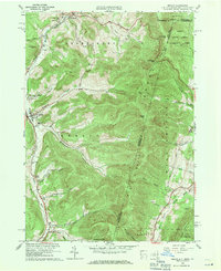
 1960 West Kill1962 Print · USGSThe high Catskills of Greene, Ulster, and Delaware counties appear in this mid-century survey as a landscape of isolated mountain hollows and narrow valley roads. Genealogists and local historians can locate Halcott Cem, trace the New York Central rail line near Highmount, and find early school sites like the Hunter Tannersville Central Sch.3 unique versions available
 - 1960 Map of Redfield, 1962 Print
 1960 Redfield1962 Print · USGSThe Tug Hill region of New York comes to life in the early sixties, showing the settlement of Redfield and the expansion of the Salmon River Reservoir. Genealogists and local historians can trace the paths of Waterbury Road to find Myrtle Cem or the industrial remnants at Otto Mills.4 unique versions available
 - 1960 Map of Sherwood Point, 1962 Print
 1960 Sherwood Point1962 Print · USGSThe Fairfield County coast at the start of the sixties shows a landscape of tidal inlets and growing shoreline communities. Genealogists and local historians can trace the foundations of Saugatuck, identify plots near St Marys Cem, and explore the layout of Sherwood Island State Park.2 unique versions available
 - 1960 Map of Lake Carmel, 1962 Print
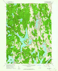 1960 Lake Carmel1962 Print · USGSPutnam County in the early sixties reveals a landscape of expanding residential tracts and massive water works. Genealogists can trace family roots through Raymond Hill Cem, the Towner Sch, or the small settlement of Farmers Mills.4 unique versions available
 - 1960 Map of Glenville, 1962 Print
 1960 Glenville1962 Print · USGSThe Connecticut and New York borderlands are seen here in the early sixties, as suburban growth transformed the wooded landscape between the reservoir and the sound. Genealogists and local historians can trace legacy institutions like Manhattanville College, the Harkness Home, and the Blind Brook Polo Club.4 unique versions available
Showing maps 1-25 of 437
Top cities of New York
- New York historical maps
- Hempstead historical maps
- Brookhaven historical maps
- Islip historical maps
- Oyster Bay historical maps
- Buffalo historical maps
See more
Top counties of New York
- Kings County historical maps
- Queens County historical maps
- New York County historical maps
- Suffolk County historical maps
- Bronx County historical maps
- Nassau County historical maps
See more
Frequently asked questions
- What are the different types of historical maps available for New York?
- What is the oldest map of New York?
- Where can I purchase historical maps of New York for my home or office?
- Where can I download high-res historical maps of New York?
- Are there historical topographic maps available for New York?
- Is there historical aerial imagery available for New York?
- Where are historical maps of New York sourced from?