1970s Maps of New York
Explore 137 historic maps of New York from the 1970s. These maps offer a rare glimpse into what life looked like during the 1970s — showing old roads, neighborhoods, homes, and landmarks that have changed or disappeared over time.
Whether you're researching your family's past, planning a metal detecting trip, or studying how New York's landscape evolved across the 1970s, these high-resolution maps are a powerful tool for exploring the history of this region.
- Focus on a specific era: All maps on this page are from the 1970s, giving you a focused view of this time period.
- See what’s changed: Compare century-old streets, trails, and buildings to today's modern landscape using overlays and satellite layers.
- Research with precision: Use these maps for genealogy, historical research, land use analysis, or educational projects.
- View, download, or print: Maps are fully viewable online in high resolution, and can be downloaded or printed for your own records.
Start exploring New York's history through authentic maps from the 1970s. This is your window into the past.
New York maps
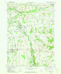
(137)- 1970 Map of Bullis Mills, 1972 Print
 1970 Bullis Mills1972 Print · USGSThe Pennsylvania and New York border comes alive in the 1970s as a landscape of timbered hollows and active energy extraction. Researchers can locate remote family landmarks like St Marys Ch, the Sartwell Oil Field, and the rail junction at Bullis Mills.2 unique versions available
 - 1970 Map of Northville, 1972 Print
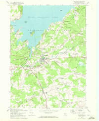
 1970 Northville1972 Print · USGSFulton County’s lakeside communities are captured here in the early seventies, showcasing the developed shoreline of the Great Sacandaga Lake. Genealogists can locate family landmarks such as Gifford Valley Cem, Sweets Crossing, and the historic settlement of Fish House.2 unique versions available
 - 1970 Map of Edinburg, 1972 Print
 1970 Edinburg1972 Print · USGSSaratoga County life in the early seventies centers on the shores of Great Sacandaga Lake and the southern Adirondacks. Researchers can locate old family landmarks like Partridge Cem, Consolidated School No 1, and the Plateau Landing Field.2 unique versions available
 - 1970 Map of Albert Marsh, 1972 Print
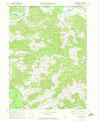
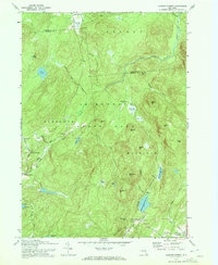
 1970 Albert Marsh1972 Print · USGSSt. Lawrence County is captured here in the early seventies, showing a landscape defined by the Adirondack forest and the forks of the Grass River. Researchers can trace the legacy of local camps and logging at Sellecks Corners, Gleasons Mill, and along the Old Railroad Grade.
 - 1970 Map of Gloversville, 1972 Print
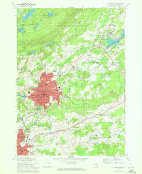 1970 Gloversville1972 Print · USGSGloversville and Johnstown are shown in detail during the early 1970s, from the urban manufacturing core to the Adirondack foothills. Trace local history at the F J & G RR, Tryon State School for Boys, and Prospect Hill Cem.
 - 1970 Map of Broadalbin, 1972 Print
 1970 Broadalbin1972 Print · USGSThe foothills of the Adirondacks meet the southern shores of the lake during the early seventies, showing a landscape of lakeside points and inland hamlets. Researchers can trace family sites at Perth Cem, the route of the Fonda Johnstown and Gloversville rail, and local industry at Stever Mill.
 - 1970 Map of Galway, 1972 Print
 1970 Galway1972 Print · USGSSaratoga County's southern Adirondack foothills were a landscape of established hamlets and family crossroads during the early seventies. Trace local lineages and old property lines through namesake locations like Whiteside Corners, Hooseville, and the Zion Hill Cemetery.
 - 1970 Map of Augerhole Falls, 1972 Print
 1970 Augerhole Falls1972 Print · USGSAdirondack wilderness in the 1970s is documented here as the river system cuts through Franklin and St. Lawrence counties. Outdoorsmen and historians can trace old routes to Augerhole Camp, Wolf Pond, and the falls along the West Branch St Regis River.
 - 1970 Map of Brother Ponds, 1972 Print
 1970 Brother Ponds1972 Print · USGSSt. Lawrence County’s interior wilderness is documented in the 1970s before modern development altered these remote highlands. Researchers can trace historic trails through Adirondack State Park and locate secluded landmarks like Dismal Swamp and Wolf Ridge.
 - 1970 Map of Peck Lake, 1972 Print
 1970 Peck Lake1972 Print · USGSThe Fulton County countryside in the 1970s shows the meeting of the Adirondack wilderness and the growing outskirts of Gloversville. Locate family landmarks like Eppie Corners, the Boshart Cem, and North Bush.
 - 1970 Map of Caroga Lake, 1972 Print
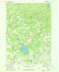
 1970 Caroga Lake1972 Print · USGSThe southern Adirondacks come into focus during the early 1970s, showing a landscape defined by recreational camps and high-country hamlets. Researchers can trace local heritage through St Josephs Cemetery, the Union School at Wheelerville, and the lakeside community at Caroga Lake.
 - 1970 Map of Carry Falls Reservoir, 1972 Print
 1970 Carry Falls Reservoir1972 Print · USGSSt. Lawrence County is shown here in the 1970s as a landscape of managed wilderness and hydroelectric power. Researchers can trace the winding shorelines of the Carry Falls Reservoir and find remote landmarks like Joe Indian Pond and Newton Hill.
 - 1970 Map of Jackson Summit, 1972 Print
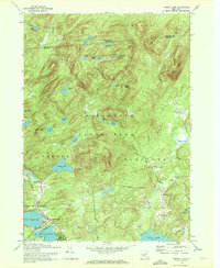
 1970 Jackson Summit1972 Print · USGSThe Adirondack foothills in the early 1970s show a landscape of isolated mountain settlements and expansive vlys. Genealogists and hikers can trace the old road networks through Lindsley Corners and find landmarks like Buttermilk Falls or the Jackson Summit Reservoir.2 unique versions available
 - 1970 Map of Genoa, 1974 Print
 1970 Genoa1974 Print · USGSSouthern Cayuga County in the early seventies remained a landscape of rural hamlets and deep creek valleys. Genealogists can trace family names through landmarks like Genoa Cem and old crossroads such as Poplar Ridge and King Ferry.2 unique versions available
 - 1970 Map of West Groton, 1974 Print
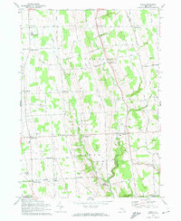
 1970 West Groton1974 Print · USGSUpper Tompkins County is shown here in the early 1970s, characterized by its dense network of named rural crossroads and family homesteads. Genealogists and local historians can trace specific family landmarks like Pierson Corners, Stearns Cem, and the South Lansing School for Girls.2 unique versions available
 - 1970 Map of Trumansburg, 1974 Print
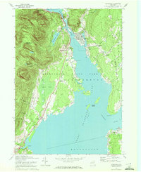
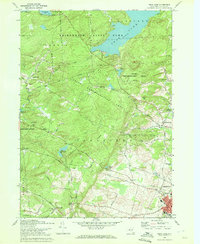
 1970 Trumansburg1974 Print · USGSThe western Cayuga Lake shoreline and the village of Trumansburg are shown here as they appeared in the early 1970s. Researchers can trace the Lehigh Valley RR, locate the Nun-Dak-Et Airfield, and find small settlements like Podunk and Waterburg.2 unique versions available
 - 1970 Map of Ovid, 1974 Print
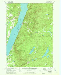
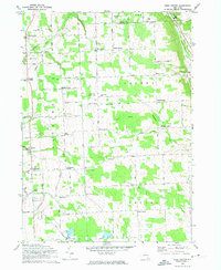
 1970 Ovid1974 Print · USGSSettled between the shores of the Finger Lakes in the early 1970s, this area showcases the massive footprint of the Seneca Army Depot. Researchers can trace the Lehigh Valley Railroad and locate burial sites like Ovid Center Cem.2 unique versions available
 - 1970 Map of Groton, 1974 Print
 1970 Groton1974 Print · USGSThe rural crossroads of Tompkins and Cortland counties are captured in the early 1970s, showing the enduring agricultural character of the region. Researchers can trace the Lehigh Valley rail line or locate family-named settlements like Morton Corners and Lacy Corners.2 unique versions available
 - 1971 Map of Warren
 1971 Warren1971 Print · USGSNorth Central Pennsylvania is captured here in the early seventies, showing a landscape defined by industrial centers and massive state forests. Genealogists and historians can trace the rail lines of the Penn Central and Erie Lackawanna connecting towns like Warren, Kane, and Du Bois.
 - 1971 Map of Hinsdale
 1971 Hinsdale1971 Print · USGSCattaraugus County in the early sixties maintains its character as a transport hub where the Pennsylvania and Erie Lackawanna railroads meet. Trace family roots through local sites like Union Valley Ch and the Maple Grove Cem.
 - 1971 Map of Hamlin, 1973 Print
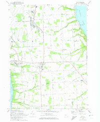
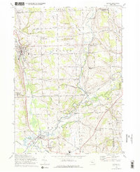
 1971 Hamlin1973 Print · USGSThe Lake Ontario shoreline near Hamlin and Kendall Mills is captured here in the early 1970s as a quiet agricultural and recreational corridor. Researchers can trace family history through local landmarks like St Johns Sch, Lakeside Cem, and the path of the Penn Central railroad.
 - 1971 Map of Ninemile Point, 1973 Print
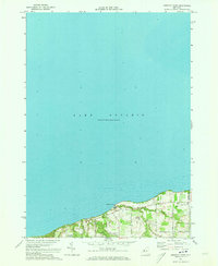 1971 Ninemile Point1973 Print · USGSThe Lake Ontario shoreline in Monroe County appears in the early 1970s as a blend of recreational parkland and quiet residential roads. Trace family roots at Union Cem or explore the coastal drainages of Fourmile Creek and Ninemile Point.2 unique versions available
 - 1971 Map of Hilton, 1973 Print
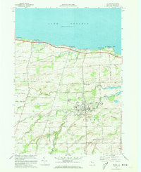 1971 Hilton1973 Print · USGSMonroe County's lakefront and agricultural interior are captured here in the early seventies as the village of Hilton flourished. Researchers can trace historic schools and cemeteries such as Williams Jr High Sch and Parma Union Cem, or locate the path of the Penn Central rail line.2 unique versions available
 - 1971 Map of Braddock Heights, 1973 Print
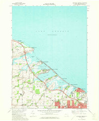 1971 Braddock Heights1973 Print · USGSCoastal Monroe County in the early seventies reveals a landscape of lakeside cottage communities and marshland preserves along the Great Lake shoreline. Trace the development of Grand View Heights and North Greece near Braddock Bay State Park and the Penn Central railroad.2 unique versions available
 - 1971 Map of Honeoye Falls, 1973 Print
 1971 Honeoye Falls1973 Print · USGSThe Monroe and Livingston county borders are defined by the winding course of Honeoye Creek in the early 1970s. Researchers can trace the legacy of the Lehigh Valley tracks, find St Pauls Cem, and locate older settlements like Sibleyville.3 unique versions available
Showing maps 1-25 of 137
Top cities of New York
- New York historical maps
- Hempstead historical maps
- Brookhaven historical maps
- Islip historical maps
- Oyster Bay historical maps
- Buffalo historical maps
See more
Top counties of New York
- Kings County historical maps
- Queens County historical maps
- New York County historical maps
- Suffolk County historical maps
- Bronx County historical maps
- Nassau County historical maps
See more
Frequently asked questions
- What are the different types of historical maps available for New York?
- What is the oldest map of New York?
- Where can I purchase historical maps of New York for my home or office?
- Where can I download high-res historical maps of New York?
- Are there historical topographic maps available for New York?
- Is there historical aerial imagery available for New York?
- Where are historical maps of New York sourced from?