1900-1909 Maps of Pennsylvania
Explore 152 historic maps of Pennsylvania from 1900-1909. These maps offer a rare glimpse into what life looked like during the 1900s — showing old roads, neighborhoods, homes, and landmarks that have changed or disappeared over time.
Whether you're researching your family's past, planning a metal detecting trip, or studying how Pennsylvania's landscape evolved across the 1900s, these high-resolution maps are a powerful tool for exploring the history of this region.
- Focus on a specific era: All maps on this page are from the 1900s, giving you a focused view of this time period.
- See what’s changed: Compare century-old streets, trails, and buildings to today's modern landscape using overlays and satellite layers.
- Research with precision: Use these maps for genealogy, historical research, land use analysis, or educational projects.
- View, download, or print: Maps are fully viewable online in high resolution, and can be downloaded or printed for your own records.
Start exploring Pennsylvania's history through authentic maps from the 1900s. This is your window into the past.
Pennsylvania maps
(152)- 1900 Map of Accident
 1900 Accident1900 Print · USGSGarrett County highlands at the turn of the century reveal a landscape of mountain settlements and river-valley industry. Genealogists can trace family roots through the Blooming Rose Settlement, early milling sites like Speelman Mills, and the Baltimore and Ohio RR corridor.6 unique versions available
 - 1900 Map of Pawpaw
 1900 Pawpaw1900 Print · USGSThe Potomac River's intricate meanders define this borderland at the close of the nineteenth century. Researchers can trace the parallel routes of the Chesapeake and Ohio Canal and the Baltimore and Ohio Railroad past Magnolia, Dam No. 6, and Fisher Ford.8 unique versions available
 - 1900 Map of Gaines
 1900 Gaines1900 Print · USGSThe Cowanesque River valley at the turn of the century shows a landscape defined by new rail lines and remote timbering settlements. Genealogists can trace family holdings near Sunderlinville, Harrison Valley, and the rural crossroads of Mixtown and Lansing.5 unique versions available
 - 1900 Map of Girard
 1900 Girard1900 Print · USGSNorthwestern Pennsylvania at the dawn of the twentieth century was a vital rail corridor defined by the shoreline of Lake Erie. You can trace the path of historic rail lines through Thornton Junction and locate vanished local landmarks like Lundys Lane and Paperville.5 unique versions available
 - 1900 Map of Erie
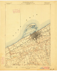 1900 Erie1900 Print · USGSLake Erie's shoreline and the growing industrial port of Erie are captured here at the end of the nineteenth century. Researchers can trace the early rail corridors and find local landmarks like West Library, Sterrettania, and the Presque Isle L.H..8 unique versions available
 - 1900 Map of Uniontown
 1900 Uniontown1900 Print · USGSFayette County at the turn of the century shows a landscape defined by the iron and coal industries and early American frontier history. Researchers can locate significant sites like Fort Necessity, Braddocks Grave, and the path of the National Pike.5 unique versions available
 - 1900 Map of Elkton
 1900 Elkton1900 Print · USGSMaryland's tidewater and rail corridors meet at the turn of the century in this detailed survey of Cecil County. Genealogists can trace family roots through old settlements like McClellandville and Singerly or locate ancestors near the Pivot Bridge.7 unique versions available
 - 1900 Map of Mercersburg
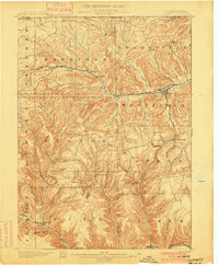
 1900 Mercersburg1900 Print · USGSFranklin County at the turn of the century is captured here as a landscape of iron furnaces and valley farms. Trace the early transport lines through Mercersburg, Richmond Furnace, and the old Southern Pennsylvania Br. rail line.
 - 1900 Map of Fairview
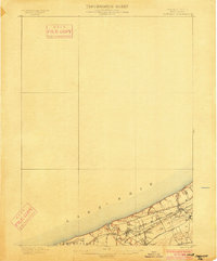 1900 Fairview1900 Print · USGSThe Erie County shoreline was a bustling corridor of steam and steel at the turn of the century. Genealogists and rail historians can trace the early footprints of Miles Grove, Avonia, and the complex rail interchanges at Girard Junction.5 unique versions available
 - 1900 Map of Tioga
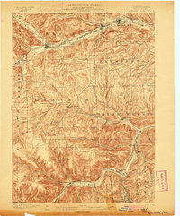
 1900 Tioga1900 Print · USGSTioga County at the turn of the century shows a landscape defined by the busy river corridors and the arrival of major rail networks. Researchers can trace the early footprints of Lawrenceville, Mansfield, and Tioga, or locate rural landmarks like Jackson Summit and Canoe Camp.
 - 1900 Map of Elkland
 1900 Elkland1900 Print · USGSTioga County at the turn of the century is defined by its deep river valleys and the expanding rail networks of the Cowanesque River. Genealogists and local historians can trace the early footprints of Knoxville, Academy Corners, and the rail junction at Stokesdale Junc.5 unique versions available
 - 1900 Map of Havre De Grace
 1900 Havre De Grace1900 Print · USGSThe Susquehanna River valley at the turn of the century shows a landscape transitioning from the canal era to the railroad age. Genealogists and historians can trace defunct transport routes like the Tidewater Canal alongside active hubs like Rising Sun and Port Deposit.7 unique versions available
 - 1900 Map of Parkton
 1900 Parkton1900 Print · USGSThe Pennsylvania-Maryland borderlands in the early 1900s were defined by the busy Northern Central RR and the many mills along Gunpowder Falls. Researchers can trace old family locales and crossroads like Philopolis, Mount Carmel Ch, and Gorsuchs Mills.
 - 1900 Map of Masontown
 1900 Masontown1900 Print · USGSThe Monongahela River valley was a hub of transit and industry at the turn of the century, defined by its numerous ferry crossings and coal-country junctions. Researchers can trace historic river crossings like McCanns Ferry, follow the National Pike, and locate vanished rail stops at Ache Junction.
 - 1900 Map of Flintstone
 1900 Flintstone1900 Print · USGSThe Maryland and West Virginia border at the close of the nineteenth century centers on the vital Potomac River transportation corridor. Researchers can trace the Chesapeake and Ohio Canal, the B. & O. R. R., and early settlements like Oldtown, Flintstone, and Wolf Mill.6 unique versions available
 - 1900 Map of Latrobe, 1958 Print
 1900 Latrobe1958 Print · USGSThe industrial heart of Westmoreland County is shown at a pivotal moment when the coal and coke industry was reshaping the land. Genealogists and historians can trace the early layouts of Latrobe, Derry, and Blairsville alongside company towns like Whitney and Baggaley.
 - 1900 Map of Everett, 1959 Print
 1900 Everett1959 Print · USGSBedford County at the turn of the century shows a landscape of deep limestone valleys and industrial river towns. Genealogists and historians can trace family-named sites and rail stops from Everett to New Enterprise and the river depot at Cypher Sta.
 - 1900 Map of Kittanning, 1963 Print
 1900 Kittanning1963 Print · USGSThe Allegheny River valley was a bustling corridor of rail and river industry at the turn of the century. Genealogists and researchers can trace family landmarks and early industrial sites like Redbank Furnace, Laceys Store, and Buffalo Mills.
 - 1901 Map of Belair
 1901 Belair1901 Print · USGSThe Harford County borderlands at the start of the twentieth century show a landscape defined by rail corridors and early mining. Genealogists can trace family names and small settlements along the Maryland and Pennsylvania RR, such as Fawn Grove, McIntyre Minefield, and Delta.7 unique versions available
 - 1901 Map of Camden
 1901 Camden1901 Print · USGSThe Delaware River valley at the turn of the century shows a bustling corridor of early industrial growth and established mill towns. Researchers can trace the heritage of local industry at Sycamore Mills or locate early settlements like Penns Grove and Village Green.3 unique versions available
 - 1901 Map of Hancock
 1901 Hancock1901 Print · USGSMaryland and West Virginia met at the turn of the century along a busy corridor of river transport and rail expansion. Genealogists can trace family roots through old landmarks like Yeakle Mill, Fairview Church, and early hamlets such as Stotlers Crossroads.8 unique versions available
 - 1901 Map of Frostburg
 1901 Frostburg1901 Print · USGSMaryland's coal country and the critical mountain pass at Cumberland are shown in detail at the turn of the century. Genealogists and industrial historians can locate old mining works at Eckhart Mines, the path of the C. & O. Canal, and the early layout of Frostburg.2 unique versions available
 - 1901 Map of Amity, 1956 Print
 1901 Amity1956 Print · USGSWashington County at the turn of the century shows a landscape transitioning between historic pikes and the burgeoning rail era. Researchers can trace ancestral property near Tenmile Creek or follow the route of the National Pike through Laboratory and Zediker.
 - 1901 Map of Rural Valley, 1957 Print
 1901 Rural Valley1957 Print · USGSArmstrong County’s river valleys and iron-working hamlets are captured here at the start of the twentieth century. Researchers can trace the legacy of early industry at Mahoning Furnace or follow the path of the Pennsylvania R.R. through Templeton.2 unique versions available
 - 1901 Map of Waynesburg, 1958 Print
 1901 Waynesburg1958 Print · USGSGreene County at the start of the twentieth century shows a landscape of deep valleys and rising townships connected by the South Fork of Tenmile Creek. Genealogists can trace family names through landmarks like Rees Mill, Gump, and the dual settlement of Kirby Newtown.
Showing maps 1-25 of 152
Top cities of Pennsylvania
- Philadelphia historical maps
- Pittsburgh historical maps
- Allentown historical maps
- Erie historical maps
- Reading historical maps
- Upper Darby historical maps
See more
Top counties of Pennsylvania
- Philadelphia County historical maps
- Allegheny County historical maps
- Montgomery County historical maps
- Bucks County historical maps
- Delaware County historical maps
- Chester County historical maps
See more
Frequently asked questions
- What are the different types of historical maps available for Pennsylvania?
- What is the oldest map of Pennsylvania?
- Where can I purchase historical maps of Pennsylvania for my home or office?
- Where can I download high-res historical maps of Pennsylvania?
- Are there historical topographic maps available for Pennsylvania?
- Is there historical aerial imagery available for Pennsylvania?
- Where are historical maps of Pennsylvania sourced from?