1950s Maps of Pennsylvania
Explore 426 historic maps of Pennsylvania from the 1950s. These maps offer a rare glimpse into what life looked like during the 1950s — showing old roads, neighborhoods, homes, and landmarks that have changed or disappeared over time.
Whether you're researching your family's past, planning a metal detecting trip, or studying how Pennsylvania's landscape evolved across the 1950s, these high-resolution maps are a powerful tool for exploring the history of this region.
- Focus on a specific era: All maps on this page are from the 1950s, giving you a focused view of this time period.
- See what’s changed: Compare century-old streets, trails, and buildings to today's modern landscape using overlays and satellite layers.
- Research with precision: Use these maps for genealogy, historical research, land use analysis, or educational projects.
- View, download, or print: Maps are fully viewable online in high resolution, and can be downloaded or printed for your own records.
Start exploring Pennsylvania's history through authentic maps from the 1950s. This is your window into the past.
Pennsylvania maps
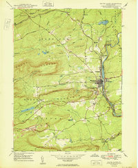
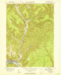
(426)- 1950 Map of Shenandoah
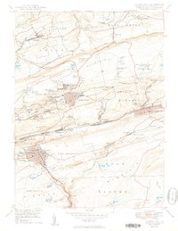 1950 Shenandoah1950 Print · USGSSchuylkill County’s coal heartland is revealed at its mid-century peak, showing the dense rail and mining infrastructure of the anthracite region. Genealogy researchers can trace family sites from Shenandoah to Mahanoy City, locating landmarks like The Peddlars Grave and Old White Ch.2 unique versions available
 - 1950 Map of Wilkes-Barre West
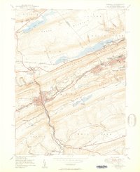
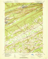
 1950 Wilkes-Barre West1950 Print · USGSThe Susquehanna Valley thrives in this mid-century portrait of Pennsylvania's coal country. Genealogists and historians can trace the footprint of Wilkes-Barre alongside local landmarks like Shawnee Cem and the Pennsylvania RR.2 unique versions available
 - 1950 Map of Marshlands
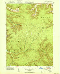
 1950 Marshlands1950 Print · USGSTioga and Potter Counties are captured here at the mid-century, defined by the deep valleys of Pine Creek and its many tributaries. Genealogists can trace family landmarks like Maynard Sch and the Nolton Cem amidst the dense network of named hollows.
 - 1950 Map of Elmira
 1950 Elmira1950 Print · USGSThe Finger Lakes region thrived in the late 1940s as a hub of industry and transport. Trace family roots and vanished landmarks near Seneca Lake or explore the rail lines of the Erie RR and the sprawling Seneca Ordnance Depot.2 unique versions available
 - 1950 Map of Tamaqua
 1950 Tamaqua1950 Print · USGSThe anthracite coal region of Schuylkill and Carbon counties comes into sharp focus during the mid-century peak of industrial activity. Trace the dense rail networks of the Reading Co through Tamaqua and locate ancestral landmarks like the Odd Fellows Cem or Owl Creek Sch.2 unique versions available
 - 1950 Map of Scranton
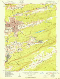
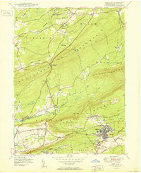
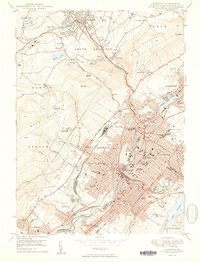 1950 Scranton1950 Print · USGSThe Lackawanna Valley at mid-century shows a bustling industrial landscape defined by coal, rail, and academia. Trace the urban layout of Scranton and Dunmore, finding family sites at Forest Hill Cemetery or landmarks like Marywood College.2 unique versions available
 - 1950 Map of Cleveland
 1950 Cleveland1950 Print · USGSCovers Pennsylvania, including Cleveland, Akron, and other nearby areas
 - 1950 Map of Conrad
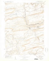
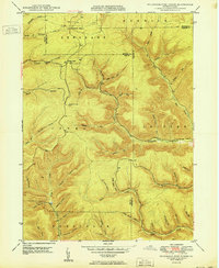
 1950 Conrad1950 Print · USGSPotter County’s remote valley landscapes are captured here at the start of the 1950s, showing the intersection of forest management and the gas industry. Researchers can find old family sites at McFall Cem or trace the early paths of Wild Boy Trail and Gravel Lick Trail.
 - 1950 Map of Rich Valley
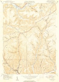
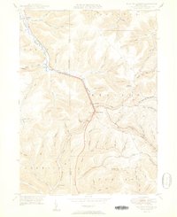
 1950 Rich Valley1950 Print · USGSCameron and McKean counties in the early postwar era are defined by the steep hollows of the Pennsylvania Wilds. Genealogists can trace family names and small-town footprints at Lockwood, Weber City, and the North Creek Chapel.2 unique versions available
 - 1950 Map of Wilkes-Barre East
 1950 Wilkes-Barre East1950 Print · USGSLuzerne County at the midpoint of the century shows a landscape defined by coal extraction, mountain railroading, and upland resorts. Genealogists and researchers can trace family landmarks like Oliver Mills, Llewellyn Corners, and the historic Holy Trinity Cem.2 unique versions available
 - 1950 Map of White Haven
 1950 White Haven1950 Print · USGSThe industrial Lehigh River corridor is captured here just after the war, showing the vital rail and mining networks of the day. Researchers can trace family sites at White Haven or Pond Creek, and locate features like the Ripple Sch and Jefferson Hospital.2 unique versions available
 - 1950 Map of Hazleton
 1950 Hazleton1950 Print · USGSThe anthracite coal region of Pennsylvania comes into sharp focus during the post-war era. Researchers can trace the extensive rail networks of the Lehigh Valley and identify localized mining communities like Lattimer Mines (PO) and Coxes Village.2 unique versions available
 - 1950 Map of Lee Fire Tower
 1950 Lee Fire Tower1950 Print · USGSThe Pennsylvania Wilds are captured here at mid-century, showcasing the rugged drainage basins where Potter, Tioga, and Lycoming counties meet. Genealogists and hikers can trace the old Randall Trail, locate the Lee Fire Tower, or find the historical Clay Mine.
 - 1950 Map of Nuremberg
 1950 Nuremberg1950 Print · USGSThe tri-county borderlands of Eastern Pennsylvania are captured here at the start of the 1950s. Genealogists can trace family names at Millers Corner and Raricks, or locate ancestors at the Nuremberg Cem and Mt Zion Ch.2 unique versions available
 - 1950 Map of Austin
 1950 Austin1950 Print · USGSPotter County's deep-cut valleys and timbered ridges are captured here at mid-century as the local economy transitioned toward modern energy and infrastructure. Genealogists and historians can trace family-named hollows and vanished landmarks like the Inez Sch, the riverside hamlet of Mina, and the industrial footprint of Austin.2 unique versions available
 - 1950 Map of Norwich
 1950 Norwich1950 Print · USGSNorthern Pennsylvania's timber and oil lands appear here at mid-century, focused on the settlement of Norwich. Genealogists and historians can trace family-named terrain like Evans Hill and explore the drainage of Potato Creek.
 - 1950 Map of Nesquehoning
 1950 Nesquehoning1950 Print · USGSCarbon County's anthracite landscape is captured here in the mid-twentieth century as rail and mining towns still hummed with activity. Genealogists can locate family landmarks from Bloomingdale to Mertz Town, including the Our Lady of Mt Carmel Cem and East Penn Airport.2 unique versions available
 - 1950 Map of Freeland
 1950 Freeland1950 Print · USGSLuzerne County's anthracite country is documented here in the mid-century, showing the intensive mining operations and rail networks around the borough of Freeland. Researchers can trace the industrial landscape of Upper Lehigh or locate local landmarks like Honey Hole, Kis-Lyn, and St Ann Cem.2 unique versions available
 - 1950 Map of Wharton
 1950 Wharton1950 Print · USGSPotter County's deep-cut valleys and river confluences are captured here in the post-war era. Genealogists and historians can locate remote family landmarks like Reesville Sch, the Splash Dam on Bailey Run, and the burial grounds at Forest Hill Cem.2 unique versions available
 - 1950 Map of Keating Summit
 1950 Keating Summit1950 Print · USGSThe Allegheny Plateau in north-central Pennsylvania at mid-century shows a landscape shaped by rail and river. Genealogists can trace family names through Keating Summit, Odin, and Liberty, or locate the Fox Mountain Fire Tower and the railroad corridor.2 unique versions available
 - 1950 Map of Emporium
 1950 Emporium1950 Print · USGSEmporium and the Sinnemahoning Creek valleys are captured here at mid-century, as the region's railroad era and timbering history met new state park conservation. Researchers can trace family plots at Newton Cem, old rail stops at Gardeau, and local paths like the Pine Camp Trail.
 - 1950 Map of Birdsboro
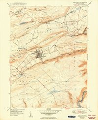
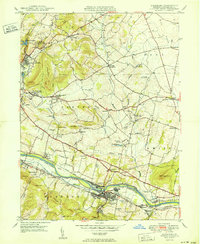 1950 Birdsboro1950 Print · USGSBerks County's industrial and agricultural heartland is captured here just after the war, centered on the Birdsboro rail hub. Trace family history through landmarks like the Daniel Boone Homestead, Exeter Friends Meeting House, and Stony Creek Mills.
 - 1950 Map of Morris
 1950 Morris1950 Print · USGSMid-century Tioga County comes alive in this survey of the high hollows and creek valleys surrounding Morris. Genealogists and historians can trace the Erie RR line, locate the Crawford Fire Tower, and explore old rural centers like Hoytville and Oregon Hill.
 - 1950 Map of Wildwood Fire Tower
 1950 Wildwood Fire Tower1950 Print · USGSThe Elk and McKean county line runs through this mid-century survey of the Pennsylvania highlands, featuring rugged drainage networks and early timbering hubs. Genealogists can trace family-named hollows and sites like Wellendorf Station, Dead Mans Lick, and Wildwood Fire Tower.2 unique versions available
 - 1950 Map of Weatherly
 1950 Weatherly1950 Print · USGSWeatherly and the surrounding anthracite coal fields are documented here in the late 1940s as industry and local life intertwined. Genealogists and historians can trace family locations near St Joseph Ch, the Larrytown Sch, and the old company town at Eckley.2 unique versions available
Showing maps 1-25 of 426
Top cities of Pennsylvania
- Philadelphia historical maps
- Pittsburgh historical maps
- Allentown historical maps
- Erie historical maps
- Reading historical maps
- Upper Darby historical maps
See more
Top counties of Pennsylvania
- Philadelphia County historical maps
- Allegheny County historical maps
- Montgomery County historical maps
- Bucks County historical maps
- Delaware County historical maps
- Chester County historical maps
See more
Frequently asked questions
- What are the different types of historical maps available for Pennsylvania?
- What is the oldest map of Pennsylvania?
- Where can I purchase historical maps of Pennsylvania for my home or office?
- Where can I download high-res historical maps of Pennsylvania?
- Are there historical topographic maps available for Pennsylvania?
- Is there historical aerial imagery available for Pennsylvania?
- Where are historical maps of Pennsylvania sourced from?