1970s Maps of Pennsylvania
Explore 144 historic maps of Pennsylvania from the 1970s. These maps offer a rare glimpse into what life looked like during the 1970s — showing old roads, neighborhoods, homes, and landmarks that have changed or disappeared over time.
Whether you're researching your family's past, planning a metal detecting trip, or studying how Pennsylvania's landscape evolved across the 1970s, these high-resolution maps are a powerful tool for exploring the history of this region.
- Focus on a specific era: All maps on this page are from the 1970s, giving you a focused view of this time period.
- See what’s changed: Compare century-old streets, trails, and buildings to today's modern landscape using overlays and satellite layers.
- Research with precision: Use these maps for genealogy, historical research, land use analysis, or educational projects.
- View, download, or print: Maps are fully viewable online in high resolution, and can be downloaded or printed for your own records.
Start exploring Pennsylvania's history through authentic maps from the 1970s. This is your window into the past.
Pennsylvania maps
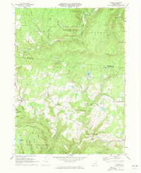
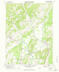
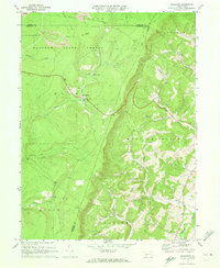
(144)- 1970 Map of Bullis Mills, 1972 Print
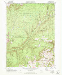
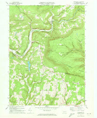
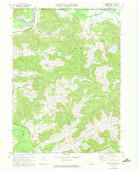 1970 Bullis Mills1972 Print · USGSThe Pennsylvania and New York border comes alive in the 1970s as a landscape of timbered hollows and active energy extraction. Researchers can locate remote family landmarks like St Marys Ch, the Sartwell Oil Field, and the rail junction at Bullis Mills.2 unique versions available
 - 1970 Map of Blossburg, 1972 Print
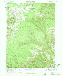
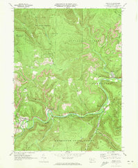
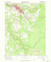
 1970 Blossburg1972 Print · USGSTioga County's coal and rail heritage is on full display in the early 1970s as the Erie Lackawanna winds through the river valley. Researchers can trace the layout of mining towns like Arnot and Morris Run or locate family sites at Frost Settlement Cem and Union Cem.4 unique versions available
 - 1970 Map of Cherry Flats, 1972 Print
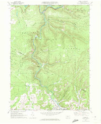
 1970 Cherry Flats1972 Print · USGSTioga County’s highland communities and forest industry are preserved here as they appeared in the early seventies. Genealogists and historians can trace the Welsh Settlement area and its Welsh Settlement Ch, or follow the Old Railroad Grade through the Tioga State Forest.3 unique versions available
 - 1970 Map of Brandy Camp, 1972 Print
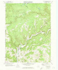
 1970 Brandy Camp1972 Print · USGSElk County's coal and rail landscapes are meticulously detailed in this early 1970s survey. Researchers can trace the Erie-Lackawanna line through Brockport and locate family landmarks like Holy Cross Ch and Ridge Cem.3 unique versions available
 - 1970 Map of Gleason, 1972 Print
 1970 Gleason1972 Print · USGSThe northern Pennsylvania highlands near the Tioga and Bradford County line are captured here in the early 1970s. Local researchers can trace family landmarks like Gleason and Allen, or locate the North Union Cem and the nearby North Union Ch.4 unique versions available
 - 1970 Map of Kersey, 1972 Print
 1970 Kersey1972 Print · USGSThe Elk County coal and timber country is captured here in the early seventies, showing a landscape shaped by resource extraction. Local historians can trace the Penn Central rail line and locate specific operations at Dagus Mines, Coal Hollow, and Byrnedale.3 unique versions available
 - 1970 Map of Carman, 1972 Print
 1970 Carman1972 Print · USGSElk and Jefferson counties during the 1970s show a landscape shaped by coal mining, timber, and the winding rail lines of the Baltimore and Ohio. Researchers can trace the industrial footprint of Strip Mine sites and find local landmarks like St Tobias Cem and the Empire Tunnel.3 unique versions available
 - 1970 Map of Picture Rocks, 1973 Print
 1970 Picture Rocks1973 Print · USGSThe Lycoming County highlands come into focus in the early seventies, centered on the mill-town origins of Picture Rocks and the winding Muncy Creek. Genealogists and researchers can trace rural homesteads near Tivoli, historic sites like Bryan Mill, and remote landmarks including Mapleton Ch.3 unique versions available
 - 1970 Map of Shunk, 1973 Print
 1970 Shunk1973 Print · USGSSullivan and Bradford Counties are shown here during the early 1970s, a period of quiet rural life and expanding state forest conservation. Researchers can locate remote settlements like Shunk and Minerville, or find family landmarks such as the Elkland Meetinghouse and Camp Brule.3 unique versions available
 - 1970 Map of Canton, 1973 Print
 1970 Canton1973 Print · USGSBradford County’s rugged valley and rail corridor are captured here during the early seventies. Genealogists and local historians can trace the foundations of Canton and Granville Summit, or locate family sites like St Michaels Cem and the Beech Flats settlement.2 unique versions available
 - 1970 Map of Overton, 1973 Print
 1970 Overton1973 Print · USGSSullivan and Bradford counties in the early 1970s showcase a high-elevation world of remote crossroads and upland farms. Trace family roots and local history through rural anchors like Peters Ch, the Greenwood Cem, and the village of Campbellville.2 unique versions available
 - 1970 Map of Hillsgrove, 1973 Print
 1970 Hillsgrove1973 Print · USGSSullivan County’s high plateau country is captured here in the early seventies, showing the traditional mountain settlements and vast conservation lands. Researchers can trace historic crossings and landmarks like the Covered Bridge, Angel Falls, and the old forest hamlet of Ogdonia.
 - 1970 Map of Sonestown, 1973 Print
 1970 Sonestown1973 Print · USGSThe high ridges and deep hollows of Sullivan County are captured here during the 1970s, showcasing a landscape of mountain hamlets and forest preserves. Researchers can trace the Old Railroad Grade through Sonestown or locate rural landmarks like the Covered Bridge and Franklin Ch.3 unique versions available
 - 1970 Map of Weedville, 1973 Print
 1970 Weedville1973 Print · USGSElk County at the start of the 1970s reveals a rugged coal and gas landscape along the Bennett Branch Sinnemahoning Creek. Trace the path of the Penn Central rail line through Weedville and Benezette, or locate family sites at Mt Zion Ch and Gray Cem.3 unique versions available
 - 1971 Map of Warren
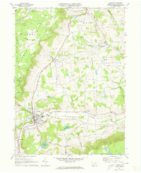
 1971 Warren1971 Print · USGSNorth Central Pennsylvania is captured here in the early seventies, showing a landscape defined by industrial centers and massive state forests. Genealogists and historians can trace the rail lines of the Penn Central and Erie Lackawanna connecting towns like Warren, Kane, and Du Bois.
 - 1971 Map of Schellsburg, 1972 Print
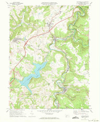
 1971 Schellsburg1972 Print · USGSBedford County at the start of the seventies reveals a landscape of protected game lands and emerging state recreation areas. Genealogists and hikers can trace old homesteads near New Paris, remote churches like Pleasant View Ch, and the shoreline of Shawnee Lake.3 unique versions available
 - 1971 Map of Central City, 1972 Print
 1971 Central City1972 Print · USGSSomerset County coal towns and lakeside developments are captured here in the early seventies. Genealogists and industrial historians can trace the Penn Central rail lines connecting Central City and Cairnbrook to local strip mines and the Township High Sch.2 unique versions available
 - 1971 Map of Alum Bank, 1973 Print
 1971 Alum Bank1973 Print · USGSBedford County in the early 1970s shows a landscape of ridge-and-valley settlements connected by the Penn Central railroad. Genealogists and historians can locate family-named sites, rural churches like Horne Ch, and landmarks like the Fish Hatchery or Alum Bank.3 unique versions available
 - 1971 Map of Hooversville, 1973 Print
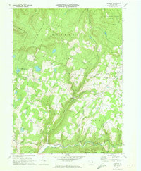
 1971 Hooversville1973 Print · USGSSomerset County in the early seventies shows a landscape shaped by coal and water, from the banks of Stony Creek to the hilltop mines. Genealogists and historians can trace family locations near Hooversville, Thomas Mill, and Kaufman Cem.3 unique versions available
 - 1971 Map of Bedford, 1973 Print
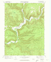
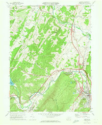 1971 Bedford1973 Print · USGSBedford County during the early seventies is a landscape defined by the Raystown Branch valley and the bustling Pennsylvania Turnpike. Researchers can trace family roots through St Pauls Cem, the Covered Bridge at Napier, and old crossroads like Wolfsburg and Cessna.3 unique versions available
 - 1971 Map of Stoystown, 1973 Print
 1971 Stoystown1973 Print · USGSSomerset County's industrial and rural character is caught in transition during the early seventies as coal extraction and residential development expanded. Genealogists can locate family landmarks like Walker Cem and Hayman Ch or trace the Baltimore and Ohio rail line through Shanksville and Stoystown.4 unique versions available
 - 1971 Map of Ogletown, 1973 Print
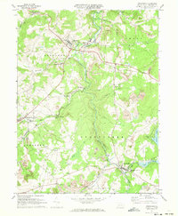
 1971 Ogletown1973 Print · USGSBedford and Somerset Counties are documented here in the early 1970s, showing a landscape defined by state forestry and mountain ridges. Researchers can locate remote settlements like Ogletown and Ryot, alongside local landmarks such as Calvary Ch and Pine Lake.4 unique versions available
 - 1971 Map of Windber, 1973 Print
 1971 Windber1973 Print · USGSWindber and the surrounding coal country are captured in the early seventies, showing a landscape of active strip mines and tight-knit company towns. Genealogists can locate family landmarks like Maple Grove Sch, Old Shade Furnace, and the community of Cairnbrook.4 unique versions available
 - 1971 Map of Short Run, 1984 Print
 1971 Short Run1984 Print · USGSPotter County’s high Allegheny Plateau is captured here during the early 1970s, showcasing the isolated settlements and logging-era remnants of North Central Pennsylvania. Genealogists and hikers can trace old routes along the Splash Dam Trail or locate remote points like Elk Lick Knob and the small outpost at Abbott.
 - 1972 Map of Wilmington, 1976 Print
 1972 Wilmington1976 Print · USGSThe Delaware Valley and Jersey Shore are seen here in the 1970s, showcasing the region's dense transport networks and vast state forests. Trace early coastal development near Atlantic City or locate rural landmarks like Mount Holly and Dover Air Force Base.2 unique versions available
Showing maps 1-25 of 144
Top cities of Pennsylvania
- Philadelphia historical maps
- Pittsburgh historical maps
- Allentown historical maps
- Erie historical maps
- Reading historical maps
- Upper Darby historical maps
See more
Top counties of Pennsylvania
- Philadelphia County historical maps
- Allegheny County historical maps
- Montgomery County historical maps
- Bucks County historical maps
- Delaware County historical maps
- Chester County historical maps
See more
Frequently asked questions
- What are the different types of historical maps available for Pennsylvania?
- What is the oldest map of Pennsylvania?
- Where can I purchase historical maps of Pennsylvania for my home or office?
- Where can I download high-res historical maps of Pennsylvania?
- Are there historical topographic maps available for Pennsylvania?
- Is there historical aerial imagery available for Pennsylvania?
- Where are historical maps of Pennsylvania sourced from?