1940s Maps of Pennsylvania
Explore 413 historic maps of Pennsylvania from the 1940s. These maps offer a rare glimpse into what life looked like during the 1940s — showing old roads, neighborhoods, homes, and landmarks that have changed or disappeared over time.
Whether you're researching your family's past, planning a metal detecting trip, or studying how Pennsylvania's landscape evolved across the 1940s, these high-resolution maps are a powerful tool for exploring the history of this region.
- Focus on a specific era: All maps on this page are from the 1940s, giving you a focused view of this time period.
- See what’s changed: Compare century-old streets, trails, and buildings to today's modern landscape using overlays and satellite layers.
- Research with precision: Use these maps for genealogy, historical research, land use analysis, or educational projects.
- View, download, or print: Maps are fully viewable online in high resolution, and can be downloaded or printed for your own records.
Start exploring Pennsylvania's history through authentic maps from the 1940s. This is your window into the past.
Pennsylvania maps
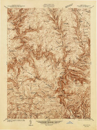
(413)- 1940 Map of Brownsville
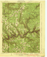
 1940 Brownsville1940 Print · USGSThe Monongahela and Youghiogheny river valleys were the industrial heart of Pennsylvania during this era of coal and steel. Genealogists and historians can trace the exact locations of Vesta Mine, Salem Church, and historic rural schools like Central Sch.
 - 1940 Map of Orbisonia
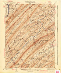
 1940 Orbisonia1940 Print · USGSCentral Pennsylvania's Ridge and Valley province is captured here just as the Pennsylvania Turnpike reached Burnt Cabins. Researchers can trace the narrow-gauge EAST BROAD TOP RR and locate family landmarks like Jordan Cem, Kuhns Mill, or St Marys Ch.2 unique versions available
 - 1940 Map of Hallton
 1940 Hallton1940 Print · USGSElk and Jefferson Counties appear here in the early 1940s, showing a landscape defined by the Clarion River valley and the growth of the Allegheny National Forest. Researchers can find old industrial sites and rural landmarks like the Empire Tunnel, St Tobias Cem, and the CCC Camp.3 unique versions available
 - 1940 Map of Mt. Jewett
 1940 Mt. Jewett1940 Print · USGSNorthern Pennsylvania’s timber and rail country is captured here during the mid-1930s, showing a landscape defined by industrial development. Researchers can locate vanished rural infrastructure like the Stenstrom Sch, the CCC Camp, and specific rail stops at Dahoga and Instanter.3 unique versions available
 - 1940 Map of Bridgeport
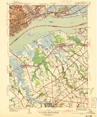 1940 Bridgeport1940 Print · USGSThe industrial Delaware River waterfront and the rural truck farms of Gloucester County meet at the start of the 1940s. Researchers can trace family sites at Oaklawn Cem, follow the rail lines to Repaupo Sta, and see the footprint of the Locomotive Works.
 - 1941 Map of Sheffield
 1941 Sheffield1941 Print · USGSForest and Warren Counties are seen here during the early 1940s, a period when local logging and oil activities shaped the landscape. Researchers can trace the Tionesta Valley RR and find remote outposts like Pigeon PO or Seldom Seen Cors.2 unique versions available
 - 1941 Map of Millheim
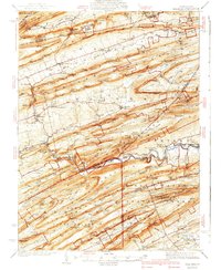 1941 Millheim1941 Print · USGSCentral Pennsylvania's ridge-and-valley landscape is documented here just before the mid-century, showing a network of mountain gaps and small valley settlements. Researchers can locate family landmarks like Wolfs Chapel, the Hironimus Sch, and the BM Sawmill along the banks of Penns Creek.3 unique versions available
 - 1941 Map of Delaware Water Gap
 1941 Delaware Water Gap1941 Print · USGSThe Delaware River valley is captured here in the early 1940s, showing the borderlands of Pennsylvania and New Jersey. Genealogists can trace family names through dozens of rural landmarks like Three Church Hill, Brass Castle, and the Stone Church PO.
 - 1941 Map of Marcus Hook
 1941 Marcus Hook1941 Print · USGSThe industrial and maritime riverfront at the start of the 1940s is captured here, showing the dense rail networks of the Marcus Hook area. Researchers can trace ancestral property near Hambys Corner, Siloam Ch, or the U S Military Reservation.
 - 1941 Map of Kinzua
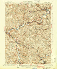
 1941 Kinzua1941 Print · USGSThe Allegheny River valley and the Cornplanter Indian Reservation are shown here in the years before mid-century dam projects forever changed the landscape. Researchers can trace the river-level Pennsylvania Railroad, the Kinzua Coal Mine, and now-submerged settlements like Kinzua and Corydon.3 unique versions available
 - 1941 Map of Marienville
 1941 Marienville1941 Print · USGSForest, Clarion, and Jefferson counties meet along the winding Clarion River in this pre-war survey of northern Pennsylvania's timberlands. Genealogists can locate numerous rural schoolhouses and social landmarks like Kahletown Hall, Greenwood Ch, and the Downey Cem.3 unique versions available
 - 1941 Map of Honeybrook
 1941 Honeybrook1941 Print · USGSSoutheastern Pennsylvania at the onset of the Second World War shows a landscape of established farm communities and the newly cut path of the Pennsylvania Turnpike. Researchers can locate numerous local landmarks such as Silver Hill School, Stone Church, and the rail stops along the Reading Lines.
 - 1941 Map of East Waterford
 1941 East Waterford1941 Print · USGSThe Ridge-and-Valley province of Central Pennsylvania appears here in the years before the war, dominated by the great parallel spans of Tuscarora Mountain. Genealogists can locate family sites among numerous rural institutions like Pine Glen Ch, McCullochs Mills, and the CCC Camp at East Waterford.3 unique versions available
 - 1941 Map of New Holland
 1941 New Holland1941 Print · USGSLancaster County’s agricultural heartland is documented here just as the modern highway era arrived. Genealogists and local historians can trace family locations through dozens of named rural landmarks like Heller Church, Fetter School, and the Pennsylvania RR corridor.
 - 1941 Map of Bridgeport
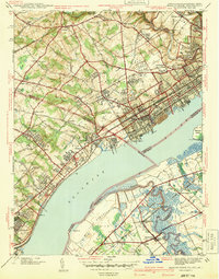
 1941 Bridgeport1941 Print · USGSThe Delaware River waterfront near Chester and Bridgeport was a hub of transit and industry in the early 1940s. Genealogists and historians can trace family locations through St Michael Cem, Oak Grove Sch, and the residential blocks of Westinghouse Village.
 - 1941 Map of Benezette, 1952 Print
 1941 Benezette1952 Print · USGSElk County at the start of the 1940s reveals a network of valley settlements defined by the Pennsylvania RR and Sinnemahoning Creek. Researchers can trace rural life through scattered landmarks like Mt Zion Ch, Rathbun Sch, and the high point at Winslow Hill.3 unique versions available
 - 1941 Map of Ridgway, 1956 Print
 1941 Ridgway1956 Print · USGSElk County at the start of the 1940s reveals a landscape shaped by coal mining and heavy rail industry. Genealogists can locate family homes near Dagus Mines or trace the early foundations of Ridgway and St. Marys.2 unique versions available
 - 1941 Map of Bradford, 1958 Print
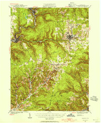
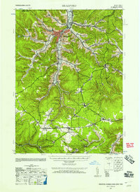 1941 Bradford1958 Print · USGSMcKean County's industrial landscape was at its peak during the early 1940s, marked by a dense network of mountain railroads and small oil-country settlements. Genealogists can trace family roots through numerous rural landmarks like Songbird Sch, Irishtown, and Davis Gifford PO.2 unique versions available
 - 1942 Map of Norristown
 1942 Norristown1942 Print · USGSSoutheastern Pennsylvania at the onset of World War II shows a landscape of busy industrial river towns and expanding rail suburbs. Genealogists and historians can trace the early transit networks connecting Norristown, Doylestown, and the riverfront at New Hope.
 - 1942 Map of Curwensville
 1942 Curwensville1942 Print · USGSClearfield County settlements and river-side industries are documented here in the early years of the war. Genealogists and historians can trace family roots through landmarks like Fruit Hill Ch, Friends Cem, and the Oakland Sch in the hills above the Susquehanna River.
 - 1942 Map of Camden
 1942 Camden1942 Print · USGSThe Philadelphia and Camden metropolitan corridor is captured here at the height of the Second World War. Genealogists and historians can trace rail networks like the Reading R.R. and locate communities from Swedesboro to Merchantville.
 - 1942 Map of Havre De Grace
 1942 Havre De Grace1942 Print · USGSThe Susquehanna riverfront and Mason-Dixon borderlands are captured here in the early 1940s, just as modern infrastructure began to reshape the region. Genealogists can trace family roots through landmarks like Smith Chapel, Lees Mill, and the Brookview Cem near Rising Sun.4 unique versions available
 - 1942 Map of Hagerstown
 1942 Hagerstown1942 Print · USGSThe Cumberland Valley and Potomac corridor are captured here at the height of the Second World War rail-and-river era. Genealogists and historians can trace the industrial landscape of Richmond Furnace, the route of the Chesapeake and Ohio Canal, and the grounds of Camp Ritchie.
 - 1942 Map of Bel Air
 1942 Bel Air1942 Print · USGSHarford and York counties at the start of the 1940s show a landscape shaped by the Maryland and Pennsylvania R.R. and deep-cut creek valleys. Trace the local rail-and-mill economy through Clermont Mills, Whiteford, and the village of Delta near the state line.
 - 1942 Map of Allentown West
 1942 Allentown West1942 Print · USGSLehigh County during the early war years displays a landscape of industrial river towns and agrarian crossroads. Researchers can locate dozens of country schools like Snyder Sch, historic landmarks like Cedar Crest College, and the sprawling Trexler Game Preserve.3 unique versions available
Showing maps 1-25 of 413
Top cities of Pennsylvania
- Philadelphia historical maps
- Pittsburgh historical maps
- Allentown historical maps
- Erie historical maps
- Reading historical maps
- Upper Darby historical maps
See more
Top counties of Pennsylvania
- Philadelphia County historical maps
- Allegheny County historical maps
- Montgomery County historical maps
- Bucks County historical maps
- Delaware County historical maps
- Chester County historical maps
See more
Frequently asked questions
- What are the different types of historical maps available for Pennsylvania?
- What is the oldest map of Pennsylvania?
- Where can I purchase historical maps of Pennsylvania for my home or office?
- Where can I download high-res historical maps of Pennsylvania?
- Are there historical topographic maps available for Pennsylvania?
- Is there historical aerial imagery available for Pennsylvania?
- Where are historical maps of Pennsylvania sourced from?