1930s Maps of Pennsylvania
Explore 86 historic maps of Pennsylvania from the 1930s. These maps offer a rare glimpse into what life looked like during the 1930s — showing old roads, neighborhoods, homes, and landmarks that have changed or disappeared over time.
Whether you're researching your family's past, planning a metal detecting trip, or studying how Pennsylvania's landscape evolved across the 1930s, these high-resolution maps are a powerful tool for exploring the history of this region.
- Focus on a specific era: All maps on this page are from the 1930s, giving you a focused view of this time period.
- See what’s changed: Compare century-old streets, trails, and buildings to today's modern landscape using overlays and satellite layers.
- Research with precision: Use these maps for genealogy, historical research, land use analysis, or educational projects.
- View, download, or print: Maps are fully viewable online in high resolution, and can be downloaded or printed for your own records.
Start exploring Pennsylvania's history through authentic maps from the 1930s. This is your window into the past.
Pennsylvania maps
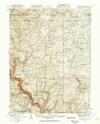
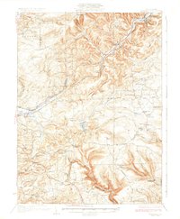
(86)- 1930 Map of Starrucca
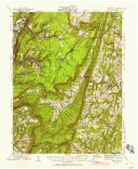
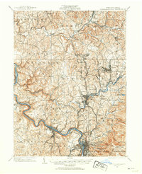
 1930 Starrucca1930 Print · USGSUpper Wayne County was a major transportation and recreation hub in the 1930s, defined by the Delaware River rail corridors and numerous upland lakes. Genealogists can trace family roots through localized sites like the South Preston Grange Hall and schools like Fairmont Sch.3 unique versions available
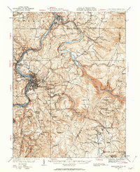
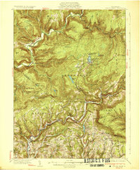
 - 1930 Map of Tidioute
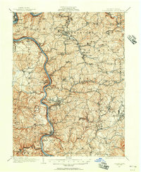
 1930 Tidioute1930 Print · USGSThe Allegheny River valley and the Pennsylvania Railroad corridor are shown in detail during the late 1920s. Genealogists and historians can trace defunct school sites like Triumph Sch and remote settlements such as Fagundus or Trunkeyville.4 unique versions available
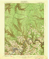
 - 1930 Map of Warrensville
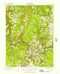
 1930 Warrensville1930 Print · USGSLycoming County’s rugged valley and ridge landscape is captured here during the 1930s as small farming and timber communities thrived along the creek networks. Genealogists can trace family names at the County Farm or locate rural landmarks like Quaker Hill Sch, Fairfield Center, and the remote Coal Mine Hollow.3 unique versions available
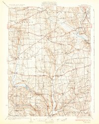
 - 1930 Map of Loysville, 1953 Print
 1930 Loysville1953 Print · USGSPerry County's rural heartland is meticulously detailed in the 1930s, showing a landscape of ridge-and-valley farms and forest camps. Genealogists can trace family roots through numerous local landmarks like St Paul Ch, Academia Sch, and Loysville.
 - 1930 Map of Broad Top, 1958 Print
 1930 Broad Top1958 Print · USGSThe Broad Top coalfields of the 1930s come alive through this survey of the region's mining towns and mountain ridges. Genealogists can trace family footprints at Bills Place, Miller Sch, and the Garlick Mine along the Huntingdon and Broad Top Mountain RR.2 unique versions available
 - 1931 Map of Troy
 1931 Troy1931 Print · USGSBradford County’s northern valleys and high ridges appear here in the early 1930s, showing a landscape of small hamlets and cross-country rail lines. Genealogists can locate family landmarks such as Besley Cem, Mitchells Mill, and early schools like Doty Hill Sch.2 unique versions available
 - 1931 Map of Show Shoe
 1931 Show Shoe1931 Print · USGSThe Pennsylvania coalfields and river valleys are captured here in the early 1930s, showing a rugged landscape defined by mountain camps and mining towns. Genealogists can trace family roots through industrial settlements like Clarence and Snow Shoe or locate old schools such as Cherry Run Sch.3 unique versions available
 - 1931 Map of Clearville
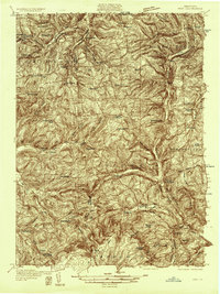
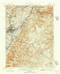
 1931 Clearville1931 Print · USGSBedford County at the start of the 1930s shows a landscape of deep ridges and busy valley farms. Genealogists can trace family names through landmarks like Jackson Mills, Chaneysville, and schools such as Barkman Sch or Bittle Sch.3 unique versions available
 - 1931 Map of Hyndman
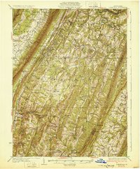
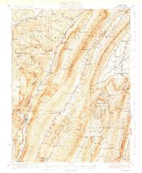 1931 Hyndman1931 Print · USGSHyndman and the surrounding ridges of Bedford County are captured in the late twenties, showing a landscape of tight mountain gaps and railroad hubs. Researchers can trace family-named schoolhouses like Pender Sch, the old Bedford Valley PO, and the Horseshoe Trail.3 unique versions available
 - 1931 Map of Brownsville, 1954 Print
 1931 Brownsville1954 Print · USGSThe industrial Monongahela and Youghiogheny river valleys are captured here in the early thirties, showcasing a landscape of coal mines and river locks. Genealogists can trace family homes near Vesta Mine, Sutersville, and rural landmarks like Salem Church.
 - 1931 Map of Connellsville, 1954 Print
 1931 Connellsville1954 Print · USGSSouthwestern Pennsylvania's coal and rail heartland is meticulously detailed here in the early thirties. Local researchers can trace the industrial footprint of Star Mines, the sprawling rail yards of Connellsville, and rural landmarks like Bryner Ch and Mud Sch.2 unique versions available
 - 1931 Map of Uniontown, 1956 Print
 1931 Uniontown1956 Print · USGSFayette County is captured in the early 1930s during a period of transition for its mountain communities and industrial furnace towns. Genealogists can trace family roots at Sylvan Heights Cem or locate the rural Hughes Sch and Wharton Furnace.2 unique versions available
 - 1931 Map of Masontown, 1957 Print
 1931 Masontown1957 Print · USGSFayette County’s industrial landscape is captured here during the 1930s, showing the high-water mark of the regional coal and coke era. Genealogists and historians can trace company towns and numbered mines like Tower Hill No 1 and Thompson No 2 alongside river crossings like Crows Ferry.
 - 1931 Map of Confluence, 1958 Print
 1931 Confluence1958 Print · USGSThe Laurel Highlands at the start of the 1930s reveal a landscape of deep river valleys and high ridges defined by coal mining and heavy rail. Genealogists can trace family names through dozens of rural sites like Sands Church, Somerfield, and the Mary Ann Mine.2 unique versions available
 - 1931 Map of Bruceton Mills, 1962 Print
 1931 Bruceton Mills1962 Print · USGSNorthern Preston County and the Pennsylvania border are shown in the 1930s as a landscape of rural mills and mountain schools. Genealogists can locate family names at Glade Farms, Clifton Mills, and the Old Brick Church.
 - 1931 Map of Morgantown, 1962 Print
 1931 Morgantown1962 Print · USGSMorgantown and the Monongahela River valley are shown here during the early twentieth-century peak of the regional rail-and-river economy. Genealogists can trace family names through numerous rural landmarks like Lazzell School, Burns Chapel, and Clinton Furnace.
 - 1932 Map of Corry
 1932 Corry1932 Print · USGSThe industrial crossroads at the junction of the Pennsylvania and Erie Railroads come to life in the early 1930s. Trace old family roots and rural schoolhouses like Picidilli Sch and Daytown Sch near Spartansburg and Corry.3 unique versions available
 - 1932 Map of Clearfield
 1932 Clearfield1932 Print · USGSClearfield and the West Branch of the Susquehanna are captured here in the early 1930s as a vital hub of rail and river industry. Researchers can trace ancestral locations through numerous rural landmarks like Lecontes Mills, Goshen Ch, and Mt Sinai Sch.4 unique versions available
 - 1932 Map of Townville
 1932 Townville1932 Print · USGSCrawford and Venango Counties are captured here in the early thirties, showing a rural landscape of crossroads hamlets and family-named schools. Genealogists can trace ancestral sites from Little Cooley to Dempseytown, including landmarks like Wilson Mills and Sugar Lake.2 unique versions available
 - 1932 Map of Union City
 1932 Union City1932 Print · USGSNorthwestern Pennsylvania at the dawn of the 1930s reveals a landscape of thriving rail junctions and rural crossroads. Genealogists can trace family landmarks and forgotten hamlets such as Riceville, Mill Village, and the many one-room schools like Bonnell Sch.3 unique versions available
 - 1932 Map of Penfield
 1932 Penfield1932 Print · USGSClearfield County is shown in the early thirties at a time when mountain railroads and forest management defined the region. Local historians can trace the paths of the Pennsylvania RR through Penfield or locate schools such as Coal Hill Sch and Hickory Sch.3 unique versions available
 - 1932 Map of Eagle Mere
 1932 Eagle Mere1932 Print · USGSSullivan County mountain life comes alive in this early 1930s survey of the resort at Eagles Mere. Genealogists can trace family footprints at Bunker Hill Sch, the Swank Cem, or along the Williamsport and North Branch railroad.4 unique versions available
 - 1932 Map of Ariel
 1932 Ariel1932 Print · USGSWayne and Pike counties are seen here in the early 1930s as the regional landscape adjusted to the presence of Lake Wallenpaupack. Trace family roots at Ammerman Sch or follow the Erie RR past Gravity and Lake Ariel.3 unique versions available
 - 1932 Map of Karthaus
 1932 Karthaus1932 Print · USGSThe Susquehanna’s West Branch winds through Clearfield and Centre Counties in the late 1920s, a landscape shaped by the rail and timber industries. Genealogists can trace family names through dozens of rural schools and churches like Mignot Sch and Fairview Ch.3 unique versions available
 - 1932 Map of Easton
 1932 Easton1932 Print · USGSThe Delaware River valley thrived as a corridor of industry and transport in the early 1930s, bridging Pennsylvania and New Jersey. Genealogists and historians can trace the legacy of early industry along the Morris Canal or locate local landmarks like St Josephs Ch and Mine Hill.5 unique versions available
Showing maps 1-25 of 86
Top cities of Pennsylvania
- Philadelphia historical maps
- Pittsburgh historical maps
- Allentown historical maps
- Erie historical maps
- Reading historical maps
- Upper Darby historical maps
See more
Top counties of Pennsylvania
- Philadelphia County historical maps
- Allegheny County historical maps
- Montgomery County historical maps
- Bucks County historical maps
- Delaware County historical maps
- Chester County historical maps
See more
Frequently asked questions
- What are the different types of historical maps available for Pennsylvania?
- What is the oldest map of Pennsylvania?
- Where can I purchase historical maps of Pennsylvania for my home or office?
- Where can I download high-res historical maps of Pennsylvania?
- Are there historical topographic maps available for Pennsylvania?
- Is there historical aerial imagery available for Pennsylvania?
- Where are historical maps of Pennsylvania sourced from?