1920s Maps of Pennsylvania
Explore 95 historic maps of Pennsylvania from the 1920s. These maps offer a rare glimpse into what life looked like during the 1920s — showing old roads, neighborhoods, homes, and landmarks that have changed or disappeared over time.
Whether you're researching your family's past, planning a metal detecting trip, or studying how Pennsylvania's landscape evolved across the 1920s, these high-resolution maps are a powerful tool for exploring the history of this region.
- Focus on a specific era: All maps on this page are from the 1920s, giving you a focused view of this time period.
- See what’s changed: Compare century-old streets, trails, and buildings to today's modern landscape using overlays and satellite layers.
- Research with precision: Use these maps for genealogy, historical research, land use analysis, or educational projects.
- View, download, or print: Maps are fully viewable online in high resolution, and can be downloaded or printed for your own records.
Start exploring Pennsylvania's history through authentic maps from the 1920s. This is your window into the past.
Pennsylvania maps
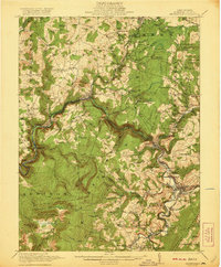
(95)- 1920 Map of Philadelphia
 1920 Philadelphia1920 Print · USGSPhiladelphia and its New Jersey neighbors are captured here just after the Great War, showing a landscape defined by massive riverfront industry and a dense rail network. Genealogists can trace family footprints through numerous small communities and stations like Blenheim Station, Woodbury Heights, and the grounds of the Alms House.
 - 1920 Map of Long Eddy
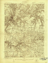
 1920 Long Eddy1920 Print · USGSThe Delaware River borderlands come alive in the 1920s as a hub of rail activity and riverfront commerce. Genealogists can locate family names near landmarks like Peckville P O, Equinunk, and rural schoolhouses like the South Branch School.3 unique versions available
 - 1920 Map of Altoona, 1954 Print
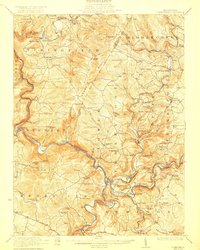
 1920 Altoona1954 Print · USGSThe industrial and rail-heavy corridor of the 1920s is on full display as the Pennsylvania RR cuts through the mountains. Genealogists and local historians can trace family roots through numerous country schools like Beech Grove School and lost settlements such as Wopsononock or Fostoria.6 unique versions available
 - 1920 Map of Damascus, 1956 Print
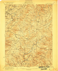
 1920 Damascus1956 Print · USGSThe Upper Delaware River valley at the start of the 1920s shows a landscape of river-fronting hamlets and upland dairy farms. Genealogists can locate numerous rural schoolhouses and churches, such as Kester School, Smith Hill Church, and the Oil Pumping Station at Cochecton.2 unique versions available
 - 1920 Map of New Florence, 1958 Print
 1920 New Florence1958 Print · USGSThe Conemaugh River valley at the dawn of the 1920s shows a landscape defined by the PENNSYLVANIA RR and industrial coal towns. Genealogists can locate family homesteads near dozens of named country schools like Wallace School or trace the old Lincoln Highway through Armagh.
 - 1920 Map of Hanover, 1959 Print
 1920 Hanover1959 Print · USGSYork County's rail-and-mill economy is on full display in the early twentieth century, centered on the busy junctions of Hanover and Hanover Junction. Genealogists and local historians can trace hundreds of rural sites, including Lischy Church, Porters Sideling, and the Trimmer's School.
 - 1921 Map of Howard
 1921 Howard1921 Print · USGSThe valleys and ridges of Central Pennsylvania are captured here just as the rail-and-river economy was maturing. Researchers can trace family sites among a high density of rural schools and churches like Cedar Spring School, Hunter Run Church, and the town of Lamar.3 unique versions available
 - 1921 Map of Long Eddy
 1921 Long Eddy1921 Print · USGSThe Delaware River borderlands are captured here in the early twenties, showing a network of small upland communities and river crossings. Genealogists can trace family footprints through numerous rural schoolhouses and landmarks like Read Cemetery, Abrahamsville, and the Ferry.
 - 1921 Map of Williamsport
 1921 Williamsport1921 Print · USGSWilliamsport and the West Branch Susquehanna valley are captured here in the early 1920s, showing a landscape defined by rail corridors and steep mountain ridges. Genealogists can locate family-named schools and social landmarks like the Morgan Valley School, Nippono Park, and Shakespeare Club.
 - 1921 Map of New Florence
 1921 New Florence1921 Print · USGSWestmoreland and Indiana counties are captured in the early 1920s as industrial rail corridors and the Lincoln Highway begin to modernize the rural landscape. Genealogists can locate family landmarks like Campbell's Mill, the Centerville Huff PO, and several country schools including Robbs School.
 - 1921 Map of Meyersdale
 1921 Meyersdale1921 Print · USGSSomerset County's industrial and mountain landscape comes to life in the early 1920s as coal mining and railroads dominate the Casselman River valley. Genealogists can trace family roots through dozens of local sites like Sanners Church, Shaw Mines, and the Ganguey School.3 unique versions available
 - 1921 Map of Trout Run, 1957 Print
 1921 Trout Run1957 Print · USGSThe Lycoming Creek valley in the 1920s served as a vital transit and industrial corridor north of Williamsport. Genealogists and local historians can trace family ties through dozens of named rural schools, including Beech Grove School and Chestnut Grove School, or locate early industry at Balls Mills.3 unique versions available
 - 1921 Map of Lock Haven, 1958 Print
 1921 Lock Haven1958 Print · USGSLock Haven and the Susquehanna River West Branch are captured in the early twenties, showing a landscape defined by industry and mountain ridges. Researchers can trace historic schools and family hamlets from Woolrich to Logan Mills, or locate the State Normal School and Great Island.2 unique versions available
 - 1921 Map of Pocono, 1962 Print
 1921 Pocono1962 Print · USGSThe Pocono Mountains at the start of the 1920s reveal a landscape of military training grounds, remote mountain schools, and early summer resorts. Trace the rail lines of the Wilkes-Barre and Eastern RR or locate rural landmarks like Cherry Lane Church and Beaver Brook School.
 - 1922 Map of White Lake
 1922 White Lake1922 Print · USGSSullivan County's lake-strewn highlands appear here in the early twenties, showing a landscape defined by small mountain hamlets and rural school districts. Genealogists can trace family names through landmarks like Stewart Cemetery, Bauer's Mill, and Mount Hope School.6 unique versions available
 - 1922 Map of Oil City
 1922 Oil City1922 Print · USGSVenango County's river-driven economy and rural community structure are captured here in the early twenties, showing the intersection of heavy rail and upland farming. Researchers can trace family origins through numerous rural school sites like Rose School and old post offices at Cranberry PO or Davis Corners.2 unique versions available
 - 1922 Map of Mt Union
 1922 Mt Union1922 Print · USGSThe Juniata River valley in the early 1920s reveals a landscape shaped by the Pennsylvania RR and early motor routes like the Lincoln Highway. Genealogists can trace dozens of rural schoolhouses and vanished post offices, including Red Fork PO, Shirleysburg, and Lucy Furnace School.2 unique versions available
 - 1922 Map of Confluence
 1922 Confluence1922 Print · USGSThe confluence of the Youghiogheny River and Casselman River was a major rail and river hub in the 1920s. Genealogists and local historians can trace the foundations of many small settlements and mountain schools, from Ohiopyle to the Baldwin Mine and Wesley Chapel.3 unique versions available
 - 1922 Map of Donegal
 1922 Donegal1922 Print · USGSWestmoreland and Fayette counties are captured here in the early twenties, showing a landscape of mountain ridges and busy valley crossroads. Genealogists can trace family roots through dozens of rural landmarks like St Boniface Chapel, Hoods Mill, and the Snowball School.2 unique versions available
 - 1922 Map of Hanover
 1922 Hanover1922 Print · USGSYork County's rolling farmland and industrial hubs are captured here in the early 1920s, just as the Lincoln Highway began transforming rural travel. Genealogists can locate family-named landmarks and country institutions like Wildasin Chapel, Menges Mills, and the Iron Ridge Ironore PO.5 unique versions available
 - 1922 Map of Philipsburg
 1922 Philipsburg1922 Print · USGSPhilipsburg and the northern Allegheny coalfields are captured here in the early twenties during a period of heavy rail and mining activity. Genealogists can trace family locations through dozens of named rural schoolhouses like Klondike School and industrial sites including Cuba Mines and the Central RR of Pennsylvania.3 unique versions available
 - 1922 Map of Altoona
 1922 Altoona1922 Print · USGSThe industrial hub of Altoona and the steep slopes of the Allegheny Front are captured here in the early 1920s. Researchers can trace the extensive rail operations of the Pennsylvania railroad and locate numerous vanished rural landmarks like the Richland School and Grandview Cemetery.8 unique versions available
 - 1922 Map of New Florence
 1922 New Florence1922 Print · USGSWestern Pennsylvania in the early 1920s shows a landscape of river-carved ridges and busy rail corridors connecting coal and quarry towns. Genealogists can trace family footprints across dozens of rural schools and stations like Lockport Station, Centerville (Huff PO), and Grafton.5 unique versions available
 - 1922 Map of Mauch Chunk, 1952 Print
 1922 Mauch Chunk1952 Print · USGSThe industrial Lehigh Valley thrives in the early 1920s, dominated by the winding river and two major competing railroad lines. Genealogists can locate old rural landmarks like the Larrytown Poor Farm, Indian Hills School, and the busy rail hub of Mauch Chunk.2 unique versions available
 - 1922 Map of Tionesta, 1953 Print
 1922 Tionesta1953 Print · USGSNorthwestern Pennsylvania in the early twenties reveals a landscape defined by timber, the Allegheny River, and a dense network of country schools. Researchers can trace the legacy of small communities like Lucinda, Newmansville, and Fryburg alongside early railroad corridors.3 unique versions available
Showing maps 1-25 of 95
Top cities of Pennsylvania
- Philadelphia historical maps
- Pittsburgh historical maps
- Allentown historical maps
- Erie historical maps
- Reading historical maps
- Upper Darby historical maps
See more
Top counties of Pennsylvania
- Philadelphia County historical maps
- Allegheny County historical maps
- Montgomery County historical maps
- Bucks County historical maps
- Delaware County historical maps
- Chester County historical maps
See more
Frequently asked questions
- What are the different types of historical maps available for Pennsylvania?
- What is the oldest map of Pennsylvania?
- Where can I purchase historical maps of Pennsylvania for my home or office?
- Where can I download high-res historical maps of Pennsylvania?
- Are there historical topographic maps available for Pennsylvania?
- Is there historical aerial imagery available for Pennsylvania?
- Where are historical maps of Pennsylvania sourced from?