1920s Maps of Tennessee
Explore 29 historic maps of Tennessee from the 1920s. These maps offer a rare glimpse into what life looked like during the 1920s — showing old roads, neighborhoods, homes, and landmarks that have changed or disappeared over time.
Whether you're researching your family's past, planning a metal detecting trip, or studying how Tennessee's landscape evolved across the 1920s, these high-resolution maps are a powerful tool for exploring the history of this region.
- Focus on a specific era: All maps on this page are from the 1920s, giving you a focused view of this time period.
- See what’s changed: Compare century-old streets, trails, and buildings to today's modern landscape using overlays and satellite layers.
- Research with precision: Use these maps for genealogy, historical research, land use analysis, or educational projects.
- View, download, or print: Maps are fully viewable online in high resolution, and can be downloaded or printed for your own records.
Start exploring Tennessee's history through authentic maps from the 1920s. This is your window into the past.
Tennessee maps
- 1924 Map of Lillydale
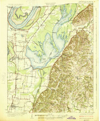
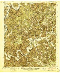
 1924 Lillydale1924 Print · USGSThe Tennessee-Kentucky borderlands in the early twenties were defined by tight river bends and isolated ridge-top schools. Genealogists can trace the rural life of Lillydale through landmarks like Thompsons Store, Willow Grove, and the uniquely named Hongkong School.
 - 1925 Map of Memphis
 1925 Memphis1925 Print · USGSThe Memphis riverfront and its Arkansas neighbors are shown here in the mid-1920s as modern highway projects began to parallel the extensive rail network. Genealogists can locate family-named features like Bertons Store, Mound City School, and Plunkett Chapel.
 - 1925 Map of Reelfoot Lake
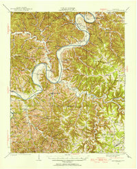
 1925 Reelfoot Lake1925 Print · USGSNorthwestern Tennessee in the mid-twenties is defined here by the intricate waters of the Reelfoot basin and the shifting course of the Mississippi. Genealogists and historians can trace family-named sites like Rodgers School and Jones School, or locate old river landings including Cates and Whites Landing.3 unique versions available
 - 1925 Map of Gainesboro, 1954 Print
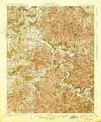
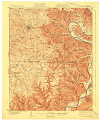
 1925 Gainesboro1954 Print · USGSJackson County, Tennessee, is captured here in the mid-1920s when the river and hollows defined every community boundary. Genealogists can trace family landmarks and vanished river crossings like Gainesboro Ferry, Cummins Mill, and the Free State Sch.
 - 1926 Map of Lillydale, 1964 Print
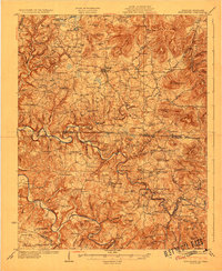
 1926 Lillydale1964 Print · USGSThe Cumberland and Obey Rivers wind through this border region in the mid-twenties, documenting life before the damming of the river valleys. Genealogists can trace family footprints at Lillydale, Carys Ferry, and numerous rural schoolhouses like Greenbrier School.
 - 1927 Map of Memphis
 1927 Memphis1927 Print · USGSMemphis and the Mississippi River bottomlands are captured here in the late twenties during a period of massive rail and river commerce. Genealogists can locate family landmarks like Plunkett Chapel, Levi School, and the Bunker Hill cemetery.2 unique versions available
 - 1927 Map of Big Junction
 1927 Big Junction1927 Print · USGSThe Tennessee-North Carolina high country comes alive in this late 1920s survey of the Unicoi Mountains. Trace old mountain routes and clearings like Whigg Cabin, Stratton Meadow, and the headwaters of the Tellico River.2 unique versions available
 - 1927 Map of Middlesboro, 1955 Print
 1927 Middlesboro1955 Print · USGSThe Cumberland Gap region comes alive in this survey from the late 1920s, showing the intersection of three states and the rugged rail networks that shaped it. Trace family roots and local industry at Gibson Station PO, Lincoln Memorial University, and Ellison Mill.
 - 1928 Map of Adolphus
 1928 Adolphus1928 Print · USGSThe Kentucky-Tennessee state line was a landscape of small schools and river crossings in the late twenties. Genealogists can locate family landmarks like Allen Cem, Reeders Sch, and the numerous crossings along Trammel Creek including Old Mill Ford.
 - 1928 Map of Gordonsville
 1928 Gordonsville1928 Print · USGSMiddle Tennessee in the late twenties was a landscape defined by the winding bends of the Caney Fork and the rise of rural river settlements. Genealogists can locate family-named landmarks like Walker Creek Sch and Hurst Chapel, or trace old river crossings at Greenmoos Ferry and Loves Ferry.2 unique versions available
 - 1928 Map of Decherd
 1928 Decherd1928 Print · USGSFranklin County in the late twenties shows a landscape defined by the rise of the Cumberland Mountains and the busy lines of the Nashville Chattanooga and St Louis Railway. Genealogists can locate family landmarks in Motlow Cove or trace students at Peabody Sch and Hatchett Sch.3 unique versions available
 - 1929 Map of Lillydale
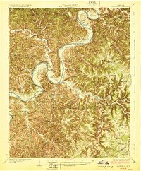
 1929 Lillydale1929 Print · USGSThe Tennessee and Kentucky borderlands are captured here in the 1920s, showing a river-linked landscape of bottomland farms and ridge-top communities. Genealogists can trace family roots through numerous schools and churches like Bearwallow School, Lillydale, and History Grove Church.3 unique versions available
 - 1929 Map of Byrdstown
 1929 Byrdstown1929 Print · USGSThe Tennessee-Kentucky state line comes alive in the late twenties, showing a landscape defined by the winding Obey River before the era of modern dams. Researchers can trace ancestral roots through dozens of local sites like Davidson Cem, Franklin Ferry, and the Almshouse.2 unique versions available
 - 1929 Map of Gainesboro
 1929 Gainesboro1929 Print · USGSJackson County in the late twenties was defined by its river-and-rail economy and upland settlements. Researchers can trace historic river crossings like Gainesboro Ferry and find family-named landmarks such as Cummins Mill and Butlers Landing.2 unique versions available
 - 1929 Map of Tompkinsville
 1929 Tompkinsville1929 Print · USGSThe Kentucky-Tennessee borderlands appear here in the late 1920s, showing a river-centered economy before modern infrastructure. Trace family ties through dozens of rural landmarks like Mulkey Meeting House, Bennett Ferry, and Moores Mill.4 unique versions available
End of results
Showing maps 1-15
Top cities of Tennessee
- Nashville historical maps
- Memphis historical maps
- Knoxville historical maps
- Chattanooga historical maps
- Clarksville historical maps
- Murfreesboro historical maps
See more
Top counties of Tennessee
- Shelby County historical maps
- Davidson County historical maps
- Knox County historical maps
- Hamilton County historical maps
- Rutherford County historical maps
- Williamson County historical maps
See more
Frequently asked questions
- What are the different types of historical maps available for Tennessee?
- What is the oldest map of Tennessee?
- Where can I purchase historical maps of Tennessee for my home or office?
- Where can I download high-res historical maps of Tennessee?
- Are there historical topographic maps available for Tennessee?
- Is there historical aerial imagery available for Tennessee?
- Where are historical maps of Tennessee sourced from?