1940s Maps of Tennessee
Explore 338 historic maps of Tennessee from the 1940s. These maps offer a rare glimpse into what life looked like during the 1940s — showing old roads, neighborhoods, homes, and landmarks that have changed or disappeared over time.
Whether you're researching your family's past, planning a metal detecting trip, or studying how Tennessee's landscape evolved across the 1940s, these high-resolution maps are a powerful tool for exploring the history of this region.
- Focus on a specific era: All maps on this page are from the 1940s, giving you a focused view of this time period.
- See what’s changed: Compare century-old streets, trails, and buildings to today's modern landscape using overlays and satellite layers.
- Research with precision: Use these maps for genealogy, historical research, land use analysis, or educational projects.
- View, download, or print: Maps are fully viewable online in high resolution, and can be downloaded or printed for your own records.
Start exploring Tennessee's history through authentic maps from the 1940s. This is your window into the past.
Tennessee maps
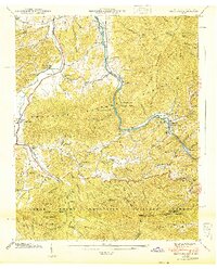
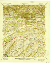
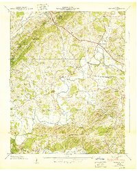
(338)- 1940 Map of Stony Point
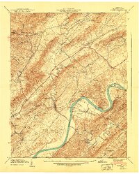
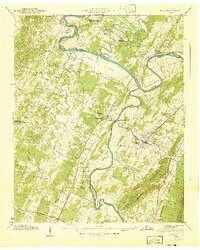
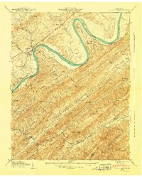 1940 Stony Point1940 Print · USGSHawkins County is captured here just before the mid-century, where the winding Holston River meets a landscape of steep mountain ridges and fertile valley bottoms. Genealogists and local historians can locate Surgoinsville, trace the old Southern Railroad, and find rural landmarks like Mowls Mill and Maxwell Academy.
 - 1940 Map of Loudon
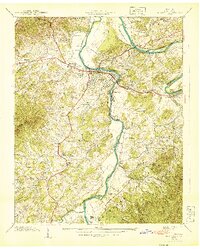
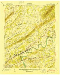
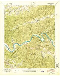
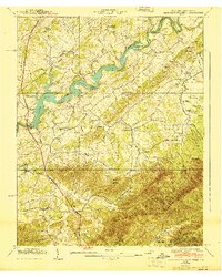
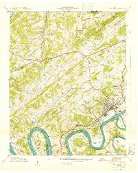
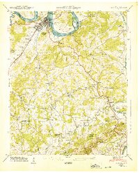 1940 Loudon1940 Print · USGSTennessee river life and rural industry meet in the early 1940s as the river valley begins to transform. Genealogists and historians can trace family landmarks like Eve-Mills, Huff Ferry, and the Maple Spring Wadkins Cem.
 - 1940 Map of Talbott
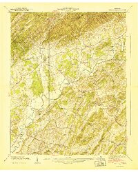
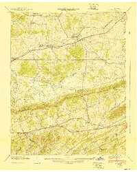
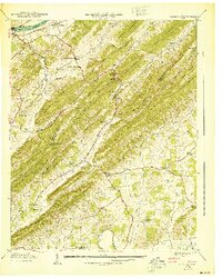
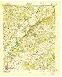 1940 Talbott1940 Print · USGSIn the Tennessee Valley just before the 1940s, this area shows a landscape shaped by the Holston River and the Southern railroad. Genealogists can locate family-named landmarks like Kidwell Ridge Ch, Lawrence Mill, and the Sunderland Cem.
 - 1940 Map of Lee Valley
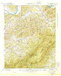
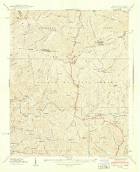
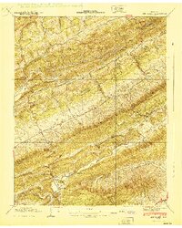 1940 Lee Valley1940 Print · USGSHawkins and Hancock Counties appear here at the start of the 1940s, showing a landscape defined by the ridgelines of Clinch Mountain. Local historians can trace old homesteads and community hubs like Lee Valley, Fairmont Sch, and the Morrell Cem.
 - 1940 Map of Hartford
 1940 Hartford1940 Print · USGSThe Pigeon River valley comes to life in this 1940s survey of the Tennessee and North Carolina border. Genealogists can locate family names at Shultz Cem and Mcmillan Cem or trace the original route of the Appalachian Trail.6 unique versions available
 - 1940 Map of Baileyton
 1940 Baileyton1940 Print · USGSGreene County agriculture and mountain life are captured here just before the mid-century, showing the tightly-knit network of mills and valley schools. Researchers can trace family sites near Lick Creek Mill, Wesley Chapel, and Brittontown Sch.
 - 1940 Map of Newport
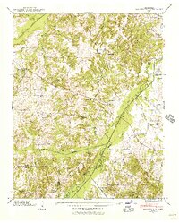
 1940 Newport1940 Print · USGSNewport and its surrounding river valleys come alive in this pre-war survey of Cocke County. Researchers can trace historic family names and community centers through sites like Rosenwald Sch, Union Cem, and the industrial activity near Tannery Island.2 unique versions available
 - 1940 Map of Parrottsville
 1940 Parrottsville1940 Print · USGSEast Tennessee river life and mountain hollows are captured here just as the Tennessee Valley Authority began its regional transformations. Genealogists can trace family roots through an extensive network of landmarks including Brookside Mill, Ottinger Cem, and Harned Chapel.
 - 1940 Map of Indian Springs
 1940 Indian Springs1940 Print · USGSThe Tennessee and Virginia borderlands come alive in this pre-war survey of Sullivan County. Genealogists and local historians can trace the family networks of Bridwell Town, locate Gunnings Academy, and find long-standing mills like Huddle Mill.
 - 1940 Map of John Sevier
 1940 John Sevier1940 Print · USGSKnox County at the start of the 1940s is defined by the Holston River and the industrial activity of the Southern railroad. Trace family sites like Clapps Chapel, the County Workhouse, and Ruggles Ferry Bridge before the landscape was fully reshaped by modern expansion.2 unique versions available
 - 1940 Map of New Market
 1940 New Market1940 Print · USGSJefferson County's rural and industrial landscape is captured here in the years before the war, centered on the New Market rail corridor. Genealogists and historians can locate family landmarks like Dinwoody Mill, trace the SOUTHERN railroad line, and find old burial grounds such as Caldwell Cem.2 unique versions available
 - 1940 Map of Clevenger
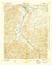
 1940 Clevenger1940 Print · USGSJefferson and Cocke counties are captured here in the late 1930s, showing a landscape of high ridges and river bottomlands. Researchers can find numerous rural landmarks like the Blowing Cave Mill, the Bogard Ch Rainwater Sch, and the riverside community of Dutch Bottoms.2 unique versions available
 - 1940 Map of Burem
 1940 Burem1940 Print · USGSHawkins County, Tennessee, is captured here just before the 1940s, showing a river-carved landscape of ridges and rural settlements. Genealogists and local historians can trace family locations through Alumwell Academy, Hennard Mill, and the Ebbing and Flowing Spring.2 unique versions available
 - 1940 Map of Manleyville
 1940 Manleyville1940 Print · USGSThe West Tennessee river bottoms and hill country are shown just before the war, when the Big Sandy River valley was a patchwork of small farms and family cemeteries. Trace vanished local landmarks like Smith College, McDavid Sch, and the isolated Rushing Chapel among the network of drainage ditches.
 - 1940 Map of Paint Rock
 1940 Paint Rock1940 Print · USGSThe French Broad River valley at the Tennessee-North Carolina border is captured here during the 1940s, showing a landscape of mountain gaps and riverside rail settlements. Family historians can locate family plots and early rural schools like Mooneyham Cem, Justis Cem, and the Fugate Sch.4 unique versions available
 - 1940 Map of Pigeon Forge
 1940 Pigeon Forge1940 Print · USGSSevier County during the pre-war period shows the early development of Pigeon Forge and the established county seat at Sevierville. Genealogists and historians can trace family locations near Mc Mahan Cem, Henderson Springs, and the Williamsburg Sch.
 - 1940 Map of Mohawk
 1940 Mohawk1940 Print · USGSEast Tennessee at the dawn of the 1940s reveals a landscape of tight-knit rural communities connected by the SOUTHERN railroad. Genealogists can locate family landmarks like Darrow Mill, Crosby Cem, and several local schoolhouses like Salem Sch.
 - 1940 Map of Davy Crockett Lake
 1940 Davy Crockett Lake1940 Print · USGSGreene County, Tennessee, is captured here in the early 1940s just as the Nolichucky River valley was being reshaped by the waters of Lake Davy Crockett. Trace family roots and local history through features like Cove Creek Mill, Price Cem, and the Orphanage.
 - 1940 Map of Sams Gap
 1940 Sams Gap1940 Print · USGSThe high ridges of Madison County were still dominated by small-scale farming and forest life when this survey was completed. Genealogists can trace family footprints across Sams Gap through landmarks like the Robinson Cem, Higgins Chapel, and Halls Store.
 - 1940 Map of Mc Cloud
 1940 Mc Cloud1940 Print · USGSJust before the mid-century, this corner of East Tennessee shows a landscape defined by the Bays Mountains and rural agriculture. Genealogists can trace family names at Patterson Cem or locate community hubs like Romeo and Bandy Chapel.
 - 1940 Map of Benton
 1940 Benton1940 Print · USGSPolk County life in the early 1940s centers on the fertile river bottoms and the rail lines connecting these valley communities. Researchers can trace family roots through numerous local landmarks, from Chestuee Mills to rural sites like New Harmony Ch and Baker Chapel Cem.3 unique versions available
 - 1940 Map of Lenoir City
 1940 Lenoir City1940 Print · USGSLoudon and Roane counties are captured here just as the Tennessee Valley Authority was reshaping the river landscape. Researchers can trace family-named sites like Brazeale Cem, old schoolhouses such as Oak Grove Sch, and historic river crossings at Bussell Ferry.2 unique versions available
 - 1940 Map of Johnson City
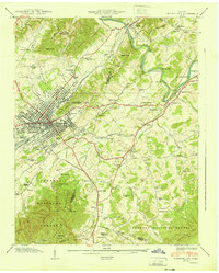 1940 Johnson City1940 Print · USGSJohnson City and its surrounding valleys are captured here at the start of the 1940s, showing a vital rail junction and industrial center. Genealogists can locate family landmarks like Taylor Chapel Cem, Milligan College, and the National Soldiers Home.2 unique versions available
 - 1940 Map of Chattanooga
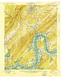
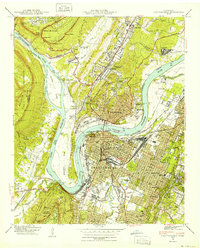 1940 Chattanooga1940 Print · USGSChattanooga and the Tennessee River valley are captured here at the dawn of the 1940s, showcasing a bustling rail and river hub. Researchers can trace the legacy of Union Station, find family plots in National Cem, or locate the historic Cravens House on the slopes of Lookout Mountain.2 unique versions available
 - 1940 Map of Rockwood
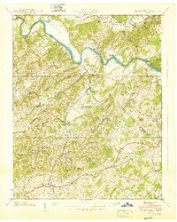
 1940 Rockwood1940 Print · USGSThe Tennessee River valley at Rockwood is shown here during the transition to the reservoir era in the early 1940s. Genealogists can locate family sites like Odd Fellows Cem, trace the railroad to Glen Alice, or find old schools like New Hope Sch.
Showing maps 1-25 of 338
Top cities of Tennessee
- Nashville historical maps
- Memphis historical maps
- Knoxville historical maps
- Chattanooga historical maps
- Clarksville historical maps
- Murfreesboro historical maps
See more
Top counties of Tennessee
- Shelby County historical maps
- Davidson County historical maps
- Knox County historical maps
- Hamilton County historical maps
- Rutherford County historical maps
- Williamson County historical maps
See more
Frequently asked questions
- What are the different types of historical maps available for Tennessee?
- What is the oldest map of Tennessee?
- Where can I purchase historical maps of Tennessee for my home or office?
- Where can I download high-res historical maps of Tennessee?
- Are there historical topographic maps available for Tennessee?
- Is there historical aerial imagery available for Tennessee?
- Where are historical maps of Tennessee sourced from?