1980s Maps of Tennessee
Explore 126 historic maps of Tennessee from the 1980s. These maps offer a rare glimpse into what life looked like during the 1980s — showing old roads, neighborhoods, homes, and landmarks that have changed or disappeared over time.
Whether you're researching your family's past, planning a metal detecting trip, or studying how Tennessee's landscape evolved across the 1980s, these high-resolution maps are a powerful tool for exploring the history of this region.
- Focus on a specific era: All maps on this page are from the 1980s, giving you a focused view of this time period.
- See what’s changed: Compare century-old streets, trails, and buildings to today's modern landscape using overlays and satellite layers.
- Research with precision: Use these maps for genealogy, historical research, land use analysis, or educational projects.
- View, download, or print: Maps are fully viewable online in high resolution, and can be downloaded or printed for your own records.
Start exploring Tennessee's history through authentic maps from the 1980s. This is your window into the past.
Tennessee maps
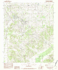
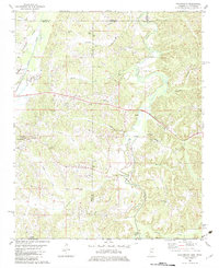
- 1980 Map of Winfield
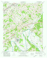
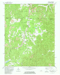 1980 Winfield1980 Print · USGSThe borderlands of Tennessee and Kentucky are captured here in the late twentieth century as the railroad and mining industries shaped the local economy. Researchers can trace family history through dozens of rural landmarks, from Chitwood Cem and Isham Cem to the local congregations at Second Bethlehem Ch.2 unique versions available
 - 1980 Map of Snow Hill
 1980 Snow Hill1980 Print · USGSHamilton County was entering a new era of energy production and suburban growth during the late seventies. Family historians and researchers can trace dozens of rural burial sites like Roddy-Yarnell Cem alongside the rising Sequoyah Nuclear Plant and the developing Lakesite community.2 unique versions available
 - 1980 Map of Ketchen
 1980 Ketchen1980 Print · USGSThe Kentucky and Tennessee borderlands are captured here in the early eighties as industrial mining reshaped the forest landscape. Genealogists can trace family landmarks and burial sites like Baird Creek Cem, Trammel Cem, and the settlement of Stephens.2 unique versions available
 - 1980 Map of Johnson City, 1981 Print
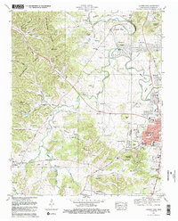
 1980 Johnson City1981 Print · USGSEast Tennessee in the early eighties shows a landscape of mountain ridges and growing valley towns. Trace local history through Washington College and the Andrew Johnson National Cemetery, or find sites like David Crockett Birthplace State Park.
 - 1980 Map of Talbott, 1981 Print
 1980 Talbott1981 Print · USGSEast Tennessee's landscape was transformed by the 1980s as industrial growth met the rising waters of the Holston River. Genealogists can trace family landmarks like Bacon Cem and Sitton Cem near the developed shores of Cherokee Lake.2 unique versions available
 - 1980 Map of Springvale, 1981 Print
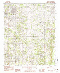
 1980 Springvale1981 Print · USGSHamblen and Greene counties are shown during a period of transition in the early eighties as industrial growth met traditional river life. Trace family history through numerous small burial grounds like Heath Cem and Luster Cem, or locate landmarks like the Morristown State Fish Hatchery.
 - 1980 Map of Hopkinsville, 1983 Print
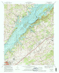
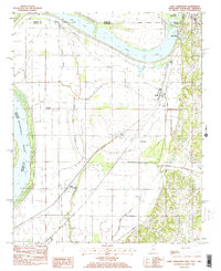
 1980 Hopkinsville1983 Print · USGSThe Kentucky and Tennessee borderlands appear here at the start of the 1980s, centered on the massive Fort Campbell Military Reservation. Trace the impact of the Cumberland River impoundment at Lake Barkley or locate rail hubs like Guthrie and Elkton.
 - 1981 Map of Franklin
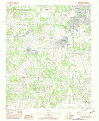
 1981 Franklin1981 Print · USGSFranklin and Brentwood appear during a transformative era of growth south of Nashville in the early eighties. Family historians can trace numerous pioneer burial sites such as Primm Cem and McConnico Cem alongside landmarks like Ropers Knob.2 unique versions available
 - 1981 Map of Morristown
 1981 Morristown1981 Print · USGSEast Tennessee's ridge-and-valley corridor is captured here in the early eighties, showing the region's transformation by TVA reservoirs. Genealogists and historians can trace family locations near Alpha Ch, follow the Southern Railway, or locate the Young Mine.
 - 1981 Map of Bristol
 1981 Bristol1981 Print · USGSAppalachia and the Tri-Cities region are shown at a peak of industrial and rail development in the early eighties. Researchers can trace the Clinchfield Railroad through the mountains or find local landmarks like King College and the Holston Army Ammunition Plant.2 unique versions available
 - 1981 Map of Mc Minnville
 1981 Mc Minnville1981 Print · USGSThe Cumberland Plateau and the Sequatchie Valley meet in this early 1980s look at Warren and White Counties. Researchers can locate vanished rural landmarks like Hutchins College, the old rail stops of the Tennessee Central, and Mount Zion Cem.
 - 1981 Map of Cleveland
 1981 Cleveland1981 Print · USGSSoutheast Tennessee and Western North Carolina are documented here in the early eighties, as the Tennessee Valley Authority managed the region's vast river and forest resources. Researchers can trace the rail lines of the Southern and Louisville and Nashville or locate industrial sites in the Copper Basin and settlements like Ducktown.2 unique versions available
 - 1981 Map of Chickamauga, 1982 Print
 1981 Chickamauga1982 Print · USGSThe tri-state border region of Georgia, Alabama, and Tennessee comes into focus during the early eighties, defined by the towering ridges of the Appalachians. Historians can trace the preserved grounds of Chickamauga and Chattanooga National Military Park and old rail stops like Rising Fawn or Sulphur Springs.2 unique versions available
 - 1981 Map of Edmondson, 1982 Print
 1981 Edmondson1982 Print · USGSCrittenden County, Arkansas, is captured here in the early eighties as a landscape of bayous and small farming communities west of the river. Genealogists and local historians can trace the sites of Edmondson Cem, Claybrook Ch, and the Old Railroad Grade.
 - 1981 Map of Horseshoe Lake, 1982 Print
 1981 Horseshoe Lake1982 Print · USGSThe Arkansas-Mississippi borderlands along the great river bend are captured here in the early eighties. Genealogists and local historians can trace family roots through sites like Mosley Temple Ch, Rodgers Cem, and the river landings at Seyppel and Bruins.2 unique versions available
 - 1981 Map of Dalton, 1982 Print
 1981 Dalton1982 Print · USGSNorth Georgia and the tristate borderlands are captured in the early eighties as the textile economy of Dalton thrived alongside the expanding Chattahoochee National Forest. Genealogists and hikers can trace the Appalachian Trail through the high country or locate family-named landmarks like Haskins Mill and Carters Mill.
 - 1981 Map of Tullahoma, 1982 Print
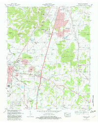
 1981 Tullahoma1982 Print · USGSSouthern Tennessee enters the 1980s with a mix of aerospace technology and deep rural roots. Researchers can trace the L & N RR through Shelbyville and Fayetteville or locate family sites like Old Salem Cem and Blanton Chapel near the Cumberland Plateau.
 - 1981 Map of Leipers Fork, 1982 Print
 1981 Leipers Fork1982 Print · USGSFranklin and the rural stretches of the West Harpeth River valley are captured in the early eighties as residential growth began to meet historic farmsteads. Genealogists and local historians can trace legacy sites from the Indian Mound and Slave Cem to the Battle Ground Academy.3 unique versions available
 - 1981 Map of Watts Bar Lake, 1984 Print
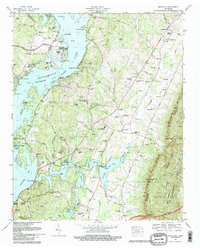
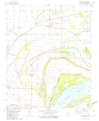
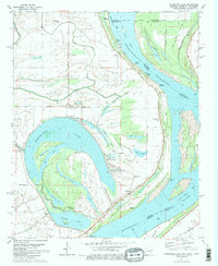
 1981 Watts Bar Lake1984 Print · USGSEast Tennessee's river valleys and industrial corridors are captured here during the expansion of the TVA power system in the early eighties. Researchers can trace the legacy of the Southern Railway and the development of Watts Bar Lake and Tellico Lake.2 unique versions available
 - 1981 Map of Corbin, 1984 Print
 1981 Corbin1984 Print · USGSThe Kentucky and Tennessee borderlands in the early eighties were characterized by coal towns and deep mountain ridges. Trace family history or rail routes through Stearns, Williamsburg, and the mining settlements near Jellico Mountain along the L & N RR.
 - 1982 Map of Lake Cormorant
 1982 Lake Cormorant1982 Print · USGSThe Mississippi Delta's northern edge meets the Tennessee border in the early eighties, showing a landscape of river-bend lakes and rail-side settlements. Trace the local geography of Lake Cormorant, Walls, and the Twinkle Town Landing Field during this era of regional transition.2 unique versions available
 - 1982 Map of Pleasant Hill
 1982 Pleasant Hill1982 Print · USGSDeSoto County and Shelby County meet in the early 1980s as suburban expansion reaches southward across the state line. Genealogists and local historians can trace the development of Southaven or locate the rural Pleasant Hill community and Sunrise Lake.
 - 1982 Map of Horn Lake
 1982 Horn Lake1982 Print · USGSNorthwestern Mississippi was undergoing a period of suburban expansion in the early eighties as the outskirts of the Delta met the growing reach of the city. Researchers can trace the development of Southaven and Horn Lake or locate rural sites like Nesbit and Deans Corner.
 - 1982 Map of Olive Branch
 1982 Olive Branch1982 Print · USGSDe Soto County, Mississippi, sits just below the Tennessee line in the early eighties as the area begins a transition toward growth. Genealogists and researchers can trace the roads connecting Olive Branch to smaller settlements like Miller and Fairhaven near the Goldwater River.
 - 1982 Map of Chalybeate, 1983 Print
 1982 Chalybeate1983 Print · USGSStraddling the Tennessee-Mississippi border in the early eighties, this area shows a landscape defined by its creek-bottom farms and rural family settlements. Researchers can trace local roots through Union Cem, Union Center Sch, and crossroads like Jonesboro or Mathis.
Showing maps 1-25
Top cities of Tennessee
- Nashville historical maps
- Memphis historical maps
- Knoxville historical maps
- Chattanooga historical maps
- Clarksville historical maps
- Murfreesboro historical maps
See more
Top counties of Tennessee
- Shelby County historical maps
- Davidson County historical maps
- Knox County historical maps
- Hamilton County historical maps
- Rutherford County historical maps
- Williamson County historical maps
See more
Frequently asked questions
- What are the different types of historical maps available for Tennessee?
- What is the oldest map of Tennessee?
- Where can I purchase historical maps of Tennessee for my home or office?
- Where can I download high-res historical maps of Tennessee?
- Are there historical topographic maps available for Tennessee?
- Is there historical aerial imagery available for Tennessee?
- Where are historical maps of Tennessee sourced from?