1950s Maps of Tennessee
Explore 1,420 historic maps of Tennessee from the 1950s. These maps offer a rare glimpse into what life looked like during the 1950s — showing old roads, neighborhoods, homes, and landmarks that have changed or disappeared over time.
Whether you're researching your family's past, planning a metal detecting trip, or studying how Tennessee's landscape evolved across the 1950s, these high-resolution maps are a powerful tool for exploring the history of this region.
- Focus on a specific era: All maps on this page are from the 1950s, giving you a focused view of this time period.
- See what’s changed: Compare century-old streets, trails, and buildings to today's modern landscape using overlays and satellite layers.
- Research with precision: Use these maps for genealogy, historical research, land use analysis, or educational projects.
- View, download, or print: Maps are fully viewable online in high resolution, and can be downloaded or printed for your own records.
Start exploring Tennessee's history through authentic maps from the 1950s. This is your window into the past.
Tennessee maps
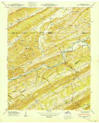
- 1950 Map of Monteagle
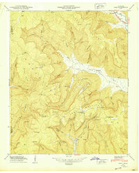
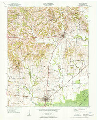
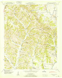
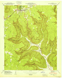 1950 Monteagle1950 Print · USGSMonteagle and the surrounding Cumberland Plateau are shown at mid-century as a network of plateau settlements and deep cove farms. Researchers can trace family history through numerous rural landmarks like Lappin Cem, St Johns Ch, and the Jumpoff Sch.3 unique versions available
 - 1950 Map of Clarkrange
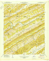
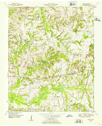
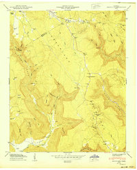
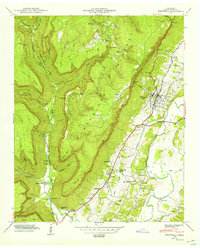
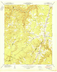 1950 Clarkrange1950 Print · USGSMid-century Fentress County is defined here by the high-plateau route of the Alvin C York Highway and the rugged breaks of the Cumberland Plateau. You can trace family homesteads near Muddy Pond, local schools like Martha Washington School, and the crossroads at Clarkrange.2 unique versions available
 - 1950 Map of Bodenham
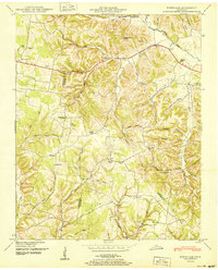 1950 Bodenham1950 Print · USGSGiles County in the years following World War II was a landscape of ridge-top farms and country schools. You can trace early property lines near New Prospect or locate family sites like Chestnut Grove Church and Copperas Sch.
 - 1950 Map of Colemen Gap
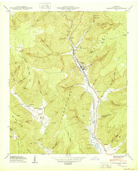
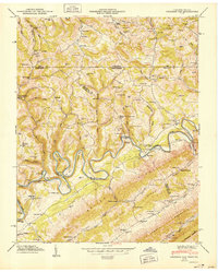 1950 Colemen Gap1950 Print · USGSThe Tennessee-Virginia state line follows the high ridges and winding river bends of the Appalachian borderlands just after the war. Researchers can locate family landmarks such as Yeary Mill, trace the Powell River through the Narrows, and find remote schools like Hoop Creek Sch.
 - 1950 Map of Eureka
 1950 Eureka1950 Print · USGSThe Alabama and Tennessee borderlands come alive in the late 1940s, showing a landscape defined by mountain gaps and valley railways. Genealogists can trace family names through the Willis Cem, Matthews Cem, and the community surrounding Helton Memorial Church.
 - 1950 Map of Kyles Ford
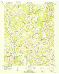
 1950 Kyles Ford1950 Print · USGSHancock County life in the mid-century is centered on the winding Clinch River and the rugged ridges of East Tennessee and Southwest Virginia. Researchers can locate family landmarks like Livesay Mill and numerous burial grounds including Testerman Cem and Sizemore Cem.
 - 1950 Map of Looneys Gap
 1950 Looneys Gap1950 Print · USGSThe Tennessee-Virginia borderlands in the 1940s are characterized by the steep ridges of Clinch Mountain and the deep bends of the Clinch River. Researchers can trace old mountain life through family sites like Sizemore Cem and rural schools like Wake Forest School.
 - 1950 Map of Obey City
 1950 Obey City1950 Print · USGSOverton County’s rugged plateau terrain is captured here in the post-war era as the Tennessee Central railroad served the mountain communities. Genealogists can trace family roots at Obey City, Hanging Limb, and numerous rural landmarks like Buckner Chapel or the Shaver Cem.
 - 1950 Map of Mount Pleasant
 1950 Mount Pleasant1950 Print · USGSMaury County at the peak of its mid-century phosphate mining era reveals a landscape shaped by industry and community. Trace family roots at Arlington Cem or explore established neighborhoods like Red Row and Frierson Town near the LOUISVILLE & NASHVILLE rail line.2 unique versions available
 - 1950 Map of Orme
 1950 Orme1950 Print · USGSMarion County at mid-century reveals a landscape of isolated coves and high plateau settlements tucked into the Cumberland Mountains. Genealogists and hikers can trace old family sites like the Thomas Cem or locate the remote Orme Mountain School and Lous Chapel.
 - 1950 Map of Osage
 1950 Osage1950 Print · USGSHenry County in the early fifties shows a landscape of established farmsteads and rural social centers. Genealogists can trace family names through dozens of landmarks like Central Point School, Oak Hill Church, and the Palestine Cem burial grounds.3 unique versions available
 - 1950 Map of Mingo Mountains
 1950 Mingo Mountains1950 Print · USGSThe Kentucky-Tennessee borderlands appear here at mid-century, capturing the coal-mining settlements and mountain hollows of the Appalachians. Researchers can trace family sites and local landmarks like Rising Spring Church, Manring, and Watson Cem.
 - 1950 Map of Paris
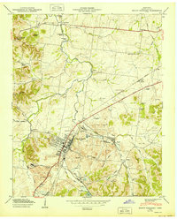
 1950 Paris1950 Print · USGSMid-century Paris, Tennessee, thrived as a vital railroad crossroads where two major lines intersected amidst the ridges of the Tennessee Valley Divide. Genealogists can trace family roots through numerous sites like Jones Chapel, Greenwood Cem, and the Nelson Sch.
 - 1950 Map of Helena
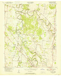
 1950 Helena1950 Print · USGSMid-century Phillips County and the surrounding Delta region are shown at a peak of rail and river commerce. Genealogists and historians can trace family locations through numerous rural communities like Old Austin, Cotton Plant, and West Helena, or follow the routes of the Missouri Pacific RR across Grand Prairie.2 unique versions available
 - 1950 Map of Tracy City
 1950 Tracy City1950 Print · USGSThe industrial and social landscape of the Cumberland Plateau is revealed in this mid-century survey of the Grundy County highlands. Local historians can trace the influence of the N C & S T L railroad on settlements like Coalmont and locate family landmarks such as Bonnie Oak Cem and Nunley Sch.
 - 1950 Map of Obion
 1950 Obion1950 Print · USGSObion County at the midpoint of the century shows a landscape transitioning between traditional river life and modern infrastructure. Genealogists can locate family-named sites such as Beard Cem, Rose Hill Cem, and the community around Englewood Ch.2 unique versions available
 - 1950 Map of White City
 1950 White City1950 Print · USGSThe Cumberland Plateau in the late 1940s is captured here in intricate detail, showing a landscape of deep coves and ridge-top settlements. Genealogists can trace family locations like Sides Place or Lankford Town, and find landmarks like Foster Falls Sch.
 - 1950 Map of Sinking Cove
 1950 Sinking Cove1950 Print · USGSFranklin County in the mid-century is a landscape of steep plateau hollows and valley rail towns. Local researchers can trace family landmarks like Sinking Cove School, Red Hill Cem, and the path of the Nashville Chattanooga and St Louis RR.
 - 1950 Map of Appleton
 1950 Appleton1950 Print · USGSGiles County in the late 1940s is captured here as a network of creek-side communities and family homesteads. Genealogists and local historians can trace legacy sites like the Sam Davis Monument, Minor Hill, and schools including Appleton Sch and Puncheon Sch.3 unique versions available
 - 1950 Map of Aspen Hill
 1950 Aspen Hill1950 Print · USGSGiles County at mid-century reveals a landscape of high ridges and deep hollows connected by the Louisville and Nashville railroad. You can trace early family roots through dozens of local identifiers like Davis Academy, Hanna Ch, and Mt Carmel Cem.3 unique versions available
 - 1950 Map of Whitwell
 1950 Whitwell1950 Print · USGSThe industrial and agricultural heart of Marion County is captured here in the mid-twentieth century as the Whitwell Mine overlooks the valley. Researchers can trace family sites at Ketner Mill, Victoria Sch, and the Mt Zion Cem.2 unique versions available
 - 1950 Map of Walterhill
 1950 Walterhill1950 Print · USGSMid-century Rutherford County comes to life through the winding forks of the river and the hallowed grounds of the Stones River National Military Park. Researchers can trace the old paths of Old Jefferson or locate family roots near Hickory Grove Ch and Burleson Cem.5 unique versions available
 - 1950 Map of Doran Cove
 1950 Doran Cove1950 Print · USGSJackson County, Alabama, is shown here as the post-war industrial era arrives along the Tennessee River. Researchers can trace family sites at Hackworth Cem, visit Coopers Mill, or locate the Widows Creek Steam Plant during its construction.2 unique versions available
 - 1950 Map of Palmer
 1950 Palmer1950 Print · USGSThe Cumberland Plateau coal mining district comes into focus mid-century as rail lines and mines reached into the coves. Genealogists and researchers can locate family sites like Layne Cem, the Palmer Mine, and the Tatesville Sch.2 unique versions available
 - 1950 Map of Campbell Junction
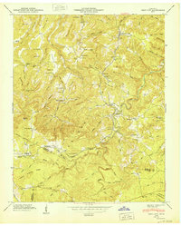
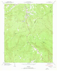
 1950 Campbell Junction1950 Print · USGSThe Cumberland Plateau in the mid-century is captured here as the Tennessee Central railroad snakes through the divide between Putnam and Cumberland counties. Family researchers can trace local roots through Welch Cem, Rains Cem, and settlements like Campbell Junction and The Cowpens.2 unique versions available
Showing maps 1-25
Top cities of Tennessee
- Nashville historical maps
- Memphis historical maps
- Knoxville historical maps
- Chattanooga historical maps
- Clarksville historical maps
- Murfreesboro historical maps
See more
Top counties of Tennessee
- Shelby County historical maps
- Davidson County historical maps
- Knox County historical maps
- Hamilton County historical maps
- Rutherford County historical maps
- Williamson County historical maps
See more
Frequently asked questions
- What are the different types of historical maps available for Tennessee?
- What is the oldest map of Tennessee?
- Where can I purchase historical maps of Tennessee for my home or office?
- Where can I download high-res historical maps of Tennessee?
- Are there historical topographic maps available for Tennessee?
- Is there historical aerial imagery available for Tennessee?
- Where are historical maps of Tennessee sourced from?