1970s Maps of Tennessee
Explore 131 historic maps of Tennessee from the 1970s. These maps offer a rare glimpse into what life looked like during the 1970s — showing old roads, neighborhoods, homes, and landmarks that have changed or disappeared over time.
Whether you're researching your family's past, planning a metal detecting trip, or studying how Tennessee's landscape evolved across the 1970s, these high-resolution maps are a powerful tool for exploring the history of this region.
- Focus on a specific era: All maps on this page are from the 1970s, giving you a focused view of this time period.
- See what’s changed: Compare century-old streets, trails, and buildings to today's modern landscape using overlays and satellite layers.
- Research with precision: Use these maps for genealogy, historical research, land use analysis, or educational projects.
- View, download, or print: Maps are fully viewable online in high resolution, and can be downloaded or printed for your own records.
Start exploring Tennessee's history through authentic maps from the 1970s. This is your window into the past.
Tennessee maps
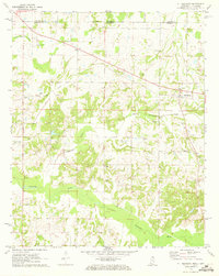
(131)- 1970 Map of Brownsville
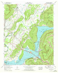
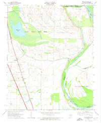
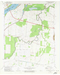
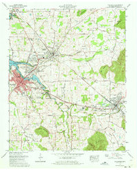
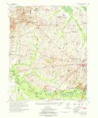 1970 Brownsville1970 Print · USGSHaywood County in the late sixties and early seventies is defined by its deep river bottomlands and scattered rural crossroads. Genealogists and researchers can trace family landmarks and vanished schools like Nutbush, Durhamville, and the Flag Grove Sch.
 - 1970 Map of Bells
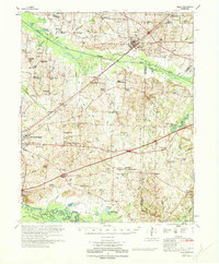 1970 Bells1970 Print · USGSWest Tennessee river bottoms and upland farms come alive in this 1970s survey of the Haywood and Crockett county border. Researchers can trace historic family burial sites at Magnolia Cem and Hess Cem or locate vanished local schools such as Bradford Sch.
 - 1970 Map of Jellico East, 1972 Print
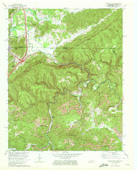 1970 Jellico East1972 Print · USGSThe Tennessee-Kentucky border comes alive in the early seventies, showing a landscape defined by coal mining and mountain rail lines. Genealogists and historians can trace families near Jellico, locate the Boston Sch, or find rural sites like Habersham and Walnut Grove Ch.3 unique versions available
 - 1970 Map of Hooker, 1972 Print
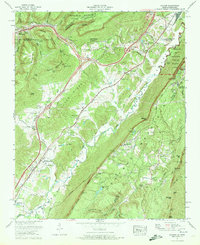 1970 Hooker1972 Print · USGSThe Tennessee-Georgia borderlands come to life in the early seventies, where the massive profiles of Lookout Mountain and Raccoon Mountain meet. Genealogists and local historians can trace family-named sites like Bates Cem, Sarah Chapel, and the small community of New England.
 - 1970 Map of Wauhatchie, 1972 Print
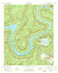 1970 Wauhatchie1972 Print · USGSThe Tennessee River loops around Raccoon Mountain during the early seventies as new energy infrastructure begins to reshape the riverbank. Genealogists and hikers can trace family sites like McNabb Cem or explore landmarks such as Crystal Cave and Suck Shoals.3 unique versions available
 - 1970 Map of Hickman, 1972 Print
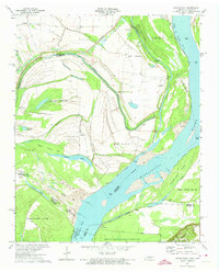
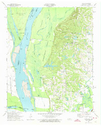
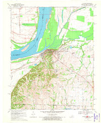 1970 Hickman1972 Print · USGSThe riverfront at Hickman and the surrounding Kentucky-Tennessee borderlands are shown here during the early seventies. Genealogists and local historians can trace family sites at Hubbard Cem, visit Anna Lynne, or follow the Illinois Central Railroad line.2 unique versions available
 - 1970 Map of Cayce, 1972 Print
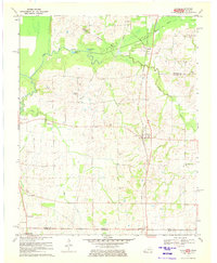 1970 Cayce1972 Print · USGSThe West Kentucky borderlands are documented here in 1970, centered on the rail-aligned settlements of Cayce and Moscow. Genealogists and historians can trace numerous family burial sites and rural congregations like Johnson Cem and Liberty Ch.2 unique versions available
 - 1970 Map of New Home, 1972 Print
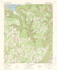 1970 New Home1972 Print · USGSThe tri-state border of Georgia, Alabama, and Tennessee comes alive in the early seventies as the Tennessee River valley meets the coal-rich ridges. Genealogists and historians can trace family roots at Reeves Cem or Stephens Cem, and locate landmarks like Nickajack Cave and Cole City.2 unique versions available
 - 1970 Map of Sequatchie, 1972 Print
 1970 Sequatchie1972 Print · USGSThe Tennessee River valley south of Jasper is captured here in the early seventies, showing a landscape defined by major TVA reservoirs. Genealogists and researchers can locate family landmarks like Old Union Grove Cem or trace the site of the Hales Bar Dam.2 unique versions available
 - 1970 Map of Drummonds, 1973 Print
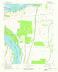
 1970 Drummonds1973 Print · USGSTipton County in the early seventies shows a landscape of ridge-top settlements and river bottomlands. Genealogists can locate family landmarks like Poplar Grove Cem, Mt Harmon Jerusalem Ch, and the rural community of Quito.3 unique versions available
 - 1970 Map of Frenchmans Bayou, 1974 Print
 1970 Frenchmans Bayou1974 Print · USGSThe Arkansas-Tennessee borderlands appear here in the early 1970s, defined by the river’s winding chutes and protected agricultural bottoms. Researchers can locate vanished rural landmarks like St Pauls Ch, Shawnee Sch, and the riverside community of Lambethville.2 unique versions available
 - 1970 Map of Pecan Point, 1974 Print
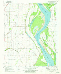
 1970 Pecan Point1974 Print · USGSThe Tennessee-Arkansas borderlands along the Mississippi River are captured here just as modern flood control was maturing. Genealogists and river historians can locate vanished river landings and remote burial sites like Black Cat Landing, Corona, and Jacob Cem.2 unique versions available
 - 1970 Map of Jericho, 1974 Print
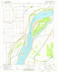
 1970 Jericho1974 Print · USGSCrittenden County, Arkansas, and the Mississippi riverfront appear in the 1970s as a managed landscape of agriculture and wildlife preservation. Family historians can trace small-town life in Jericho and Clarkedale, or locate rural markers like Malone Cem and New Mt Zion Ch.2 unique versions available
 - 1970 Map of Locke, 1974 Print
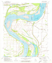
 1970 Locke1974 Print · USGSThe river bluffs of Shelby County are captured here in the early seventies, where state forest lands meet the shifting Mississippi. Researchers can trace rural life and riverside labor through features like Giles Town, Benjestown Cem, and Brandywine Landing.2 unique versions available
 - 1971 Map of Teague
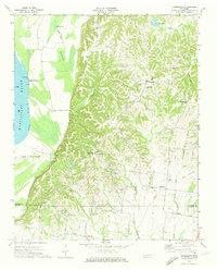
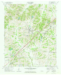
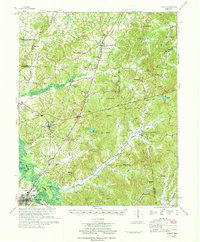 1971 Teague1971 Print · USGSThe Hatchie River lowlands and the uplands of Chickasaw State Park are captured here in the early seventies. Genealogists and historians can trace rail-side communities like Medon and Toone or locate family sites like Maple Springs Cem and Toone Sch.
 - 1971 Map of Whiteville
 1971 Whiteville1971 Print · USGSWest Tennessee’s river-bottom country is captured here in the early seventies, centered on the Hatchie River and its vast wetlands. Genealogists can trace family names through dozens of rural landmarks like Hayes Chapel Cem, Rubens Sch, and the Western State Hospital grounds.
 - 1971 Map of Caruthersville SE, 1972 Print
 1971 Caruthersville SE1972 Print · USGSThe Mississippi River bottomlands of Dyer County come to life in this early 1970s survey of the Tennessee-Missouri border. Researchers can trace the rural landscape through family-centric hubs like Boothspoint, Mengelwood, and the Emmanuel Ch cemetery and church site.2 unique versions available
 - 1971 Map of Tennemo, 1972 Print
 1971 Tennemo1972 Print · USGSThe Mississippi River bottoms of Lake County come into focus during the early 1970s, showing a landscape defined by levees and drainage bayous. Researchers can trace the layout of riverside hamlets like Tennemo and Owl Hoot, or locate the Cottonwood Ch near the Tennessee-Missouri border.2 unique versions available
 - 1971 Map of Caruthersville, 1973 Print
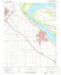 1971 Caruthersville1973 Print · USGSThe Mississippi River levee system and early interstate expansion define this riverfront area in the early seventies. Trace local genealogy and industry through Magnolia Cem, the Indian Mound, and the busy St Louis Southwestern rail lines.3 unique versions available
 - 1971 Map of Munford, 1973 Print
 1971 Munford1973 Print · USGSWest Tennessee rural life centers on the rail corridor between Munford and Atoka in the early seventies. Genealogists can trace family roots through numerous local landmarks like Ellis Sch, St Marks Ch, and the Adams Cem.3 unique versions available
 - 1971 Map of Winchester, 1973 Print
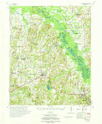
 1971 Winchester1973 Print · USGSFranklin County at the start of the seventies reveals a landscape transformed by the new Tims Ford Lake and steady town growth. Trace the heritage of Winchester and Decherd through local landmarks like Cedar Bluff Mill, Owens Chapel, and the Louisville and Nashville rail lines.
 - 1971 Map of Point Pleasant, 1973 Print
 1971 Point Pleasant1973 Print · USGSThe Missouri-Tennessee borderlands in the early 1970s reveal a landscape of river-town life and family burial grounds along the Mississippi River. Researchers can trace local roots at Le Sieur Cem, Lily of the Valley Ch, and the ferry crossing at Linda.2 unique versions available
 - 1971 Map of Cottonwood Point, 1973 Print
 1971 Cottonwood Point1973 Print · USGSThe Missouri Bootheel and western Tennessee meet along the shifting banks of the Mississippi River in the early 1970s. Researchers can locate small communities like Cottonwood Point and Heloise, alongside family landmarks such as Taylor Cem and Riverside Ch.2 unique versions available
 - 1971 Map of Mooring, 1973 Print
 1971 Mooring1973 Print · USGSThe Mississippi River forms a complex boundary between Missouri and Tennessee in the early 1970s, carving a landscape of shifting towheads and chutes. Researchers can find historical river access points and family sites such as Burrus Landing, Mooring Cem, and Island No 13.2 unique versions available
 - 1971 Map of Mt. Pleasant, 1973 Print
 1971 Mt. Pleasant1973 Print · USGSThe Tennessee-Mississippi borderlands appear here in the early 1970s, showing a rural landscape of small churches and family burial sites. Researchers can trace local history through features like Mt Pleasant, Carey Chapel, and Carington Cem along the Coldwater River.
Showing maps 1-25 of 131
Top cities of Tennessee
- Nashville historical maps
- Memphis historical maps
- Knoxville historical maps
- Chattanooga historical maps
- Clarksville historical maps
- Murfreesboro historical maps
See more
Top counties of Tennessee
- Shelby County historical maps
- Davidson County historical maps
- Knox County historical maps
- Hamilton County historical maps
- Rutherford County historical maps
- Williamson County historical maps
See more
Frequently asked questions
- What are the different types of historical maps available for Tennessee?
- What is the oldest map of Tennessee?
- Where can I purchase historical maps of Tennessee for my home or office?
- Where can I download high-res historical maps of Tennessee?
- Are there historical topographic maps available for Tennessee?
- Is there historical aerial imagery available for Tennessee?
- Where are historical maps of Tennessee sourced from?