1960s Maps of Tennessee
Explore 648 historic maps of Tennessee from the 1960s. These maps offer a rare glimpse into what life looked like during the 1960s — showing old roads, neighborhoods, homes, and landmarks that have changed or disappeared over time.
Whether you're researching your family's past, planning a metal detecting trip, or studying how Tennessee's landscape evolved across the 1960s, these high-resolution maps are a powerful tool for exploring the history of this region.
- Focus on a specific era: All maps on this page are from the 1960s, giving you a focused view of this time period.
- See what’s changed: Compare century-old streets, trails, and buildings to today's modern landscape using overlays and satellite layers.
- Research with precision: Use these maps for genealogy, historical research, land use analysis, or educational projects.
- View, download, or print: Maps are fully viewable online in high resolution, and can be downloaded or printed for your own records.
Start exploring Tennessee's history through authentic maps from the 1960s. This is your window into the past.
Tennessee maps
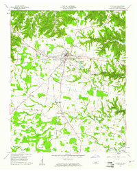
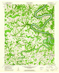
- 1960 Map of Gadsden
 1960 Gadsden1960 Print · USGSNorthern Alabama in the mid-1950s is defined by the mighty Tennessee River and its massive reservoirs. Trace the development of Huntsville and Redstone Arsenal or explore the vast William B Bankhead National Forest.2 unique versions available
 - 1960 Map of Knoxville
 1960 Knoxville1960 Print · USGSThe Southern Appalachians come alive in the 1950s, showing the intersection of new national park tourism and deep-rooted mountain industry. Trace old rail lines like the Clinchfield RR and find high-altitude landmarks from Mt Le Conte to the Cherokee Indian Reservation.2 unique versions available
 - 1960 Map of Johnson City
 1960 Johnson City1960 Print · USGSUpper East Tennessee and the surrounding tri-state area are shown in the mid-fifties during the height of the TVA reservoir era. Trace the industrial rail lines of the Southern and Louisville and Nashville between Kingsport and Johnson City.
 - 1960 Map of Chattanooga
 1960 Chattanooga1960 Print · USGSSoutheast Tennessee and the southern Appalachians are shown here at the height of the river-management era. You can trace the valley rail lines and locate Lookout Mountain and the expansive waters of Chickamauga Reservoir.
 - 1960 Map of Helena
 1960 Helena1960 Print · USGSThe Arkansas and Mississippi Delta regions meet along the great river bends during a period of significant agricultural and rail expansion. Genealogists and historians can trace the paths of the Missouri Pacific railroad through Clarendon or locate landings along the Mississippi River and White River.
 - 1960 Map of Short Mountain, 1961 Print
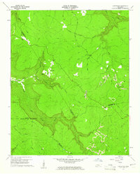
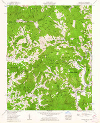
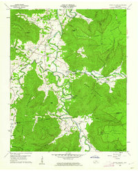
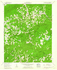
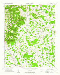 1960 Short Mountain1961 Print · USGSThe rural uplands of Middle Tennessee come alive in this mid-century survey of the Cannon County highlands. Genealogists and local researchers can trace family landmarks like Grizzly Gunter Cem, Bratchers Crossroads, and the remote Osment Chapel.2 unique versions available
 - 1960 Map of Welchland, 1961 Print
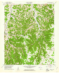
 1960 Welchland1961 Print · USGSIn the early sixties, the Rocky River corridor defined the border and lifestyle of the Van Buren and Warren County line. Local historians can trace family roots at Drake Cem, find the site of Welchland School, or locate the Quarry near White Hill.2 unique versions available
 - 1960 Map of Sligo Bridge, 1961 Print
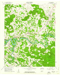
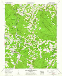
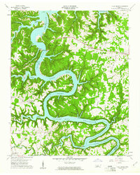 1960 Sligo Bridge1961 Print · USGSThe rising waters of the Caney Fork valley define the rural landscape of DeKalb and White Counties at the dawn of the 1960s. Researchers can trace deep family roots through dozens of local landmarks like Johnsons Chapel, Peeled Chestnut, and the Taylor Providence Cem.4 unique versions available
 - 1960 Map of Dibrell, 1961 Print
 1960 Dibrell1961 Print · USGSWarren and De Kalb counties are captured here in the early sixties, showing a rural landscape of family farms and creek-side settlements. Genealogists can locate legacy sites like Bildad Ch, Woods Cem, and the communities of Dibrell and Earleyville.3 unique versions available
 - 1960 Map of Smithville, 1961 Print
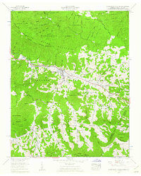
 1960 Smithville1961 Print · USGSSmithville and the surrounding DeKalb County highlands are captured here in the early sixties as the regional landscape adjusted to the Center Hill Reservoir. Genealogists and local historians can locate numerous rural landmarks like Jacobs Pillar Ch, Martins Chapel, and the Evins Mill Pond.3 unique versions available
 - 1960 Map of Curtistown, 1961 Print
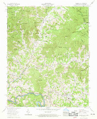
 1960 Curtistown1961 Print · USGSThe Tennessee Plateau at the start of the 1960s reveals a landscape defined by isolated settlements and a rugged river-carved geography. Researchers can trace rural lineages at Pleasant Hill Cem or explore the mid-century industrial footprint of Strip Mines and the Old Target Area.3 unique versions available
 - 1960 Map of Gassaway, 1961 Print
 1960 Gassaway1961 Print · USGSDeKalb and Cannon counties were defined by deep hollows and high ridges during the mid-century. Genealogists can trace family landmarks and rural centers like Gassaway, Mt Pisgah Ch, and Beech Hill Cem among the numerous caves and springs.3 unique versions available
 - 1960 Map of Doyle, 1961 Print
 1960 Doyle1961 Print · USGSWhite and Van Buren counties are captured here in the early sixties, as the Caney Fork and Rocky River meet at the headwaters of the reservoir. Genealogists can locate family landmarks like Simrell Cem, O'Neal Cem, and the rural community at Bone Cave.4 unique versions available
 - 1960 Map of Campaign, 1961 Print
 1960 Campaign1961 Print · USGSThe rural crossing at the junction of the Caney Fork and Collins River is captured here in the early sixties as the reservoir system shaped the landscape. Genealogists can locate family landmarks like Friendship Cem and rural centers such as Campaign and Keltonburg.4 unique versions available
 - 1960 Map of Cassville, 1961 Print
 1960 Cassville1961 Print · USGSWhite County life in the early sixties is preserved here through its network of highland ridges and valley settlements. Genealogists can trace family roots at Hutchins College or locate the Black Oak Cems near the historic Old Kentucky Road.3 unique versions available
 - 1960 Map of Bakersville, 1962 Print
 1960 Bakersville1962 Print · USGSMitchell County mountain life in the early sixties centers on the river valleys and high gaps of the Blue Ridge. Genealogists can trace family lines across dozens of small cemeteries and remote settlements like Loafers Glory, Toecane, and Buladean.3 unique versions available
 - 1960 Map of Carvers Gap, 1962 Print
 1960 Carvers Gap1962 Print · USGSThe high country of the North Carolina and Tennessee border is captured here during the early sixties, showing the Appalachian Trail as it crosses Roan Mountain. Researchers can locate family landmarks like the Ollis Cem, Glen Ayre school, and Burleson Chapel.2 unique versions available
 - 1960 Map of Irving College, 1962 Print
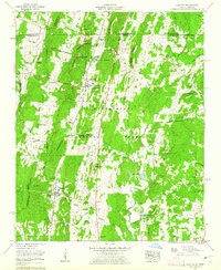
 1960 Irving College1962 Print · USGSThe Collins River valley in Warren County comes to life in the early 1960s, showing a landscape defined by riverside settlements and high timbered ridges. Researchers can locate remote landmarks like Badger Mine, Camp Woodlee, and rural churches such as Philadelphia Ch.4 unique versions available
 - 1960 Map of Holston Valley, 1962 Print
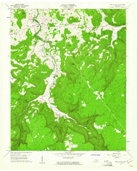
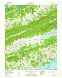
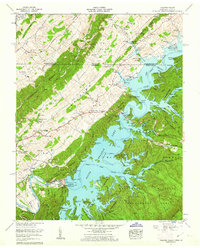 1960 Holston Valley1962 Print · USGSSullivan County and the Virginia borderland are shown here at a moment when the recently completed South Holston Dam had transformed the river valley. Genealogists and historians can locate old landmarks like Scalf Cemetery, Sinking Spring Church, and the Bristol Caverns.4 unique versions available
 - 1960 Map of Cohutta, 1962 Print
 1960 Cohutta1962 Print · USGSWhitfield County and the Georgia-Tennessee border are detailed here in the early sixties, showing a landscape of forest ridges and rail-side towns. Genealogists can locate family landmarks like Prater Mill, South Cohutta Ch, and the Hoskins Cem.3 unique versions available
 - 1960 Map of Shady Valley, 1962 Print
 1960 Shady Valley1962 Print · USGSShady Valley and the Iron Mountains are captured here in the early sixties, showing a high Appalachian basin defined by family farms and forest management. Researchers can trace family roots at Potter Cem and Crosswhite Cem or locate the old Shady Valley Sch.4 unique versions available
 - 1960 Map of Iron Mountain Gap, 1962 Print
 1960 Iron Mountain Gap1962 Print · USGSThe Tennessee and North Carolina borderlands are captured here during the mid-century, showing the deeply rooted mountain communities of Carter and Unicoi counties. Genealogists can locate numerous family cemeteries and remote sites like Woodby Hill, Little Mountain Sch, and the Appalachian Trail.4 unique versions available
 - 1960 Map of Elk Park, 1962 Print
 1960 Elk Park1962 Print · USGSThe high country of the North Carolina-Tennessee border is shown here during a period of transition in the early sixties. Genealogists and historians can trace family roots through numerous landmarks like Cranberry Mines, Lees-McRae College, and the Pritchard Cemetery.3 unique versions available
 - 1960 Map of White Rocks Mountain, 1962 Print
 1960 White Rocks Mountain1962 Print · USGSHigh-altitude settlements and rugged border ridges define the landscape around the Tennessee and North Carolina line in the early sixties. Genealogists and hikers can trace the Appalachian Trail as it passes through Roan Mountain and past local landmarks like Cloudland High School and Magill Memorial Ch.3 unique versions available
 - 1960 Map of Avondale, 1962 Print
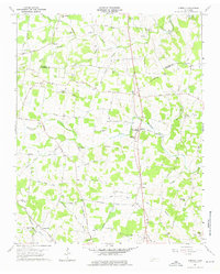
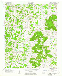
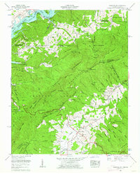
 1960 Avondale1962 Print · USGSGrainger County is shown here at the start of the 1960s, defined by the towering ridges and the rising waters of the TVA reservoirs. Researchers can trace rural lineages through the numerous family cemeteries and local landmarks like Thorn Hill Sch, Avondale Springs, and Dotson.
Showing maps 1-25
Top cities of Tennessee
- Nashville historical maps
- Memphis historical maps
- Knoxville historical maps
- Chattanooga historical maps
- Clarksville historical maps
- Murfreesboro historical maps
See more
Top counties of Tennessee
- Shelby County historical maps
- Davidson County historical maps
- Knox County historical maps
- Hamilton County historical maps
- Rutherford County historical maps
- Williamson County historical maps
See more
Frequently asked questions
- What are the different types of historical maps available for Tennessee?
- What is the oldest map of Tennessee?
- Where can I purchase historical maps of Tennessee for my home or office?
- Where can I download high-res historical maps of Tennessee?
- Are there historical topographic maps available for Tennessee?
- Is there historical aerial imagery available for Tennessee?
- Where are historical maps of Tennessee sourced from?