1990s Maps of Tennessee
Explore 51 historic maps of Tennessee from the 1990s. These maps offer a rare glimpse into what life looked like during the 1990s — showing old roads, neighborhoods, homes, and landmarks that have changed or disappeared over time.
Whether you're researching your family's past, planning a metal detecting trip, or studying how Tennessee's landscape evolved across the 1990s, these high-resolution maps are a powerful tool for exploring the history of this region.
- Focus on a specific era: All maps on this page are from the 1990s, giving you a focused view of this time period.
- See what’s changed: Compare century-old streets, trails, and buildings to today's modern landscape using overlays and satellite layers.
- Research with precision: Use these maps for genealogy, historical research, land use analysis, or educational projects.
- View, download, or print: Maps are fully viewable online in high resolution, and can be downloaded or printed for your own records.
Start exploring Tennessee's history through authentic maps from the 1990s. This is your window into the past.
Tennessee maps
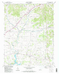
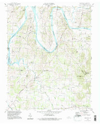
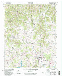
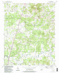
- 1990 Map of Helena, 1991 Print
 1990 Helena1991 Print · USGSThe Arkansas and Mississippi delta regions meet here in the 1990s, where the great river's oxbows and islands define the state line. Genealogists and historians can trace the rail networks of the Illinois Central Gulf RR and local settlements like Palestine, Marvell, and La Grange.
 - 1994 Map of Corinth
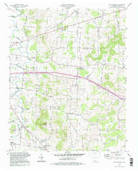
 1994 Corinth1994 Print · USGSNortheast Mississippi and the Tennessee borderlands are captured in the mid-1990s as the region's modern industrial and recreational landscape took shape. Genealogists and historians can trace rail-to-river connections through Corinth, the old courthouse at Jacinto, and the route of the Natchez Trace Parkway.
 - 1994 Map of Bethpage, 1997 Print
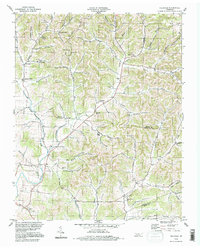
 1994 Bethpage1997 Print · USGSSumner and Trousdale counties are shown in the mid-nineties, a period when the rural landscape between Bethpage and Castalian Springs remained largely intact. Researchers can trace the Old Railroad Grade and locate long-standing community landmarks like Old Union Ch and Durham Chapel Sch.
 - 1994 Map of Whites Creek, 1997 Print
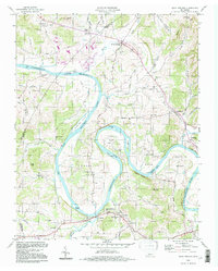
 1994 Whites Creek1997 Print · USGSNorth of Nashville in the mid-1990s, the hollows and ridges of the Highland Rim remained a patchwork of small communities and family landmarks. Genealogists and local historians can trace the foundations of Joelton and Whites Creek or locate historic sites like Walkers Ch and Alex Green Sch.
 - 1994 Map of Watertown, 1997 Print
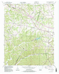
 1994 Watertown1997 Print · USGSWilson County's rural landscape is captured here in the mid-nineties, showing a network of ridge-and-hollow settlements. Researchers can trace family history through sites like Doaks Crossroads, Norene Sch, and the Smith Fork Cem Ch.
 - 1994 Map of Carvers Gap, 1997 Print
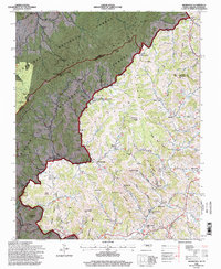
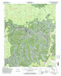
 1994 Carvers Gap1997 Print · USGSThe high North Carolina and Tennessee borderlands are captured here in the mid-nineties as the wilderness and rural communities intersected. Researchers can trace family sites like Hobson Cem, Plumtree, and Roaring Creek Ch along the base of Roan Mountain.
 - 1994 Map of Bellwood, 1997 Print
 1994 Bellwood1997 Print · USGSThe river bends and rural uplands of the Wilson and Trousdale county lines are shown here during the late twentieth century. Researchers can trace family sites from Centerville to Taylorsville, alongside landmarks like Dickerson Chapel and Tomlinson Cem.
 - 1994 Map of Shop Springs, 1997 Print
 1994 Shop Springs1997 Print · USGSWilson County in the mid-nineties remained a landscape of quiet crossroads and historic congregation sites. Genealogists and local researchers can trace family landmarks like Linwood Cem, Shop Springs, and numerous churches from Grissim Ch to Bethlehem Ch.
 - 1994 Map of Hillsdale, 1997 Print
 1994 Hillsdale1997 Print · USGSThe rural borders of Macon and Trousdale counties come into focus in the mid-1990s, revealing a landscape of family-named hollows and ridge-top settlements. Genealogists and local researchers can trace historic community hubs like Hillsdale, Horsleys, and Beech Hill alongside numerous unnamed cemeteries and local landmarks.
 - 1994 Map of Dixon Springs, 1997 Print
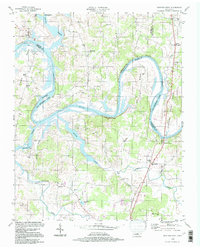
 1994 Dixon Springs1997 Print · USGSThe Cumberland River bends through Smith County in the 1990s, where reservoir waters have reshaped the valley floor. Genealogists can locate family landmarks like Piper-Hughes Cem, Chapel Hill Ch, and the rural settlement of Dixon Springs.
 - 1994 Map of Hartsville, 1997 Print
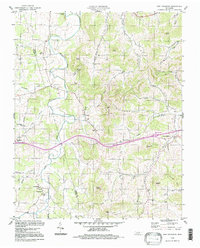
 1994 Hartsville1997 Print · USGSHartsville and the surrounding Trousdale County countryside are shown here in the mid-nineties, just north of the Cumberland River. Researchers can trace rural lineages through landmarks like Leaths Chapel, Willow Grove Cem, and the old Ward High Sch.
 - 1994 Map of Cottontown, 1997 Print
 1994 Cottontown1997 Print · USGSSumner County in the mid-nineties remains a landscape of deep family roots and rural crossroads. Researchers can trace historic sites like the Sumner County Home, Fairmont Sch, and numerous family plots such as the Pitt-Bursby Cem.
 - 1994 Map of New Middleton, 1997 Print
 1994 New Middleton1997 Print · USGSThe Tennessee interior during the mid-1990s reveals a quiet landscape of agricultural valleys and family-named knobs along the Wilson Co Smith Co line. Local history enthusiasts can trace the rural communities of New Middleton and Grant alongside landmarks like Rawls Creek Ch and Bethlehem Cem.
 - 1994 Map of Hunters Point, 1997 Print
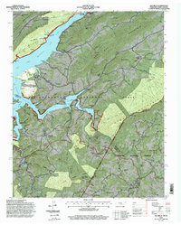
 1994 Hunters Point1997 Print · USGSThe Cumberland River loops through Wilson and Sumner counties in the mid-1990s, where old oxbows meet the modern waters of Old Hickory Lake. Researchers can trace early settlements at Cairo and Macedonia, or locate rural landmarks like Carroll Sch and the Nathan J Harsh Bridge.
 - 1994 Map of Vine, 1997 Print
 1994 Vine1997 Print · USGSThe Wilson and Rutherford county borderlands appear in the mid-nineties as a landscape of dense state forests and scattered rural hamlets. Researchers can trace family landmarks like Jacobs Hill Ch, find the old crossing at Bairds Mill, or explore Hermit Cave.
 - 1994 Map of Forest Grove, 1997 Print
 1994 Forest Grove1997 Print · USGSThe hills of Cheatham and Davidson Counties are captured here in the mid-nineties, showing a landscape of rural ridges and developing communities. Researchers can trace the heritage of local settlements through landmarks like Paines Chapel, Morny Sch, and the winding Old Clarksville Pike.
 - 1994 Map of Elk Park, 1998 Print
 1994 Elk Park1998 Print · USGSThe high country of the North Carolina-Tennessee border comes into focus in the mid-nineties, showing a landscape shaped by mining, education, and steep terrain. Genealogists can locate family landmarks like McGuire Cemetery and the Cranberry Mines or the campus of Lees-McRae College.
 - 1994 Map of Elk Mills, 1998 Print
 1994 Elk Mills1998 Print · USGSThe Tennessee-North Carolina border country in the 1990s reveals a landscape of isolated mountain settlements and Forest Service wilderness. Trace local genealogy and industry through family landmarks like Grindstaff Cemetery, Stout Hill Church, and the Strip Mine near Dry Run.
 - 1994 Map of Sherwood, 1998 Print
 1994 Sherwood1998 Print · USGSWatauga County high country life is centered on crossroads like Sherwood and Sugar Grove during the 1990s. Genealogists can trace family names through landmarks like Henson Hollow and locate historic sites such as Beaverdam Sch and Zion Hill Ch.
 - 1994 Map of White Rocks Mountain, 1998 Print
 1994 White Rocks Mountain1998 Print · USGSThe Tennessee-North Carolina borderlands come alive in this 1990s survey, showing the mountain communities and high ridges as they appeared at the end of the century. Trace family roots and local landmarks through sites like the Cloudland High School, Sunrise View Church, and Birchfield Cemetery.
 - 1996 Map of Pleasant Hill, 2001 Print
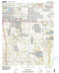 1996 Pleasant Hill2001 Print · USGSDeSoto County at the turn of the millennium shows the transition from rural crossroads to suburban expansion south of the state line. Genealogists and local historians can trace family locations near Pleasant Hill, Nesbitt, and the old Welch Sta.
 - 1997 Map of Germantown, 1999 Print
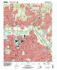
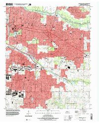 1997 Germantown1999 Print · USGSThe eastern suburbs of Shelby County show significant residential and educational development in the late nineties as Memphis expanded toward Germantown. Researchers can locate family sites near Polk Chapel, the Memphis Memorial Park Cemetery, and established schools such as Lausanne Sch.
 - 1997 Map of Northwest Memphis, 1999 Print
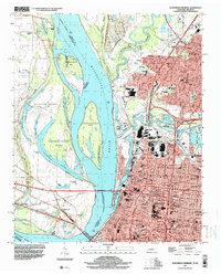 1997 Northwest Memphis1999 Print · USGSThe riverfront and urban expansion of Memphis meet the Arkansas shoreline in the late nineties, documenting a landscape of critical bridges and historic neighborhoods. Genealogists and historians can trace schools and landmarks like Owen College, Green Hill Cem, and St Johns Ch.
 - 1997 Map of Northeast Memphis, 1999 Print
 1997 Northeast Memphis1999 Print · USGSNortheast Memphis and Bartlett are captured here during a period of significant suburban integration and industrial activity in the late nineties. Genealogists and historians can trace institutional roots at the Memphis National Cemetery, Bojo Town, and Spring Hill Cem.
 - 1997 Map of Altamont, 1999 Print
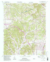
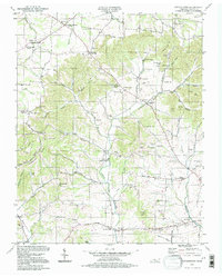
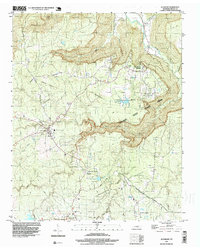 1997 Altamont1999 Print · USGSThe Cumberland Plateau during the late nineties reveals a landscape of high-elevation settlements and deep gorges. Genealogists and researchers can trace family landmarks like Killians Chapel, Beersheba Springs Cem, and the industrial footprint of Strip Mines near Coalmont.
Showing maps 1-25
Top cities of Tennessee
- Nashville historical maps
- Memphis historical maps
- Knoxville historical maps
- Chattanooga historical maps
- Clarksville historical maps
- Murfreesboro historical maps
See more
Top counties of Tennessee
- Shelby County historical maps
- Davidson County historical maps
- Knox County historical maps
- Hamilton County historical maps
- Rutherford County historical maps
- Williamson County historical maps
See more
Frequently asked questions
- What are the different types of historical maps available for Tennessee?
- What is the oldest map of Tennessee?
- Where can I purchase historical maps of Tennessee for my home or office?
- Where can I download high-res historical maps of Tennessee?
- Are there historical topographic maps available for Tennessee?
- Is there historical aerial imagery available for Tennessee?
- Where are historical maps of Tennessee sourced from?