Old Maps of Tennessee
Explore 2,164 old maps of Tennessee, spanning from 1883 to today. These high-resolution historic maps reveal how streets, neighborhoods, landmarks, and natural features evolved over time — perfect for genealogy, metal detecting, research, and local history exploration.
What you can do with these maps:
- See how Tennessee changed over time: Compare historical maps to modern-day views to trace roads, homesites, rail lines & more.
- View detailed metadata: Each map includes creators, publishers, year, scale, and archive source.
- Overlay maps with satellite & LiDAR: Visualize the past alongside modern tools to explore terrain & human change.
- Trusted historical sources: Maps sourced from the USGS, Library of Congress, and other archives.
- Access maps your way: View online, download high-res files, or order prints for personal or research use.
Start exploring old maps of Tennessee to uncover forgotten places, hidden landmarks, and the deep history beneath your feet.
Tennessee maps
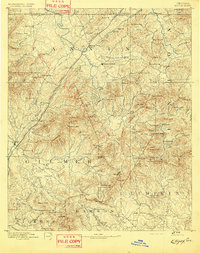
(2,164)- 1883 Map of Morristown
 1883 Morristown1883 Print · USGSCovers Tennessee, including Morristown, Jefferson City, and other nearby areas
 - 1886 Map of Dalton
 1886 Dalton1886 Print · USGSCovers Tennessee, including Dalton, Calhoun, and other nearby areas
 - 1886 Map of Cleveland
 1886 Cleveland1886 Print · USGSCovers Tennessee, including Cleveland, Athens, and other nearby areas
 - 1886 Map of Knoxville
 1886 Knoxville1886 Print · USGSCovers Tennessee, including Knoxville, Maryville, and other nearby areas
 - 1886 Map of Ringgold
 1886 Ringgold1886 Print · USGSCovers Tennessee, including Chattanooga, Dalton, and other nearby areas
 - 1886 Map of Stevenson
 1886 Stevenson1886 Print · USGSCovers Tennessee, including Scottsboro, Fort Payne, and other nearby areas
 - 1886 Map of Cumberland Gap
 1886 Cumberland Gap1886 Print · USGSCovers Tennessee, including Middlesboro, Harrogate, and other nearby areas
 - 1887 Map of Kingston
 1887 Kingston1887 Print · USGSCovers Tennessee, including Athens, Crossville, and other nearby areas
 - 1887 Map of Jonesville
 1887 Jonesville1887 Print · USGSCovers Tennessee, including Cumberland, Harlan, and other nearby areas
 - 1888 Map of Cumberland Gap
 1888 Cumberland Gap1888 Print · USGSCovers Tennessee, including Middlesboro, Harrogate, and other nearby areas
 - 1888 Map of Ellijay
 1888 Ellijay1888 Print · USGSCovers Tennessee, including Dahlonega, Ellijay, and other nearby areas
 - 1888 Map of Chattanooga
 1888 Chattanooga1888 Print · USGSCovers Tennessee, including Chattanooga, East Ridge, and other nearby areas
 - 1888 Map of Scottsboro
 1888 Scottsboro1888 Print · USGSCovers Tennessee, including Huntsville, Scottsboro, and other nearby areas
 - 1888 Map of Huntsville
 1888 Huntsville1888 Print · USGSCovers Tennessee, including Huntsville, Decatur, and other nearby areas
 - 1890 Map of Williamsburg
 1890 Williamsburg1890 Print · USGSCovers Tennessee, including Corbin, Williamsburg, and other nearby areas2 unique versions available
 - 1891 Map of Cumberland Gap
 1891 Cumberland Gap1891 Print · USGSCovers Tennessee, including Middlesboro, Harrogate, and other nearby areas7 unique versions available
 - 1891 Map of Kingston
 1891 Kingston1891 Print · USGSCovers Tennessee, including Athens, Crossville, and other nearby areas2 unique versions available
 - 1891 Map of Roan Mountain
 1891 Roan Mountain1891 Print · USGSCovers Tennessee, including Johnson City, Kingsport, and other nearby areas
 - 1891 Map of Abingdon
 1891 Abingdon1891 Print · USGSCovers Tennessee, including Abingdon, Marion, and other nearby areas
 - 1891 Map of Jonesville
 1891 Jonesville1891 Print · USGSCovers Tennessee, including Cumberland, Harlan, and other nearby areas9 unique versions available
 - 1892 Map of Pikeville
 1892 Pikeville1892 Print · USGSCovers Tennessee, including Crossville, Dayton, and other nearby areas
 - 1892 Map of Ringgold
 1892 Ringgold1892 Print · USGSCovers Tennessee, including Chattanooga, Dalton, and other nearby areas9 unique versions available
 - 1892 Map of Cleveland
 1892 Cleveland1892 Print · USGSCovers Tennessee, including Cleveland, Athens, and other nearby areas
 - 1892 Map of Ellijay
 1892 Ellijay1892 Print · USGSCovers Tennessee, including Dahlonega, Ellijay, and other nearby areas2 unique versions available
 - 1892 Map of Greeneville
 1892 Greeneville1892 Print · USGSCovers Tennessee, including Johnson City, Kingsport, and other nearby areas
Showing maps 1-25 of 2,164
Top cities of Tennessee
- Nashville historical maps
- Memphis historical maps
- Knoxville historical maps
- Chattanooga historical maps
- Clarksville historical maps
- Murfreesboro historical maps
See more
Top counties of Tennessee
- Shelby County historical maps
- Davidson County historical maps
- Knox County historical maps
- Hamilton County historical maps
- Rutherford County historical maps
- Williamson County historical maps
See more
Frequently asked questions
- What are the different types of historical maps available for Tennessee?
- What is the oldest map of Tennessee?
- Where can I purchase historical maps of Tennessee for my home or office?
- Where can I download high-res historical maps of Tennessee?
- Are there historical topographic maps available for Tennessee?
- Is there historical aerial imagery available for Tennessee?
- Where are historical maps of Tennessee sourced from?