1950s Maps of Texas
Explore 2,238 historic maps of Texas from the 1950s. These maps offer a rare glimpse into what life looked like during the 1950s — showing old roads, neighborhoods, homes, and landmarks that have changed or disappeared over time.
Whether you're researching your family's past, planning a metal detecting trip, or studying how Texas's landscape evolved across the 1950s, these high-resolution maps are a powerful tool for exploring the history of this region.
- Focus on a specific era: All maps on this page are from the 1950s, giving you a focused view of this time period.
- See what’s changed: Compare century-old streets, trails, and buildings to today's modern landscape using overlays and satellite layers.
- Research with precision: Use these maps for genealogy, historical research, land use analysis, or educational projects.
- View, download, or print: Maps are fully viewable online in high resolution, and can be downloaded or printed for your own records.
Start exploring Texas's history through authentic maps from the 1950s. This is your window into the past.
Texas maps
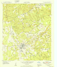
- 1950 Map of Zephyr
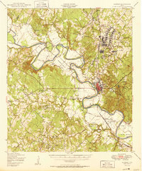
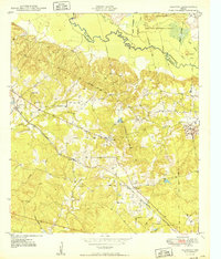
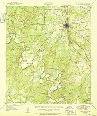
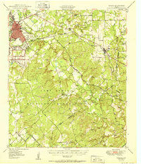 1950 Zephyr1950 Print · USGSBrownwood and the surrounding central Texas countryside are shown at a pivotal mid-century moment as the military and rail industries shaped the local economy. Researchers can locate the sprawling Camp Bowie Military Reservation, find local burial sites like Indian Creek Cemetery, and trace the path of the Santa Fe railroad.2 unique versions available
 - 1950 Map of Hitchcock
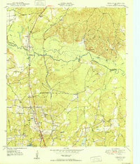
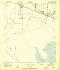 1950 Hitchcock1950 Print · USGSGalveston County settlement at mid-century is centered on the railroad corridor between the coastal prairies and the marshy bayous. Researchers can trace family-named routes like Bene Road and Jay Road or locate the Alta Loma Cemetery and Camp Wallace Military Reservation.
 - 1950 Map of Platt
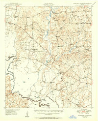
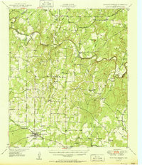
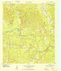 1950 Platt1950 Print · USGSThe Piney Woods of East Texas are captured here at mid-century as the Angelina River winds through the borderlands of Nacogdoches and Angelina counties. Genealogists can locate family landmarks like Saints Rest Ch, the Site of Marion, and the rail siding at Platt.
 - 1950 Map of Athens
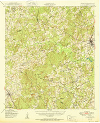
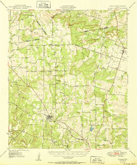
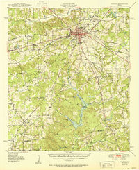 1950 Athens1950 Print · USGSHenderson County center at mid-century, where the rail lines of the St Louis Southwestern and Southern Pacific cross. Genealogists can locate family landmarks like Metzkoff Cem, the Junior College, and Shelby Chapel.
 - 1950 Map of Cedar Bend
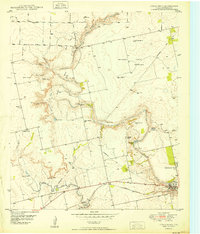 1950 Cedar Bend1950 Print · USGSThe Colorado River valley north of Colorado City reveals a mid-century landscape of oil extraction and rural settlement. Researchers can trace family history at Handley Cem or locate industrial landmarks like the Colo-Tex Refinery and the Texas and Pacific rail line.3 unique versions available
 - 1950 Map of Palestine
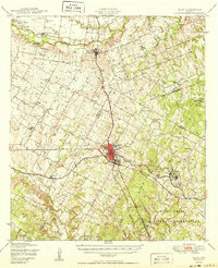
 1950 Palestine1950 Print · USGSEast Texas at mid-century was a landscape of rural schools and rail-dependent towns like Montalba and Elmtown. Genealogists and historians can trace family roots through numerous sites like Cuney Academy, Broyles Chapel, and Hopewell Cem.2 unique versions available
 - 1950 Map of Lexington
 1950 Lexington1950 Print · USGSLee and Bastrop Counties are captured in the late 1940s as rural crossroads like Beaukiss and Fedor thrived alongside the Southern Pacific railroad. Genealogists can trace family roots at New Knobs Springs Cem, Biehle Sch, and the Peat Mine.
 - 1950 Map of Keltys
 1950 Keltys1950 Print · USGSAngelina County saw significant growth in the early post-war years as the rail lines connected rural timberlands and towns. Genealogists can trace family names at Wallace Cem, Hudson Sch, and New Hope Ch.
 - 1950 Map of Bastrop
 1950 Bastrop1950 Print · USGSThe Colorado River valley around the turn of the decade is defined by sprawling military infrastructure and tight-knit farming communities. Researchers can trace the heritage of Bastrop and Sayersville or locate family landmarks like Burleson Cem and Union Hill Sch.
 - 1950 Map of Mercury
 1950 Mercury1950 Print · USGSMcCulloch County and its neighbors are shown in the mid-twentieth century as the rural landscape transitioned from pioneer roots to modern ranching. Researchers can trace family history through community sites like Cowboy Cemetery, Elm Grove School, and the village of Mercury.2 unique versions available
 - 1950 Map of Lufkin
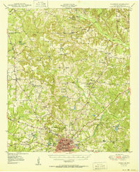
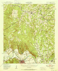
 1950 Lufkin1950 Print · USGSMid-century Lufkin serves as a vital rail and industrial hub in the East Texas timber belt as it appeared just after the war. Local historians can trace the foundations of the community at Keltys, Homer, and rural sites like Harbucks Chapel or Glendale Cem.
 - 1950 Map of Frankston
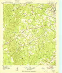
 1950 Frankston1950 Print · USGSThe Southern Pacific corridor between Henderson and Anderson Counties comes alive in this mid-century survey. Genealogists and historians can trace family roots at New York and Fincastle, or locate rural landmarks like Central High Sch and Rounsavall Cem.
 - 1950 Map of Clawson
 1950 Clawson1950 Print · USGSEast Texas timber and rail communities thrive along the St Louis Southwestern line in the years following World War II. Genealogists and local historians can trace family ties through Pollok Cem, Gann Cem, and the rural Pollok Sch near the Angelina River.
 - 1950 Map of Redland
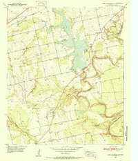
 1950 Redland1950 Print · USGSThe Angelina River valley in the early fifties was a landscape of bayous and new infrastructure. Local historians can trace the paths of the Southern Pacific and locate family landmarks like Walker Cem, St Anns School, and the settlement of Davisville.4 unique versions available
 - 1950 Map of Tennessee Colony
 1950 Tennessee Colony1950 Print · USGSMid-century Anderson County is captured here just as the oil industry began to shape the Trinity River basin. Trace old family sites and community roots through landmarks like Tennessee Colony, the historic Tyler Ferry crossing, and rural centers like New Bethel Ch.2 unique versions available
 - 1950 Map of Mullin
 1950 Mullin1950 Print · USGSThe crossroads of Mills and Brown counties come into focus at the mid-century, centered on the rail hub of Mullin. Researchers can trace old family sites and rural institutions like Williams Ranch, Rock Springs Cem, and the Villa Siding railroad stop.2 unique versions available
 - 1950 Map of Huntington
 1950 Huntington1950 Print · USGSMid-century Angelina County, Texas, reveals a landscape of dense piney woods and vital railroad junctions. Genealogists and historians can trace local family roots through sites like Huntington Cem, Rocky Hill Sch, and the remote Robinson Blue Springs.
 - 1950 Map of Smithville
 1950 Smithville1950 Print · USGSBastrop and Fayette Counties come into focus at the dawn of the fifties, centered on the Colorado River and the busy rail hub of Smithville. Genealogists can trace family roots through numerous rural landmarks like Crafts Prairie Sch, Goebel Store, and St Michaels Cem and Ch.
 - 1950 Map of Richland Springs
 1950 Richland Springs1950 Print · USGSRichland Springs and the surrounding San Saba ranch lands are captured here at mid-century, just as the regional rail and river network reached its mature form. Genealogists can locate family landmarks like Varga Chapel, Old Algerita Cemetery, and China Creek School.
 - 1950 Map of Elgin
 1950 Elgin1950 Print · USGSMid-century Elgin and the surrounding blackland prairies are shown here just as the local rail and brick industries were peaking. Researchers can trace family roots through numerous local sites like Youngs Prairie Cem, Coupland, and the Brickyards at Butler.
 - 1950 Map of Goldthwaite
 1950 Goldthwaite1950 Print · USGSGoldthwaite and the surrounding ranchlands of Mills County are shown here at mid-century, following the winding meanders of the Colorado River. Researchers can locate several rural schools and churches like Flat Rock School and Lower Valley Church, or trace the path of the Gulf Colorado and Santa Fe Railway.
 - 1950 Map of Lake Colorado City, 1952 Print
 1950 Lake Colorado City1952 Print · USGSTexas ranching and utility infrastructure intersect at Lake Colorado City during the early fifties. Researchers can trace family sites at Spade Cem, locate the Dorn Sch (Abandoned), or follow the winding Colorado River to Horseshoe Bend.3 unique versions available
 - 1950 Map of Colorado City SE, 1952 Print
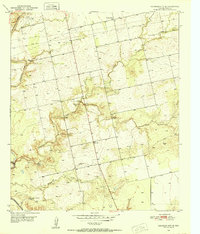 1950 Colorado City SE1952 Print · USGSMitchell County in the early fifties shows a rugged West Texas landscape shaped by the Colorado River and its complex creek systems. Researchers can trace rural landmarks including the Seven Wells Monument, Payne Ch, and the Looney Sch.
 - 1950 Map of Corpus Christi, 1953 Print
 1950 Corpus Christi1953 Print · USGSThe South Texas coast comes into focus during the early fifties, showing the interplay between booming oil fields and expansive ranching operations. Genealogists and historians can trace the Texas Mexican rail line through Kingsville or locate heritage sites like Chapman Ranch and Riviera Beach.
 - 1950 Map of Houston, 1953 Print
 1950 Houston1953 Print · USGSCoastal Texas in the early fifties reveals a landscape of massive civil engineering and industrial transit. Genealogists and researchers can trace the growth of the Houston suburbs and the maritime infrastructure of Galveston Bay, including the Gulf Freeway and the Texas City Dike.
Showing maps 1-25
Top cities of Texas
- Houston historical maps
- San Antonio historical maps
- Dallas historical maps
- Fort Worth historical maps
- Austin historical maps
- El Paso historical maps
See more
Top counties of Texas
- Harris County historical maps
- Dallas County historical maps
- Tarrant County historical maps
- Bexar County historical maps
- Travis County historical maps
- Collin County historical maps
See more
Frequently asked questions
- What are the different types of historical maps available for Texas?
- What is the oldest map of Texas?
- Where can I purchase historical maps of Texas for my home or office?
- Where can I download high-res historical maps of Texas?
- Are there historical topographic maps available for Texas?
- Is there historical aerial imagery available for Texas?
- Where are historical maps of Texas sourced from?