1930s Maps of Texas
Explore 158 historic maps of Texas from the 1930s. These maps offer a rare glimpse into what life looked like during the 1930s — showing old roads, neighborhoods, homes, and landmarks that have changed or disappeared over time.
Whether you're researching your family's past, planning a metal detecting trip, or studying how Texas's landscape evolved across the 1930s, these high-resolution maps are a powerful tool for exploring the history of this region.
- Focus on a specific era: All maps on this page are from the 1930s, giving you a focused view of this time period.
- See what’s changed: Compare century-old streets, trails, and buildings to today's modern landscape using overlays and satellite layers.
- Research with precision: Use these maps for genealogy, historical research, land use analysis, or educational projects.
- View, download, or print: Maps are fully viewable online in high resolution, and can be downloaded or printed for your own records.
Start exploring Texas's history through authentic maps from the 1930s. This is your window into the past.
Texas maps
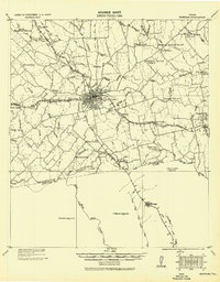
(158)- 1930 Map of Austin-2
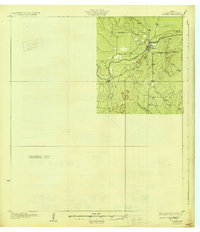
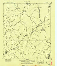
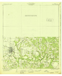
 1930 Austin-21930 Print · USGSThe winding loops of the Colorado River dominate this 1930 survey of Travis County before the era of major dams. Researchers can trace early crossings like Stewart Ford and locate local landmarks such as the Jack Sch and Ch.
 - 1930 Map of Galveston
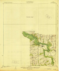
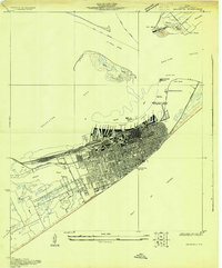 1930 Galveston1930 Print · USGSGalveston thrived as a premier Gulf port and rail terminus during the interwar years. Genealogists and maritime historians can trace the harbor's layout through Union Station, the Fort Crockett Flying Field, and the Immigrant Station.
 - 1930 Map of Blanco-1
 1930 Blanco-11930 Print · USGSCentral Texas river valleys appear in high detail during the early 1930s, showing the landscape before later reservoir projects. Trace the original paths of the Colorado River and Pedernales River past Pleasant Grove Sch and Buggy Ford.
 - 1930 Map of Jordan Gap
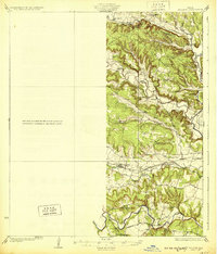
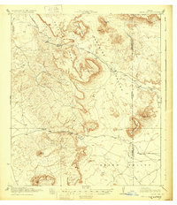 1930 Jordan Gap1930 Print · USGSPresidio and Brewster Counties are captured in the interwar years, showing a landscape of high mesas and desert passes. Genealogists and historians can trace old trails To Marfa and locate family-named landmarks like McKinney Mtn and McTurney Pk.3 unique versions available
 - 1930 Map of Richland Springs
 1930 Richland Springs1930 Print · USGSThe Colorado River divides Mills and San Saba counties in the late 1920s, a period defined by small-town farming and ranching. You can trace early family sites through several river crossings and community hubs like Hanna Valley Cem and the Jones Valley Sch.
 - 1930 Map of Padre Island No. 1
 1930 Padre Island No. 11930 Print · USGSThe South Texas coast in 1930 appears as a quiet landscape of shifting sands and tidal reaches. Researchers can trace the early topography of Padre Island, the vast Laguna Madre shoreline, and the curious site of an (Abandoned Hotel).
 - 1930 Map of Farmersville
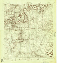
 1930 Farmersville1930 Print · USGSSoutheastern Collin County in the early twentieth century shows a landscape of rail-connected towns and rural school districts. Genealogists can locate family landmarks like Stringtown, Cairo Sch, and BUMPASS BRIDGE along the East Fork Trinity River.2 unique versions available
 - 1930 Map of Los Fresnos
 1930 Los Fresnos1930 Print · USGSCameron County's agricultural and rail landscape is captured here in the early thirties. Genealogists can trace early homesteads near Los Fresnos or locate landmarks like the Palo Alto Battlefield Monument and White House Sch.
 - 1930 Map of West Brownsville
 1930 West Brownsville1930 Print · USGSThe Texas-Mexico border landscape is captured here in the early twentieth century as the river winds through Cameron County. Genealogists and historians can trace family-named lands like Carmen Ranch and landmarks such as Barreda Sch and the International Bridge.
 - 1930 Map of Barreda
 1930 Barreda1930 Print · USGSCoastal South Texas is seen here during the irrigation boom of the early thirties, showing the intricate oxbows and ranch lands. Researchers can trace the St Louis Brownsville and Mexico Railway past Barreda and the Old Military Road.
 - 1930 Map of La Leona
 1930 La Leona1930 Print · USGSCoastal Texas ranching and tidal waterways are frozen in time during this pre-war survey of the Rio Grande Valley. Genealogists and historians can trace the footprint of early holdings like La Leona Ranch and Los Coyotes Ranch along the Arroyo Colorado.
 - 1930 Map of Tilden
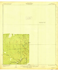
 1930 Tilden1930 Print · USGSMcMullen County settlement and drainage patterns are captured here in the mid-1920s during a pivotal water engineering survey. Genealogists and researchers can trace the early footprint of Tilden and its proximity to the Frio River and Calliham Road.2 unique versions available
 - 1930 Map of Bassett
 1930 Bassett1930 Print · USGSBowie and Cass Counties are captured here as the traditional rural landscape met the expanding reach of the railroad and early oil exploration. Genealogists can locate many namesake schools and churches like Big Woods Sch, Mt Zion Ch, and the settlement of White Cotton.2 unique versions available
 - 1930 Map of Whitsett
 1930 Whitsett1930 Print · USGSThe South Texas brush country unfolds in this late-1920s survey of McMullin County, showing the region as it appeared before widespread development. Trace early drainage routes like San Miguel Creek and find the small settlement of Crowther near Opossum Hill.2 unique versions available
 - 1930 Map of Stillwell Creek
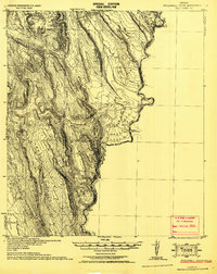 1930 Stillwell Creek1930 Print · USGSThe Texas borderlands along the Rio Grande are documented here in the early thirties as the region remained a territory of remote ranches and desert industry. Trace local landmarks like the Walkers Ranch, the Roberts (Wax Plant), and the deep Maravillas Canyon.
 - 1930 Map of Padre Island No. 2
 1930 Padre Island No. 21930 Print · USGSThe Texas coast near Cameron County appears in its raw state in the early thirties, before major coastal development reached these shores. Researchers can study the primitive shoreline of Padre Island and the expansive Mud Flats bordering the Laguna Madre.
 - 1930 Map of Marquez
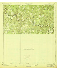
 1930 Marquez1930 Print · USGSRobertson and Leon counties are mapped here at the height of the steam-rail era. Genealogists can trace family footprints through rural post offices like Bald Prairie P.O. and community anchors like Holly Church and James School.
 - 1930 Map of Killeen
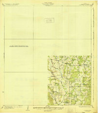
 1930 Killeen1930 Print · USGSBell County was a landscape of small school districts and river crossings in the early thirties. Genealogists can trace family roots through rural landmarks like Keyes Valley Sch, Youngsport, and the Santa Fe line at Stone Siding.2 unique versions available
 - 1930 Map of Boyd
 1930 Boyd1930 Print · USGSNorth-central Texas rural life comes into focus in the mid-1920s as the Chicago Rock Island and Gulf railroad tracks its way through Boyd. Genealogists and historians can locate old landmarks like Arkansas Sch and the community of Aurora.2 unique versions available
 - 1930 Map of Laguna Atascosa
 1930 Laguna Atascosa1930 Print · USGSDeep in South Texas in the early thirties, this survey reveals a landscape of working cattle ranches and coastal lagoons. Genealogists and historians can trace family holdings like El Alazan Ranch and San Pedro Ranch or locate the old San Jose settlement.
 - 1930 Map of Lockhart
 1930 Lockhart1930 Print · USGSCaldwell County is captured here in the mid-twenties, showing a landscape defined by small farming communities and a high density of rural schoolhouses. Researchers can trace family-named landmarks like McMahan and Seawillow or locate community centers such as Tilmon Sch and Clark Chapel.2 unique versions available
 - 1930 Map of East Brownsville
 1930 East Brownsville1930 Print · USGSBrownsville and the Rio Grande borderlands are captured here just as early flight and rail were transforming the South Texas landscape. Researchers can locate Fort Brown, trace the winding Resaca de la Palma, and find old rural schools like Jardin Sch.
 - 1930 Map of Seguin
 1930 Seguin1930 Print · USGSGuadalupe County at the height of the mid-twenties reflects a thriving rural economy centered on the Southern Pacific rail line. Researchers can locate numerous local landmarks including Walter Nixon Sch, the Faust Gin, and Mill Creek Salt.2 unique versions available
 - 1930 Map of Brenham, 1937 Print
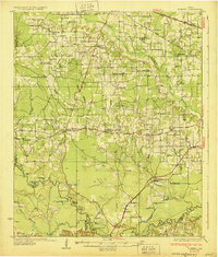
 1930 Brenham1937 Print · USGSBrenham and Chapel Hill appear here during the interwar years as vital rail and agricultural centers for Washington County. Researchers can trace rural life through numerous labeled landmarks like the County Farm, Harrison Spring Church, and Polaski School.
 - 1931 Map of Falls City
 1931 Falls City1931 Print · USGSSouth Texas river life and rail transport meet in this early thirties survey of Karnes and Wilson Counties. Trace the Southern Pacific through Falls City or locate rural landmarks like Froshinn Hall and Laake Sch.4 unique versions available
Showing maps 1-25 of 158
Top cities of Texas
- Houston historical maps
- San Antonio historical maps
- Dallas historical maps
- Fort Worth historical maps
- Austin historical maps
- El Paso historical maps
See more
Top counties of Texas
- Harris County historical maps
- Dallas County historical maps
- Tarrant County historical maps
- Bexar County historical maps
- Travis County historical maps
- Collin County historical maps
See more
Frequently asked questions
- What are the different types of historical maps available for Texas?
- What is the oldest map of Texas?
- Where can I purchase historical maps of Texas for my home or office?
- Where can I download high-res historical maps of Texas?
- Are there historical topographic maps available for Texas?
- Is there historical aerial imagery available for Texas?
- Where are historical maps of Texas sourced from?