1940s Maps of Texas
Explore 340 historic maps of Texas from the 1940s. These maps offer a rare glimpse into what life looked like during the 1940s — showing old roads, neighborhoods, homes, and landmarks that have changed or disappeared over time.
Whether you're researching your family's past, planning a metal detecting trip, or studying how Texas's landscape evolved across the 1940s, these high-resolution maps are a powerful tool for exploring the history of this region.
- Focus on a specific era: All maps on this page are from the 1940s, giving you a focused view of this time period.
- See what’s changed: Compare century-old streets, trails, and buildings to today's modern landscape using overlays and satellite layers.
- Research with precision: Use these maps for genealogy, historical research, land use analysis, or educational projects.
- View, download, or print: Maps are fully viewable online in high resolution, and can be downloaded or printed for your own records.
Start exploring Texas's history through authentic maps from the 1940s. This is your window into the past.
Texas maps
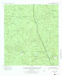
- 1940 Map of Heuco Tanks
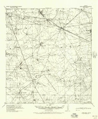
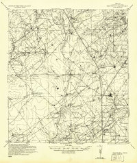
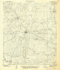
 1940 Heuco Tanks1940 Print · USGSEl Paso County ranching and transit are captured at the end of the 1930s as the desert landscape evolved. Genealogists and historians can trace the Old Butterfield Trail and locate family outposts like Escontrias Ranch and Rockhouse.
 - 1940 Map of El Paso Gap
 1940 El Paso Gap1940 Print · USGSThe Guadalupe Mountains of southern New Mexico are shown in the mid-1930s, defined by a network of remote livestock ranches and isolated mountain schools. Genealogists and historians can trace family landholdings at Hepler Ranch or Lewis Ranch and locate vanished local landmarks like Queen Sch and the Old Post Place.3 unique versions available
 - 1940 Map of Aguilares
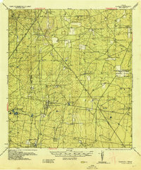
 1940 Aguilares1940 Print · USGSSouth Texas ranching and the early oil industry meet in the late 1930s along the Texas Mexican Railroad. Local historians can trace family landholdings from Zapata Ranch to Dodier Ranch, or locate commerce hubs like Pullin Store and the Magnolia Pump Station.
 - 1940 Map of Cotulla
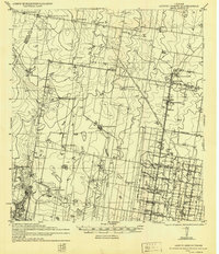
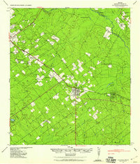
 1940 Cotulla1940 Print · USGSLa Salle County ranching life is frozen in time at the start of the 1940s, centered on the rail junction at Cotulla. Genealogists and historians can trace family landmarks across the brush country, from the Buckholt School to the Albert Martin Ranch and Harriss Valley.
 - 1940 Map of Randado
 1940 Randado1940 Print · USGSJim Hogg County ranchlands and oil fields are captured here in the late thirties just before the war. Researchers can trace family landholdings like De La Garza Ranch and Armstrong Ranch or locate early industrial sites at the Randado Oil Field.
 - 1940 Map of Smithson Valley
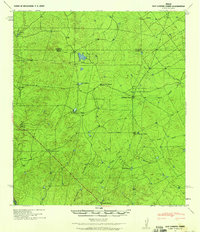
 1940 Smithson Valley1940 Print · USGSComal County's Hill Country comes into focus during the late twenties and thirties, showing a landscape of family ranches and rural schoolhouses. Researchers can trace ancestral tracts belonging to Alex Scheel or G. Krause and locate landmarks like Anhalt or Fischer Store.2 unique versions available
 - 1940 Map of Monte Christo
 1940 Monte Christo1940 Print · USGSHidalgo County ranching and irrigation systems are shown here in the 1930s and 40s as a structured agricultural grid takes shape. Researchers can trace family homesteads like Tanquecillas Ranch or locate the site of the Wimobasis Club and early railroad stops on the St L B & M Ry.2 unique versions available
 - 1940 Map of Mogotes Hill
 1940 Mogotes Hill1940 Print · USGSZapata County ranching and early petroleum discovery meet in the brush country during the 1940s. Genealogists and historians can trace family landholdings from Trinidad Ranch to Bella Vista Ranch, while locating early industry at Escobas Field and the Cuellar Store.
 - 1940 Map of Kilgore
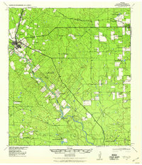
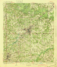 1940 Kilgore1940 Print · USGSKilgore and the surrounding oil fields come to life in this mid-century survey of the East Texas boom. Researchers can trace the layout of early energy settlements like Oil City and Swamp City alongside rural landmarks like Laird Hill Sch and Rock Springs Mission.2 unique versions available
 - 1940 Map of Guadalupe Peak, 1949 Print
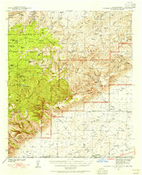
 1940 Guadalupe Peak1949 Print · USGSCulberson County ranching and the high peaks of West Texas are captured here in the decade before the national park's founding. Genealogists and historians can trace family landholdings like Williams Ranch, Hegler Ranch, and the remote settlement at Frijole.2 unique versions available
 - 1940 Map of Bassett Lake, 1954 Print
 1940 Bassett Lake1954 Print · USGSThe high desert of Otero County at the start of the 1940s reveals a landscape organized around vital water sources and remote ranching outposts. Researchers can trace the network of desert storage like Camaleche Tanks and Escondida Tank or locate the site of Foster Ranch.
 - 1940 Map of Carlsbad Caverns West, 1955 Print
 1940 Carlsbad Caverns West1955 Print · USGSThe Guadalupe Mountains of southern New Mexico are shown here just before the mid-century, revealing a remote ranching and caving landscape. Researchers can trace early family outposts like Able Ranch and Thurman Ranch or locate the numerous karst features such as Mudgetts Cave and Painted Grotto.5 unique versions available
 - 1940 Map of Asherton, 1958 Print
 1940 Asherton1958 Print · USGSSouth Texas ranching country comes into focus in this mid-century survey of Dimmit County as it appeared just before the war. Genealogists can trace family holdings and rural landmarks like the Dentonio School, Asheston, and the expansive Briscoe Ranch.2 unique versions available
 - 1940 Map of Velenzuela Creek, 1958 Print
 1940 Velenzuela Creek1958 Print · USGSSouth Texas ranching country at the start of the 1940s shows a landscape of expansive family holdings and seasonal creek beds. Researchers can locate specific sites like Velenzuela Ranch, the Hill Top Inn, and S Cotulla.2 unique versions available
 - 1940 Map of San Loranzo Creek, 1958 Print
 1940 San Loranzo Creek1958 Print · USGSThe ranching country of the Webb and Dimmit borderlands is captured here just before the mid-century, defined by scattered holdings and vital water tanks. Researchers can trace historic property boundaries and find locations like Brown Ranch, the Ruins site, and the Dos Hermanos Peaks.3 unique versions available
 - 1940 Map of Catarina, 1958 Print
 1940 Catarina1958 Print · USGSDimmit County ranching and rail infrastructure are captured here in the early 1940s, just as modern utilities reached the brush country. Genealogists can trace family holdings like the Buckhorn Ranch and Valley Wells along the Central and Gulf (Mo Pac) rail line.2 unique versions available
 - 1940 Map of Cometa, 1958 Print
 1940 Cometa1958 Print · USGSSouthwest Texas ranching country in the early nineteen-forties shows a landscape of large family holdings and seasonal creek beds. Genealogists can trace specific homesteads such as the Sullivan Ranch, F C Anglin Ranch, and the small settlement at Cometa.2 unique versions available
 - 1940 Map of Eagle Pass, 1959 Print
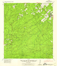
 1940 Eagle Pass1959 Print · USGSMaverick County sits along the winding bend of the Rio Grande during the early days of the Second World War. Researchers can trace numerous family-named landmarks and agricultural holdings like Milton Frank Farms, La Rosita Ranch, and the Sullivan Ranch.
 - 1940 Map of Chupadera, 1959 Print
 1940 Chupadera1959 Print · USGSThe Texas-Mexico borderlands along the Rio Grande are captured here just before the war, showing the remote ranching country of Webb Co. Researchers can locate isolated water sources and early landmarks like Chupadera Ranch, Sullivan Spring, and Cathedral Rock.2 unique versions available
 - 1940 Map of Paloma, 1959 Print
 1940 Paloma1959 Print · USGSMaverick County ranch lands and early energy infrastructure are detailed here at the dawn of the 1940s. Genealogists and historians can trace family operations like Burr Ranch and Sullivan Ranch, or locate the specific footprint of the Chittim Gas Field.
 - 1940 Map of Quemado, 1959 Print
 1940 Quemado1959 Print · USGSMaverick County sits along the Rio Grande during the early years of the war, showcasing a landscape of riverside irrigation and military expansion. Researchers can find family-named sites like Lehmann Ranch, the local Hydro Elec Plant, and the layout of the Eagle Pass Army Airfield.
 - 1940 Map of Artesia Wells, 1959 Print
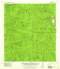
 1940 Artesia Wells1959 Print · USGSLa Salle and Dimmit Counties are captured here just before the Second World War, showing a ranching landscape defined by the Nueces River. Researchers can trace family homesteads like R Armstrong and J Henderson or follow the path of the International-Great Northern Railroad through Artesia Wells.
 - 1940 Map of Chacon Creek, 1959 Print
 1940 Chacon Creek1959 Print · USGSRanching operations and early energy pipelines define the Maverick and Zavala County line at the start of the 1940s. Genealogists and historians can locate family-named homesteads such as Plumly Ranch and Van Cleve Ranch or trace water sources like Chilipin Lake.
 - 1940 Map of Newman, 1965 Print
 1940 Newman1965 Print · USGSThe high desert borderlands near the New Mexico-Texas line come alive in the 1940s, showing a landscape of remote cattle operations and vital rail links. Trace family history through ranch sites like Trueblood Ranch, locate the old Blythe Sch, and follow the Southern Pacific tracks to Newman.
 - 1941 Map of Zwolle
 1941 Zwolle1941 Print · USGSSabine Parish in the early 1940s is captured here as a landscape of timber-driven rail lines and riverside crossings. Genealogists can trace the rural communities of the era through sites like Pattersons Ferry, Alliance Sch, and Sardis Cem.
Showing maps 1-25
Top cities of Texas
- Houston historical maps
- San Antonio historical maps
- Dallas historical maps
- Fort Worth historical maps
- Austin historical maps
- El Paso historical maps
See more
Top counties of Texas
- Harris County historical maps
- Dallas County historical maps
- Tarrant County historical maps
- Bexar County historical maps
- Travis County historical maps
- Collin County historical maps
See more
Frequently asked questions
- What are the different types of historical maps available for Texas?
- What is the oldest map of Texas?
- Where can I purchase historical maps of Texas for my home or office?
- Where can I download high-res historical maps of Texas?
- Are there historical topographic maps available for Texas?
- Is there historical aerial imagery available for Texas?
- Where are historical maps of Texas sourced from?