1900s (20th Century) Maps of Texas
Explore 10,028 historic maps of Texas from the 1900s (20th Century). These maps offer a rare glimpse into what life looked like during the 1900s — showing old roads, neighborhoods, homes, and landmarks that have changed or disappeared over time.
Whether you're researching your family's past, planning a metal detecting trip, or studying how Texas's landscape evolved across the 1900s, these high-resolution maps are a powerful tool for exploring the history of this region.
- Focus on a specific era: All maps on this page are from the 1900s, giving you a focused view of this time period.
- See what’s changed: Compare century-old streets, trails, and buildings to today's modern landscape using overlays and satellite layers.
- Research with precision: Use these maps for genealogy, historical research, land use analysis, or educational projects.
- View, download, or print: Maps are fully viewable online in high resolution, and can be downloaded or printed for your own records.
Start exploring Texas's history through authentic maps from the 1900s. This is your window into the past.
Texas maps
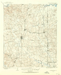
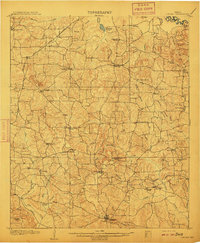
- 1901 Map of Addington
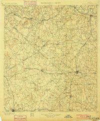
 1901 Addington1901 Print · USGSThe Chickasaw Nation at the turn of the century shows a landscape transitioning from cattle trails to rail commerce. Local historians can trace the Chisholm Trail and the Chicago Rock Island and Pacific rail line through Duncan, Comanche, and Addington.6 unique versions available
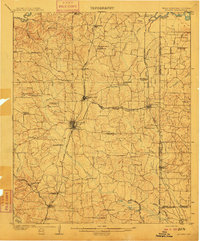
 - 1901 Map of Flatonia
 1901 Flatonia1901 Print · USGSCentral Texas at the turn of the century shows a landscape defined by the railroad and distinct ethnic communities. Trace family roots in the Bohemian Settlement or Negro Settlement, and locate early sites like Old Redrock and Old Flatonia.2 unique versions available
 - 1901 Map of Denison
 1901 Denison1901 Print · USGSThe Red River valley in the final years of the Indian Territory era was a landscape of river crossings and rail expansion. Genealogists and historians can trace the early transit networks through Willis Ferry, Cedar Mills, and the Colbert Bridge.4 unique versions available
 - 1902 Map of Gainesville
 1902 Gainesville1902 Print · USGSThe Red River frontier comes alive in the years before Oklahoma statehood, showing the border between Texas and the Chickasaw Nation. Trace early river travel through Rock Bluff Ferry and Freemans Ferry or locate old schoolhouses like Wolf Ridge Schoolhouse.5 unique versions available
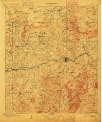
 - 1903 Map of Burnet
 1903 Burnet1903 Print · USGSThe Texas Hill Country at the turn of the century shows a landscape of river-side industry and early rail expansion. Trace the historic Houston and Texas Central Railroad line through Burnet and Bertram or locate long-standing landmarks like Morman Mill and Tanyard Crossing.
 - 1903 Map of Paris
 1903 Paris1903 Print · USGSThe Red River borderlands of the Indian Territory and Texas are shown here at the start of the century. Genealogists and researchers can trace early settlements and social hubs like Grant, Oberlin, and the Camp Ground along the winding banks of the Red River.
 - 1903 Map of Cerro Alto, 1929 Print
 1903 Cerro Alto1929 Print · USGSThe high desert of West Texas and the New Mexico border come alive in this turn-of-the-century survey. Trace early cattle-country water sources like Sparrow Tanks and Coyote Tanks or the peaks of the Hueco Mountains.
 - 1903 Map of Chisos Mountains, 1956 Print
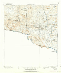
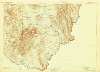
 1903 Chisos Mountains1956 Print · USGSThe Big Bend region of West Texas appears here at the start of the twentieth century, showing a landscape defined by ranching and mining. Trace early frontier outposts like Stroud's Ranch, the industrial remains at Old Smelter, and reliable water at Dugout Wells.
 - 1903 Map of Terlingua, 1963 Print
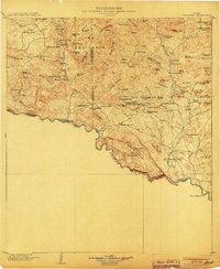
 1903 Terlingua1963 Print · USGSThe Big Bend borderlands emerge at the height of the quicksilver boom, showing the isolated ranching and mining camps along the Rio Grande. Trace the roots of early mining at Study Butte and find remote family outposts like Gourleys Ranch and Lajitas.
 - 1904 Map of Bastrop
 1904 Bastrop1904 Print · USGSBastrop and Smithville thrive along the Colorado River at the turn of the century, serving as vital hubs for the Texas interior. Trace ancestral roots and old transport routes through Nashs Ferry, the Coal Mine near Sayersville, and Colorado Chapel.3 unique versions available
 - 1904 Map of Llano
 1904 Llano1904 Print · USGSThe Texas Hill Country around the turn of the century centered on the rail hub of Llano and the winding Llano River. Genealogists can trace early homesteads like Kuykendall's Ranch and locate remote landmarks such as Hesterville Church and the Iron Mine.
 - 1904 Map of Terlingua
 1904 Terlingua1904 Print · USGSThe Trans-Pecos frontier is captured here at the height of the early quicksilver mining boom. Genealogists and historians can locate remote family sites like Howard's Ranch and Madril Ranch, or trace early industrial efforts at the Colquitt-Tigner Mine.5 unique versions available
 - 1905 Map of Montague
 1905 Montague1905 Print · USGSMontague County and the bordering Chickasaw Nation are captured here in the early twentieth century as the frontier transitioned into a settled rail corridor. Genealogists and local researchers can locate numerous rural schools like Eagle Pt. School and trace river crossings such as Owings Ferry.3 unique versions available
 - 1905 Map of Chisos Mountains, 1940 Print
 1905 Chisos Mountains1940 Print · USGSThe Big Bend frontier of West Texas comes to life here at the dawn of the twentieth century, during a time of border expansion and ranching. Researchers can trace the early trails between family outposts like Stroud's Ranch and landmarks like the Old Smelter or Dugout Wells.2 unique versions available
 - 1906 Map of Van Horn
 1906 Van Horn1906 Print · USGSThe Trans-Pecos frontier is captured here at the turn of the century as the railroad and mining industry reshaped the high desert. Trace early family landholdings like Jones Ranch and Millican's Ranch, or locate historic operations like the Hazel Mine.5 unique versions available
 - 1907 Map of Atlanta, 1954 Print
 1907 Atlanta1954 Print · USGSNorthwest Louisiana and Northeast Texas meet in this early century survey of the rail-and-timber corridor surrounding Atlanta. Researchers can trace the heritage of rural communities through dozens of local landmarks like Laws Chapel, Pritchard's Gin, and the Cass Lumber Co Sawmill.2 unique versions available
 - 1908 Map of El Paso
 1908 El Paso1908 Print · USGSEl Paso and the lower Rio Grande valley are seen here in the first decade of the century as the railroad and military presence transformed the borderlands. Genealogists can trace family footprints in historic river towns like San Elizario, Ysleta, and Socorro, or find early ranch sites like Newman's Ranch.2 unique versions available
 - 1909 Map of Llano
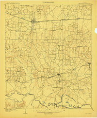
 1909 Llano1909 Print · USGSCentral Texas at the first decade of the new century shows a landscape of cattle ranches and growing rail towns. Genealogists can locate family landmarks such as Atkinson's Ranch, Oxford, and rural social centers like Kennedy School or Wooten Church.3 unique versions available
 - 1909 Map of Burnet
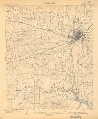
 1909 Burnet1909 Print · USGSThe Texas Hill Country at the turn of the century shows a landscape of river crossings and rail towns before the creation of the Highland Lakes. Genealogists can locate family-named landmarks like Morman Mill, Tumlinson, and rural schoolhouses such as Berry School or Sunny Lane.3 unique versions available
 - 1909 Map of New Boston
 1909 New Boston1909 Print · USGSBowie County at the dawn of the twentieth century was a landscape shaped by competing railroads and the winding Sulphur River. Genealogists and local historians can locate early landmarks like Boston, Chalybeate School, and the historic Bigham Ferry crossing.2 unique versions available
 - 1909 Map of Texarkana
 1909 Texarkana1909 Print · USGSTexarkana emerged as a bustling tri-state rail center at the dawn of the twentieth century, defined by its complex web of iron roads and river commerce. Genealogists and local historians can trace family roots at White Chapel, the Stateline Ferry, and rural sites like Alamo Mills.5 unique versions available
 - 1910 Map of Linden
 1910 Linden1910 Print · USGSNortheast Texas at the dawn of the century reveals a landscape defined by the timber industry and small rural hubs. You can trace the development of Cass County through landmarks like the T.P. Sawmill, Bryans Mill, and dozens of family-named sites like Harbucks Store.2 unique versions available
 - 1910 Map of Atlanta
 1910 Atlanta1910 Print · USGSNortheast Texas at the height of the timber boom is captured here, showing the intricate network of sawmills and rail lines crossing into Arkansas and Louisiana. Genealogists can locate family landmarks like Laws Chapel, Hosey's Store, and the Henderson Hill School among the many rural settlements.2 unique versions available
 - 1910 Map of Austin
 1910 Austin1910 Print · USGSAustin and the surrounding Travis County hill country are captured here at the start of the twentieth century. Genealogists and researchers can locate pioneer landmarks like Anderson Mill, Mc.Kinney Falls, and numerous river crossings including Lohmann Ford.3 unique versions available
 - 1910 Map of Buckholts, 1911 Print
 1910 Buckholts1911 Print · USGSThe Milam County bottomlands along the Little River appear here just before major levee projects reshaped the valley. Trace family homesteads and crossings like the Live Oak School, Bryant Station Bridge, and Nielson Farm.
Showing maps 1-25
Top cities of Texas
- Houston historical maps
- San Antonio historical maps
- Dallas historical maps
- Fort Worth historical maps
- Austin historical maps
- El Paso historical maps
See more
Top counties of Texas
- Harris County historical maps
- Dallas County historical maps
- Tarrant County historical maps
- Bexar County historical maps
- Travis County historical maps
- Collin County historical maps
See more
Frequently asked questions
- What are the different types of historical maps available for Texas?
- What is the oldest map of Texas?
- Where can I purchase historical maps of Texas for my home or office?
- Where can I download high-res historical maps of Texas?
- Are there historical topographic maps available for Texas?
- Is there historical aerial imagery available for Texas?
- Where are historical maps of Texas sourced from?