1920s Maps of Texas
Explore 291 historic maps of Texas from the 1920s. These maps offer a rare glimpse into what life looked like during the 1920s — showing old roads, neighborhoods, homes, and landmarks that have changed or disappeared over time.
Whether you're researching your family's past, planning a metal detecting trip, or studying how Texas's landscape evolved across the 1920s, these high-resolution maps are a powerful tool for exploring the history of this region.
- Focus on a specific era: All maps on this page are from the 1920s, giving you a focused view of this time period.
- See what’s changed: Compare century-old streets, trails, and buildings to today's modern landscape using overlays and satellite layers.
- Research with precision: Use these maps for genealogy, historical research, land use analysis, or educational projects.
- View, download, or print: Maps are fully viewable online in high resolution, and can be downloaded or printed for your own records.
Start exploring Texas's history through authentic maps from the 1920s. This is your window into the past.
Texas maps
- 1920 Map of Longfellow
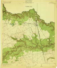
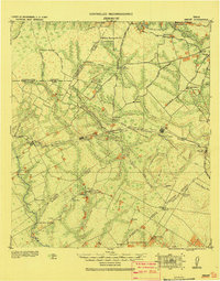
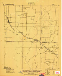
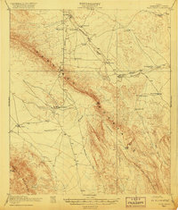
 1920 Longfellow1920 Print · USGSRailroad outposts and high desert terrain define this West Texas survey from the early twentieth century. Genealogists and historians can trace the Southern Pacific line through stops like Purrington, Tesnus, and Rosenfeld, along with landmarks like the Pittsburg Boring.
 - 1920 Map of Seabrook
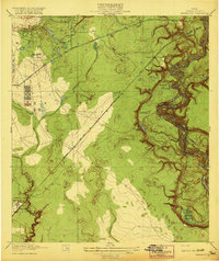
 1920 Seabrook1920 Print · USGSCoastal Harris County near the end of the Great War was a network of bayous and new rail lines. Genealogists and local historians can locate early landmarks like the Old Middle Bayou School, the Clear Lake Inn, and the transit hub at Webster.
 - 1920 Map of Waco
 1920 Waco1920 Print · USGSWaco and its surrounding rail corridors are captured in high detail shortly after the first World War. Researchers can trace the legacy of Rifle Range Camp MacArthur and vanished river crossings like Greenwoods Ferry and Old Towash.
 - 1920 Map of Spring
 1920 Spring1920 Print · USGSNorthern Harris County is shown at a pivotal rail-junction moment as the Galveston Line and International and Great Northern meet at Spring. Genealogists can locate early community landmarks like the Kothman School, Bammel settlement, and Roth School along the winding Cypress Creek.2 unique versions available
 - 1920 Map of Genoa
 1920 Genoa1920 Print · USGSSoutheast Texas at the end of the Great War shows a landscape defined by new airfields and electric transit. Genealogists and historians can trace the early rail corridor serving Genoa, the initial layout of Ellington Field, and the crossing at Friendswood Bridge.
 - 1920 Map of Mexia
 1920 Mexia1920 Print · USGSLimestone and Freestone counties are shown here just after the Great War, during a period of significant railway expansion and rural settlement. Researchers can trace the routes of the Houston and Texas Central and locate sites like Cotton Gin, Pt. Enterprise, and Duck Lake.
 - 1920 Map of Fauna
 1920 Fauna1920 Print · USGSHarris County east of Houston is captured here as a landscape of winding bayous and prairie just after the Great War. Researchers can trace the early footprints of Fauna and Abbots Store or follow the path of the Market Street Road through the bottomlands.
 - 1920 Map of Mykawa
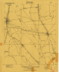
 1920 Mykawa1920 Print · USGSIn the early twentieth century, the Gulf Coast prairie around Mykawa was a landscape of emerging rail stops and rural schoolhouses. Genealogists and historians can trace the early paths of the Houston and Alvin Road and the Minnetex School.3 unique versions available
 - 1920 Map of Mart
 1920 Mart1920 Print · USGSCentral Texas at the dawn of the 1920s shows a landscape of busy rail junctions and small post office hubs. Researchers can trace rural lineages through William's School, the community at Axtell P.O., and the Navasota River bottomlands.
 - 1920 Map of Smiley
 1920 Smiley1920 Print · USGSSouth Texas ranching and rail life are preserved here in the era following the first World War. Genealogists can trace family roots through labeled landmarks like Willow Springs Ranch, the Southern Pacific Railroad, and the settlement at Nixon.
 - 1920 Map of Beaver Creek
 1920 Beaver Creek1920 Print · USGSWichita and Wilbarger counties are captured here just after the Great War, showing a landscape defined by seasonal creek beds and isolated schoolhouses. Researchers can locate early community hubs like Marvin Chapel, Ronda School, and landmarks such as Potato Hill.2 unique versions available
 - 1920 Map of Hockley
 1920 Hockley1920 Print · USGSHarris County at the edge of the prairie reveals a landscape of early rail and timber industry just after the First World War. Trace local roots at Hockley and the Hegar School or locate the old Bauers Sawmill near Spring Creek.3 unique versions available
 - 1920 Map of Rose Hill
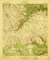
 1920 Rose Hill1920 Print · USGSNorthwest Harris County appears as a burgeoning rural community in the years following the Great War. Genealogists and local historians can trace the foundations of the district through several early schoolhouses, including East Rose Hill School and Neidorff School, as well as Cypress Church.
 - 1920 Map of La Porte
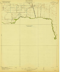
 1920 La Porte1920 Print · USGSCoastal Harris County is documented here during a period of industrial growth along the Houston Ship Channel. Researchers can trace the early rail networks of the Galveston Harrisburg and San Antonio RR and locate community landmarks like Lomax School and Sylvan Beach.3 unique versions available
 - 1920 Map of Kemp
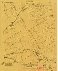
 1920 Kemp1920 Print · USGSNortheast Texas at the start of the 1920s reveals a landscape of railroad towns and rural post offices at the junction of three counties. Genealogists can trace early homesteads and schoolhouses near Mabank, Prairieville, and Ansley.
 - 1920 Map of Harmaston
 1920 Harmaston1920 Print · USGSCoastal Harris County near the San Jacinto River comes into focus during the early oil boom era. Researchers can trace the path of the Beaumont Sour Lake and Western railroad and locate early industrial sites like the Oil Tanks or the river Ferry near Harmaston.2 unique versions available
 - 1920 Map of Waller
 1920 Waller1920 Print · USGSThe Waller and Harris county line area comes into focus in this 1920s-era survey, detailing the early rail-and-road network. Genealogists and local historians can trace family sites like Badke Ranch, the Binford School, and the early layout of Waller.2 unique versions available
 - 1920 Map of Highlands
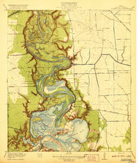 1920 Highlands1920 Print · USGSHarris County at the dawn of the oil age reveals a landscape of tidal bayous and historic river crossings. Genealogists can locate family landmarks like Tory Hill, early education sites like Lynchburg School, and the hallowed grounds of the San Jacinto Battlefield.4 unique versions available
 - 1920 Map of Stephenville
 1920 Stephenville1920 Print · USGSErath County thrived at the intersection of three major railroads during the early twentieth century. Genealogists and historians can trace the foundations of Stephenville and Dublin, alongside rural landmarks like Morgan Mill and Tanner School.
 - 1920 Map of Bone Spring
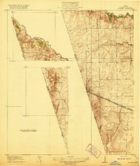
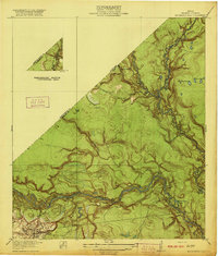
 1920 Bone Spring1920 Print · USGSBrewster County's high-desert frontier is captured in the years following the Great War, showing a landscape defined by isolated ranching outposts and rugged mountain gaps. Genealogists and historians can trace family landholdings and early industry through sites like Walkers Ranch, Buttrell Ranch, and the Old Wax Plant.2 unique versions available
 - 1920 Map of Moonshine Hill
 1920 Moonshine Hill1920 Print · USGSHarris County at the height of the 1920s oil boom reveals a landscape of river bends and early settlements. Trace the original footprints of Moonshine Hill and the Huffman School alongside the oxbows of Horseshoe Lake and Blue Lake.2 unique versions available
 - 1920 Map of Smithsons Valley
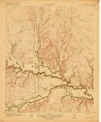
 1920 Smithsons Valley1920 Print · USGSThe Texas Hill Country comes alive in this 1920s-era survey of the Guadalupe River valley. Genealogists and local historians can trace early family outposts and commerce at Fischers Store, Cranes Mill, and Wesson P.O.
 - 1920 Map of Almeda
 1920 Almeda1920 Print · USGSHarris County prairie land is captured here during the First World War era, showing a landscape defined by rail and water. Genealogists and researchers can trace the early footprint of Almeda and the path of the International and Great Northern railroad.2 unique versions available
 - 1920 Map of Louetta
 1920 Louetta1920 Print · USGSNorthern Harris County was a landscape of timber mills and rail junctions in the years following the Great War. Genealogists and local historians can trace family roots through landmarks like Kohrville School, Ross Sawmill, and the settlement at Louetta.2 unique versions available
 - 1920 Map of Huffman
 1920 Huffman1920 Print · USGSCoastal prairie and timberlands north of Houston come into focus during the early twentieth century as a burgeoning rail and road network took shape. Genealogists can trace family landmarks and early transit routes through Huffman, Scott Ranch, and the Lumber R R.2 unique versions available
Showing maps 1-25
Top cities of Texas
- Houston historical maps
- San Antonio historical maps
- Dallas historical maps
- Fort Worth historical maps
- Austin historical maps
- El Paso historical maps
See more
Top counties of Texas
- Harris County historical maps
- Dallas County historical maps
- Tarrant County historical maps
- Bexar County historical maps
- Travis County historical maps
- Collin County historical maps
See more
Frequently asked questions
- What are the different types of historical maps available for Texas?
- What is the oldest map of Texas?
- Where can I purchase historical maps of Texas for my home or office?
- Where can I download high-res historical maps of Texas?
- Are there historical topographic maps available for Texas?
- Is there historical aerial imagery available for Texas?
- Where are historical maps of Texas sourced from?