1960s Maps of Texas
Explore 3,924 historic maps of Texas from the 1960s. These maps offer a rare glimpse into what life looked like during the 1960s — showing old roads, neighborhoods, homes, and landmarks that have changed or disappeared over time.
Whether you're researching your family's past, planning a metal detecting trip, or studying how Texas's landscape evolved across the 1960s, these high-resolution maps are a powerful tool for exploring the history of this region.
- Focus on a specific era: All maps on this page are from the 1960s, giving you a focused view of this time period.
- See what’s changed: Compare century-old streets, trails, and buildings to today's modern landscape using overlays and satellite layers.
- Research with precision: Use these maps for genealogy, historical research, land use analysis, or educational projects.
- View, download, or print: Maps are fully viewable online in high resolution, and can be downloaded or printed for your own records.
Start exploring Texas's history through authentic maps from the 1960s. This is your window into the past.
Texas maps
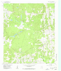
- 1960 Map of Beeville
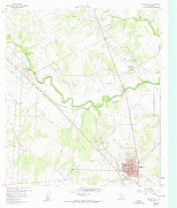
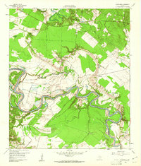
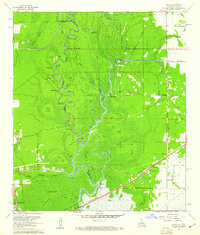
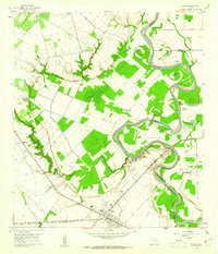
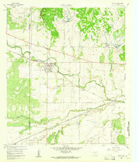
 1960 Beeville1960 Print · USGSCoastal Texas in the mid-fifties reveals a landscape of growing towns and vital military outposts like Foster AFB. Researchers can trace old rail lines including the Missouri Pacific and explore the vast Aransas National Wildlife Refuge.
 - 1960 Map of Karnes City
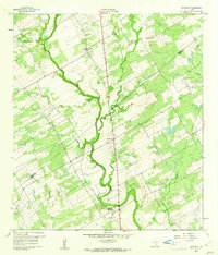
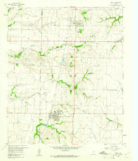
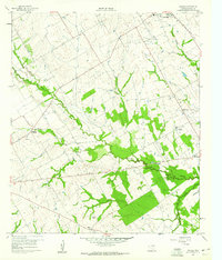
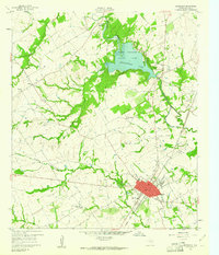
 1960 Karnes City1960 Print · USGSMid-century South Texas life centers on the river valleys and rail lines between Panna Maria and Karnes City. Researchers can trace old family sites at St Mary Cem, locate the Karnes City Hot Springs, or follow the Texas and New Orleans railroad corridor.3 unique versions available
 - 1960 Map of Corpus Christi
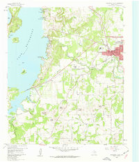
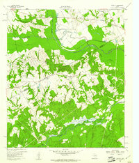
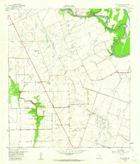
 1960 Corpus Christi1960 Print · USGSCoastal South Texas and the Nueces County hinterlands are detailed in this mid-century survey. Genealogists and historians can trace early settlement patterns and rural landmarks like Casa Blanca during a period of steady regional growth.
 - 1960 Map of Tool, 1961 Print
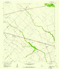
 1960 Tool1961 Print · USGSThe rural Henderson County landscape of the early 1960s is preserved here, centered on the creek-fed agricultural lands near the Trinity River. Genealogists and local historians can trace the foundations of Tool, Tolosa, and Aley, alongside family landmarks like Baker Cem and King Cem.3 unique versions available
 - 1960 Map of Waller, 1961 Print
 1960 Waller1961 Print · USGSThe Waller and Prairie View area at the dawn of the 1960s reveals a landscape of growing educational institutions and vital rail corridors. Researchers can trace the boundaries of Prairie View A & M College and locate family history at Waller Cem or Mathis Cem.4 unique versions available
 - 1960 Map of West Sweden, 1961 Print
 1960 West Sweden1961 Print · USGSMcCulloch County in the early sixties shows a landscape of cattle ranching and rail commerce at the base of the Brady Mountains. Researchers can trace the Gulf Colorado and Santa Fe line through Niblock or locate the Carroll Colony Cem near the banks of Bowie Creek.2 unique versions available
 - 1960 Map of Blanchard, 1961 Print
 1960 Blanchard1961 Print · USGSEast Texas river life is captured here in the early sixties along the winding Trinity River on the Polk County border. Genealogists and local historians can trace the Old Railroad Grade or locate family sites near Blanchard, Garner Chapel, and Tigerville.3 unique versions available
 - 1960 Map of Kosciusko, 1961 Print
 1960 Kosciusko1961 Print · USGSPolish-Texan heritage in the early sixties is preserved on this survey of the Wilson and Karnes county line. Genealogists and researchers can trace the rural landscape surrounding Kosciusko, including local landmarks like St Anns Ch, Pulaski Sch, and the winding Cibolo Creek.2 unique versions available
 - 1960 Map of Canyon, 1961 Print
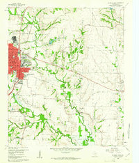
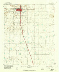 1960 Canyon1961 Print · USGSRandall County in the early sixties centers on the growing campus of West Texas State College and the surrounding plains. Genealogists and rail historians can trace the Panhandle and Santa Fe line through the small siding at Ogg and locate rural landmarks like Dreamland Cem.2 unique versions available
 - 1960 Map of Mabank, 1961 Print
 1960 Mabank1961 Print · USGSThe crossroads of Henderson, Kaufman, and Van Zandt counties are captured here in the early sixties, showing a landscape defined by small-town life and the railroad. Genealogists can trace family roots through landmarks like Elam Grove Ch, Mabank Cem, and rural outposts such as Payne Springs.5 unique versions available
 - 1960 Map of Echo, 1961 Print
 1960 Echo1961 Print · USGSThe Sabine River bottomlands on the Texas-Louisiana border are captured here at the start of the 1960s. Researchers can trace the winding river at Niblett Bluff and locate family landmarks like Comier Cem and Crossroad Ch.4 unique versions available
 - 1960 Map of Bridgeport West, 1961 Print
 1960 Bridgeport West1961 Print · USGSWise County's landscape in the early sixties is dominated by the sprawling shoreline of Lake Bridgeport and the rail activity in Bridgeport. Researchers can locate historic burial sites like the Oldtown Cem and Mexican Cem or trace rural landmarks like the Pleasant Valley Ch.4 unique versions available
 - 1960 Map of Frisco, 1961 Print
 1960 Frisco1961 Print · USGSThe rural landscape of Collin County appears here just as the post-war era began to shape North Texas. Researchers can trace the early rail-side footprints of Frisco and Prosper, or locate family landmarks like Bethel Cem and the Rockhill Sch.5 unique versions available
 - 1960 Map of McKinney East, 1961 Print
 1960 McKinney East1961 Print · USGSCollin County's transition from rural farming to mid-century growth is visible here as the eastern edge of McKinney meets the river. Researchers can locate family landmarks like Pine Grove Cemetery and historic rural hubs including New Hope and Milligan.4 unique versions available
 - 1960 Map of Shady Grove, 1961 Print
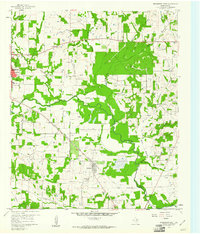
 1960 Shady Grove1961 Print · USGSWood County was a landscape of petroleum and pine in the early sixties, with oil wells and rural churches scattered across the creeks. Genealogists can locate family sites near Shady Grove or trace landmarks like Maple Springs Ch and the Hawkins Oil Field.3 unique versions available
 - 1960 Map of Echols, 1961 Print
 1960 Echols1961 Print · USGSLimestone County was a landscape of quiet rural communities and creek-side farms at the dawn of the sixties. You can trace early settlement roots through local markers like Coolidge Cem, the Old Railroad Grade, and the Echols Sch.2 unique versions available
 - 1960 Map of Winkler, 1961 Print
 1960 Winkler1961 Print · USGSNavarro and Freestone Counties appear here in the early sixties as a network of creek-side settlements and rural churches. Genealogists and researchers can trace local roots at Winkler, St Elmo, and the Sweetman Cem.4 unique versions available
 - 1960 Map of Lissie, 1961 Print
 1960 Lissie1961 Print · USGSWharton County agricultural and industrial life is captured here in the early sixties, showing the expansion of oil and gas alongside traditional rice farming. Trace the rail-and-canal network between Lissie and Nottawa, or locate the Rice Mill and Chesterville Oil Field.2 unique versions available
 - 1960 Map of Wallis, 1961 Print
 1960 Wallis1961 Print · USGSThe Brazos River bottomlands in the early sixties reveal a landscape shaped by rail junctions and small farming communities. Genealogists can trace family roots through sites like Hartville Cem, Mount Olive Ch, and the intersection of two major railroads in Wallis.3 unique versions available
 - 1960 Map of Groesbeck, 1961 Print
 1960 Groesbeck1961 Print · USGSLimestone County at the start of the sixties revolves around the rail hub of Groesbeck and the waters of the Navasota River. Genealogists can trace family roots at Faulkenberry Cem and the site of Fort Parker (Historical).2 unique versions available
 - 1960 Map of Fairview, 1961 Print
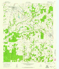
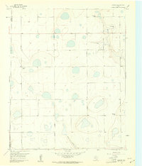 1960 Fairview1961 Print · USGSArmstrong and Randall counties are shown here in the early 1960s, a period of established High Plains ranching. Researchers can trace historic property boundaries and family-named homesteads such as Willow Valley Farm, Butterfield, and the small community of Fairview.3 unique versions available
 - 1960 Map of The Palisades, 1961 Print
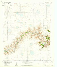 1960 The Palisades1961 Print · USGSRandall County's dramatic canyonlands are shown in detail during the early sixties as the landscape supported both ranching and recreation. Researchers can locate the winding Prairie Dog Town Fork Red River, Camp Harrington, and the railroad stops at Zita and Haney.3 unique versions available
 - 1960 Map of Melvin, 1961 Print
 1960 Melvin1961 Print · USGSMcCulloch County in the early sixties centers on the rail-side community of Melvin as it navigates the landscape of the BRADY MOUNTAINS. Researchers can trace the path of the GULF COLORADO AND SANTA FE railroad through Whiteland and Homer Junction or locate family plots at Melvin Cem.2 unique versions available
 - 1960 Map of New Taiton, 1961 Print
 1960 New Taiton1961 Print · USGSThe Wharton County prairie comes alive in the early sixties, showing a landscape defined by ranching and the emerging oil industry. Genealogists and historians can trace the foundations of New Taiton, located near St John Ch, or map the energy infrastructure of the New Taiton Oil Field.2 unique versions available
 - 1960 Map of Bridgeport East, 1961 Print
 1960 Bridgeport East1961 Print · USGSThe West Fork Trinity River valley in the early sixties was a landscape of industrial energy and deep-rooted rural life. Researchers can trace the Chicago Rock Island and Pacific rail line between Paradise and Bridgeport, while locating local landmarks like Cuba Church and Paradise Cemetery.2 unique versions available
Showing maps 1-25
Top cities of Texas
- Houston historical maps
- San Antonio historical maps
- Dallas historical maps
- Fort Worth historical maps
- Austin historical maps
- El Paso historical maps
See more
Top counties of Texas
- Harris County historical maps
- Dallas County historical maps
- Tarrant County historical maps
- Bexar County historical maps
- Travis County historical maps
- Collin County historical maps
See more
Frequently asked questions
- What are the different types of historical maps available for Texas?
- What is the oldest map of Texas?
- Where can I purchase historical maps of Texas for my home or office?
- Where can I download high-res historical maps of Texas?
- Are there historical topographic maps available for Texas?
- Is there historical aerial imagery available for Texas?
- Where are historical maps of Texas sourced from?