1910s Maps of Virginia
Explore 191 historic maps of Virginia from the 1910s. These maps offer a rare glimpse into what life looked like during the 1910s — showing old roads, neighborhoods, homes, and landmarks that have changed or disappeared over time.
Whether you're researching your family's past, planning a metal detecting trip, or studying how Virginia's landscape evolved across the 1910s, these high-resolution maps are a powerful tool for exploring the history of this region.
- Focus on a specific era: All maps on this page are from the 1910s, giving you a focused view of this time period.
- See what’s changed: Compare century-old streets, trails, and buildings to today's modern landscape using overlays and satellite layers.
- Research with precision: Use these maps for genealogy, historical research, land use analysis, or educational projects.
- View, download, or print: Maps are fully viewable online in high resolution, and can be downloaded or printed for your own records.
Start exploring Virginia's history through authentic maps from the 1910s. This is your window into the past.
Virginia maps
- 1910 Map of Antietam
 1910 Antietam1910 Print · USGSMaryland's borderlands and the Potomac River valley are captured here in the early twentieth century. Genealogists can locate family landmarks like Garretts Mill, trace the Chesapeake and Ohio Canal, or find historic sites including Dunkard Church.6 unique versions available
 - 1910 Map of Iaeger
 1910 Iaeger1910 Print · USGSMcDowell County's steep coal country is documented here in the early twentieth century as the railroad transformed the mountain landscape. Genealogists can trace family names and early homesteads near Iaeger, Avondale PO, and Paynesville along the Norfolk and Western RR.
 - 1911 Map of Abingdon
 1911 Abingdon1911 Print · USGSSouthwest Virginia's rugged corridors are captured here during the height of the mountain rail era. Genealogists and historians can trace old homesteads and local landmarks such as Whites Mill, Valley Church, and the County Farm near Abingdon.5 unique versions available
 - 1911 Map of Pocahontas Special
 1911 Pocahontas Special1911 Print · USGSThe West Virginia coalfields are in full industrial bloom in this early century survey, showing the rail-dependent towns along the Norfolk & Western RR. Genealogists can trace family locations in mining hubs like Keystone, Goodwill, and Bearwallow Worth PO.
 - 1911 Map of Wicomico, 1961 Print
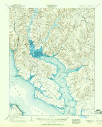 1911 Wicomico1961 Print · USGSSouthern Maryland's river-dependent landscape is documented here during the early twentieth century, showing the tidewater border of Charles and St Marys counties. Genealogists can trace family-named points and wharves like Lancaster Wharf, the Laidlow Ferry, and the rail terminus at Popes Creek.
 - 1912 Map of Point Lookout
 1912 Point Lookout1912 Print · USGSSouthern St. Mary's County appears here just after the turn of the century, showing a waterfront economy dependent on the river and bay. Genealogists and historians can trace family landings at Broomes Wharf and Miller Wharf or locate old settlements like St Inigoes and Great Mills.2 unique versions available
 - 1912 Map of Pound
 1912 Pound1912 Print · USGSThe borderlands of Wise County and Kentucky are captured in the early twentieth century before the coal industry fully reshaped the mountain hollows. Researchers can trace ancestral locations of schools and gaps, such as Upper Millstone School, Pound Gap, and the settlement of Jenkins.2 unique versions available
 - 1912 Map of Pounding Mill
 1912 Pounding Mill1912 Print · USGSThe McDowell and Tazewell borderlands appear here in the decade before the First World War, showing the early infrastructure of this mountainous region. Researchers can trace the path of Squire Jim Road and locate the settlement of Horsepen among the headwaters of Big Creek.
 - 1912 Map of Gilbert
 1912 Gilbert1912 Print · USGSThe Guyandot River valley and the industrial Tug Fork corridor define this region in the early nineteen-hundreds. Researchers can trace rail-tied settlements like Wharncliffe and War Eagle or find rural landmarks such as Twisted Gun Gap and North Spring.2 unique versions available
 - 1912 Map of Iaeger
 1912 Iaeger1912 Print · USGSMcDowell County's rugged Tug Fork valley is documented here in the early twentieth century, showing a landscape defined by rail and remote hollows. Genealogists and historians can trace the foundations of Iaeger, find the locations of Avondale PO and Bradshaw PO, and follow the Norfolk and Western tracks.
 - 1912 Map of Welch
 1912 Welch1912 Print · USGSMcDowell County's coal country comes alive in this pre-war survey, centered on the junction of the Norfolk and Western RR and the Tug Fork. Trace the early development of mining towns like Coalwood, Gary, and Kimball or locate vanished post offices such as Yukon PO.2 unique versions available
 - 1913 Map of Peterstown
 1913 Peterstown1913 Print · USGSPeterstown and the New River valley are captured in the early twentieth century as the railroad transformed these mountain borderlands. Genealogists and historians can trace dozens of rural schoolhouses and stops like Willowton PO, Shanklins Ferry, and Oakvale.
 - 1913 Map of Oven Fork
 1913 Oven Fork1913 Print · USGSLetcher County's steep ridges and narrow hollows are shown here in the early twentieth century, just as the Lexington and Eastern Ry arrived. Genealogists can trace family settlements from Whitesburg to Blackey, and locate early schools and landmarks like Campbranch Chapel or Pound Gap.
 - 1913 Map of Indian Head
 1913 Indian Head1913 Print · USGSThe Potomac River tidewater south of the capital was a region of defensive forts and busy river landings before the First World War. Researchers can trace the early layout of the Naval Proving Grounds and locate family landmarks like Mattinglys Wharf or the Granny Thompson School.2 unique versions available
 - 1913 Map of Bluefield
 1913 Bluefield1913 Print · USGSMercer County and the Virginia borderlands are captured here just before the Great War, showing a landscape of mountain ridges and river valleys. Genealogists and historians can locate dozens of early rural schoolhouses like Sand Gap School and Grecian Bend School, alongside the developing streets of Princeton and South Bluefield.
 - 1913 Map of Nanjemoy
 1913 Nanjemoy1913 Print · USGSThe Nanjemoy peninsula in the early nineteen-hundreds was a world of tidal creeks and tobacco landings. Researchers can trace the rural fabric of Charles County through family-named landmarks like Mudds Marsh and community hubs such as Durham Church and Green Leek School.3 unique versions available
 - 1913 Map of Eagle Rock
 1913 Eagle Rock1913 Print · USGSBotetourt County at the dawn of the twentieth century shows a landscape tied to the James River and iron-era industry. Genealogists can trace family roots through numerous local landmarks like Salisbury Furnace, Fincastle, and the Fair Grounds.2 unique versions available
 - 1913 Map of Clintwood, 1962 Print
 1913 Clintwood1962 Print · USGSVirginia's rugged coal country is captured here during the early twentieth century, showing a landscape of isolated ridge-top schools and river-valley settlements. Genealogists can trace family footprints across dozens of local sites like Hatchet Church, Smith Corners, and the Nichols Gap School.
 - 1914 Map of Martinsburg
 1914 Martinsburg1914 Print · USGSThe eastern panhandle of West Virginia comes alive in this survey, showing a landscape defined by the Potomac River and burgeoning rail hubs. Genealogists can trace family footprints through dozens of schools and churches, from Shepherdstown to the Snyder Hill Riverside School and John Browns Cave.3 unique versions available
 - 1914 Map of Gerrardstown
 1914 Gerrardstown1914 Print · USGSBerkeley County was a landscape of mountain ridges and orchard valleys just before the Great War. Researchers can locate vanished landmarks like the Toll Gate at Darkesville or early rural institutions such as the Gerrardstown Colored School.
 - 1914 Map of Pound
 1914 Pound1914 Print · USGSThe Central Appalachian coal country comes alive in this survey of the Kentucky and Virginia borderlands during a period of rapid industrial growth. Genealogists can trace family roots through dozens of rural schools like Phipps School and Donald School, or follow the early path of the Lexington and Eastern RR.4 unique versions available
 - 1914 Map of Bucu
 1914 Bucu1914 Print · USGSCovers Virginia, including Vansant, Council, and other nearby areas
 - 1914 Map of Iaeger
 1914 Iaeger1914 Print · USGSCovers Virginia, including Raysal, Iaeger, and other nearby areas
 - 1914 Map of Hurley
 1914 Hurley1914 Print · USGSThe Buchanan County borderlands come to life in this early twentieth-century survey, showcasing a landscape of high ridges and deep hollows. Genealogists can trace family roots through a dense network of mountain schools like Bull Creek School and remote outposts such as Kelsa PO or Artia.
 - 1914 Map of Wicomico
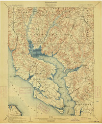 1914 Wicomico1914 Print · USGSSouthern Maryland's riverfront life is captured here during the early twentieth century, showing a landscape of tidal creeks and busy steamboat landings. Genealogists can trace family footprints near Charlotte Hall, find old crossings like Ludlow Ferry, or locate historic maritime hubs like Bushwood Wharf.4 unique versions available
Showing maps 1-25
Top cities of Virginia
- Virginia Beach historical maps
- Chesapeake historical maps
- Arlington historical maps
- Norfolk historical maps
- Richmond historical maps
- Newport News historical maps
See more
Top counties of Virginia
- Fairfax County historical maps
- Virginia Beach historical maps
- Prince William County historical maps
- Loudoun County historical maps
- Chesterfield County historical maps
- Henrico County historical maps
See more
Frequently asked questions
- What are the different types of historical maps available for Virginia?
- What is the oldest map of Virginia?
- Where can I purchase historical maps of Virginia for my home or office?
- Where can I download high-res historical maps of Virginia?
- Are there historical topographic maps available for Virginia?
- Is there historical aerial imagery available for Virginia?
- Where are historical maps of Virginia sourced from?