1940s Maps of Virginia
Explore 548 historic maps of Virginia from the 1940s. These maps offer a rare glimpse into what life looked like during the 1940s — showing old roads, neighborhoods, homes, and landmarks that have changed or disappeared over time.
Whether you're researching your family's past, planning a metal detecting trip, or studying how Virginia's landscape evolved across the 1940s, these high-resolution maps are a powerful tool for exploring the history of this region.
- Focus on a specific era: All maps on this page are from the 1940s, giving you a focused view of this time period.
- See what’s changed: Compare century-old streets, trails, and buildings to today's modern landscape using overlays and satellite layers.
- Research with precision: Use these maps for genealogy, historical research, land use analysis, or educational projects.
- View, download, or print: Maps are fully viewable online in high resolution, and can be downloaded or printed for your own records.
Start exploring Virginia's history through authentic maps from the 1940s. This is your window into the past.
Virginia maps
- 1940 Map of Orkney Springs
 1940 Orkney Springs1940 Print · USGSThe West Virginia and Virginia borderlands appear in the early 1940s, showing a landscape of mountain resorts and valley farms. Genealogists can trace family landmarks like Halterman Cem and schools such as Mt Hermon Sch.2 unique versions available
 - 1940 Map of Indian Springs
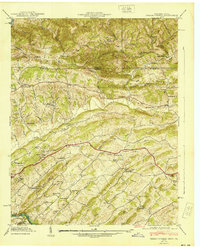 1940 Indian Springs1940 Print · USGSThe Tennessee and Virginia borderlands come alive in this pre-war survey of Sullivan County. Genealogists and local historians can trace the family networks of Bridwell Town, locate Gunnings Academy, and find long-standing mills like Huddle Mill.
 - 1940 Map of Buena Vista
 1940 Buena Vista1940 Print · USGSThe industrial and rail corridor of the James River is captured here as the region's mountain economy evolved in the 1930s. Researchers can trace the dual rail lines serving Glasgow, find CCC Camp No 10, and locate rural landmarks like Buffalo Forge and Ben Salam Sch.2 unique versions available
 - 1940 Map of Pulaski
 1940 Pulaski1940 Print · USGSPulaski and the surrounding Blue Ridge foothills are captured in the mid-1930s as the railroad and timber industries shaped the local economy. Researchers can trace family sites near Shiloh Ch, locate the Stange Mines, or find old schoolhouses like Mill Iron Sch.3 unique versions available
 - 1940 Map of Quantico
 1940 Quantico1940 Print · USGSCoastal Virginia and Maryland are captured here during the late pre-war era, showing the growing military footprint around the Potomac. Genealogists can trace family names and landmarks like Sinclairs Mill, Bacon Race School, and the historic Dumfries settlement.2 unique versions available
 - 1940 Map of Mouth of Wilson
 1940 Mouth of Wilson1940 Print · USGSGrayson County's high ridges and river valleys were home to a dense network of mountain communities in the 1930s. Genealogists and historians can trace long-gone rural institutions like the COUNTY HOME, Cornell Store, and schools such as Razor Ridge Sch or Bethel Sch.3 unique versions available
 - 1940 Map of Lake Drummond, 1964 Print
 1940 Lake Drummond1964 Print · USGSThe Great Dismal Swamp and its drainage canals are captured here in the 1940s, showing a landscape defined by timber extraction and transit. Genealogists and historians can trace old schools and landings from Jacks Camp to Wallaceton Sch and the Lumber RR.
 - 1941 Map of Vesuvius
 1941 Vesuvius1941 Print · USGSThe Blue Ridge highlands at the start of the 1940s reveal a landscape of mountain mines and early parkway development. Genealogists and hikers can trace the Appalachian Trail past the Irish Creek Mission and forgotten sites like Mill Creek Sch.2 unique versions available
 - 1941 Map of Broadwater
 1941 Broadwater1941 Print · USGSThe Virginia barrier islands appear here just before the mid-century, showing the isolated settlement of Broadwater on Hog Island. Researchers can trace old coastal infrastructure and maritime landmarks like the Little Machipongo Inlet C G S and Great Machipongo Inlet.
 - 1941 Map of Glen Allen
 1941 Glen Allen1941 Print · USGSNorth of Richmond in the mid-1930s, this area shows a landscape of rural crossroads and established family farms before modern suburbanization. Genealogists and researchers can locate historic landmarks like Ground Squirrel Ch, the Coalpit Sch, and the community of Short Pump.2 unique versions available
 - 1941 Map of Pounding Mill
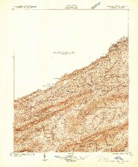 1941 Pounding Mill1941 Print · USGSThe Clinch River valley in the early 1940s shows a landscape organized by rail and ridge. Genealogists can trace family names at Maiden Spr, locate rural landmarks like Wittens Mill, or find old school sites like Linkous Sch.
 - 1941 Map of Burkes Garden
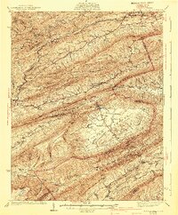 1941 Burkes Garden1941 Print · USGSTazewell County in the late nineteen-thirties reveals the distinctive enclosed valley of Burkes Garden and the rail corridors of the north. Genealogists and hikers can trace the paths to Gose Mills, rural congregations like Marys Chapel, and schools such as Redoak Sch.3 unique versions available
 - 1941 Map of Clarksville
 1941 Clarksville1941 Print · USGSMecklenburg County and the Virginia-North Carolina border are captured here just before the Roanoke River valley was transformed by mid-century dam projects. Researchers can trace ancestral roots through dozens of local landmarks like Oakhurst Cem, Buffalo Junc, and Occaneechi Island.
 - 1941 Map of Monterey, 1963 Print
 1941 Monterey1963 Print · USGSHighland County at the start of the 1940s reveals a network of high-valley settlements and strategic turnpikes. Trace the locations of early schools and churches like Strait Creek School and Union Chapel near the South Branch of the Potomac.2 unique versions available
 - 1941 Map of Harrisonburg, 1965 Print
 1941 Harrisonburg1965 Print · USGSHarrisonburg and the surrounding Rockingham County countryside are shown here in the early 1940s, a landscape shaped by rail, river, and regional history. Genealogists can trace family roots through landmarks like Weyers Cave, St Michaels Ch, and the Civilian Public Service Camp No 8.
 - 1942 Map of Bowling Green
 1942 Bowling Green1942 Print · USGSCaroline County is shown during its wartime expansion in the 1940s as military boundaries reshaped traditional rural life. Researchers can trace the intersection of new defense infrastructure like the C A A Emergency Landing Field with historic locales such as Broaddus Mill and Poorhouse Corner.
 - 1942 Map of Chesconessex
 1942 Chesconessex1942 Print · USGSThe salt marshes and tidal creeks of the Virginia Eastern Shore are captured here during the early war years. Genealogists and local historians can trace family-named landmarks like Savage Island, Leatherbury Church, and the village of Chesconessex.2 unique versions available
 - 1942 Map of Upper Zion
 1942 Upper Zion1942 Print · USGSCaroline and Essex counties appear here during the early forties as the military footprint expanded. Genealogists can trace family landmarks and rural crossroads like Naulakla, Upper Zion, and the quiet Enon Church.
 - 1942 Map of Woodford
 1942 Woodford1942 Print · USGSCaroline County's rural crossroads and river systems are meticulously detailed in this early wartime survey. Genealogists and historians can trace family locations near Woodford, Burkes Shop, and Bethel Church, or follow the Mattaponi River valley.3 unique versions available
 - 1942 Map of Winchester
 1942 Winchester1942 Print · USGSThe Shenandoah Valley during the early years of the war shows a landscape of busy pikes and vital rail junctions. Researchers can trace historic fortifications like Star Fort, family sites at Ridings Mill, and landmarks like Greenway Court.3 unique versions available
 - 1942 Map of Cheriton
 1942 Cheriton1942 Print · USGSThe Virginia Eastern Shore comes alive in this wartime-era survey of Northampton County, showing the region's transition from maritime hub to rail-connected agricultural center. Genealogists and historians can trace family roots through settlements like Cheriton, Pat Town, and Stumptown or explore the coastal inlets near Oyster.
 - 1942 Map of Occupacia
 1942 Occupacia1942 Print · USGSEssex County's riverfront and rural interior are documented here during the early 1940s, showing a landscape of crossroads settlements and timber resources. Genealogists and historians can trace family locations near Vauters Church, Bethlehem Fork, and the Lumber Mill near Iraville.
 - 1942 Map of Lawrenceville
 1942 Lawrenceville1942 Print · USGSBrunswick County at the start of the 1940s is defined by its busy rail junctions and a landscape of small rural schoolhouses. Trace the origins of local families near Lawrenceville or find old community centers like Charlie Hope and Price Mill.
 - 1942 Map of Rollins Fork
 1942 Rollins Fork1942 Print · USGSThe Northern Neck region during the early 1940s reveals a landscape defined by the river economy and established rural crossroads. Genealogists and local historians can trace family land and community hubs from Wilmont Wharf on the river to inland points like Rollins Fork and Kings Mill.
 - 1942 Map of Mineral
 1942 Mineral1942 Print · USGSLouisa County during the early years of the war shows a landscape of rural crossroads and established rail hubs. Trace local history through family landmarks like Bibbs Store, Holladay Mill, and the many churches like Miners Chapel along the Chesapeake and Ohio line.2 unique versions available
Showing maps 1-25
Top cities of Virginia
- Virginia Beach historical maps
- Chesapeake historical maps
- Arlington historical maps
- Norfolk historical maps
- Richmond historical maps
- Newport News historical maps
See more
Top counties of Virginia
- Fairfax County historical maps
- Virginia Beach historical maps
- Prince William County historical maps
- Loudoun County historical maps
- Chesterfield County historical maps
- Henrico County historical maps
See more
Frequently asked questions
- What are the different types of historical maps available for Virginia?
- What is the oldest map of Virginia?
- Where can I purchase historical maps of Virginia for my home or office?
- Where can I download high-res historical maps of Virginia?
- Are there historical topographic maps available for Virginia?
- Is there historical aerial imagery available for Virginia?
- Where are historical maps of Virginia sourced from?