1930s Maps of Virginia
Explore 198 historic maps of Virginia from the 1930s. These maps offer a rare glimpse into what life looked like during the 1930s — showing old roads, neighborhoods, homes, and landmarks that have changed or disappeared over time.
Whether you're researching your family's past, planning a metal detecting trip, or studying how Virginia's landscape evolved across the 1930s, these high-resolution maps are a powerful tool for exploring the history of this region.
- Focus on a specific era: All maps on this page are from the 1930s, giving you a focused view of this time period.
- See what’s changed: Compare century-old streets, trails, and buildings to today's modern landscape using overlays and satellite layers.
- Research with precision: Use these maps for genealogy, historical research, land use analysis, or educational projects.
- View, download, or print: Maps are fully viewable online in high resolution, and can be downloaded or printed for your own records.
Start exploring Virginia's history through authentic maps from the 1930s. This is your window into the past.
Virginia maps
(198)- 1930 Map of Wakefield
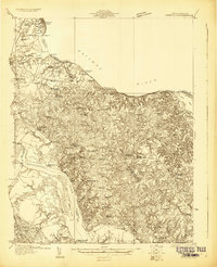 1930 Wakefield1930 Print · USGSWestmoreland County and the Northern Neck appear here in the early thirties, defined by a historic riverfront landscape and rural hamlets. Researchers can locate the Birthplace of Washington and Monroe Birthplace alongside old river ports like Leedstown and Steve Landing.
 - 1930 Map of Speedwell
 1930 Speedwell1930 Print · USGSWythe County is captured here in the late twenties, showing the intersection of vital transit corridors and mountain wilderness. Researchers can trace the early Appalachian Trail or locate family roots at St Paul Ch and Slate Spring Sch.
 - 1930 Map of Independence
 1930 Independence1930 Print · USGSGrayson County and the North Carolina borderlands are captured here during the 1930s, showing a landscape of high ridges and deep river bends. Genealogists can trace family names through landmarks like Moyers Store, Bennington Mill, and numerous river crossings like Moore Ferry.
 - 1930 Map of Warrenton
 1930 Warrenton1930 Print · USGSFauquier and Culpeper counties are captured here in the late twenties, showing a rural landscape organized around the Southern railroad and the Rappahannock River. Researchers can trace old school districts and river crossings like Hinson Ford and Litchfield Sch.2 unique versions available
 - 1930 Map of Madison
 1930 Madison1930 Print · USGSThe Blue Ridge foothills of Madison and Greene counties are captured here just as Shenandoah National Park was being established. Researchers can trace the early mountain communities around Graves Mill, Criglersville, and the remote Upper Pocosin Mission.3 unique versions available
 - 1930 Map of Max Meadows
 1930 Max Meadows1930 Print · USGSThe industrial and riverine corridor of Wythe and Carroll counties comes alive in the late 1920s, showcasing a network of mining towns and rail lines. Trace family roots and local history through landmarks like Fort Chiswell, the Boom Furnace, and the ferry crossing at Carter Ferry.3 unique versions available
 - 1930 Map of Warm Springs Run
 1930 Warm Springs Run1930 Print · USGSBath County's rugged ridge-and-valley landscape is captured here in the early 1930s as mountain communities remained deeply tied to their local terrain. Genealogists and historians can trace family locations near Thomastown, Mitchelltown, and schools like Thomastown Sch.2 unique versions available
 - 1930 Map of Mountain Grove
 1930 Mountain Grove1930 Print · USGSThe Virginia and West Virginia borderlands in the late 1920s are captured here during a time of isolated mountain settlements and river-bottom farming. Genealogists can trace family footprints through the numerous named hollows and crossings like Mcclintic Bridge, Mountain Grove, and Mooretown.
 - 1930 Map of Middlesboro
 1930 Middlesboro1930 Print · USGSThe tri-state border region comes alive in the late 1920s, centered on the strategic mountain pass at Cumberland Gap. Genealogists and historians can trace family locations near Middlesboro, early campus sites at Lincoln Memorial University, and rural landmarks like Ellison Mill.4 unique versions available
 - 1931 Map of Rural Retreat
 1931 Rural Retreat1931 Print · USGSSouthwestern Virginia in the early 1930s is defined by its ridge-and-valley terrain and the rail-and-road corridor of the Norfolk and Western. Genealogists can trace local landmarks like Wasson Cem, Roberts Mill, and the Old Iron Mine near Sugar Grove.
 - 1931 Map of Healing Springs
 1931 Healing Springs1931 Print · USGSBath County's famous resort corridor is captured here in the early thirties, showing a unique mix of high-society recreation and deep-hollow rural life. Genealogists and historians can trace family-named sites like Ashwood, Tinkertown, and the Indian Hill Sch.2 unique versions available
 - 1931 Map of University
 1931 University1931 Print · USGSAlbemarle County is shown here during the late Prohibition era, when the university and the railroad defined the local economy. Genealogists can trace family names through landmarks like the Miller School, Whitehall, and Mt Plains Ch.2 unique versions available
 - 1931 Map of Waiteville
 1931 Waiteville1931 Print · USGSThe Virginia and West Virginia borderlands in the early 1930s reveal a landscape of high ridges and isolated valley settlements. Genealogists can trace family footprints around Newport, Clover Hollow Ch, and the waters of Striking Creek.
 - 1931 Map of Stuart
 1931 Stuart1931 Print · USGSThe Blue Ridge plateau meets the Piedmont in the late 1920s, showing a landscape of mountain farming and river-driven milling. Genealogists can trace family roots through numerous local landmarks like Meadows of Dan, Stonewall Jackson Sch, and Three Forks Mill.3 unique versions available
 - 1931 Map of Stafford
 1931 Stafford1931 Print · USGSStafford County and the city of Fredericksburg are shown here in the early 1930s, documenting a landscape still deeply shaped by nineteenth-century transit and conflict. Genealogists and historians can locate family landmarks like Mountain View PO, Enon Sch, and the grounds of the Battle of Fredericksburg 1862.
 - 1931 Map of Galax
 1931 Galax1931 Print · USGSThe Blue Ridge foothills of Virginia and North Carolina come into focus during the early 1930s as the rail-and-river economy develops. Genealogists and researchers can trace family landmarks like Bishop Cem, McKnights Mill, and the early river crossings at Blair Ferry.
 - 1931 Map of Accomac
 1931 Accomac1931 Print · USGSThe Eastern Shore of Virginia in the early thirties shows a thriving rail corridor and a wild, unbridged Atlantic coast. Genealogists can locate family landmarks like Oak Grove Chapel and Becker Ch or trace the early days of the Keller Fairgrounds.4 unique versions available
 - 1932 Map of Hagan
 1932 Hagan1932 Print · USGSThe rugged borderlands of Kentucky and Virginia come to life in this early 1930s survey of the high gaps and hollows. Researchers can locate remote mountain landmarks like Hensley Sch, Feepee Store, and the scattered cabins at Alva.3 unique versions available
 - 1932 Map of Wakefield
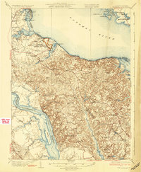 1932 Wakefield1932 Print · USGSWestmoreland County at the start of the 1930s shows a landscape defined by the great bends of the Potomac and Rappahannock Rivers. Researchers can trace ancestral locations near the George Washington Birthplace or find local landmarks like Potomac Mills and Monroe Hall.2 unique versions available
 - 1932 Map of Salem
 1932 Salem1932 Print · USGSThe Roanoke Valley and the high ridges of the Blue Ridge meet in this early 1930s survey of the Salem area. Genealogists can locate family landmarks like Webbs Mill, the Catawba Sanatorium, and numerous rural churches including New Hope Church.3 unique versions available
 - 1932 Map of Falling Spring
 1932 Falling Spring1932 Print · USGSThe Virginia and West Virginia borderlands in the early 1930s reveal a landscape of mountain ridges and riverside rail industry. Genealogists can trace family footprints at Greavers Mill, Jenkins Ford, and the old Cedar Creek Sch.3 unique versions available
 - 1932 Map of Lexington
 1932 Lexington1932 Print · USGSRockbridge County in the early 1930s shows a landscape of academic centers and rural mill towns. Genealogists and historians can trace family locations near Rockbridge Alum Springs, Brownsburg Mill, or the segregated White Hall (Colored View) School.
 - 1932 Map of Peterstown
 1932 Peterstown1932 Print · USGSThe borderlands of Giles and Mercer counties come alive in the early 1930s as the New River carves a path through the Appalachian ridges. Trace the rail-and-river economy of Narrows and find family-named landmarks like Blankenship Sch and Cedar Grove Ch.3 unique versions available
 - 1932 Map of Pearisburg
 1932 Pearisburg1932 Print · USGSGiles County in the early 1930s is defined by the winding New River and its mountain-bound communities. Genealogists can trace early homesteads and local institutions through Goodwins Ferry, Hoges Store, and several named schools like McGrady Sch.3 unique versions available
 - 1932 Map of Blacksburg
 1932 Blacksburg1932 Print · USGSMontgomery and Floyd Counties are documented here in the early thirties as the regional rail and coal economy thrived. Genealogists can trace family homesteads near landmarks like the Virginia Polytechnic Institute, Merrimac Mines, and Christiansburg Industrial Sch.2 unique versions available
Showing maps 1-25 of 198
Top cities of Virginia
- Virginia Beach historical maps
- Chesapeake historical maps
- Arlington historical maps
- Norfolk historical maps
- Richmond historical maps
- Newport News historical maps
See more
Top counties of Virginia
- Fairfax County historical maps
- Virginia Beach historical maps
- Prince William County historical maps
- Loudoun County historical maps
- Chesterfield County historical maps
- Henrico County historical maps
See more
Frequently asked questions
- What are the different types of historical maps available for Virginia?
- What is the oldest map of Virginia?
- Where can I purchase historical maps of Virginia for my home or office?
- Where can I download high-res historical maps of Virginia?
- Are there historical topographic maps available for Virginia?
- Is there historical aerial imagery available for Virginia?
- Where are historical maps of Virginia sourced from?