1930s Maps of Wisconsin
Explore 98 historic maps of Wisconsin from the 1930s. These maps offer a rare glimpse into what life looked like during the 1930s — showing old roads, neighborhoods, homes, and landmarks that have changed or disappeared over time.
Whether you're researching your family's past, planning a metal detecting trip, or studying how Wisconsin's landscape evolved across the 1930s, these high-resolution maps are a powerful tool for exploring the history of this region.
- Focus on a specific era: All maps on this page are from the 1930s, giving you a focused view of this time period.
- See what’s changed: Compare century-old streets, trails, and buildings to today's modern landscape using overlays and satellite layers.
- Research with precision: Use these maps for genealogy, historical research, land use analysis, or educational projects.
- View, download, or print: Maps are fully viewable online in high resolution, and can be downloaded or printed for your own records.
Start exploring Wisconsin's history through authentic maps from the 1930s. This is your window into the past.
Wisconsin maps
- 1930 Map of Robbins
 1930 Robbins1930 Print · USGSThe Vilas and Oneida County lake country comes into focus in the early 1930s as tourism and industry overlap. Locate vanished rural schoolhouses like Evergreen Sch. and Sebastian Sch. or trace the early path of the Chicago and Northwestern RR.2 unique versions available
 - 1930 Map of La Crescent
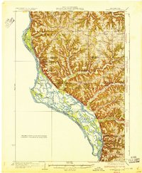
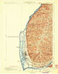
 1930 La Crescent1930 Print · USGSAs the Mississippi and Black Rivers met in the late twenties, this survey captured a world of river-bottom sloughs and busy rail junctions. Genealogists can trace early homesteads and schools like Oak Grove Sch, while exploring the vanished river paths of Bullet Chute and New Amsterdam.3 unique versions available
 - 1930 Map of La Crosse
 1930 La Crosse1930 Print · USGSThe riverfront and blufflands of western Wisconsin are captured here as the Great Depression began, showing a landscape defined by rail transit and coulee farming. Researchers can find numerous rural landmarks, from the County Asylum to small district sites like Maple Shade Sch and Barre Mills.3 unique versions available
 - 1930 Map of Strum
 1930 Strum1930 Print · USGSWestern Wisconsin's river valleys and rail corridors are captured here just before the 1930s. Researchers can trace the lineage of rural townships like Washington and Unity through a network of country schools and churches, including St Paul Ch and Big Creek Sch.2 unique versions available
 - 1932 Map of Cochrane
 1932 Cochrane1932 Print · USGSThe Mississippi River valley in the early thirties shows a intricate network of islands and sloughs tucked beneath high bluffs. Trace the historical footprints of Buffalo City, locate rural schoolhouses like Oak Valley Sch, and follow the Chicago Burlington and Quincy rail line.
 - 1932 Map of Gilmanton
 1932 Gilmanton1932 Print · USGSBuffalo and Trempealeau Counties appear here in the early thirties, showing a rural landscape organized around deep valleys and high ridges. Genealogists can locate dozens of family-named landmarks and country schools like Lookout Sch and the Irish Valley Sch.2 unique versions available
 - 1932 Map of Harvard
 1932 Harvard1932 Print · USGSNorthern Illinois and the Wisconsin borderlands are captured here in the early 1930s, centered on the rail hub of Harvard. Genealogists can locate dozens of named rural schools like Hoppen School and Shields School, or trace the path of the Chicago and Northwestern Electric (Abandoned) line.3 unique versions available
 - 1932 Map of Ferryville
 1932 Ferryville1932 Print · USGSThe Mississippi River bottoms and the ridge-and-hollow country of western Wisconsin are captured here in the early 1930s. Genealogists can trace family farm locations near dozens of rural landmarks like Redmound School, Freeman Church, and Battle Slough.
 - 1932 Map of Wabasha
 1932 Wabasha1932 Print · USGSThe Mississippi River valley near the Chippewa delta was a thriving hub of rail and river commerce in the early thirties. Genealogists can trace early homesteads and community hubs through landmarks like Hicks Valley Sch, Stockholm, and the river crossing at Nelson.2 unique versions available
 - 1932 Map of Prairie Du Chien
 1932 Prairie Du Chien1932 Print · USGSCrawford County at the confluence of the two great rivers in the early thirties shows a landscape of ridge-top schools and bustling riverfront rail towns. Genealogists can trace family footprints at Wrights Ferry, Hazen Corners, or rural outposts like Lamer Ridge Sch.4 unique versions available
 - 1932 Map of Durand
 1932 Durand1932 Print · USGSThe Chippewa River valley in the early 1930s is a landscape of complex waterways and bustling rural districts. Genealogists and historians can locate dozens of country schools like Luna Sch and trace the old rail lines serving Durand and Dunnville.2 unique versions available
 - 1932 Map of Alma
 1932 Alma1932 Print · USGSThe river valleys and high ridges of Buffalo County are captured here in the early 1930s, showing a landscape of small farms and rural schoolhouses. Genealogists and local historians can trace the foundations of this community through dozen of school sites like Mill Creek Sch and Cascade Sch, alongside the U S Game Refuge and the rail lines through Alma.2 unique versions available
 - 1932 Map of Mondovi
 1932 Mondovi1932 Print · USGSThe Buffalo River valley and surrounding coulees are shown here in the early thirties, centered on the hub of Mondovi. Genealogists can locate dozens of country schoolhouses like White Block Sch and rural landmarks such as Norden Ch.2 unique versions available
 - 1932 Map of Pecatonica
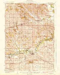
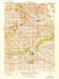 1932 Pecatonica1932 Print · USGSThe Pecatonica River valley at the start of the 1930s shows a landscape of busy rail towns and a remarkable density of rural schoolhouses. Genealogists can locate family landmarks like Woodruff Corners, Pioneer Cem, and the Twelvemile Grove Ch.3 unique versions available
 - 1933 Map of Boaz
 1933 Boaz1933 Print · USGSRichland and Vernon counties are shown in the early thirties as a landscape of steep ridges and school-rich valleys. Genealogists can trace family roots through dozens of rural schools and churches, from Rolling Ground and Jimtown to the Dieter Hollow Church.2 unique versions available
 - 1933 Map of Boscobel
 1933 Boscobel1933 Print · USGSThe Driftless Area of Southwest Wisconsin is captured here in the early 1930s, showing the intricate ridge-and-valley landscape of Grant and Richland counties. Researchers can locate dozens of country schools and churches, including Rock Elm School, Steele Cem, and the riverfront village of Port Andrew.2 unique versions available
 - 1934 Map of Winona, 1955 Print
 1934 Winona1955 Print · USGSThe Mississippi River valley in the mid-1930s reveals a complex network of rail lines and river engineering. Researchers can trace the grounds of St Marys College, find rural schools like Meyers Sch, and locate the early infrastructure of Lock and Dam No 5A.2 unique versions available
 - 1934 Map of Elk Mound, 1960 Print
 1934 Elk Mound1960 Print · USGSDunn and Eau Claire counties come alive in this mid-thirties survey, showing the intricate network of rural schools and the bustling rail corridor through Elk Mound. Genealogists can trace family roots at Porters Mills, Big Elk Creek Ch, or numerous local school sites like Waneka Sch.2 unique versions available
 - 1934 Map of Chippewa Falls, 1967 Print
 1934 Chippewa Falls1967 Print · USGSThe Chippewa and Eau Claire River valleys are captured here in the 1930s as vital rail and water hubs. Genealogists can locate family-named landmarks like Old Badger Mills, Anson Sta, and dozens of rural schoolhouses such as Tilden Mill Sch.2 unique versions available
 - 1934 Map of Cochrane, 1968 Print
 1934 Cochrane1968 Print · USGSThe Mississippi River corridor and surrounding bluffs are captured here in the mid-1930s, documenting the riverside rail lines and upland farm communities. Genealogists can trace family landmarks like Young Cem, Mount Vernon Sch, and the Transient Relief Camp.
 - 1935 Map of Arkansaw
 1935 Arkansaw1935 Print · USGSThe rural uplands and river valleys of Pepin and Dunn Counties are captured here during the mid-1930s. Researchers can trace dozens of country school sites like Point Sch and Knight Sch, or locate family landmarks at Exile and Eau Galle Mill.
 - 1935 Map of Osseo
 1935 Osseo1935 Print · USGSOsseo and Augusta were busy railway and river hubs in the mid-1930s, where the rural landscape was tied together by dozens of local schools and the Chicago and Northwestern. Genealogists can trace family footprints at Bear Grass Cem and vanished rural landmarks like Rodell Spur and Troubled Waters Sch.
 - 1936 Map of Chippewa Falls
 1936 Chippewa Falls1936 Print · USGSChippewa Falls and Eau Claire are captured here in the mid-1930s, showing a landscape defined by the convergence of major rivers and the massive Lake Wissota. Trace the rail lines of the C and NW Line or locate ancestral sites like Old Badger Mills, Hallie Ch, and numerous rural schools.3 unique versions available
 - 1936 Map of Pecatonica
 1936 Pecatonica1936 Print · USGSNorthern Illinois agriculture and river life thrive in the 1930s along the winding Pecatonica River and the Wisconsin border. Genealogists can trace hundreds of rural homes and a dense grid of schoolhouses including College Sch, Irish Grove Sch, and Twelvemile Grove Ch.2 unique versions available
 - 1936 Map of Elk Mound
 1936 Elk Mound1936 Print · USGSDunn and Eau Claire Counties in the mid-thirties show a landscape of thriving rural school districts and river-bound commerce. Genealogists can trace family landmarks like The Yankee Woods or locate vanished sites like Porters Mills and the Old Meridean Ferry.2 unique versions available
Showing maps 1-25
Top cities of Wisconsin
- Milwaukee historical maps
- Madison historical maps
- Green Bay historical maps
- Kenosha historical maps
- Racine historical maps
- Appleton historical maps
See more
Top counties of Wisconsin
- Milwaukee County historical maps
- Dane County historical maps
- Waukesha County historical maps
- Brown County historical maps
- Racine County historical maps
- Outagamie County historical maps
See more
Frequently asked questions
- What are the different types of historical maps available for Wisconsin?
- What is the oldest map of Wisconsin?
- Where can I purchase historical maps of Wisconsin for my home or office?
- Where can I download high-res historical maps of Wisconsin?
- Are there historical topographic maps available for Wisconsin?
- Is there historical aerial imagery available for Wisconsin?
- Where are historical maps of Wisconsin sourced from?