1950s Maps of Wisconsin
Explore 312 historic maps of Wisconsin from the 1950s. These maps offer a rare glimpse into what life looked like during the 1950s — showing old roads, neighborhoods, homes, and landmarks that have changed or disappeared over time.
Whether you're researching your family's past, planning a metal detecting trip, or studying how Wisconsin's landscape evolved across the 1950s, these high-resolution maps are a powerful tool for exploring the history of this region.
- Focus on a specific era: All maps on this page are from the 1950s, giving you a focused view of this time period.
- See what’s changed: Compare century-old streets, trails, and buildings to today's modern landscape using overlays and satellite layers.
- Research with precision: Use these maps for genealogy, historical research, land use analysis, or educational projects.
- View, download, or print: Maps are fully viewable online in high resolution, and can be downloaded or printed for your own records.
Start exploring Wisconsin's history through authentic maps from the 1950s. This is your window into the past.
Wisconsin maps
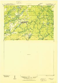
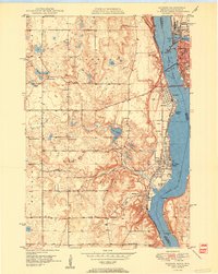
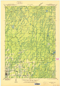
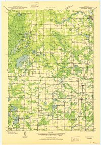
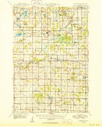
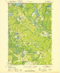
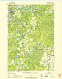
(312)- 1950 Map of Weyerhauser
 1950 Weyerhauser1950 Print · USGSRusk County at the dawn of the 1950s reveals a transition from timber-driven rail towns to a landscape of lakeside communities. Genealogists and historians can trace local landmarks like Indian Cem, the Stan Lookout Tower, and numerous rural schoolhouses including Amacoy Sch.
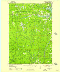
 - 1950 Map of Downing
 1950 Downing1950 Print · USGSWisconsin's dairy and timber heartland is captured here just after the war, centered on the rail-linked towns of Glenwood City and Boyceville. Genealogists can trace family roots through numerous country schools like Peaceful Valley and local landmarks like Chimney Rock.
 - 1950 Map of Pike Lake
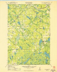
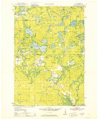
 1950 Pike Lake1950 Print · USGSNorthern Wisconsin's timber and lake country comes to life in the mid-century, showing a landscape shaped by conservation and seasonal recreation. Local historians can trace the locations of the Riley Creek CCC Camp, Shady Knoll Sch, and numerous family-named landmarks like Patterson Lake.
 - 1950 Map of Phelps
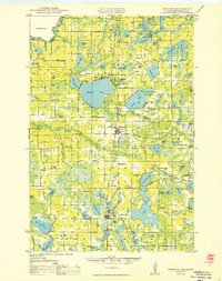
 1950 Phelps1950 Print · USGSVilas County's lake country is captured here during the mid-century, showing the development of Phelps and Land O' Lakes along the state line. Researchers can trace the Chicago and Northwestern rail line and locate the Augustus Adolphus Ch or the C C C Camp near Afterglow Lake.
 - 1950 Map of Lac Du Flambeau
 1950 Lac Du Flambeau1950 Print · USGSThe northern lake country of Vilas and Oneida Counties is captured here at mid-century, centered on the Lac du Flambeau reservation. Researchers can trace the old Chicago and Northwestern rail line and locate landmarks like the Marlands Sch or the Flambeau Fire Tower.
 - 1950 Map of Wabeno
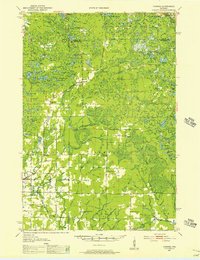
 1950 Wabeno1950 Print · USGSThe Northwoods of Forest County are captured here at mid-century, where logging roots and lake country recreation meet. Genealogists and historians can locate rural schoolhouses like Rummel Sch, explore the Abandoned CCC Camp, or trace the old Logging RR routes.
 - 1950 Map of Ladysmith
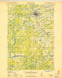 1950 Ladysmith1950 Print · USGSMid-century Rusk County centers on the busy rail junction and riverfront of Ladysmith just as the regional flowages were being established. Researchers can locate dozens of rural schools and churches, including Meadow Brook Sch, St Francis Ch, and the Thornapple Dam.
 - 1950 Map of Monico
 1950 Monico1950 Print · USGSOneida County at mid-century is a landscape of glacial lakes and critical rail junctions during the height of the timber and transport era. Researchers can trace rural school locations like Wolf River Sch and rail outposts including Starks, Gagen, and Lennox.
 - 1950 Map of Webster
 1950 Webster1950 Print · USGSNorthern Wisconsin lake country is captured here at mid-century, centered on the growing village of Webster. Genealogists can locate rural landmarks like Karlsborg Cem, Yellow Lake Ch, and the Siren Landing Field.
 - 1950 Map of Star Lake
 1950 Star Lake1950 Print · USGSVilas County's lake-strewn borderlands are captured here at mid-century, showing a landscape defined by timber management and early rail travel. Researchers can trace the Chicago and Northwestern Ry through Conover and locate remote outposts like Camp 5 or the Monahan Fire Tower.
 - 1950 Map of Stone Lake
 1950 Stone Lake1950 Print · USGSWashburn and Sawyer Counties are shown in the 1950s at the height of their rural rail and schoolhouse era. Researchers can trace the legacy of small communities through the Evergreen Cem, the Potato Lake Fire Tower, and local landmarks like Stinnett Sch and Mackay Valley Sch.
 - 1950 Map of Hudson
 1950 Hudson1950 Print · USGSThe St. Croix River valley at mid-century shows a network of thriving riverfront towns and rural school districts along the Minnesota-Wisconsin border. Researchers can trace the footprints of old schools like Ellmann Sch and Rentz Sch or locate the Toll Bridge connecting these two states.2 unique versions available
 - 1950 Map of Butternut
 1950 Butternut1950 Print · USGSWisconsin's Northwoods were still defined by logging camps and rural school districts in the mid-twentieth century. Genealogists and local historians can trace the foundations of Butternut and the surrounding townships, locating sites like Agenda Town Hall, Old Camp, and Tank Sch.
 - 1950 Map of Rush City
 1950 Rush City1950 Print · USGSThe St. Croix River valley in the late 1940s reveals a quiet borderland where timber and rail infrastructure meet rural crossroads. Genealogists and historians can trace the foundations of local life at Indian Cem, the Rush City Ferry, and the Logging RR.
 - 1950 Map of Coleman
 1950 Coleman1950 Print · USGSNortheastern Wisconsin comes alive in the mid-century as family farms and lakeside communities thrived between Marinette and Oconto counties. Genealogists and local historians can trace legacy sites like the Second Polish Ch, Victory Sch, and the vanished tracks of the St Paul and Pacific RR.
 - 1950 Map of Deer Park
 1950 Deer Park1950 Print · USGSNorthwestern Wisconsin at the end of the 1940s reveals a patchwork of small townships and dairy country connected by vital rail lines. Genealogists can trace family roots through numerous country schools like Jewett Mills Sch and historic parishes such as St Bridget Ch.2 unique versions available
 - 1950 Map of Grantsburg
 1950 Grantsburg1950 Print · USGSBurnett County was a landscape of river crossings and rural outposts at mid-century, bounded by the winding St Croix River. Genealogists and historians can locate legacy sites like Ekdall Sch, Wood Lake Ch, and the village of Grantsburg.
 - 1950 Map of Elcho, 1952 Print
 1950 Elcho1952 Print · USGSLanglade and Oneida Counties come into focus during the early fifties, a time when the Chicago and North Western railway still connected these timber-rich lakeside communities. You can trace early township schools like Enterprise Sch, find the Pence Lake Lookout Tower, and locate vanished landmarks along the Old Railroad Grade.3 unique versions available
 - 1950 Map of Alma, 1952 Print
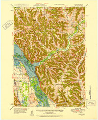 1950 Alma1952 Print · USGSThe Mississippi River valley serves as a bustling corridor for rail and river traffic at mid-century. Genealogists can trace family roots through numerous rural landmarks like St Paul Ch, Church Valley Cem, and the riverfront town of Alma.8 unique versions available
 - 1950 Map of Maiden Rock, 1952 Print
 1950 Maiden Rock1952 Print · USGSThe bluffs of Lake Pepin were a hive of rail and river activity at mid-century, supporting a dense network of upland farms and small towns. Researchers can trace rural life through dozens of named landmarks like Old Frontenac, the Villa Maria Academy, and Sleepy Hollow School.4 unique versions available
 - 1950 Map of Balsam Lake, 1952 Print
 1950 Balsam Lake1952 Print · USGSPolk County's lake country is captured here at mid-century, showing a landscape defined by the Soo Line and the Apple River. Genealogists can trace family roots through numerous sites like Holy Rosary Ch, Lykens, and School No 1.3 unique versions available
 - 1950 Map of Lily, 1952 Print
 1950 Lily1952 Print · USGSWisconsin’s northwoods are documented here at mid-century, showing the timber and rail landscape across Langlade and Forest Counties. Genealogists and historians can locate community sites like Pearson Cem, the Arbutus Sch, and the rail stop at Lily.3 unique versions available
 - 1950 Map of Parrish, 1956 Print
 1950 Parrish1956 Print · USGSLanglade and Lincoln Counties are shown in the early fifties as a landscape of timber-era relics and rural immigrant communities. Researchers can trace the Old Railroad Grade and locate cultural landmarks like the Estonian Ch or the Liberty Bell Sch.2 unique versions available
 - 1950 Map of Tomahawk, 1956 Print
 1950 Tomahawk1956 Print · USGSThe river and rail networks of Lincoln County are captured here in the early fifties, centering on the industrial activity of the Wisconsin River. Genealogists and historians can trace family roots through numerous country schools and cemeteries like Calvary Cemetery, Little Pine Creek School, and the settlement at Irma.
 - 1950 Map of Spirit Falls, 1957 Print
 1950 Spirit Falls1957 Print · USGSLincoln County’s river valleys and timberlands are captured here in the early 1950s, documenting the era of hydroelectric power and forest management. Genealogists and historians can trace Old Railroad Grade, remote outposts like Camp 25, and local landmarks like Grandfather Falls.2 unique versions available
Showing maps 1-25 of 312
Top cities of Wisconsin
- Milwaukee historical maps
- Madison historical maps
- Green Bay historical maps
- Kenosha historical maps
- Racine historical maps
- Appleton historical maps
See more
Top counties of Wisconsin
- Milwaukee County historical maps
- Dane County historical maps
- Waukesha County historical maps
- Brown County historical maps
- Racine County historical maps
- Outagamie County historical maps
See more
Frequently asked questions
- What are the different types of historical maps available for Wisconsin?
- What is the oldest map of Wisconsin?
- Where can I purchase historical maps of Wisconsin for my home or office?
- Where can I download high-res historical maps of Wisconsin?
- Are there historical topographic maps available for Wisconsin?
- Is there historical aerial imagery available for Wisconsin?
- Where are historical maps of Wisconsin sourced from?