1970s Maps of Wisconsin
Explore 518 historic maps of Wisconsin from the 1970s. These maps offer a rare glimpse into what life looked like during the 1970s — showing old roads, neighborhoods, homes, and landmarks that have changed or disappeared over time.
Whether you're researching your family's past, planning a metal detecting trip, or studying how Wisconsin's landscape evolved across the 1970s, these high-resolution maps are a powerful tool for exploring the history of this region.
- Focus on a specific era: All maps on this page are from the 1970s, giving you a focused view of this time period.
- See what’s changed: Compare century-old streets, trails, and buildings to today's modern landscape using overlays and satellite layers.
- Research with precision: Use these maps for genealogy, historical research, land use analysis, or educational projects.
- View, download, or print: Maps are fully viewable online in high resolution, and can be downloaded or printed for your own records.
Start exploring Wisconsin's history through authentic maps from the 1970s. This is your window into the past.
Wisconsin maps
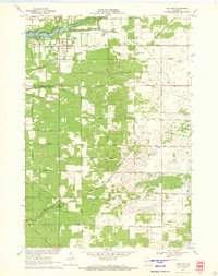
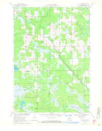
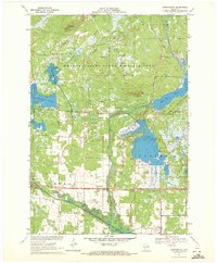
(518)- 1970 Map of Butternut Lake, 1972 Print
 1970 Butternut Lake1972 Print · USGSThe Price County timberlands and lakefronts are frozen in time just as the seventies began. Researchers can trace the Chicago and North Western rail route or locate local landmarks like the Kennedy Lookout Tower and Pixley Dam.
 - 1970 Map of Tipler, 1972 Print
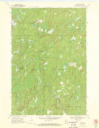
 1970 Tipler1972 Print · USGSForest County's timber and lake country is captured here in the early seventies as the rail-and-water economy shaped the landscape. Genealogists and historians can trace the Chicago and North Western line or locate the Martin Cem and Maple Grove Ch.2 unique versions available
 - 1970 Map of Oxbo, 1972 Print
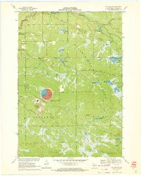
 1970 Oxbo1972 Print · USGSThe Flambeau River country comes alive in this 1970s record of Sawyer and Price counties. Trace the river's path past Barnaby Rapids and Oxbo, or locate mid-century landmarks like the Connors Lake Lookout Tower and Mason Lake Landing Field.2 unique versions available
 - 1970 Map of Kellner, 1972 Print
 1970 Kellner1972 Print · USGSThe rural border of Wood and Portage Counties was a landscape of managed waterways and rail lines in the 1970s. Genealogists and local historians can trace the community around Kellner, finding landmarks like St Johns Cem, Grant Sch, and the Church of God.
 - 1970 Map of Alvin, 1972 Print
 1970 Alvin1972 Print · USGSForest County in the early seventies shows a remote logging and recreation landscape centered on the settlement of Alvin. Researchers can trace old family landmarks and local infrastructure like Lakeview Cem, the Pine River Lookout Tower, and Windsor Dam Campground.3 unique versions available
 - 1970 Map of Westboro, 1972 Print
 1970 Westboro1972 Print · USGSTaylor County's northwoods were transitioning in the 1970s, as traditional rail activity met the expanding public lands of the Chequamegon National Forest. Trace family histories near Westboro and Chelsea, locating Mount Olive Cem and the Old Railroad Grade through the timber.2 unique versions available
 - 1970 Map of Hatfield SW, 1972 Print
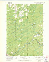
 1970 Hatfield SW1972 Print · USGSJackson County is shown during a period of industrial expansion in the early seventies. Genealogists and historians can trace the footprint of the Jackson County Iron Mine and local landmarks like Komensky Station, Iron Mound, and the Staffon Flowage.3 unique versions available
 - 1970 Map of Jump River Fire Tower NW, 1972 Print
 1970 Jump River Fire Tower NW1972 Print · USGSThe Northwoods of Rusk and Price counties are documented here in the early 1970s, showing a landscape shaped by winding river systems and old timber routes. Trace the path of the Old Railroad Grade or locate historic recreation spots like Big Falls and Big Falls Campground.3 unique versions available
 - 1970 Map of City Point NE, 1972 Print
 1970 City Point NE1972 Print · USGSThe Wood County marshlands and the settlement of Sherwood are captured here in the early 1970s. Researchers can trace the drainage of Ammundson Marsh or locate the Cranberry Bog and Sherwood Lake recreation area.2 unique versions available
 - 1970 Map of Sugar Camp, 1972 Print
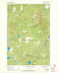
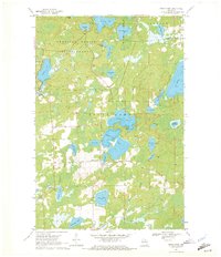 1970 Sugar Camp1972 Print · USGSOneida County's lake-studded landscape is captured here in the early seventies, centered on the settlement of Sugar Camp. Local historians and genealogists can trace property lines near Sugar Camp Lake, locate the Indian Lookout Tower, and explore the northern woods of the American Legion State Forest.2 unique versions available
 - 1970 Map of Wyeville, 1972 Print
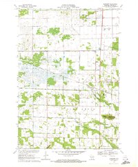
 1970 Wyeville1972 Print · USGSMonroe County was a nexus of rail activity and cranberry production around 1970, centered on the village of Wyeville. Local historians can trace the Chicago and North Western line or locate sites like Valley Junction, Indian Cem, and the Veterans Administration Hospital.2 unique versions available
 - 1970 Map of Junction City, 1972 Print
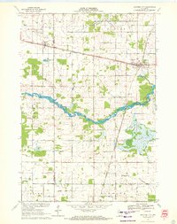 1970 Junction City1972 Print · USGSJunction City and Milladore sit at a vital rail crossing in central Wisconsin as the seventies began. Genealogists and rail historians can trace the intersection of the Soo Line and Chicago Milwaukee St Paul and Pacific, alongside local landmarks like St Wenceslaus Cem and Fogarty Marsh.
 - 1970 Map of Capron, 1972 Print
 1970 Capron1972 Print · USGSThe Illinois-Wisconsin borderlands are captured here in the early seventies, showing a landscape of established farmsteads and rail-linked villages. Genealogists can locate family sites at Burr Oak Cem, Chester Cem, or the rural community of Lawrence.3 unique versions available
 - 1970 Map of Ogema, 1972 Print
 1970 Ogema1972 Print · USGSPrice and Taylor counties come into focus in the early 1970s, centered on the millpond and rail-side settlements of the Wisconsin Northwoods. Genealogists and local historians can trace family locations along Hallstrand Road, visit Hillside Cem, or locate the old Townhall and Mackeys Spur.
 - 1970 Map of Long Lake SE, 1972 Print
 1970 Long Lake SE1972 Print · USGSFlorence County’s lake country appears as a pristine forest landscape during the 1970s. Trace the remote network of wilderness sites like Morgan Lake Campground, the Chapel of St Pius X, and the historic Railroad Grade.2 unique versions available
 - 1970 Map of Mather, 1972 Print
 1970 Mather1972 Print · USGSThe cranberry bogs and flowages of Juneau County are at their peak development in this 1970s record of the central Wisconsin marshes. Genealogists and historians can locate Mather, the Oak Grove Cem, and the old rail-aligned settlement of Norway Ridge.
 - 1970 Map of Spaulding, 1972 Print
 1970 Spaulding1972 Print · USGSJackson County’s cranberry country and railroad corridors are captured here in the early seventies. Genealogists and local historians can trace the tracks through Pray and Spaulding or locate landmarks like Potter Flowage and Saddle Mound.2 unique versions available
 - 1970 Map of Stevens Point, 1972 Print
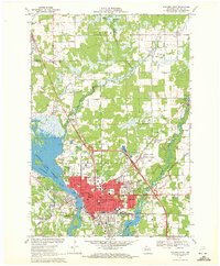 1970 Stevens Point1972 Print · USGSStevens Point and the Wisconsin River corridor are captured here at a peak of mid-century development. Researchers can trace the footprints of Wisconsin State University and local history at St Stephens Cem, McDill Pond, and the Soo Line tracks.4 unique versions available
 - 1970 Map of City Point, 1972 Print
 1970 City Point1972 Print · USGSWood County’s cranberry country and rail history are well-preserved here in the early seventies, centered on the junction at City Point. Researchers can trace the legacy of local families through the Martyrs Cem City Point Cem and the complex drainage of the Remington Ditch and Bissig Ditch.3 unique versions available
 - 1970 Map of Long Lake, 1972 Print
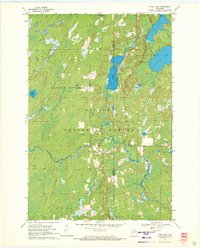 1970 Long Lake1972 Print · USGSFlorence and Forest Counties are shown in the early seventies, centered on the logging and rail lands of the Nicolet National Forest. You can locate historical landmarks like the Long Lake Lookout Tower, the Townhall, and the Long Lake Cemetery.2 unique versions available
 - 1970 Map of Hatfield, 1972 Print
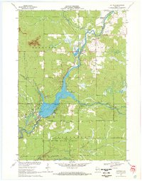 1970 Hatfield1972 Print · USGSThe Black River valley at the Clark and Jackson county line shows a landscape of state forests and river recreation in the early seventies. Genealogists and local historians can locate Hatfield, several cemeteries like Dells Dam Cem, and the old Clay School among the glacial mounds.2 unique versions available
 - 1970 Map of Shennington, 1972 Print
 1970 Shennington1972 Print · USGSWisconsin’s cranberry and timber country is well-documented in the early seventies, centered on the Chicago and North Western rail line. Genealogists and historians can trace the rural community through Shennington, St Peters Cem, and the Norway Ridge Lookout Tower.
 - 1970 Map of Bancroft, 1972 Print
 1970 Bancroft1972 Print · USGSPortage County at the start of the seventies reveals a landscape of reclaimed marshlands and rail-dependent hamlets. Genealogists and local historians can trace the foundations of Bancroft and West Bancroft alongside landmarks like Mosquito Bluff and the Pine Grove Cem.2 unique versions available
 - 1970 Map of Long Lake NE, 1972 Print
 1970 Long Lake NE1972 Print · USGSFlorence County's border with Michigan was a hub for forestry and recreation during the early seventies. Genealogists and researchers can locate established sites like Lost Lake Campground, the Purdue University Forestry Camp, and Chipmunk Rapids.
 - 1970 Map of Eagle River West, 1972 Print
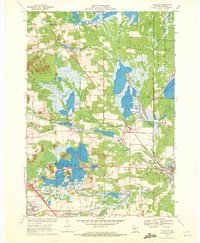
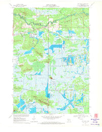
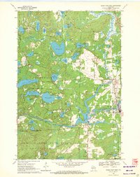 1970 Eagle River West1972 Print · USGSVilas and Oneida Counties appear here as a interconnected network of Northwoods lakes and timberlands during the early 1970s. Trace the industrial and civic landscape through the Chicago and North Western rail line, the Otter Rapids Dam, and the Fairground.2 unique versions available
Showing maps 1-25 of 518
Top cities of Wisconsin
- Milwaukee historical maps
- Madison historical maps
- Green Bay historical maps
- Kenosha historical maps
- Racine historical maps
- Appleton historical maps
See more
Top counties of Wisconsin
- Milwaukee County historical maps
- Dane County historical maps
- Waukesha County historical maps
- Brown County historical maps
- Racine County historical maps
- Outagamie County historical maps
See more
Frequently asked questions
- What are the different types of historical maps available for Wisconsin?
- What is the oldest map of Wisconsin?
- Where can I purchase historical maps of Wisconsin for my home or office?
- Where can I download high-res historical maps of Wisconsin?
- Are there historical topographic maps available for Wisconsin?
- Is there historical aerial imagery available for Wisconsin?
- Where are historical maps of Wisconsin sourced from?