1990s Maps of Wisconsin
Explore 97 historic maps of Wisconsin from the 1990s. These maps offer a rare glimpse into what life looked like during the 1990s — showing old roads, neighborhoods, homes, and landmarks that have changed or disappeared over time.
Whether you're researching your family's past, planning a metal detecting trip, or studying how Wisconsin's landscape evolved across the 1990s, these high-resolution maps are a powerful tool for exploring the history of this region.
- Focus on a specific era: All maps on this page are from the 1990s, giving you a focused view of this time period.
- See what’s changed: Compare century-old streets, trails, and buildings to today's modern landscape using overlays and satellite layers.
- Research with precision: Use these maps for genealogy, historical research, land use analysis, or educational projects.
- View, download, or print: Maps are fully viewable online in high resolution, and can be downloaded or printed for your own records.
Start exploring Wisconsin's history through authentic maps from the 1990s. This is your window into the past.
Wisconsin maps
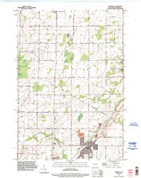
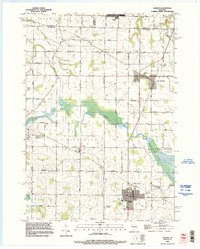
- 1990 Map of Wakefield
 1990 Wakefield1990 Print · USGSThe Michigan-Wisconsin borderlands are captured here in the late twentieth century, showing the transition from an industrial rail-and-timber hub to a recreation-focused landscape. Trace the Chicago & North Western RR through Marenisco or locate landmarks like Agate Falls and Wakefield.
 - 1990 Map of Wabeno, 1991 Print
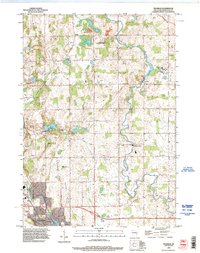
 1990 Wabeno1991 Print · USGSThe Wisconsin Northwoods in the early nineties is a landscape of deep timber, tribal lands, and glacial lakes. Researchers can trace the Chicago and North Western rail line through lumber towns like Wabeno and Townsend or locate the Lakewood State Fish Hatchery.
 - 1990 Map of La Crosse, 1991 Print
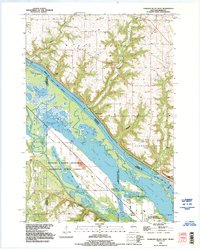
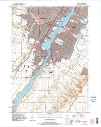
 1990 La Crosse1991 Print · USGSThe tri-state river valley at the end of the twentieth century shows a landscape defined by the Mississippi River and heavy rail. Trace the paths of the Soo Line and Burlington Northern through river towns like Brownsville and La Crescent.
 - 1990 Map of Wisconsin Dells, 1991 Print
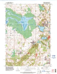
 1990 Wisconsin Dells1991 Print · USGSCentral Wisconsin's river valleys and lake country are captured in detail here during the late twentieth century. Researchers can trace the rail-and-water geography connecting Wisconsin Dells and Portage with landmarks like Blackhawk Island and Buffalo Lake.
 - 1990 Map of Outer Island, 1991 Print
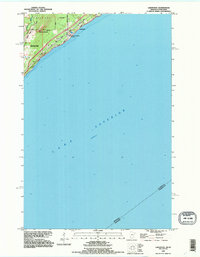
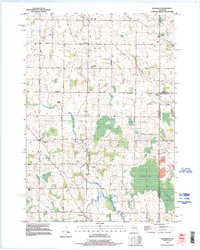
 1990 Outer Island1991 Print · USGSThe northern Apostle Islands and the Lake Superior shoreline are captured here in the early 1990s. Researchers can trace remote maritime landmarks like the Outer Island Light and Devils Island or explore the coastal boundary of the Finland State Forest.
 - 1990 Map of Merrill, 1991 Print
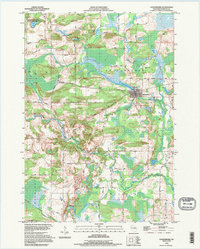
 1990 Merrill1991 Print · USGSWisconsin's Northwoods transition from timber industry to recreation in the 1990s, centered on the river corridors of Lincoln and Langlade counties. Genealogists and historians can trace rail history along the Soo Line and Old RR Grade between Merrill and Antigo.
 - 1990 Map of Hastings, 1991 Print
 1990 Hastings1991 Print · USGSThe river confluence at Hastings and Prescott is captured here in the final decade of the twentieth century, showing a landscape defined by the Mississippi River and St Croix River. Genealogists and historians can trace rail corridors like the Soo RR and find smaller settlements such as Miesville, Wacouta, and Diamond Bluff.
 - 1991 Map of Iron Mountain
 1991 Iron Mountain1991 Print · USGSThe Michigan-Wisconsin borderlands appear here in the early nineties, centered on the industrial corridor along the Menominee River. Local researchers can trace the Soo Line through remote timber settlements or locate mining sites like the Bradley Mine and Trader Mine.
 - 1991 Map of Oconomowoc
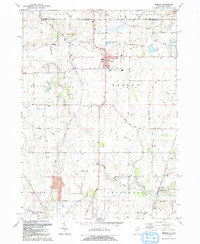
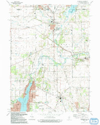
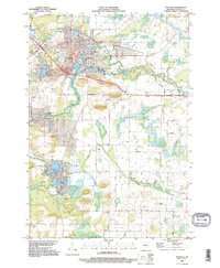
 1991 Oconomowoc1991 Print · USGSSoutheastern Wisconsin in the early nineties shows a landscape of glacial lakes and growing suburbs. Trace local history through Aztalan State Park, Carroll College, and the sprawling Horicon Marsh State Wildlife Area.
 - 1991 Map of Madison
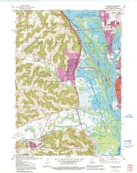
 1991 Madison1991 Print · USGSMadison and its iconic glacial lakes are captured here during a time of steady urban expansion and regional growth. Researchers can trace the mid-century development of the University of Wisconsin, locate family sites near Forest Hill Cem, or explore the footprint of the Badger Army Ammunition Plant.
 - 1991 Map of La Crescent, 1995 Print
 1991 La Crescent1995 Print · USGSThe Mississippi River valley in the early 1990s reveals a intricate landscape of island settlements and wildlife refuges between Minnesota and Wisconsin. You can trace old railroad lines like the Soo Line and locate historic sites such as Crucifixion Cem and Summit Sch.
 - 1992 Map of Hebron
 1992 Hebron1992 Print · USGSHebron and the surrounding farmland of McHenry County are shown here in the early 1990s, just as the region maintained its rural character against the state border. Researchers can trace family history at Linn-Hebron Cem or locate the old Old Railroad Grade and Galt Airport.2 unique versions available
 - 1992 Map of Richmond
 1992 Richmond1992 Print · USGSThe Illinois-Wisconsin borderlands come alive in the early nineties, showing the transition from rural crossroads to growing communities. Genealogists and historians can trace family sites like Washington Cem and schools in Richmond or Ringwood.
 - 1992 Map of Lakewood, 1995 Print
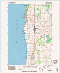
 1992 Lakewood1995 Print · USGSThe North Shore of Lake Superior comes into focus in the early nineties as the outskirts of Duluth meet Lakewood. Trace the historic winding paths of Old North Shore Road and Lester River as they follow the rugged elevation of Moose Mountain.2 unique versions available
 - 1992 Map of Diamond Bluff West, 1995 Print
 1992 Diamond Bluff West1995 Print · USGSThe Mississippi River valley near the Wisconsin border appears here in the early nineties, revealing a complex network of sloughs and backwater lakes. Genealogists and river historians can locate Smith Landing, the Prairie Island Cem, and landmarks like Welch Prairie.
 - 1992 Map of Waupaca, 1995 Print
 1992 Waupaca1995 Print · USGSWaupaca and its surrounding glacial lake country are captured here during the early nineties, showing the city's relationship with the local river systems. Researchers can trace family roots at Lakeside Cem or locate old community centers like Little Hope and Lind Center.
 - 1992 Map of Ogdensburg, 1995 Print
 1992 Ogdensburg1995 Print · USGSCentral Wisconsin at the dawn of the nineties shows a landscape of glacial lakes and quiet river valleys. Genealogists can trace family footprints near Ogdensburg via Iola Cem, Ogdensburg Cem, and the timbered slopes of Poverty Hill.
 - 1992 Map of New London, 1995 Print
 1992 New London1995 Print · USGSThe riverfront city of New London and the nearby settlement of Sugar Bush are captured here as they appeared in the early nineties. Genealogists and local historians can trace family-named sites like Ruckdashel Cem and landmarks such as Mosquito Hill.
 - 1992 Map of Freedom, 1996 Print
 1992 Freedom1996 Print · USGSOutagamie County in the early nineties is a patchwork of historic farmsteads and reservation lands. Genealogists and local historians can trace burial sites like St John the Baptist Cemetery and old crossroads like Chicago Corners or Murphy Corner.
 - 1992 Map of Franklin, 1996 Print
 1992 Franklin1996 Print · USGSWisconsin's dairyland landscape south of Rhine comes to life in the early nineties, centered on the winding Sheboygan River. Researchers can locate family landmarks such as St George Cemetery, the grounds of Mission House College, and the specialized facilities of the Rocky Knoll Sanatorium.
 - 1992 Map of Elkhart Lake, 1996 Print
 1992 Elkhart Lake1996 Print · USGSSheboygan County's glacial landscape is meticulously detailed here in the 1990s, from the wetland expanses of the Sheboygan Marsh to the village of Elkhart Lake. Researchers can locate historic sites like Old Wade House State Park and local family burial grounds including Walnut Grove Cemetery.
 - 1992 Map of Morrison, 1996 Print
 1992 Morrison1996 Print · USGSSouthern Brown County remained a landscape of dispersed farmsteads and rural hamlets in the 1990s. Researchers can trace family roots through sites like Zion Cemetery and follow the routes between small settlements like Hebels Corners, Morrison, and Wayside.
 - 1992 Map of Hilbert, 1996 Print
 1992 Hilbert1996 Print · USGSCalumet and Brown counties are mapped here in the early 1990s, capturing a landscape of dairy-country road grids and quiet village life. Genealogists can trace family landmarks like Saint Peters Cemetery, the Forest Assembly Ground, and the small settlement of St John.
 - 1992 Map of De Pere, 1996 Print
 1992 De Pere1996 Print · USGSThe Fox River valley in the early nineties shows a landscape of institutional growth and deep-rooted community history. Researchers can find St Norbert College, the National Railroad Museum, and the historic path of Old Military Road near the De Pere Dam.
 - 1992 Map of Stockbridge, 1996 Print
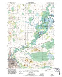
 1992 Stockbridge1996 Print · USGSLake Winnebago's eastern shoreline in the 1990s reveals a blend of lakeside recreation and deep-rooted history. Genealogists can trace family sites through the Indian Cemetery, Pingel Cemetery, and the Old Indian Treaty Boundary.
Showing maps 1-25
Top cities of Wisconsin
- Milwaukee historical maps
- Madison historical maps
- Green Bay historical maps
- Kenosha historical maps
- Racine historical maps
- Appleton historical maps
See more
Top counties of Wisconsin
- Milwaukee County historical maps
- Dane County historical maps
- Waukesha County historical maps
- Brown County historical maps
- Racine County historical maps
- Outagamie County historical maps
See more
Frequently asked questions
- What are the different types of historical maps available for Wisconsin?
- What is the oldest map of Wisconsin?
- Where can I purchase historical maps of Wisconsin for my home or office?
- Where can I download high-res historical maps of Wisconsin?
- Are there historical topographic maps available for Wisconsin?
- Is there historical aerial imagery available for Wisconsin?
- Where are historical maps of Wisconsin sourced from?