1920s Maps of Wisconsin
Explore 37 historic maps of Wisconsin from the 1920s. These maps offer a rare glimpse into what life looked like during the 1920s — showing old roads, neighborhoods, homes, and landmarks that have changed or disappeared over time.
Whether you're researching your family's past, planning a metal detecting trip, or studying how Wisconsin's landscape evolved across the 1920s, these high-resolution maps are a powerful tool for exploring the history of this region.
- Focus on a specific era: All maps on this page are from the 1920s, giving you a focused view of this time period.
- See what’s changed: Compare century-old streets, trails, and buildings to today's modern landscape using overlays and satellite layers.
- Research with precision: Use these maps for genealogy, historical research, land use analysis, or educational projects.
- View, download, or print: Maps are fully viewable online in high resolution, and can be downloaded or printed for your own records.
Start exploring Wisconsin's history through authentic maps from the 1920s. This is your window into the past.
Wisconsin maps
(37)- 1920 Map of Grays Lake
 1920 Grays Lake1920 Print · USGSLake County and the Illinois-Wisconsin borderlands are shown here in the early twenties, when the region was a bustling network of lakeside retreats and rural school districts. Genealogists and historians can trace dozens of family-named landmarks and institutions, including the English Prairie School, St Marys Chapel, and Union Cemetery.3 unique versions available
 - 1920 Map of Blue Mounds, 1959 Print
 1920 Blue Mounds1959 Print · USGSThe Driftless Area of Dane and Iowa counties comes to life in the years following the Great War, showing a landscape of ridge-top towns and river-valley rails. Genealogists can locate dozens of rural landmarks, from the Hyde Church to schools like Seitz School and Larsonville School.
 - 1920 Map of Monroe, 1960 Print
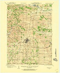 1920 Monroe1960 Print · USGSGreen County at the start of the twenties was a landscape of thriving rail towns and dozens of country schoolhouses. Genealogists can trace family footprints near named sites like Hardscrabble School, the County Farm, or along the Sugar River valley.
 - 1921 Map of Mauston
 1921 Mauston1921 Print · USGSJuneau County was a bustling hub of rail transport and rural education in the decade after the Great War. Genealogists can trace family footprints through dozens of rural school sites like Sand Hill School and family-named landmarks such as Buckley's Bridge.2 unique versions available
 - 1921 Map of Kendall
 1921 Kendall1921 Print · USGSMonroe and Juneau Counties are shown here during the early twenties, where steep ridges and isolated bluffs meet productive farm valleys. Genealogists can trace family names and local landmarks like Dorset Ridge Church, Hoffman Corners, and Sugar Bowl Bluff.2 unique versions available
 - 1922 Map of Blue Mounds
 1922 Blue Mounds1922 Print · USGSThe Wisconsin River valley and the Driftless Area uplands meet here in the early nineteen-twenties, showing a landscape defined by rail corridors and rural school districts. Researchers can pinpoint historic family landmarks like Hyde Church, the Coon Rock Mill, and Fairview School.3 unique versions available
 - 1922 Map of Monroe
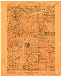 1922 Monroe1922 Print · USGSGreen County at the start of the twenties reveals a landscape of thriving rural school districts and busy rail lines. Genealogists can locate family-named landmarks like Hardscrabble School, the County Farm, and the early village of Juda.
 - 1923 Map of Blanchardville
 1923 Blanchardville1923 Print · USGSThe Driftless Area of southwest Wisconsin comes alive in the early 1920s, showing a landscape defined by the Pecatonica River and early rail lines. Genealogists can locate dozens of rural landmarks, from the York Churches to schools like Lukken School and Arneson School.2 unique versions available
 - 1923 Map of Grays Lake
 1923 Grays Lake1923 Print · USGSThe glacial lake country of northern Illinois is captured here in the early twenties, just as the resort and rail economy flourished. Genealogists can trace family roots at St Marys Chapel, English Prairie School, and numerous villages like Wauconda and Spring Grove.4 unique versions available
 - 1923 Map of New Glarus
 1923 New Glarus1923 Print · USGSGreen and Dane counties are captured here in the early 1920s, showing a region of family farms and emerging rail corridors. Genealogists can trace specific local landmarks like Primrose Churches, the County Farm, and dozens of rural schools including Hanna School.2 unique versions available
 - 1923 Map of South Wayne
 1923 South Wayne1923 Print · USGSSouthern Wisconsin and northern Illinois are shown in the early twenties as a landscape of interconnected river valleys and rail lines. Genealogists can trace dozens of country schoolhouses and churches, including Apple Grove Church, Reed School, and the community at South Wayne.3 unique versions available
 - 1923 Map of Viroqua, 1960 Print
 1923 Viroqua1960 Print · USGSViroqua and the rural townships of Vernon and Monroe counties are shown in the early 1920s as a thriving network of ridge-top farms and valley schools. Genealogists can locate family landmarks like Wang Church, the Vernon County Asylum, and the Clockmaker School.
 - 1924 Map of Whitewater
 1924 Whitewater1924 Print · USGSSoutheastern Wisconsin at the turn of the century shows a landscape of glacial lakes and thriving rail-side towns. Genealogists and historians can trace old homesteads near Heaths Mills, the station at Palmyra, and the early township centers of Rome and Lagrange.4 unique versions available
 - 1924 Map of Gays Mills, 1957 Print
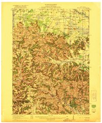
 1924 Gays Mills1957 Print · USGSCrawford County's ridgelands and the Kickapoo River valley are captured in detail during the mid-twenties, showing the region's rural character before modern road realignment. Genealogists can locate dozens of country schoolhouses and churches, from Liberty Pole to the Nash Church, alongside family landmarks like Monument Rock.
 - 1924 Map of Black River Falls, 1963 Print
 1924 Black River Falls1963 Print · USGSBlack River Falls and the surrounding central Wisconsin hills are captured in the mid-1920s during a period of established rail transport and rural education. Genealogists can trace a dense network of country schools and settlements including Winnebago Mission, Charter Oak Mill, and Vaudreuil.2 unique versions available
 - 1926 Map of Gays Mills
 1926 Gays Mills1926 Print · USGSCrawford and Vernon Counties are captured during the mid-twenties when the Kickapoo River valley was a bustling rail corridor. Genealogists can trace hundreds of family-named features like Helgerson Ridge, McManus Valley, and many rural institutions including Evergreen Cemetery and the Southwest Prairie Church.
 - 1926 Map of Stoddard
 1926 Stoddard1926 Print · USGSUpper Mississippi river life and ridge-top farming meet in the mid-1920s along the Wisconsin-Minnesota border. Researchers can trace the complex river channels near Stoddard or find family roots at rural landmarks like Evening Star School and Romance.2 unique versions available
 - 1926 Map of Viroqua
 1926 Viroqua1926 Print · USGSThe ridge-and-valley country of Vernon County is captured in the mid-1920s, showing a landscape of small farms connected by a vast network of rural schools. Genealogists can trace hundreds of family sites near Clockmaker School, Moen Church, and the Vernon County Asylum.2 unique versions available
 - 1926 Map of La Farge
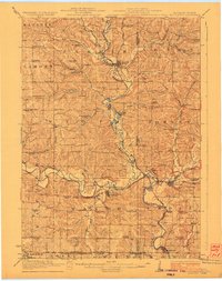
 1926 La Farge1926 Print · USGSThe Kickapoo River valley in the mid-1920s reveals a landscape of ridge-top farms and isolated coulee settlements. Genealogists can trace family footprints across dozens of local school sites like Johnniecake School and through the rail corridor of the Chicago Milwaukee and St Paul River.3 unique versions available
 - 1926 Map of Black River Falls
 1926 Black River Falls1926 Print · USGSJackson County is shown during a period of steady rural growth in the 1920s, centered on the bustling river town of Black River Falls. Local historians can trace dozens of rural schoolhouses and vanished sidings like Vaudreuil and Sheppard along the rail lines.
 - 1926 Map of Mc Henry
 1926 Mc Henry1926 Print · USGSMcHenry County in the mid-twenties is a landscape of thriving rural school districts and busy rail junctions. Genealogists can locate family-named landmarks like McConnell School and Burgett School or trace the early paths of the Chicago Milwaukee and St. Paul railroad.3 unique versions available
 - 1926 Map of Wauzeka
 1926 Wauzeka1926 Print · USGSThe confluence of the Kickapoo and Wisconsin Rivers in the 1920s reveals a landscape of ridge-top schools and valley railroads. Genealogists can trace family locations near Wauzeka, Woodman, and the Crawford County Infirmary, or find old rural sites like Anderson Mills.2 unique versions available
 - 1926 Map of North Bend, 1965 Print
 1926 North Bend1965 Print · USGSJackson and La Crosse counties are shown here in the mid-twenties, when the Black River valley was dotted with small family farms and dozens of rural school districts. Genealogists can trace ancestral locations near Stevenstown, Mindoro, and Upper Beaver Creek Ch.
 - 1926 Map of Whitehall, 1972 Print
 1926 Whitehall1972 Print · USGSTrempealeau County is captured here in the mid-twenties, a landscape of coulees and river valleys shaped by the Green Bay and Western Railroad. Genealogists can locate dozens of country schools and homestead-named landmarks like Chimney Rock or the Trempealeau County Asylum.
 - 1927 Map of Blair
 1927 Blair1927 Print · USGSIn the 1920s, the coulee country of Trempealeau and Jackson Counties was a landscape of tightly-knit valley settlements and rural schools. Genealogists can trace family footprints through numerous local landmarks like Schermerhorn School, Pigeon Falls, and Fly Creek School.2 unique versions available
Showing maps 1-25 of 37
Top cities of Wisconsin
- Milwaukee historical maps
- Madison historical maps
- Green Bay historical maps
- Kenosha historical maps
- Racine historical maps
- Appleton historical maps
See more
Top counties of Wisconsin
- Milwaukee County historical maps
- Dane County historical maps
- Waukesha County historical maps
- Brown County historical maps
- Racine County historical maps
- Outagamie County historical maps
See more
Frequently asked questions
- What are the different types of historical maps available for Wisconsin?
- What is the oldest map of Wisconsin?
- Where can I purchase historical maps of Wisconsin for my home or office?
- Where can I download high-res historical maps of Wisconsin?
- Are there historical topographic maps available for Wisconsin?
- Is there historical aerial imagery available for Wisconsin?
- Where are historical maps of Wisconsin sourced from?