1940s Maps of Wisconsin
Explore 233 historic maps of Wisconsin from the 1940s. These maps offer a rare glimpse into what life looked like during the 1940s — showing old roads, neighborhoods, homes, and landmarks that have changed or disappeared over time.
Whether you're researching your family's past, planning a metal detecting trip, or studying how Wisconsin's landscape evolved across the 1940s, these high-resolution maps are a powerful tool for exploring the history of this region.
- Focus on a specific era: All maps on this page are from the 1940s, giving you a focused view of this time period.
- See what’s changed: Compare century-old streets, trails, and buildings to today's modern landscape using overlays and satellite layers.
- Research with precision: Use these maps for genealogy, historical research, land use analysis, or educational projects.
- View, download, or print: Maps are fully viewable online in high resolution, and can be downloaded or printed for your own records.
Start exploring Wisconsin's history through authentic maps from the 1940s. This is your window into the past.
Wisconsin maps
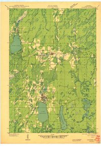
- 1940 Map of Thunder Mtn.
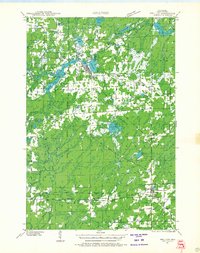
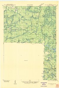 1940 Thunder Mtn.1940 Print · USGSMarinette County and the surrounding woods are captured here in the early 1940s as a hub of timber production and forestry management. Genealogists and historians can trace rural schools like Silver Cliff Sch, the site of the State Fish Hatchery, and fire lookouts atop Thunder Mountain.2 unique versions available
 - 1940 Map of Parrish
 1940 Parrish1940 Print · USGSUpper Wisconsin during the early 1940s is captured here at the edges of Three counties. Researchers can trace the Chicago and Northwestern rail line and locate the Enterprise settlement near Shingle Mill Lake before the full survey was completed.
 - 1940 Map of Osseo
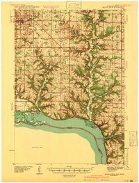
 1940 Osseo1940 Print · USGSOsseo and Augusta anchored this river-carved landscape of west-central Wisconsin in the years surrounding the Great Depression. Researchers can trace the heritage of rural neighborhoods through several dozen district schools, including Troubled Waters Sch, Yule Sch, and Churchview Sch.
 - 1940 Map of Maiden Rock
 1940 Maiden Rock1940 Print · USGSPierce County’s bluff country meets the Mississippi River in this pre-war survey of the Wisconsin-Minnesota border. Genealogists can trace hundreds of family-named landmarks, from Clayfield Ch to vanished rural schoolhouses like Oakvale Sch and Drake Sch.2 unique versions available
 - 1940 Map of Mercer, 1953 Print
 1940 Mercer1953 Print · USGSIron County’s lake-rich landscape is captured in the early 1940s, showing the early growth of Northwoods tourism and timber management. Researchers can trace the rail corridor of the Chicago and Northwestern, find the rural Springstead Sch, and locate the historic Mercer Fire Tower.
 - 1940 Map of Monico, 1955 Print
 1940 Monico1955 Print · USGSThe Northwoods of Oneida and Forest counties are captured here just before the mid-century, defined by the crossing of major rail lines and a maze of glacial lakes. Genealogists and researchers can trace the early footprints of Monico, Jennings, and Nashville, or locate local landmarks like Forest Home Cem.
 - 1940 Map of Butternut, 1961 Print
 1940 Butternut1961 Print · USGSAshland and Iron Counties come alive in this wartime-era survey of the Northwoods timber and rail country. Genealogists and historians can trace rural schoolhouses like Otto Sch, the local government at Agenda Town Hall, and the old rail paths of the Soo Line.
 - 1940 Map of Rhinelander, 1961 Print
 1940 Rhinelander1961 Print · USGSRhinelander and the surrounding lake country are captured here in the early 1940s, just as the rail-and-timber era had matured. Genealogists and local historians can trace rural school districts like Burkhart Sch and Clovernook Sch or locate the Our Saviour Ch among the region's many lakes.
 - 1940 Map of Upson, 1961 Print
 1940 Upson1961 Print · USGSIron County’s timber and rail history is captured here at the start of the 1940s, when the northwoods were dotted with logging camps and active sidings. Genealogists and historians can trace family ties at Hillside Cem or locate the distinct footprints of Iron Belt and the remote LeClair Camp.2 unique versions available
 - 1940 Map of Menomonie, 1965 Print
 1940 Menomonie1965 Print · USGSDunn County in the early 1940s is a landscape of established river towns and a dense network of country schoolhouses. Genealogists can trace family roots through sites like Beyer Settlement Sch, Ideal Cem, and the County Asylum.2 unique versions available
 - 1940 Map of Athelstane, 1969 Print
 1940 Athelstane1969 Print · USGSMarinette County was a hub of hydroelectric power and timber management during the 1940s. Researchers can trace rural school districts like Newton Lakes School or locate the specialized Molybdenite Mine near the village of Athelstane.
 - 1941 Map of Bayfield
 1941 Bayfield1941 Print · USGSThe Apostle Islands and the Bayfield Peninsula are shown in the early 1940s, highlighting the intersection of indigenous lands and maritime industry. Trace ancestral roots at Red Cliff and La Pointe, or locate long-standing landmarks like the Raspberry LH and Sand Bay Sch.
 - 1941 Map of Florence
 1941 Florence1941 Print · USGSFlorence and the surrounding lake country appear in this early 1940s survey just as modern highways began to bypass the old rail corridors. Local researchers can trace rural schoolhouse locations like Fern Sch and landmarks like the Rainbow Firetower.
 - 1941 Map of Arkansaw
 1941 Arkansaw1941 Print · USGSPepin and Pierce counties appear at the start of the 1940s as a land of rural schools and river-valley farming. Researchers can trace family sites at Plum City, Dead Lake Cem, or schools like Maxwell Prairie Sch along the Chippewa River.
 - 1941 Map of Crandon
 1941 Crandon1941 Print · USGSForest County's timberlands and rail lines are mapped here in the years following the Great Depression. Genealogists can trace rural school locations like Kokoma Sch and the Argonne Cem, while following the old tracks of the St Paul and Sault Ste Marie railroad.
 - 1941 Map of Dunbar
 1941 Dunbar1941 Print · USGSMarinette and Florence Counties are shown here just before the war, when rail lines and rural schools still defined northern Wisconsin life. Genealogists and historians can trace families near Dunbar or locate local landmarks like the Dunbar Fire Tower and Merriman Sch.
 - 1941 Map of Iron Mountain
 1941 Iron Mountain1941 Print · USGSThe Menominee River borderlands thrive with hydroelectric power and iron mining during the late thirties. Genealogists can trace family footprints at Woodlawn Cem or find early rural schoolhouses like Golden Rule Sch and Hauserman Sch.
 - 1941 Map of Park Falls, 1952 Print
 1941 Park Falls1952 Print · USGSPrice County in the early 1940s is shaped by the river-and-rail economy centered on Park Falls and Fifield. Researchers can trace old rural schoolhouses like Sugarbush Sch and forgotten rail stops at Coolidge and Lugerville.2 unique versions available
 - 1941 Map of Pike Lake, 1952 Print
 1941 Pike Lake1952 Print · USGSPrice County timberland and lake country are captured here at the end of the 1930s as the river-and-rail economy transitioned toward forest management. Genealogists and historians can locate the Riley Creek CCC Camp, the Shady Knoll Sch, and landmarks like the South Fork Fire Tower.3 unique versions available
 - 1941 Map of Kennan, 1952 Print
 1941 Kennan1952 Print · USGSIn the early 1940s, the rail-and-river corridor of Price and Rusk Counties supported a network of small timber and farm towns. Researchers can trace family-named landmarks and rural education hubs like Martins Hill Sch, the Harmony church, and the Soo Line railroad.2 unique versions available
 - 1941 Map of Kennedy, 1959 Print
 1941 Kennedy1959 Print · USGSIn the early 1940s, this portion of Price and Sawyer counties was a landscape of timber management and rail-side settlements. Genealogists can locate rural schoolhouses like Poplar Hill Sch and trace industrial sites such as Pixley Dam or the Old Mill Dam.2 unique versions available
 - 1941 Map of Coleman, 1965 Print
 1941 Coleman1965 Print · USGSMarinette and Oconto counties during the early 1940s show a landscape of timber, water power, and tight-knit rural communities. Genealogists can locate family-named landmarks like Gaffney L and numerous local schools such as Woodrow Wilson Sch and Goldfield Sch.2 unique versions available
 - 1941 Map of Phillips, 1967 Print
 1941 Phillips1967 Print · USGSNorthern Wisconsin's timber and rail landscape is meticulously detailed during the early 1940s. Genealogists can locate family-named landmarks like the Kerr Slashing Sch, the Hackett Cem, and the rural community of Prentice.
 - 1941 Map of Brantwood, 1971 Print
 1941 Brantwood1971 Print · USGSNorth-central Wisconsin is captured here in the early 1940s as a landscape of timber and rail-line settlements. You can trace the rural school system through Lone Corner Sch and Dover 3-E Sch, or locate family sites at Emery Cem and Brantwood.
 - 1942 Map of Arkansaw
 1942 Arkansaw1942 Print · USGSThe Driftless Area of Pepin and Pierce counties comes to life in the 1940s, showing a landscape of deep coulees and river valleys. Genealogists can locate dozens of country schools like Whipple Hill Sch and historic local landmarks such as St Joseph Ch and Exile.2 unique versions available
Showing maps 1-25
Top cities of Wisconsin
- Milwaukee historical maps
- Madison historical maps
- Green Bay historical maps
- Kenosha historical maps
- Racine historical maps
- Appleton historical maps
See more
Top counties of Wisconsin
- Milwaukee County historical maps
- Dane County historical maps
- Waukesha County historical maps
- Brown County historical maps
- Racine County historical maps
- Outagamie County historical maps
See more
Frequently asked questions
- What are the different types of historical maps available for Wisconsin?
- What is the oldest map of Wisconsin?
- Where can I purchase historical maps of Wisconsin for my home or office?
- Where can I download high-res historical maps of Wisconsin?
- Are there historical topographic maps available for Wisconsin?
- Is there historical aerial imagery available for Wisconsin?
- Where are historical maps of Wisconsin sourced from?