1980s Maps of Wisconsin
Explore 474 historic maps of Wisconsin from the 1980s. These maps offer a rare glimpse into what life looked like during the 1980s — showing old roads, neighborhoods, homes, and landmarks that have changed or disappeared over time.
Whether you're researching your family's past, planning a metal detecting trip, or studying how Wisconsin's landscape evolved across the 1980s, these high-resolution maps are a powerful tool for exploring the history of this region.
- Focus on a specific era: All maps on this page are from the 1980s, giving you a focused view of this time period.
- See what’s changed: Compare century-old streets, trails, and buildings to today's modern landscape using overlays and satellite layers.
- Research with precision: Use these maps for genealogy, historical research, land use analysis, or educational projects.
- View, download, or print: Maps are fully viewable online in high resolution, and can be downloaded or printed for your own records.
Start exploring Wisconsin's history through authentic maps from the 1980s. This is your window into the past.
Wisconsin maps
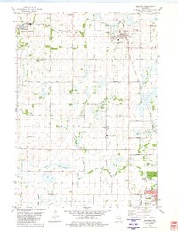
- 1980 Map of Port Wing
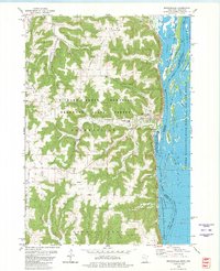
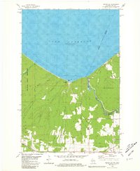
 1980 Port Wing1980 Print · USGSThe Lake Superior shoreline and the deep forests of Bayfield and Douglas counties are captured here in the early eighties. Genealogists and historians can trace the rail lines through Iron River or locate the lakeside landings at Cornucopia and Port Wing.
 - 1980 Map of Brownsville
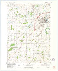
 1980 Brownsville1980 Print · USGSThe Mississippi River valley near Brownsville comes alive in this 1980 survey, showing the intricate sloughs and ridges of the region. Trace local history at St Patricks Cem, Townhall, and along the Chicago Milwaukee St Paul and Pacific railroad.
 - 1980 Map of Fond Du Lac
 1980 Fond Du Lac1980 Print · USGSThe Fox River Valley and Horicon Marsh meet here during the late twentieth century, showing a transition from lakeside industry to glacial conservation. Genealogists can locate family sites at Estabrook Cem or trace the rail lines through Ripon and Waupun.
 - 1980 Map of North Bristol
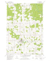
 1980 North Bristol1980 Print · USGSThe agricultural heartland of Columbia and Dane Counties is captured here in the late 1970s. Local researchers can trace family lands and rural landmarks like Hampden Cemetery, the Hampden School, and the winding Crawfish River.
 - 1980 Map of Goodrich
 1980 Goodrich1980 Print · USGSTaylor County and Lincoln County meet in this northern Wisconsin landscape as it appeared in 1980. Local researchers can trace family landmarks like Goodrich Ch, explore the path of the Old Railroad Grade, and locate the small settlement of Interwald.2 unique versions available
 - 1980 Map of Thunder Creek
 1980 Thunder Creek1980 Print · USGSPrice and Oneida counties are captured in the late seventies, showing a landscape defined by the deep woods of the Chequamegon National Forest. Researchers can trace the path of the Old Railroad Grade and locate features like Dover or the winding Willow River.3 unique versions available
 - 1980 Map of Sandstone
 1980 Sandstone1980 Print · USGSPine County and the Minnesota-Wisconsin borderlands are shown here in the early eighties as a region of dense state forests and river corridors. Genealogists and historians can trace rail-town development along the Burlington Northern including Sandstone, Askov, and Hinckley.
 - 1980 Map of Corinth
 1980 Corinth1980 Print · USGSMarathon and Taylor Counties are shown in the late seventies as a landscape of small townships and river valleys. Genealogists and historians can trace the Corinth settlement, the Old Railroad Grade, and local landmarks like Kreie Sch.
 - 1980 Map of Ironwood
 1980 Ironwood1980 Print · USGSThe Michigan-Wisconsin borderlands appear in the late twentieth century as a landscape defined by iron mining and deep forests. Researchers can trace the rail-and-river economy through the Soo Line and Chicago and North Western tracks connecting Mellen, Glidden, and Hurley.
 - 1980 Map of Lost Lake
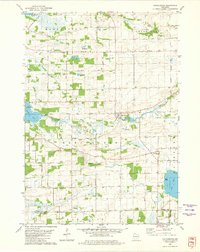
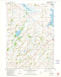 1980 Lost Lake1980 Print · USGSThe rolling lands of Dodge County in the late 1970s reveal a quiet landscape of lakeside settlements and rural townships. Genealogists can locate several family burial grounds including Bethany Cemetery and Salem Cemetery near the waters of Lost Lake.
 - 1980 Map of Spooner
 1980 Spooner1980 Print · USGSNorthwestern Wisconsin at the dawn of the eighties reveals a landscape of deep forests and transitioning rail corridors. Genealogists and historians can trace lakefront settlements like Spooner and Birchwood or follow the early Tuscobia-Park Falls State Trail.
 - 1980 Map of Waukegan
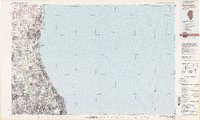 1980 Waukegan1980 Print · USGSThe Illinois North Shore and Lake Michigan coastline appear at a point of high development in the early eighties. Trace the expansive grounds of the Great Lakes Naval Training Center, Fort Sheridan, and historic Northwestern University.
 - 1980 Map of Athens
 1980 Athens1980 Print · USGSMarathon County at the end of the 1970s shows a landscape of steady agricultural and timber-linked growth centered on the village of Athens. Genealogists and historians can trace the Old Railroad Grade and locate family markers at the local Cem or along Potato Creek.2 unique versions available
 - 1980 Map of Bloomer
 1980 Bloomer1980 Print · USGSNorthwestern Wisconsin at the start of the eighties shows a landscape deeply connected to its rivers and rail lines. Genealogists and historians can trace the growth of Bloomer, Ladysmith, and Chetek or locate local landmarks like Brunet Island State Park and the Soo Line rail corridors.
 - 1980 Map of Duluth
 1980 Duluth1980 Print · USGSThe Twin Ports of the early 1980s showcase a landscape defined by heavy rail lines and Lake Superior shipping. Trace the iron-ore routes through Proctor or locate family sites near Sunrise Memorial Cem and Floodwood.
 - 1980 Map of Reno
 1980 Reno1980 Print · USGSThe bluffs of Houston County met the Mississippi backwaters in the late seventies, creating a landscape of deep timber and intricate sloughs. Genealogists and hikers can locate Winnebago Cem, the Church of Peace, and rail history along the Chicago Milwaukee St Paul and Pacific.
 - 1980 Map of Solon Springs
 1980 Solon Springs1980 Print · USGSNorthern Wisconsin in the early eighties was a landscape of dense timber and sprawling glacial waters. Trace the legacy of the Chicago and North Western rail line through Solon Springs, Hayward, and Minong at this pivotal moment.
 - 1980 Map of Park Falls
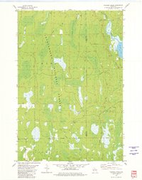
 1980 Park Falls1980 Print · USGSNorthern Wisconsin's timber and rail corridor is meticulously detailed here in the early eighties. Researchers can trace the Soo Line through forest-bound towns like Park Falls, Phillips, and Lugerville while exploring the vast Chequamegon National Forest.
 - 1980 Map of Medford
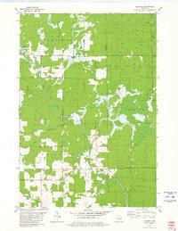
 1980 Medford1980 Print · USGSNorth-central Wisconsin in the early eighties shows a landscape of dense timber and rail-linked settlements. Genealogists and historians can trace the Soo Line through towns like Medford and Westboro or locate family homesteads near Perkinstown and Athens.
 - 1980 Map of Brandon, 1981 Print
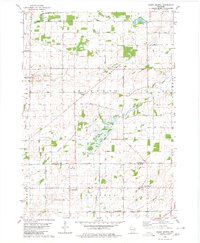
 1980 Brandon1981 Print · USGSBrandon and its surrounding townships are shown here in the late seventies, a landscape shaped by the headwaters of the Rock River and the local rail line. Genealogists can locate several rural burial grounds including Union Prairie Cem and Wood Cem near Fairwater.
 - 1980 Map of Columbus, 1981 Print
 1980 Columbus1981 Print · USGSColumbus and the surrounding townships thrive along the Crawfish River during the early 1980s, where rail and river define the landscape. Local historians can trace family-named roads and rural sites like North York Cem, Townhall, and the Wisconsin Academy.
 - 1980 Map of Manchester, 1981 Print
 1980 Manchester1981 Print · USGSGreen Lake and Marquette counties are captured here in the early eighties, showing a landscape of river-fed lakes and established farmsteads. Genealogists can trace local roots at Phelps Cem or Williams Cem, while following the Old Indian Treaty Boundary and historic Grand River crossings.
 - 1980 Map of Green Lake, 1981 Print
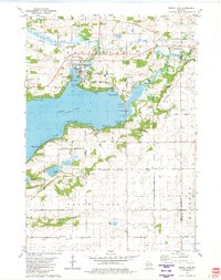 1980 Green Lake1981 Print · USGSGreen Lake at the start of the eighties shows a thriving waterfront community defined by its deep bays and emerging residential pockets. Genealogists and local historians can trace legacy sites like Dartford Cem, Center House, and the sprawling Fairground.
 - 1980 Map of Oronto Bay, 1981 Print
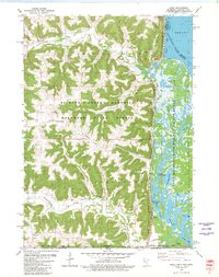
 1980 Oronto Bay1981 Print · USGSThe Wisconsin-Michigan borderlands come alive in this early 1980s survey of the Montreal River and the shores of Oronto Bay. Researchers can trace family history at Saxon Union Cem or explore the river’s power at Superior Falls and Saxon Falls.
 - 1980 Map of Clyman, 1981 Print
 1980 Clyman1981 Print · USGSDodge County agricultural life and rail infrastructure come into focus in the 1980s. Genealogists and historians can trace numerous rural burial sites like Tabor Cem and Townline Cem, or explore the transit hub at Clyman Junction.
Showing maps 1-25
Top cities of Wisconsin
- Milwaukee historical maps
- Madison historical maps
- Green Bay historical maps
- Kenosha historical maps
- Racine historical maps
- Appleton historical maps
See more
Top counties of Wisconsin
- Milwaukee County historical maps
- Dane County historical maps
- Waukesha County historical maps
- Brown County historical maps
- Racine County historical maps
- Outagamie County historical maps
See more
Frequently asked questions
- What are the different types of historical maps available for Wisconsin?
- What is the oldest map of Wisconsin?
- Where can I purchase historical maps of Wisconsin for my home or office?
- Where can I download high-res historical maps of Wisconsin?
- Are there historical topographic maps available for Wisconsin?
- Is there historical aerial imagery available for Wisconsin?
- Where are historical maps of Wisconsin sourced from?